When we think of Nepal, we tend to think of the snow-capped mountains of the Himalayas, the crystal-clear still waters of its alpine lakes, or the huge expanse of its grasslands. What some of us may not realize is that in the Himalayan foothills, where the climate is much warmer and the landscape much greener, there lives a great diversity of wildlife, including the one-horned rhinoceros, the Asian elephant and the Bengal tiger. But unfortunately, these animals are under constant threat from poachers who hunt and kill them for their body parts. To stop the killing of these animals, battalions of soldiers and rangers are sent to protect Nepal's national parks, but that is not an easy task, because these soldiers have to patrol thousands of hectares of forests on foot or elephant backs. It is also risky for these soldiers when they get into gunfights with poachers, and therefore Nepal is always looking for new ways to help with protecting the forests and wildlife.
Kada pomislimo na Nepal obično pomislimo na planine Himalaja prekrivene snegom na kristalno čiste stajaće vode njihovih alpskih jezera ili na ogromna prostranstva njihovih pašnjaka. Ono što možda neki od nas ne shvataju je to da u podnožju Himalaja, gde je klima dosta toplija i pejzaž zeleniji, živi mnogo vrsta divljih životinja, uključujući i jednorogog nosoroga, azijskog slona, i bengalskog tigra. Ali nažalost, ove životinje su u neprestanoj opasnosti od lovokradica koji ih love i ubijaju zbog delova tela. Kako bi sprečili ubijanje ovih životinja, bataljoni vojnika i rendžera šalju se da čuvaju nacionalni park Nepal, ali to nije lak zadatak, jer ovi vojnici moraju da obilaze hiljade hektara šuma peške ili na slonovima. Takođe je opasno za ove vojnike kada uđu u vatreni okršaj sa lovokradicama, i zbog toga Nepal uvek traga za novim načinima da pomogne u očuvanju šuma i životinjskog i biljnog sveta.
Well recently, Nepal acquired a new tool in the fight against wildlife crime, and these are drones, or more specifically, conservation drones. For about a year now, my colleagues and I have been building drones for Nepal and training the park protection personnel on the use of these drones. Not only does a drone give you a bird's-eye view of the landscape, but it also allows you to capture detailed, high-resolution images of objects on the ground. This, for example, is a pair of rhinoceros taking a cooling bath on a hot summer day in the lowlands of Nepal. Now we believe that drones have tremendous potential, not only for combating wildlife crime, but also for monitoring the health of these wildlife populations.
Nepal je nedavno nabavio novo oružje u borbi protiv zločina prema životinjama, a to su dronovi, tačnije, konzervacioni dronovi. Sad već oko godinu dana, moje kolege i ja pravimo dronove za Nepal i obučavamo ljude koji čuvaju park kako da koriste ove dronove. Dron ne samo da vam omogućava sliku predela iz ptičje perspektive, već i omogućava detaljne slike visoke rezolucije objekata na zemlji. Ovde, na primer, vidimo jedan par nosoroga kako se hlade u vodi po vrelom letnjem danu u nizini Nepala. Verujemo da dronovi imaju ogroman potencijal ne samo u borbi protiv zločina prema životinjama, već i za nadgledanje zdravlja ove populacije životinja.
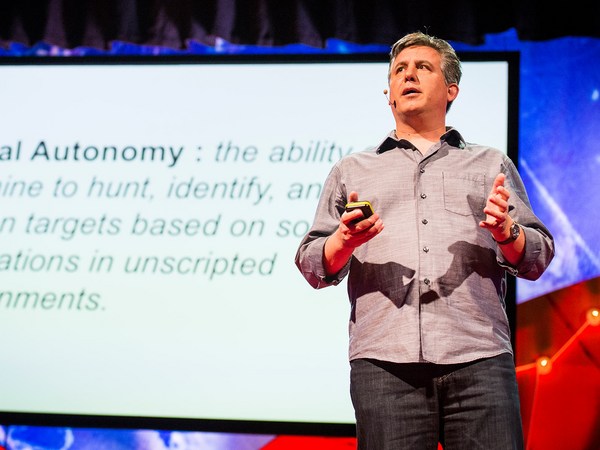
So what is a drone? Well, the kind of drone I'm talking about is simply a model aircraft fitted with an autopilot system, and this autopilot unit contains a tiny computer, a GPS, a compass, a barometric altimeter and a few other sensors. Now a drone like this is meant to carry a useful payload, such as a video camera or a photographic camera. It also requires a software that allows the user to program a mission, to tell the drone where to go.
Dakle, šta je to dron? Pa, vrsta drona o kojoj ja govorim je jednostavno maketa letelice opremljena autopilotskim sistemom, i ta autopilotska jedinica ima sićušni kompjuter, GPS, kompas, barometarski visinomer i nekoliko drugih senzora. Ovakav dron, predviđen je da nosi neki koristan teret, kao što je video kamera ili fotoaparat. Potreban mu je i softver koji omogućava korisniku da programira misiju, da govori dronu kuda da ide.
Now people I talk to are often surprised when they hear that these are the only four components that make a conservation drone, but they are even more surprised when I tell them how affordable these components are. The facts is, a conservation drone doesn't cost very much more than a good laptop computer or a decent pair of binoculars.
Ljudi sa kojima ja razgovaram obično su iznenađeni kada čuju da su ovo jedine četiri komponente koje čine konzervacioni dron, a još više su iznenađeni kada im kažem koliko su ove komponente dostupne. Istina je da konzervaconi dron ne košta puno više od nekog dobrog laptop komjutera ili dobrog dvogleda.
So now that you've built your own conservation drone, you probably want to go fly it, but how does one fly a drone? Well, actually, you don't, because the drone flies itself. All you have to do is to program a mission to tell the drone where to fly. But you simply do that by clicking on a few way points on the Google Maps interface using the open-source software. Those missions could be as simple as just a few way points, or they could be slightly longer and more complicated, to fly along a river system. Sometimes, we fly the drone in a lawnmower-type pattern and take pictures of that area, and those pictures can be processed to produce a map of that forest. Other researchers might want to fly the drone along the boundaries of a forest to watch out for poachers or people who might be trying to enter the forest illegally.
I sad kada sagradite sopstveni konzervacioni dron, verovatno da biste hteli da letite njime, međutim, kako se upravlja dronom? Pa, u stvari, i ne upravlja se, jer dron sam leti. Sve što vi treba da uradite je da programirate misiju koja govori dronu kuda da leti. A to jednostavno uradite tako što kliknete na nekoliko tačaka na interfejsu Gugl mape koristeći softver otvorenog koda. Ove misije mogu biti jednostavne kada ima samo nekoliko tačaka, ili mogu biti nešto duže i složenije kada se leti duž vodenog sistema. Ponekad spustimo dron da leti vrlo nisko i fotografiše taj predeo, i te fotografije se mogu obraditi da se dobije mapa te šume. Drugi istraživači bi možda hteli da lete dronom duž oboda šume i motre na lovokradice ili ljude koji možda pokušavaju da nelegalno uđu u šumu.
Now whatever your mission is, once you've programmed it, you simply upload it to the autopilot system, bring your drone to the field, and launch it simply by tossing it in the air. And often we'll go about this mission taking pictures or videos along the way, and usually at that point, we will go grab ourselves a cup of coffee, sit back, and relax for the next few minutes, although some of us sit back and panic for the next few minutes worrying that the drone will not return. Usually it does, and when it does, it even lands automatically.
Šta god da je vaša misija, kada je jednom programirate, jednostavno je postavite na autopilotski sistem, postavite svoj dron na polje i lansirate ga tako što ga prosto bacite u vazduh. I često ćemo i krenuti na ovu misiju da bismo fotografisali ili snimali usput, i obično tada, uzmemo šolju kafe, zavalimo se i opustimo nekoliko minuta, mada neki od nas se zavale i paniče tih nekoliko minuta jer se brinemo da se dron neće vratiti. Obično se vrati, i kada se to desi, obično sleti automatski.
So what can we do with a conservation drone? Well, when we built our first prototype drone, our main objective was to fly it over a remote rainforest in North Sumatra, Indonesia, to look for the nest of a species of great ape known as the orangutan. The reason we wanted to do that was because we needed to know how many individuals of this species are still left in that forest. Now the traditional method of surveying for orangutans is to walk the forest on foot carrying heavy equipment and to use a pair of binoculars to look up in the treetops where you might find an orangutan or its nest. Now as you can imagine, that is a very time-consuming, labor-intensive, and costly process, so we were hoping that drones could significantly reduce the cost of surveying for orangutan populations in Indonesia and elsewhere in Southeast Asia. So we were very excited when we captured our first pair of orangutan nests on camera. And this is it; this is the first ever picture of orangutan nests taken with a drone. Since then we have taken pictures of dozens of these nests from around various parts of Southeast Asia, and we're now working with computer scientists to develop algorithms that can automatically count the number of nests from the thousands of photos we've collected so far.
Dakle, šta sve možemo raditi sa konzervacionim dronom? Kada smo sagradili naš prvi prototip drona, naš glavni cilj bio je da preleti preko udaljene tropske šume u Severnoj Sumatri, u Indoneziji, i da traga za gnezdom bezrepog majmuna poznatom kao orangutan. Ovo smo želeli da uradimo jer smo morali da znamo koliko je pripadnika te vrste još ostalo u toj šumi. Tradicionalni metod potrage za orangutanima je pešačenje kroz šumu sa teškom opremom i sa dvogledom kako biste videli i krošnje u kojima možete naći orangutana ili njegovo gnezdo. Kao što možete zamisliti, ovo je vrlo dugotrajan, mučan i skup proces, stoga smo se nadali da bi dronovi mogli znatno da smanje troškove potrage za populacijom orangutana u Indoneziji i drugde u jugoistočnoj Aziji. Bili smo vrlo uzbuđeni kada smo uhvatili na kameri naš prvi par gnezda orangutana. I evo; ovo je prva fotografija gnezda orangutana koju je snimio dron. Od tada fotografisali smo na desetine ovakvih gnezda iz raznih delova jugoistočne Azije, i trenutno sarađujemo sa kompjuterskim naučnicima kako bismo razvili algoritam koji automatski detektuje broj gnezda sa hiljade slika koje smo dosad sakupili.
But nests are not the only objects these drones can detect. This is a wild orangutan happily feeding on top of a palm tree, seemingly oblivious to our drone that was flying overhead, not once but several times. We've also taken pictures of other animals including forest buffalos in Gabon, elephants, and even turtle nests.
Ali gnezda nisu jedine stvari koje dronovi mogu da detektuju. Ovo je divlji orangutan koji se bezbrižno hrani na krošnji palminog drveta, naizgled nesvestan našeg drona koji je leteo iznad, ne jedanput nego više puta. Fotografisali smo i druge životinje uključujući i šumskog bizona u Gabonu, slonove, čak i gnezda kornjača.
But besides taking pictures of just the animals themselves, we also take pictures of the habitats these animals live in, because we want to keep track of the health of these habitats. Sometimes, we zoom out a little and look at other things that might be happening in the landscape. This is an oil palm plantation in Sumatra. Now oil palm is a major driver of deforestation in that part of the world, so we wanted to use this new drone technology to keep track of the spread of these plantations in Southeast Asia. But drones could also be used to keep track of illegal logging activities. This is a recently logged forest, again in Sumatra. You could even still see the processed wooden planks left on the ground.
Ali pored fotografisanja samih životinja, fotogafisali smo i staništa u kojima ove životinje žive jer želimo da pratimo koliko su zdrava ta staništa. Ponekad malo odzumiramo i posmatramo druge stvari koje se dešavaju na tom predelu. Ovo je plantaža palminog ulja na Sumatri. Palmino ulje je glavni uzrok krčenja šuma u tom delu sveta, pa smo hteli da iskoristimo novu tehnologiju dronova da pratimo širenje ovih plantaža u jugoistočnoj Aziji. Ali dronovi bi takođe mogli da se koriste za praćenje nelegalne seče drveća. Ova šuma je skoro posečena, opet na Sumatri. Možete čak da vidite obrađene daske drveta na zemlji.
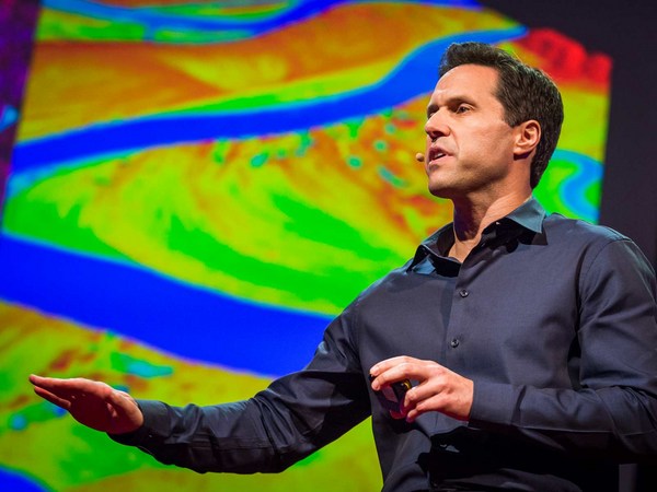
But perhaps the most exciting part about taking pictures from the air is we could later stitch these pictures together using special software to create a map of the entire landscape, and this map gives us crucial information for monitoring land use change, to let us know where and when plantations might be expanding, where forests might be contracting, or where fires might be breaking out. Aerial images could also be processed to produce three-dimensional computer models of forests. Now these models are not just visually appealing, but they are also geometrically accurate, which means researchers can now measure the distance between trees, calculate surface area, the volume of vegetation, and so on, all of which are important information for monitoring the health of these forests. Recently, we've also begun experimenting with thermal imaging cameras. Now these cameras can detect heat-emitting objects from the ground, and therefore they are very useful for detecting poachers or their campfires at night.
Međutim, možda je najuzbudljiviji deo fotografisanja iz vazduha taj što kasnije možemo da spojimo te slike uz pomoć specijalnog softvera i napravimo mapu čitavog predela, i ova mapa nam daje presudnu informaciju za nadgledanje promene namene zamljišta, obaveštava nas gde i kada se plantaže proširuju, gde se šume smanjuju, ili gde se javljaju požari Slike iz vazduha se takođe mogu obraditi kako bi se dobio trodimenzionalni kompjuterski model šume. Ovi modeli nisu samo primamljivi za oko, već su i geometrijski precizni, što znači da istraživači sada mogu da mere razdaljinu između drveća, računaju površinu oblasti, gustinu vegetacije, i tako dalje, sve informacije koje su bitne za nadgledanje zdravlja ovih šuma. Nedavno smo takođe počeli da eksperimentišemo sa termalnim kamerama. Ove kamere mogu da opaze objekte koji emituju toplotu sa zemlje, i stoga su vrlo korisne za otkrivanje lovokradica ili vatre koju pale noću.
So I've told you quite a lot about what conservation drones are, how you might operate one of these drones, and what a drone could do for you. I will now tell you where conservation drones are being used around the world. We built our first prototype drones in Switzerland. We brought a few of these to Indonesia for the first few test flights. Since then, we've been building drones for our collaborators from around the world, and these include fellow biologists and partners from major conservation organizations.
Pa, rekao sam vam dosta toga o tome šta su konzervacioni dronovi, kako možete upravljati njima, i šta dron može učiniti za vas. Sada ću vam reći gde se koriste konzervacioni dronovi širom sveta. Sagradili smo naše prve prototipske dronove u Švajcarskoj. Doneli smo nekoliko tih u Indoneziju za prve testove letenja. Od tada gradimo dronove za naše saradnike širom sveta, a među njima su kolege biolozi i partneri iz glavnih organizacija za očuvanje.
Perhaps the best and most rewarding part about working with these collaborators is the feedback they give us on how to improve our drones. Building drones for us is a constant work in progress. We are constantly trying to improve them in terms of their range, their ruggedness, and the amount of payload they can carry. We also work with collaborators to discover new ways of using these drones. For example, camera traps are a common tool used by biologists to take pictures of shy animals hiding in the forests, but these are motion-activated cameras, so they snap a picture every time an animal crosses their path. But the problem with camera traps is that the researcher has to go back to the forest every so often to retrieve those images, and that takes a lot of time, especially if there are dozens or hundreds of these cameras placed in the forest. Now a drone could be designed to perform the task much more efficiently. This drone, carrying a special sensor, could be flown over the forest and remotely download these images from wi-fi–enabled cameras.
Jedna od možda najboljih i najisplativijih stvari u radu sa ovim saradnicima su povratne informacije koje nam daju o tome kako da unapredimo naše dronove. Pravljenje dronova za nas predstavlja neprekidan rad. Neprekidno pokušavamo da ih usavršimo u pogledu dometa, stabilnosti, i količine tereta koji mogu da nose. Takođe radimo sa saradnicima kako bismo otkrili nove načine da iskoristimo ove dronove. Na primer, skrivene kamere su opšte poznate među biolozima kada fotografišu povučene životinje koje se kriju u šumi, ali ove kamere su osetljive na pokret, tako da slikaju svaki put kada se neka životinja nađe na njihovom putu. Međutim, problem sa skrivenim kamerama je taj što istraživač mora da se vraća u šumu s vremena na vreme kako bi preuzeo slike, i za to je potrebno dosta vremena, posebno ako ima na desetine ili stotine ovakvih kamera koje su postavljene u šumi. Dron može biti napravljen tako da izvede zadatak mnogo efikasnije. Ovaj dron, koji nosi poseban senzor, može preletati preko šume i skidati slike sa daljine sa kamera kojima je povezan bežičnim internetom.
Radio collars are another tool that's commonly used by biologists. Now these collars are put onto animals. They transmit a radio signal which allows the researcher to track the movements of these animals across the landscape. But the traditional way of tracking animals is pretty ridiculous, because it requires the researcher to be walking on the ground carrying a huge and cumbersome radio antenna, not unlike those old TV antennae we used to have on our rooftops. Some of us still do. A drone could be used to do the same job much more efficiently. Why not equip a drone with a scanning radio receiver, fly that over the forest canopy in a certain pattern which would allow the user or the operator to triangulate the location of these radio-collared animals remotely without having to step foot in the forest.
Okovratnik za praćenje je još jedna alatka koju biolozi obično koriste. Ovi okovratnici se stavljaju životinjama i odašilju radio signal zahvaljujući kom istraživači prate pokrete ovih životinja po čitavom predelu. A tradicionalan način praćenja životinja je prilično smešan, jer zahteva da istraživač ide peške noseći veliku i glomaznu radio antenu sličnu onim starim TV antenama koje smo držali na krovovima. Neki od nas ih drže i dan danas. Dron se može iskoristiti za isti posao mnogo efikasnije. Zašto ne bismo opremili dron sa radio prijemnikom za skeniranje, i pustili ga da leti iznad šumskih krovova po određenom šablonu koji bi omogućio korisniku ili rukovaocu da triangulira lokaciju ovih životinja sa okovratnicima za daljinsko praćenje, a da pri tom ne moraju ni da zakorače u šumu.
A third and perhaps most exciting way of using these drones is to fly them to a really remote, never-explored-before rainforest somewhere hidden in the tropics, and parachute down a tiny spy microphone that would allow us to eavesdrop on the calls of mammals, birds, amphibians, the Yeti, the Sasquatch, Bigfoot, whatever. That would give us biologists a pretty good idea of what animals might be living in those forests.
Treći i možda najuzbudljiviji način da se iskoriste ovi dronovi je da ih pustimo u neku stvarno udaljenu, do sad neistraženu tropsku šumu skrivenu negde oko povratnika, i padobranom spustimo sićušni špijunski mikrofon koji bi nam omogućio da prisluškujemo dozivanja sisara, ptica, vodozemaca, Jetija, Saskvoča, Bigfuta, koga god. To bi nama biolozima dalo ideju o tome koje sve životinje žive u tim šumama.
And finally, I would like to show you the latest version of our conservation drone. The MAJA drone has a wingspan of about two meters. It weighs only about two kilograms, but it can carry half its weight. It is a fully autonomous system. During its mission, it can even transmit a live video feed back to a ground station laptop, which allows the user to see what the drone is seeing in real time. It carries a variety of sensors, and the photo quality of some of these sensors can be as high as one to two centimeters per pixel. This drone can stay in the air for 40 to 60 minutes, which gives it a range of up to 50 kilometers. That is quite sufficient for most of our conservation applications.
I na kraju, želeo bih da vam pokažem poslednju verziju našeg konzervacionog drona. MAJA dron ima raspon krila od oko dva metra. Teži svega oko dva kilograma, ali može da nosi polovinu svoje težine. Ima potpuno autonoman sistem. Tokom misije može čak da uspostavi direktan prenos sa laptopom koji je povezan sa satelitom, i omogućava korisniku da vidi ono što dron vidi u realnom vremenu. Nosi razne senzore, i kvalitet fotografije nekih senzora može biti centimetar do dva po pikselu. Ovaj dron može ostati u vazduhu od 40 do 60 minuta, što mu daje raspon do 50 kilometara. Ovo je sasvim dovoljno za većinu naših primena u konzervatu.
Now, conservation drones began as a crazy idea from two biologists who are just deeply passionate about this technology. And we believe, strongly believe, that drones can and will be a game changer for conservation research and applications. We've had our fair share of skeptics and critics who thought that we were just fooling around with toy planes. And in a way, they are right. I mean, let's be honest, drones are the ultimate toys for boys. But at the same time, we've also gotten to know many wonderful colleagues and collaborators who share our vision and see the potential of conservation drones. To us, it is obvious that conservation biologists and practitioners should make full use of every available tool, including drones, in our fight to save the last remaining forests and wildlife of this planet.
Konzervacioni dronovi su nastali kao luda zamisao dva biologa koji su jednostavno obožavali ovu vrstu tehnologije. I mi verujemo, duboko verujemo, da dronovi mogu da budu i biće velika prekretnica za konzervaciona istraživanja i primene. Susreli smo se sa dosta skeptika i kritičara koji su mislili da se mi samo igramo sa aviončićima. I u neku ruku, u pravu su. Mislim, budimo iskreni, dronovi su vrhunske igračke za dečake. Ali istovremeno, upoznali smo puno divnih kolega i saradnika koji dele našu zamisao i vide potencijal konzervacionih dronova. Nama je očigledno da konzervacioni biolozi i praktičari treba da maksimalno iskoriste svaki alat koji je dostupan, uključujući dronove, u borbi da sačuvaju poslednje preostale šume i životinjski svet ove planete.
Thank you.
Hvala vam.
(Applause)
(Aplauz)