When we think of Nepal, we tend to think of the snow-capped mountains of the Himalayas, the crystal-clear still waters of its alpine lakes, or the huge expanse of its grasslands. What some of us may not realize is that in the Himalayan foothills, where the climate is much warmer and the landscape much greener, there lives a great diversity of wildlife, including the one-horned rhinoceros, the Asian elephant and the Bengal tiger. But unfortunately, these animals are under constant threat from poachers who hunt and kill them for their body parts. To stop the killing of these animals, battalions of soldiers and rangers are sent to protect Nepal's national parks, but that is not an easy task, because these soldiers have to patrol thousands of hectares of forests on foot or elephant backs. It is also risky for these soldiers when they get into gunfights with poachers, and therefore Nepal is always looking for new ways to help with protecting the forests and wildlife.
Când ne gândim la Nepal, ne gândim la munții cu vârfuri de zăpadă din Himalaya, apele limpezi ale lacurilor alpine, sau la uriașa întindere de pășuni. Ceea ce mulţi nu realizează e faptul că la poalele Himalayei, unde clima e mult mai caldă și peisajul mult mai verde, trăieşte o mare diversitate sălbatică inclusiv rinocerul cu un corn, elefantul asiatic şi tigrul bengalez. Din păcate, aceste animale sunt în pericol din cauza braconierilor, care le vânează şi le ucid pentru organe. Pentru a opri acest masacru, batalioane de soldaţi şi pădurari sunt trimise să protejeze parcurile naționale ale Nepalului, dar nu este uşor, pentru că soldaţii trebuie să patruleze mii de hectare de pădure pe jos sau călare pe elefanţi. Deasemeni e riscant pentru acești soldați când ajung la schimb de focuri cu braconierii, prin urmare, Nepalul caută necontenit noi modalități de a proteja pădurile şi fauna.
Well recently, Nepal acquired a new tool in the fight against wildlife crime, and these are drones, or more specifically, conservation drones. For about a year now, my colleagues and I have been building drones for Nepal and training the park protection personnel on the use of these drones. Not only does a drone give you a bird's-eye view of the landscape, but it also allows you to capture detailed, high-resolution images of objects on the ground. This, for example, is a pair of rhinoceros taking a cooling bath on a hot summer day in the lowlands of Nepal. Now we believe that drones have tremendous potential, not only for combating wildlife crime, but also for monitoring the health of these wildlife populations.
De curând, Nepalul a achiziționat un echipament nou pentru a contracara infracțiunile împotriva faunei sălbatice și anume dronele, sau mai exact, dronele de conservare. De aproximativ un an, eu şi colegii mei construim drone pentru Nepal şi instruim personalul de protecţie al parcului în utilizarea aceste drone. O dronă nu numai că oferă o imagine panoramică a terenului, dar facilitează capturarea de imagini detaliate la rezoluție înaltă a obiectelor de la sol. Iată de exemplu o pereche de rinoceri care fac baie într-o zi călduroasă în șesurile Nepalului. Noi credem că dronele au un potenţial imens, nu numai în privința combaterii infracțiunilor asupra faunei sălbatice, dar și pentru monitorizarea sănătăţii acestor populații de animale.
So what is a drone? Well, the kind of drone I'm talking about is simply a model aircraft fitted with an autopilot system, and this autopilot unit contains a tiny computer, a GPS, a compass, a barometric altimeter and a few other sensors. Now a drone like this is meant to carry a useful payload, such as a video camera or a photographic camera. It also requires a software that allows the user to program a mission, to tell the drone where to go.
Așadar, ce este o dronă? Ei bine, tipul de dronă de care vorbesc este o aeronavă la scară mică dotată cu sistem de autopilotaj care conține un mic computer, un GPS, o busolă, un altimetru barometric şi câţiva alți senzori. O asemenea dronă e menită să transporte sarcină utilă precum o cameră video sau o cameră foto. Necesită și un software care permite utilizatorului să programeze o misiune, să-i spună dronei unde să meargă.
Now people I talk to are often surprised when they hear that these are the only four components that make a conservation drone, but they are even more surprised when I tell them how affordable these components are. The facts is, a conservation drone doesn't cost very much more than a good laptop computer or a decent pair of binoculars.
Oamenii cu care vorbesc sunt adesea surprinşi când aud ca acestea sunt singurele patru componente care formează o dronă de conservare dar sunt şi mai surprinşi când le spun cât de accesibile sunt aceste componente, ca preț. În realitate, o dronă de conservare nu costă mai mult decât un laptop bun sau un binoclu decent.
So now that you've built your own conservation drone, you probably want to go fly it, but how does one fly a drone? Well, actually, you don't, because the drone flies itself. All you have to do is to program a mission to tell the drone where to fly. But you simply do that by clicking on a few way points on the Google Maps interface using the open-source software. Those missions could be as simple as just a few way points, or they could be slightly longer and more complicated, to fly along a river system. Sometimes, we fly the drone in a lawnmower-type pattern and take pictures of that area, and those pictures can be processed to produce a map of that forest. Other researchers might want to fly the drone along the boundaries of a forest to watch out for poachers or people who might be trying to enter the forest illegally.
Acum că v-ați construit propria dronă, probabil vreți să o pilotați. Dar cum se pilotează o dronă? De fapt, nu o facem pentru că drona zboară singură. Trebuie doar să programezi o misiune, să îi spui unde să zboare. Iar asta o faci simplu, apăsând pe câteva puncte de pe interfaţa Google Maps, folosind softul gratuit. Aceste misiuni pot fi simple, cu doar câteva puncte de reper, sau mai mari şi mai complicate ca zborul de-a lungul cursului unui râu. Uneori pilotăm drona pe o traiectorie tip mașină de tuns gazonul și facem poze zonei respective, iar acestea sunt procesate pentru a alcătui o hartă a pădurii. Alţi cercetători doresc să piloteze drona de-a lungul hotarelor unei păduri pentru a pândi braconierii sau oamenii care intră ilegal în pădure.
Now whatever your mission is, once you've programmed it, you simply upload it to the autopilot system, bring your drone to the field, and launch it simply by tossing it in the air. And often we'll go about this mission taking pictures or videos along the way, and usually at that point, we will go grab ourselves a cup of coffee, sit back, and relax for the next few minutes, although some of us sit back and panic for the next few minutes worrying that the drone will not return. Usually it does, and when it does, it even lands automatically.
Indiferent de misiune, odată programată, actualizați sistemul automat de pilotaj, o aduceți pe teren şi o aruncați în aer pentru a o lansa. Adesea ne desfășurăm misiunea făcând poze sau filme pe parcurs și de obicei, în acest moment ne luăm o ceașcă de cafea, ne lăsăm pe spate și ne relaxăm câteva minute, deși unii se panichează în următoarele minute de teamă că drona nu se va întoarce. De obicei, se întoarce și când o face mai și aterizează automat.
So what can we do with a conservation drone? Well, when we built our first prototype drone, our main objective was to fly it over a remote rainforest in North Sumatra, Indonesia, to look for the nest of a species of great ape known as the orangutan. The reason we wanted to do that was because we needed to know how many individuals of this species are still left in that forest. Now the traditional method of surveying for orangutans is to walk the forest on foot carrying heavy equipment and to use a pair of binoculars to look up in the treetops where you might find an orangutan or its nest. Now as you can imagine, that is a very time-consuming, labor-intensive, and costly process, so we were hoping that drones could significantly reduce the cost of surveying for orangutan populations in Indonesia and elsewhere in Southeast Asia. So we were very excited when we captured our first pair of orangutan nests on camera. And this is it; this is the first ever picture of orangutan nests taken with a drone. Since then we have taken pictures of dozens of these nests from around various parts of Southeast Asia, and we're now working with computer scientists to develop algorithms that can automatically count the number of nests from the thousands of photos we've collected so far.
Ce putem face cu o dronă de conservare? Când ne-am construit primul prototip de dronă, scopul principal era să-l survolăm peste o pădure tropicală izolată din Sumatra de Nord, Indonesia, pentru a căuta cuibul unei specii de Hominidae cunoscută sub numele de urangutan. Am vrut să facem asta pentru că trebuia să știm câți indivizi ai acestei specii au mai rămas în acea pădure. Metoda tradițională de a inspecta urangutanii e de a străbate pădurea pe jos cărând echipament greu și de a folosi un binoclu pentru a cerceta vârfurile copacilor, unde s-ar putea găsi un urangutan sau un cuib. După cum vă imaginați, e un proces care ia foarte mult timp și efort și e costisitor. Sperăm că dronele ar putea reduce semnificativ costul inspecției populației de urangutani din Indonezia și din alte locuri din Asia de Sud-Est. Am fost foarte încântați cînd am surprins primele două cuiburi de urangutani pe cameră. Iat-o: asta e prima fotografie din istorie a unor cuiburi de urangutani, făcută de o dronă. De atunci, am făcut poze a zeci de asemenea cuiburi din părți diferite ale Asiei de Sud-Est și momentan lucrăm cu informaticieni pentru a dezvolta algoritmi care să numere automat cuiburile din miile de poze pe care le-am strâns până acum.
But nests are not the only objects these drones can detect. This is a wild orangutan happily feeding on top of a palm tree, seemingly oblivious to our drone that was flying overhead, not once but several times. We've also taken pictures of other animals including forest buffalos in Gabon, elephants, and even turtle nests.
Dar cuiburile nu sunt singurele obiecte pe care aceste drone le pot detecta. Iată un urangutan sălbatic care se hrănește fericit în vârful unui palmier, indiferent la drona noastră care zbura deasupra, nu o singură dată, ci de mai multe ori. Am mai făcut și fotografii cu alte animale, inclusiv bivoli de pădure în Gabon, elefanți și chiar cuiburi de țestoase.
But besides taking pictures of just the animals themselves, we also take pictures of the habitats these animals live in, because we want to keep track of the health of these habitats. Sometimes, we zoom out a little and look at other things that might be happening in the landscape. This is an oil palm plantation in Sumatra. Now oil palm is a major driver of deforestation in that part of the world, so we wanted to use this new drone technology to keep track of the spread of these plantations in Southeast Asia. But drones could also be used to keep track of illegal logging activities. This is a recently logged forest, again in Sumatra. You could even still see the processed wooden planks left on the ground.
Dar pe lângă poze doar cu animalele, facem fotografii și cu habitatele în care trăiesc, pentru că vrem să urmărim sănătatea acestor habitate. Uneori mărim cadrul filmării și ne uităm la alte lucruri care pot avea loc în priveliște. Iată o plantație de palmier de ulei din Sumatra. Palmierul de ulei e un factor major în despădurire în acea parte a lumii, iar noi am vrut să folosim această tehnologie nouă pentru a ține evidența răspândirii acestor plantații în Asia de Sud-Est. Dar dronele se mai pot folosi pentru a urmări activitățile ilegale de tăiere a copacilor. Iată o pădure recent tăiată, tot din Sumatra. Încă se pot vedea scândurile de lemn procesate, lăsate pe pământ.
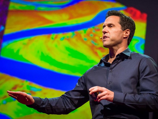
But perhaps the most exciting part about taking pictures from the air is we could later stitch these pictures together using special software to create a map of the entire landscape, and this map gives us crucial information for monitoring land use change, to let us know where and when plantations might be expanding, where forests might be contracting, or where fires might be breaking out. Aerial images could also be processed to produce three-dimensional computer models of forests. Now these models are not just visually appealing, but they are also geometrically accurate, which means researchers can now measure the distance between trees, calculate surface area, the volume of vegetation, and so on, all of which are important information for monitoring the health of these forests. Recently, we've also begun experimenting with thermal imaging cameras. Now these cameras can detect heat-emitting objects from the ground, and therefore they are very useful for detecting poachers or their campfires at night.
Dar poate cel mai entuziasmant aspect al fotografierii din aer e faptul că imaginile se pot pune cap-la-cap folosind un software special, pentru a crea o hartă a întregului peisaj, iar această hartă furnizează informații esențiale în monitorizarea schimbărilor survenite în utilizarea terenurilor, pentru a ne înștiința unde și când se extind plantațiile, unde se restrâng pădurile, sau unde ar putea apărea incendii. Imaginile din aer se mai pot procesa pentru a produce machete computerizate tridimensionale ale pădurilor. Aceste machete nu sunt doar atractive, dar și corecte din punct de vedere geometric, ceea ce înseamnă că cercetătorii pot măsura distanța dintre copaci, pot calcula suprafața și volumul vegetației etc., iar acestea sunt informații importante pentru monitorizarea sănătății pădurilor. De curând, am început și să experimentăm cu camere cu termoviziune. Aceste camere pot detecta obiecte de la sol care emit căldură și sunt utile, prin urmare, în detectarea braconierilor sau a focurilor lor de tabără noaptea.
So I've told you quite a lot about what conservation drones are, how you might operate one of these drones, and what a drone could do for you. I will now tell you where conservation drones are being used around the world. We built our first prototype drones in Switzerland. We brought a few of these to Indonesia for the first few test flights. Since then, we've been building drones for our collaborators from around the world, and these include fellow biologists and partners from major conservation organizations.
V-am spus multe despre ce sunt dronele de conservare, cum ați putea opera o asemenea dronă și ce poate face o dronă. Vă voi spune acum unde se folosesc dronele de conservare pe planetă. Ne-am construit primii prototipi de dronă în Elveția. Am adus câteva în Indonezia. pentru primele câteva zboruri de testare. De atunci, construim drone pentru colaboratorii noștri din toată lumea, inclusiv biologi ca noi și parteneri de la mari organizații de conservare.
Perhaps the best and most rewarding part about working with these collaborators is the feedback they give us on how to improve our drones. Building drones for us is a constant work in progress. We are constantly trying to improve them in terms of their range, their ruggedness, and the amount of payload they can carry. We also work with collaborators to discover new ways of using these drones. For example, camera traps are a common tool used by biologists to take pictures of shy animals hiding in the forests, but these are motion-activated cameras, so they snap a picture every time an animal crosses their path. But the problem with camera traps is that the researcher has to go back to the forest every so often to retrieve those images, and that takes a lot of time, especially if there are dozens or hundreds of these cameras placed in the forest. Now a drone could be designed to perform the task much more efficiently. This drone, carrying a special sensor, could be flown over the forest and remotely download these images from wi-fi–enabled cameras.
Poate cel mai bun și mai satisfăcător aspect al colaborării noastre este feedback-ul lor despre cum putem îmbunătăți dronele. Construirea dronelor este o muncă continuă pentru noi. Încercăm continuu să le îmbunătățim sfera de vizualizare, durabilitatea și sarcina utilă pe care o pot transporta. Mai lucrăm și cu colaboratori pentru a descoperi modalități noi de a folosi aceste drone. De exemplu, capcanele cu cameră sunt un instrument obișnuit folosite de biologi pentru a fotografia animale timide care se ascund în păduri. Sunt camere cu activare la mișcare care pozează un instantaneu de fiecare dată când un animal trece prin fața lor. Dar problema cu capcanele cu cameră este că cercetătorul trebuie să se întoarcă în pădure din când în când, pentru a recupera acele imagini, ceea ce ia mult timp, mai ales dacă sunt zeci sau sute de camere plasate în pădure. O dronă poate fi proiectată pentru a îndeplini sarcina mult mai eficient. O dronă care transportă un senzor special poate fi survolată peste pădure, iar pozele pot fi descărcate de la distanță prin camere conectate wireless la internet.
Radio collars are another tool that's commonly used by biologists. Now these collars are put onto animals. They transmit a radio signal which allows the researcher to track the movements of these animals across the landscape. But the traditional way of tracking animals is pretty ridiculous, because it requires the researcher to be walking on the ground carrying a huge and cumbersome radio antenna, not unlike those old TV antennae we used to have on our rooftops. Some of us still do. A drone could be used to do the same job much more efficiently. Why not equip a drone with a scanning radio receiver, fly that over the forest canopy in a certain pattern which would allow the user or the operator to triangulate the location of these radio-collared animals remotely without having to step foot in the forest.
Zgardele cu unde radio sunt încă o unealtă folosită curent de către biologi. Aceste zgărzi sunt puse pe animale. Emit un semnal radio care le permite cercetătorilor să urmărească deplasările animalelor pe teritoriu. Dar modul tradițional de a urmări animalele e cam ridicol, pentru că presupune ca cercetătorul să meargă pe jos purtând o antenă radio imensă și grea, ca vechile antene TV vechi pe care le aveam pe acoperișuri. Unii încă le au. O dronă poate fi folosită pentru a face treaba mult mai eficient. De ce să nu echipăm o dronă cu un receptor radio de scanare și să o pilotăm deasupra pădurii după un anumit șablon care să-i permită utilizatorului sau operatorului să repereze cu precizie locația acestor animale cu zgardă radio de la distanță, fără să fie nevoiți să facă un pas prin pădure.
A third and perhaps most exciting way of using these drones is to fly them to a really remote, never-explored-before rainforest somewhere hidden in the tropics, and parachute down a tiny spy microphone that would allow us to eavesdrop on the calls of mammals, birds, amphibians, the Yeti, the Sasquatch, Bigfoot, whatever. That would give us biologists a pretty good idea of what animals might be living in those forests.
A treia și poate cea mai interesantă metodă de a folosi aceste drone este de a le survola deasupra unei păduri tropicale izolate, neexplorate, într-un loc ascuns din tropice și de a parașuta microfoane spion minuscule care să ne permită să tragem cu urechea la comunicările mamiferelor, păsărilor, amfibienilor, ale lui Yeti, Sasquatch, Bigfoot, etc. Asta ne-ar da nouă, bilogilor, o înțelegere bunicică asupra animalelor care ar putea trăi în acele păduri.
And finally, I would like to show you the latest version of our conservation drone. The MAJA drone has a wingspan of about two meters. It weighs only about two kilograms, but it can carry half its weight. It is a fully autonomous system. During its mission, it can even transmit a live video feed back to a ground station laptop, which allows the user to see what the drone is seeing in real time. It carries a variety of sensors, and the photo quality of some of these sensors can be as high as one to two centimeters per pixel. This drone can stay in the air for 40 to 60 minutes, which gives it a range of up to 50 kilometers. That is quite sufficient for most of our conservation applications.
Finalmente, aș vrea să vă arăt ultima versiune a dronei noastre de conservare. Drona MAJA are o anvergură de aproximativ doi metri. Cântărește doar două kilograme, dar poate transporta jumătate din propria-i greutate. E un sistem complet autonom. În timpul misiunii, poate chiar transmite feedback în direct către o stație-laptop la sol, ceea ce permite utilizatorului să vadă ce vede drona în timp real. Poartă cu ea o varietate de senzori iar calitatea fotografică a unora dintre acești senzori poate ajunge la 1 - 2 centimetri pe pixel. Această dronă poate rămâne în aer 40-60 de minute, oferindu-i un câmp de survolare de până la 50 km. E suficient pentru majoritatea aplicațiilor noastre de conservare.
Now, conservation drones began as a crazy idea from two biologists who are just deeply passionate about this technology. And we believe, strongly believe, that drones can and will be a game changer for conservation research and applications. We've had our fair share of skeptics and critics who thought that we were just fooling around with toy planes. And in a way, they are right. I mean, let's be honest, drones are the ultimate toys for boys. But at the same time, we've also gotten to know many wonderful colleagues and collaborators who share our vision and see the potential of conservation drones. To us, it is obvious that conservation biologists and practitioners should make full use of every available tool, including drones, in our fight to save the last remaining forests and wildlife of this planet.
Dronele de conservare au început ca o idee nebunească a doi biologi pur și simplu pasionați de această tehnologie. Și credem cu tărie că dronele pot fi un adevărat punct de cotitură pentru cercetarea conservării pentru aplicațiile ei. Am avut parte de destui sceptici și critici care credeau că ne jucăm doar cu avioane de jucărie. Într-un fel, au dreptate. Să fim sinceri, dronele sunt jucăriile extreme pentru băieți. Dar în același timp, am ajuns să cunoaștem mulți colegi și colaboratori minunați care ne împărtășesc viziunea și care văd potențialul dronelor de conservare. Pentru noi este evident că biologii și practicienii de conservare trebuie să utilizeze pe deplin orice unealtă disponibilă, inclusiv dronele, în lupta pentru salvarea ultimelor păduri și animale rămase pe planeta asta.
Thank you.
Vă mulțumesc.
(Applause)
(Aplauze)