When we think of Nepal, we tend to think of the snow-capped mountains of the Himalayas, the crystal-clear still waters of its alpine lakes, or the huge expanse of its grasslands. What some of us may not realize is that in the Himalayan foothills, where the climate is much warmer and the landscape much greener, there lives a great diversity of wildlife, including the one-horned rhinoceros, the Asian elephant and the Bengal tiger. But unfortunately, these animals are under constant threat from poachers who hunt and kill them for their body parts. To stop the killing of these animals, battalions of soldiers and rangers are sent to protect Nepal's national parks, but that is not an easy task, because these soldiers have to patrol thousands of hectares of forests on foot or elephant backs. It is also risky for these soldiers when they get into gunfights with poachers, and therefore Nepal is always looking for new ways to help with protecting the forests and wildlife.
Cuando pensamos en Nepal, solemos pensar en las montañas nevadas del Himalaya, en las tranquilas aguas cristalinas de sus lagos de montaña, o en la enorme extensión de sus pastizales. Lo que algunos no advierten es que en las estribaciones del Himalaya, donde el clima es mucho más cálido y el paisaje mucho más verde, vive una gran diversidad de fauna, incluyendo el rinoceronte de un cuerno, el elefante asiático y el tigre de Bengala. Pero, por desgracia, estos animales están bajo la constante amenaza de los cazadores furtivos que los persiguen y los matan por sus partes. Para detener la matanza de estos animales, se envían batallones de soldados y guardas a proteger los parques nacionales de Nepal, pero no es tarea fácil, porque estos soldados tienen que patrullar miles de hectáreas de bosques a pie o en lomos de elefante. También es riesgoso para estos soldados cuando enfrentan tiroteos con los cazadores furtivos, y por eso en Nepal se buscan nuevas formas de proteger los bosques y la fauna. Recientemente Nepal adquirió una nueva herramienta
Well recently, Nepal acquired a new tool in the fight against wildlife crime, and these are drones, or more specifically, conservation drones. For about a year now, my colleagues and I have been building drones for Nepal and training the park protection personnel on the use of these drones. Not only does a drone give you a bird's-eye view of the landscape, but it also allows you to capture detailed, high-resolution images of objects on the ground. This, for example, is a pair of rhinoceros taking a cooling bath on a hot summer day in the lowlands of Nepal. Now we believe that drones have tremendous potential, not only for combating wildlife crime, but also for monitoring the health of these wildlife populations.
para enfrentar el crimen contra la fauna, y son los drones, o, más específicamente, los drones de conservación. Desde hace cerca de un año, junto con mis colegas hemos construido drones para Nepal y capacitado al personal de protección del parque en el uso de estos drones. Un dron no solo da una vista del paisaje a vuelo de pájaro, sino que también permite una captura en detalle, de imágenes de alta resolución de los objetos en el suelo. Esto, por ejemplo, es un par de rinocerontes que toman un baño refrescante en un día caluroso de verano en las tierras bajas de Nepal. Creemos que los drones tienen un potencial enorme, no solo para combatir el crimen contra la fauna, sino también para monitorear la salud de las poblaciones de fauna silvestre. ¿Qué es un dron?
So what is a drone? Well, the kind of drone I'm talking about is simply a model aircraft fitted with an autopilot system, and this autopilot unit contains a tiny computer, a GPS, a compass, a barometric altimeter and a few other sensors. Now a drone like this is meant to carry a useful payload, such as a video camera or a photographic camera. It also requires a software that allows the user to program a mission, to tell the drone where to go.
Bueno, el tipo de dron del que estoy hablando es simplemente un modelo de avión equipado con un sistema de piloto automático, con una pequeña computadora, un GPS, una brújula, un altímetro barométrico y algunos otros sensores. Un avión no tripulado como este puede llevar carga útil, como una videocámara o una cámara fotográfica. También requiere un software que le permita al usuario programar la misión, para decirle al dron a dónde ir. Muchas personas a menudo se sorprenden
Now people I talk to are often surprised when they hear that these are the only four components that make a conservation drone, but they are even more surprised when I tell them how affordable these components are. The facts is, a conservation drone doesn't cost very much more than a good laptop computer or a decent pair of binoculars.
cuando se enteran de que estos son los únicos cuatro componentes que constituyen uno de estos drones, pero se sorprenden aún más cuando les digo lo económicos que son estos componentes. De hecho, un dron de conservación no cuesta mucho más que una buena computadora portátil o un par de binoculares decente. Ahora que construyeron su propio dron de conservación,
So now that you've built your own conservation drone, you probably want to go fly it, but how does one fly a drone? Well, actually, you don't, because the drone flies itself. All you have to do is to program a mission to tell the drone where to fly. But you simply do that by clicking on a few way points on the Google Maps interface using the open-source software. Those missions could be as simple as just a few way points, or they could be slightly longer and more complicated, to fly along a river system. Sometimes, we fly the drone in a lawnmower-type pattern and take pictures of that area, and those pictures can be processed to produce a map of that forest. Other researchers might want to fly the drone along the boundaries of a forest to watch out for poachers or people who might be trying to enter the forest illegally.
quizá quieran volarlo, pero ¿cómo volar un dron? Bueno, en realidad, uno no lo hace, porque el dron vuela por sí mismo. Uno solo programa una misión para indicarle al dron a dónde volar. Para eso sencillamente pulsa sobre algunos puntos en la interfaz de Google Maps mediante un software de código abierto. Esas misiones pueden ser muy simples y tener pocos puntos, o un poco más largas y más complicadas, como sobrevolar un sistema fluvial. A veces volamos el dron en un patrón de tipo cortadora de césped, tomamos fotos de esa zona, y esas imágenes pueden ser procesadas para producir un mapa del bosque. Otros investigadores podrían querer volar el dron por los límites de un bosque para vigilar cazadores furtivos o transeuntes que tratan de entrar al bosque ilegalmente. Pero cualquiera que sea la misión,
Now whatever your mission is, once you've programmed it, you simply upload it to the autopilot system, bring your drone to the field, and launch it simply by tossing it in the air. And often we'll go about this mission taking pictures or videos along the way, and usually at that point, we will go grab ourselves a cup of coffee, sit back, and relax for the next few minutes, although some of us sit back and panic for the next few minutes worrying that the drone will not return. Usually it does, and when it does, it even lands automatically.
una vez programada, sencillamente se carga al sistema de piloto automático, se lleva el dron al terreno, y se pone en marcha simplemente arrojándolo al aire. A menudo la misión consistirá en tomar fotos o videos por el camino. Generalmente en ese momento iremos en busca de una taza de café y nos sentaremos relajados durante unos minutos, aunque algunos entremos en pánico en los siguientes minutos por temor a que el dron no regrese. Por lo general lo hace, y cuando lo hace, incluso aterriza de forma automática. ¿Qué podemos hacer con un dron de conservación?
So what can we do with a conservation drone? Well, when we built our first prototype drone, our main objective was to fly it over a remote rainforest in North Sumatra, Indonesia, to look for the nest of a species of great ape known as the orangutan. The reason we wanted to do that was because we needed to know how many individuals of this species are still left in that forest. Now the traditional method of surveying for orangutans is to walk the forest on foot carrying heavy equipment and to use a pair of binoculars to look up in the treetops where you might find an orangutan or its nest. Now as you can imagine, that is a very time-consuming, labor-intensive, and costly process, so we were hoping that drones could significantly reduce the cost of surveying for orangutan populations in Indonesia and elsewhere in Southeast Asia. So we were very excited when we captured our first pair of orangutan nests on camera. And this is it; this is the first ever picture of orangutan nests taken with a drone. Since then we have taken pictures of dozens of these nests from around various parts of Southeast Asia, and we're now working with computer scientists to develop algorithms that can automatically count the number of nests from the thousands of photos we've collected so far.
Cuando construimos el primer prototipo de dron, nuestro principal objetivo era sobrevolar una selva remota en el norte de Sumatra, Indonesia, en busca de una especie de gran simio conocido como orangután. Queríamos hacerlo porque necesitábamos saber cuántos ejemplares de esta especie quedaban en el bosque. El método tradicional de inspección de orangutanes consiste en caminar por el bosque a pie llevando equipos pesados y con un par de binoculares mirar hacia las copas de los árboles en busca de orangutanes o de sus nidos. Como podrán ver, es un proceso que lleva mucho tiempo, mucho trabajo y es muy costoso. Esperábamos que los drones pudieran reducir significativamente el costo de la búsqueda de poblaciones de orangutanes en Indonesia y otros lugares del sudeste asiático. Por eso fue emocionante capturar imágenes del primer par de nidos de orangután. Y aquí está; esta es la primera imagen de nidos de orangután tomadas con un dron. Como tomamos fotos de decenas de nidos de diversas partes del sudeste asiático, estamos trabajando con científicos informáticos, desarrollando algoritmos que puedan contar de forma automática la cantidad de nidos a partir de las miles de fotos tomadas hasta ahora. Estos drones no solo pueden detectar nidos.
But nests are not the only objects these drones can detect. This is a wild orangutan happily feeding on top of a palm tree, seemingly oblivious to our drone that was flying overhead, not once but several times. We've also taken pictures of other animals including forest buffalos in Gabon, elephants, and even turtle nests.
Este orangután en su hábitat se alimenta feliz en la copa de una palmera, aparentemente ajeno a nuestro dron que sobrevoló la zona, no una, sino varias veces. También hemos tomado fotos de otros animales incluyendo búfalos forestales en Gabón, elefantes, e incluso nidos de tortuga. Pero aparte de tomar fotos de los propios animales,
But besides taking pictures of just the animals themselves, we also take pictures of the habitats these animals live in, because we want to keep track of the health of these habitats. Sometimes, we zoom out a little and look at other things that might be happening in the landscape. This is an oil palm plantation in Sumatra. Now oil palm is a major driver of deforestation in that part of the world, so we wanted to use this new drone technology to keep track of the spread of these plantations in Southeast Asia. But drones could also be used to keep track of illegal logging activities. This is a recently logged forest, again in Sumatra. You could even still see the processed wooden planks left on the ground.
también captamos los hábitats donde viven estos animales, porque queremos seguir la pista de la salud en esos ambientes. A veces, nos acercamos un poco para observar lo que puede estar sucediendo en el paisaje. Esta es una plantación de palma de aceite en Sumatra. Estos cultivos son un motor importante en la deforestación en esa parte del mundo; por eso queríamos usar esta nueva tecnología a base de drones para hacer cuentas de la propagación de estas plantaciones en el sudeste asiático. También se podrían usar drones para vigilar la tala ilegal. Este es un bosque talado recientemente, de nuevo en Sumatra. Incluso todavía se pueden ver los tablones procesados que quedaron en el suelo. Pero tal vez la parte más emocionante
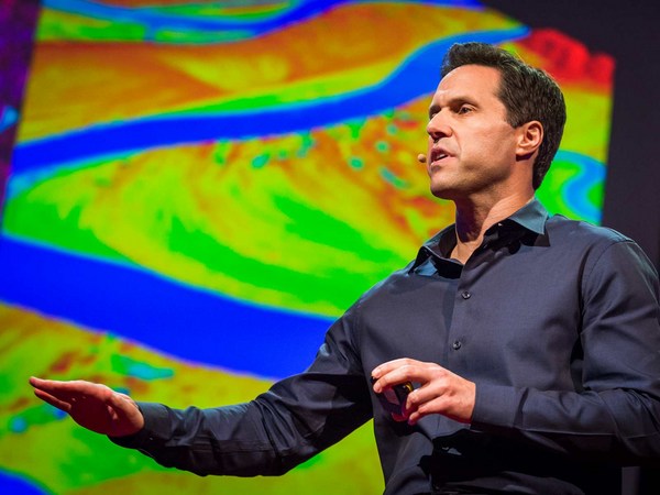
But perhaps the most exciting part about taking pictures from the air is we could later stitch these pictures together using special software to create a map of the entire landscape, and this map gives us crucial information for monitoring land use change, to let us know where and when plantations might be expanding, where forests might be contracting, or where fires might be breaking out. Aerial images could also be processed to produce three-dimensional computer models of forests. Now these models are not just visually appealing, but they are also geometrically accurate, which means researchers can now measure the distance between trees, calculate surface area, the volume of vegetation, and so on, all of which are important information for monitoring the health of these forests. Recently, we've also begun experimenting with thermal imaging cameras. Now these cameras can detect heat-emitting objects from the ground, and therefore they are very useful for detecting poachers or their campfires at night.
de tomar fotos desde el aire es que podríamos unir todas esas fotos con un software especial para confeccionar un mapa de todo el paisaje. Este mapa nos daría información crucial para monitorear el cambio de uso de la tierra; para saber dónde y cómo crecen las plantaciones, dónde se reducen los bosques, o dónde se inician los incendios. Se podrían procesar las imágenes aéreas para producir en la computadora modelos tridimensionales de los bosques. Estos modelos no solo tienen un atractivo visual, sino que también son geométricamente exactos, lo que significa que los investigadores ahora pueden medir la distancia entre los árboles, calcular las áreas, el volumen de la vegetación, etc., toda información importante para monitorear la salud de estos bosques. Recientemente, hemos empezado a experimentar con cámaras de imagen térmica. Estas cámaras pueden detectar objetos emisores de calor, y por ende, son muy útiles para detectar cazadores furtivos o fogatas en la noche.
So I've told you quite a lot about what conservation drones are, how you might operate one of these drones, and what a drone could do for you. I will now tell you where conservation drones are being used around the world. We built our first prototype drones in Switzerland. We brought a few of these to Indonesia for the first few test flights. Since then, we've been building drones for our collaborators from around the world, and these include fellow biologists and partners from major conservation organizations.
Les he contado bastante sobre qué son los drones de conservación, cómo operarlos, y qué pueden hacer por nosotros. Ahora les contaré dónde se usan en todo el mundo. Construímos nuestros primeros prototipos de drones en Suiza. Trajimos algunos a Indonesia para hacer los primeros vuelos de prueba. Después hemos construido drones para nuestros colaboradores de todo el mundo, entre ellos colegas biólogos y socios de las principales organizaciones de conservación.
Perhaps the best and most rewarding part about working with these collaborators is the feedback they give us on how to improve our drones. Building drones for us is a constant work in progress. We are constantly trying to improve them in terms of their range, their ruggedness, and the amount of payload they can carry. We also work with collaborators to discover new ways of using these drones. For example, camera traps are a common tool used by biologists to take pictures of shy animals hiding in the forests, but these are motion-activated cameras, so they snap a picture every time an animal crosses their path. But the problem with camera traps is that the researcher has to go back to the forest every so often to retrieve those images, and that takes a lot of time, especially if there are dozens or hundreds of these cameras placed in the forest. Now a drone could be designed to perform the task much more efficiently. This drone, carrying a special sensor, could be flown over the forest and remotely download these images from wi-fi–enabled cameras.
Quizá la mejor parte y la más gratificante de trabajar con estos colaboradores es la retroalimentación que nos dan sobre cómo mejorar nuestros drones. Construir drones para nosotros es una obra en progreso constante. Siempre tratamos de mejorarlos en materia de rango, robustez, y cantidad de carga que pueden transportar. También trabajamos con colaboradores para descubrir nuevas formas de usar estos drones. Por ejemplo, las cámaras trampa son herramientas comunes para los biólogos que quieren tomar imágenes de animales tímidos que se esconden en los bosques, Estas son cámaras sensibles al movimiento, que se disparan cuando un animal cruza su camino. El problema con estas cámaras es que los investigadores tienen que volver al bosque de vez en cuando para recuperar esas imágenes. Eso lleva mucho tiempo, especialmente si hay decenas o cientos de cámaras por todo el bosque. Se puede entonces diseñar un dron para hacer la tarea de manera mucho más eficiente. Este dron, con un sensor especial, podría sobrevolar el bosque y descargar estas imágenes de forma remota desde cámaras con wi-fi. Los collares con radio son otra herramienta
Radio collars are another tool that's commonly used by biologists. Now these collars are put onto animals. They transmit a radio signal which allows the researcher to track the movements of these animals across the landscape. But the traditional way of tracking animals is pretty ridiculous, because it requires the researcher to be walking on the ground carrying a huge and cumbersome radio antenna, not unlike those old TV antennae we used to have on our rooftops. Some of us still do. A drone could be used to do the same job much more efficiently. Why not equip a drone with a scanning radio receiver, fly that over the forest canopy in a certain pattern which would allow the user or the operator to triangulate the location of these radio-collared animals remotely without having to step foot in the forest.
que los biólogos usan comúnmente. Se le colocan a los animales. Los collares transmiten señales de radio que le permiten al investigador rastrear los movimientos de los animales por el paisaje. Esta forma tradicional de rastrear animales es bastante ridícula, porque requiere que el investigador camine por el terreno con una enorme y engorrosa antena de radio, como esas viejas antenas de TV que solíamos tener en el techo. Algunos todavía las tenemos. Podría usarse un dron para hacer lo mismo de manera mucho más eficiente. ¿Por qué no equipar un dron con un receptor de radio de barrido, que sobrevuele el dosel del bosque siguiendo cierto patrón que le permita al usuario o al operador, de forma remota, triangular la ubicación de los animales que llevan collar, sin tener que poner un pie en el bosque. Una tercera manera, y quizá la más interesante,
A third and perhaps most exciting way of using these drones is to fly them to a really remote, never-explored-before rainforest somewhere hidden in the tropics, and parachute down a tiny spy microphone that would allow us to eavesdrop on the calls of mammals, birds, amphibians, the Yeti, the Sasquatch, Bigfoot, whatever. That would give us biologists a pretty good idea of what animals might be living in those forests.
de usar estos drones es sobrevolar selvas muy remotas nunca antes exploradas en algún lugar oculto de los trópicos, y lanzar en paracaídas pequeños micrófonos que nos permitan espiar las llamadas de mamíferos, aves, anfibios, el Yeti, el Sasquatch, Bigfoot, lo que sea. Esto nos daría a los biólogos una idea bastante clara de lo que los animales podrían estar viviendo en los bosques. Por último, me gustaría mostrarles
And finally, I would like to show you the latest version of our conservation drone. The MAJA drone has a wingspan of about two meters. It weighs only about two kilograms, but it can carry half its weight. It is a fully autonomous system. During its mission, it can even transmit a live video feed back to a ground station laptop, which allows the user to see what the drone is seeing in real time. It carries a variety of sensors, and the photo quality of some of these sensors can be as high as one to two centimeters per pixel. This drone can stay in the air for 40 to 60 minutes, which gives it a range of up to 50 kilometers. That is quite sufficient for most of our conservation applications.
la última versión de nuestro dron de conservación. El dron MAJA tiene una envergadura de unos dos metros. Pesa solo unos dos kilos, pero puede transportar la mitad de su peso. Es un sistema totalmente autónomo. Durante su misión, incluso puede transmitir video en vivo de respuesta a una laptop en tierra, lo que le permite al usuario ver lo que está viendo el dron, en tiempo real. Lleva una serie de sensores, de modo que la calidad de sus fotos puede llegar a uno o dos centímetros por pixel. El dron puede permanecer en el aire durante 40 a 60 minutos, lo que le da un rango de hasta 50 kilómetros que es suficiente para la mayoría de las aplicaciones de conservación. Los drones de conservación empezaron como una idea alocada de dos biólogos
Now, conservation drones began as a crazy idea from two biologists who are just deeply passionate about this technology. And we believe, strongly believe, that drones can and will be a game changer for conservation research and applications. We've had our fair share of skeptics and critics who thought that we were just fooling around with toy planes. And in a way, they are right. I mean, let's be honest, drones are the ultimate toys for boys. But at the same time, we've also gotten to know many wonderful colleagues and collaborators who share our vision and see the potential of conservation drones. To us, it is obvious that conservation biologists and practitioners should make full use of every available tool, including drones, in our fight to save the last remaining forests and wildlife of this planet.
a los que les apasiona esta tecnología. Creemos, firmemente, que los drones pueden ser y serán un elemento de cambio para la investigación y las aplicaciones de conservación. Hemos tenido nuestra cuota de escépticos y críticos que pensaban que estábamos manipulando aviones de juguete. Y en cierto modo, tienen razón. Quiero decir, seamos honestos, los drones son el mejor juguete para jóvenes. Al mismo tiempo, también hemos llegado a conocer muchos colegas y colaboradores maravillosos que comparten nuestra visión y ven el gran potencial en los drones de conservación. Para nosotros, es obvio que los biólogos conservacionistas y los operadores deben hacer uso pleno de toda herramienta disponible, incluyendo los drones, en nuestra lucha por salvar los últimos bosques y la fauna silvestres del planeta. Gracias.
Thank you.
(Aplausos)
(Applause)