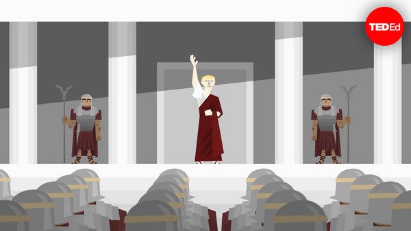
When Homer’s Iliad was first written down in the 8th century BCE, the story of the Trojan war was already an old one. From existing oral tradition, audiences knew the tales of the long siege, the epic duels outside the city walls, and the cunning trick that finally won the war. In the end, the magnificent city was burned to the ground, never to rise again. But had it ever existed?
เมื่อโคลงของโฮมเมอร์ ถูกเขียนขึ้นเมื่อ 8 ศตวรรษก่อนคริสกาล เรื่องสงครามโทรจันก็ยิ่งเก่าแก่กว่านั้น จากเรื่องเล่าปากต่อปาก ผู้ฟังได้รู้จักเรื่องราว เกี่ยวกับการล้อมเมืองอย่างยาวนาน การดวลศึกนอกกำแพงเมือง รวมถึงกลเม็ดที่ช่วยให้ชนะสงคราม ท้ายที่สุด เมืองถูกเผามอดไหม้ ไม่มีวันได้ฟื้นฟูกลับมาเลย แต่เมืองนี้มีอยู่จริงหรือเปล่า
By the time the field of archaeology began to take shape in the 19th century, many were skeptical, considering the epic to be pure fiction, a founding myth imagining a bygone heroic era. But some scholars believed that behind the superhuman feats and divine miracles there must have been a grain of historical truth - a war that was really fought, and a place where it happened.
เมื่อการศึกษาด้านโบราณคดี เริ่มเป็นรูปเป็นร่างตั้งแต่ศตวรรษที่ 19 หลายคนสงสัยว่ามันเรื่องสุดเจ๋งนี้ เป็นเพียงนิยาย เป็นปกรณัมที่บรรยายถึงวีรบุรุษจากอดีตกาล แต่นักวิชาการบางคนเชื่อว่า เบื้องหลังความเหนือมนุษย์ และปาฎิหาริย์จากทวยเทพ มันควรที่จะมีเมล็ดแห่งความจริง ทางประวัติศาสตร์ เกี่ยวกับสงครามที่มีการสู้รบกันจริง และสถานที่เกิดเหตุการณ์นั้น
Frank Calvert was one such believer. He had spent his youth traveling and learning about ancient civilizations before accompanying his brother Frederick on a diplomatic mission to the northwest Anatolian region of Çanakkale. It was here that Homer described the Greek encampment at the mouth of the Scamander river. And it was here that fate brought Frank into contact with a journalist and geologist named Charles Maclaren.
แฟรงค์ คาล์เวิร์ต เป็นคนหนึ่งที่เชื่อ เขาใช้เวลาช่วงวัยหนุ่ม ท่องเที่ยวและศึกษาอารยธรรมโบราณ ก่อนที่จะร่วมทางไปกับน้องชายเขา เฟรดเดอริก ในภารกิจการทูตทางตะวันตกเฉียงเหนือ ของเมืองชนักคาล แคว้นอานาโตเลีย ที่นี่เอง ที่โฮเมอร์บรรยายถึง การตั้งแคมป์ของชาวกรีก ที่ปากทางแม่น้ำสคาเแมนเดอร์ และที่นี่เอง ที่ชะตาได้ทำให้แฟรงค์ พบกับนักข่าวและนักธรณีวิทยา ชื่อว่า ชาร์ลส์ แมคลาเรน
Locals and travelers had long speculated that Troy might’ve stood on one of the surrounding hilltops. But Maclaren had been one of the first to publish a detailed topographical study of the area. He believed he had found the site – a 32-meter mound known by the name Hisarlık, derived from the Turkish word for “fortress.” Soon after meeting with him in 1847, the Calverts bought 2,000 acres of farmland that included part of the hill. Before they could explore any further, the Crimean War broke out and forestalled their archaeological ambitions for several years.
คนพื้นที่และนักท่องเที่ยวคิดกันมานานแล้ว ว่าเมืองทรอยน่าจะตั้งอยู่บนเขาแถว ๆ นี้ แต่แมคลาเรนเป็นหนึ่งในคนแรก ๆ ที่ตีพิมพ์การศึกษาภูมิประเทศ ในบริเวณนั้นอย่างละเอียด เขาเชื่อว่าเขาได้เจอเข้ากับบริเวณ ที่เป็นเนินขนาด 32 เมตร ที่รู้จักกันในนาม ฮิสซาลิก ซึ่งเป็นคำที่จากภาษาตุรกี แปลว่า "ป้อมปราการ" หลังจากได้พบกับแมคลาเรนในปี ค.ศ. 1847 ครอบครัวคาเวิร์ต ซื้อพื้นที่ทางการเกษตร 2,000 เอเคอร์ ซึ่งรวมถึงส่วนของภูเขาด้วย ก่อนพวกเขาจะสำรวจอะไรเพิ่มเติมได้ สงครามไครเมียก็เกิดขึ้น และขัดขวางความพยายาม ทางโบราณคดีของพวกเขาอยู่หลายปี
After the war’s end, Frank Calvert began to survey the site, but lacked the funds for a full excavation. This was where the wealthy German businessman and amateur archaeologist Heinrich Schliemann came in. At Calvert’s invitation,
หลังสงครามจบลง แฟรงค์ คาเวิร์ต เริ่มออกสำรวจพื้นที่ แต่ขาดแคลนเงินทุน สำหรับการขุดค้นบริเวณทั้งหมด ด้วยเหตุนี้เอง นักธุรกิจชาวเยอรมันผู้ร่ำรวย และนักโบราณคดีมือสมัครเล่น ไฮน์ริคช์ ชลีมัน จึงเข้ามามีส่วนเกี่ยวข้อง จากคำเชิญของคาเวิร์ต
Schliemann visited the grounds in 1868, and decided to excavate. Eager to find the ancient city, Schliemann tore massive trenches all the way to the base of the hill. There, he uncovered a hoard of precious artifacts, jewelry, and metalwork, including two diadems and a copper shield. Schliemann took full credit for the discovery, announcing that he had found Troy and the treasure of its king Priam. But the real treasure was elsewhere. When later archaeologists studied the site, they realized that the mound consisted of no less than nine cities, each built atop the ruins of the last. The layer Schliemann had uncovered dated back to the Mycenaean Age, more than 1,000 years too early for Homer.
ชลีมันไปเยี่ยมชมบริเวณในปี ค.ศ. 1868 และตัดสินใจว่าจะทำการขุดสำรวจ ด้วยความมุ่งมั่นที่จะหาเมืองโบราณ ชลีมันทำการขุดคูขนาดใหญ่ ยาวเป็นแนวไปจนถึงตีนเขา และที่นั่น เขาได้พบกับโบราณวัตถุมีค่า เครื่องประดับ และงานโลหะ ที่รวมถึง มงกุฎสององค์ และโล่ทองแดง ชลีมันอ้างเอาความดีความชอบ ในการค้นพบครั้งนี้ โดยประกาศว่าเขาได้ค้นพบเมืองทรอย และสมบัติของกษัตริย์ไพรอัม แต่สมบัติที่แท้จริงอยู่ที่อื่น ต่อมาภายหลัง เมื่อนักโบราณคดีศึกษาพื้นที่นี้ พวกเขาก็เข้าใจว่าบริเวณภูเขานี้ ประกอบด้วยเมืองไม่น้อยกว่าเก้าเมือง ที่ถูกสร้างทับอยู่บนซากเมืองเก่า ชั้นที่ชลีมันค้นพบอยู่ในยุคไมซีเนีย ซึ่งมันใหม่กว่ายุคของโฮมเมอร์ มากเกินกว่า 1,000 ปี
But inside the mound was indeed evidence for a city that had thrived during the Bronze Age, with charred stone, broken arrowheads, and damaged human skeletons suggesting a violent end. It was Troy VII, contained in the middle layers and now ravaged for a second time by Schliemann’s careless excavation. The settlement, spanning some 200,000 square meters and home to as many as 10,000 people, thrived until around 1180 BCE. Its position at the southern entrance of the Dardanelles strait would’ve made a formidable strategic location for both defense and trade. Most importantly, there are the remains of a massive fortification wall – perhaps the very same one from which Priam and Hector once watched the Greeks approach.
แต่แน่นอนว่าในเขตภูเขานั้นคือหลักฐาน ของเมืองที่รุ่งเรืองในยุคสำริด ที่มีหินรมควัน หัวธนูหัก และโครงกระดูกมนุษย์ ที่ได้รับความเสียหายจากกระปะทะต่อสู้ มันคือเมืองทรอยที่เจ็ด ซึ่งอยู่ในชั้นตอนกลาง และตอนนี้มันถูกถล่มเป็นครั้งที่สอง จากการขุดอย่างไม่ระวังของชลีมัน บริเวณของการตั้งถิ่นฐานนี้ กินพื้นที่กว่า 200,000 ตารางเมตร และเป็นที่อยู่อาศัยของคนราว ๆ 10,000 คน จนถึง 1180 ปีก่อนคริสกาล ตำแหน่งของมันที่ทางเข้าทางตอนใต้ ของช่องแคบดาเดนเนลลีส ไม่ได้เป็นจุดยุทธศาสตร์ที่ดีเลย ทั้งในด้านการป้องกันและการค้า ที่สำคัญไปกว่านั้นคือ ซากกำแพงป้อมปราการใหญ่ ที่อาจเป็นกำแพง ที่กษัตริย์ไพรอัมและเฮกเตอร์ เคยมองเห็นกองทัพกรีกรุกเข้ามาใกล้
Of course, it’s difficult to be certain that these ruins are the true remains of ancient Troy, and scholars still dispute whether the Trojan War as described by Homer ever happened. Yet the evidence is strong enough that UNESCO has labelled Hisarlık the archeological site of Troy. Regardless of its identity, thanks to persistence, a bit of faith, and a lot of research, archaeologists are bringing the long-buried secrets of an ancient, lost city to light.
แน่นอนว่า มันยากที่เราจะมั่นใจได้ ว่าซากเหล่านี้คือ เมืองทรอยโบราณที่หลงเหลืออยู่ และนักวิชาการก็ยังถกเถียงกัน ว่าสงครามโทรจันที่โฮมเมอร์กล่าวถึง เคยเกิดขึ้นจริง ๆ หรือเปล่า แต่ถึงอย่างนั้น หลักฐานก็มีน้ำหนักพอ ที่ยูเนสโก้จะประกาศให้ฮิสซาลิก คือบริเวณทางโบราณคดีของเมืองทรอย ไม่ว่ากรุงทรอยจะมีหน้าตาเช่นไร เราต้องขอขอบคุณความวิริยะ ความศรัทธาอีกเล็กน้อย และการค้นคว้ามากมาย นักโบราณคดีได้ทำให้ความลับ ของเมืองโบราณที่สูญหาย ที่ถูกฝังมาช้านานได้รับความกระจ่าง