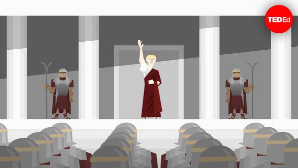
When Homer’s Iliad was first written down in the 8th century BCE, the story of the Trojan war was already an old one. From existing oral tradition, audiences knew the tales of the long siege, the epic duels outside the city walls, and the cunning trick that finally won the war. In the end, the magnificent city was burned to the ground, never to rise again. But had it ever existed?
Quando, per la prima volta, l'Iliade di Omero fu messa per iscritto nell'VIII secolo a.C., la storia della guerra di Troia era già vecchia. Grazie alla tradizione orale, il pubblico conosceva i racconti del lungo assedio, i duelli epici fuori dalle mura della città e il trucco ingegnoso che condusse alla vittoria. Alla fine, la magnifica città venne bruciata e rasa al suolo, per non risorgere mai più. Ma è realmente esistita?
By the time the field of archaeology began to take shape in the 19th century, many were skeptical, considering the epic to be pure fiction, a founding myth imagining a bygone heroic era. But some scholars believed that behind the superhuman feats and divine miracles there must have been a grain of historical truth - a war that was really fought, and a place where it happened.
Quando il campo dell'archeologia cominciò a fiorire nel XIX secolo, molti erano scettici, perché pensavano che l'epica fosse pura finzione, un mito fondativo che fantasticava su una remota era eroica. Ma alcuni studiosi credevano che dietro alle imprese sovrumane e ai miracoli divini ci dovesse essere un fondo di verità storica, una guerra realmente combattuta e un posto dove ebbe luogo.
Frank Calvert was one such believer. He had spent his youth traveling and learning about ancient civilizations before accompanying his brother Frederick on a diplomatic mission to the northwest Anatolian region of Çanakkale. It was here that Homer described the Greek encampment at the mouth of the Scamander river. And it was here that fate brought Frank into contact with a journalist and geologist named Charles Maclaren.
Frank Calvert era uno di questi studiosi. Aveva passato la gioventù a viaggiare e a studiare le civiltà antiche prima di accompagnare suo fratello Frederick in una missione diplomatica nella regione di Çanakkale nel nordovest dell'Anatolia. È qui che Omero descrisse l'accampamento greco alla foce dello Scamandro. Ed è qui che il destino mise Frank in contatto con un giornalista e geologo di nome Charles Maclaren.
Locals and travelers had long speculated that Troy might’ve stood on one of the surrounding hilltops. But Maclaren had been one of the first to publish a detailed topographical study of the area. He believed he had found the site – a 32-meter mound known by the name Hisarlık, derived from the Turkish word for “fortress.” Soon after meeting with him in 1847, the Calverts bought 2,000 acres of farmland that included part of the hill. Before they could explore any further, the Crimean War broke out and forestalled their archaeological ambitions for several years.
Locali e viaggiatori ipotizzavano da tempo che Troia potesse essere sorta sulla cima di una delle colline circostanti. Ma Maclaren era stato uno dei primi a pubblicare uno studio topografico dettagliato dell'area. Credeva di aver trovato il sito: una collinetta di 32 metri conosciuta con il nome di Hisarlık, che deriva dalla parola turca per "rocca". Poco dopo il loro incontro nel 1847, i Calvert comprarono 800 ettari di terreno agricolo che comprendevano parte della collina. Prima che potessero esplorare più a fondo, la guerra di Crimea scoppiò, ostacolando le loro ambizioni archeologiche per molti anni.
After the war’s end, Frank Calvert began to survey the site, but lacked the funds for a full excavation. This was where the wealthy German businessman and amateur archaeologist Heinrich Schliemann came in. At Calvert’s invitation,
Dopo la fine della guerra, Frank Calvert iniziò a ispezionare il sito, ma non aveva fondi sufficienti per un intero scavo. È qui che entrò in gioco Heinrich Schliemann, ricco uomo d'affari e archeologo dilettante tedesco. Su invito di Calvert,
Schliemann visited the grounds in 1868, and decided to excavate. Eager to find the ancient city, Schliemann tore massive trenches all the way to the base of the hill. There, he uncovered a hoard of precious artifacts, jewelry, and metalwork, including two diadems and a copper shield. Schliemann took full credit for the discovery, announcing that he had found Troy and the treasure of its king Priam. But the real treasure was elsewhere. When later archaeologists studied the site, they realized that the mound consisted of no less than nine cities, each built atop the ruins of the last. The layer Schliemann had uncovered dated back to the Mycenaean Age, more than 1,000 years too early for Homer.
Schliemann visitò il terreno nel 1868 e decise di iniziare a scavare. Entusiasta di trovare l'antica città, Schliemann scavò enormi fossati lungo tutta la base della collina. Qui scoprì una montagna di manufatti preziosi, gioielli e oggetti in metallo, compresi due diademi e uno scudo in rame. Schliemann si prese tutto il merito della scoperta, annunciando di aver trovato Troia e il tesoro del suo re Priamo. Ma il vero tesoro era altrove. Quando altri archeologi studiarono il sito, si accorsero che la collinetta era costituita da almeno nove città, ognuna costruita sopra le rovine della precedente. Lo strato scoperto da Schliemann risaliva all'età micenea, più di 1000 anni prima, rispetto a Omero.
But inside the mound was indeed evidence for a city that had thrived during the Bronze Age, with charred stone, broken arrowheads, and damaged human skeletons suggesting a violent end. It was Troy VII, contained in the middle layers and now ravaged for a second time by Schliemann’s careless excavation. The settlement, spanning some 200,000 square meters and home to as many as 10,000 people, thrived until around 1180 BCE. Its position at the southern entrance of the Dardanelles strait would’ve made a formidable strategic location for both defense and trade. Most importantly, there are the remains of a massive fortification wall – perhaps the very same one from which Priam and Hector once watched the Greeks approach.
Ma dentro la collinetta c'erano effettivamente tracce di una città fiorita durante l'Età del bronzo, con pietre carbonizzate, punte di frecce spezzate e scheletri umani distrutti che facevano pensare a una fine violenta. Era Troia VII, contenuta negli strati intermedi e devastata una seconda volta dallo scavo poco accurato di Schliemann. L'insediamento, che si estendeva su circa 200.000 metri quadrati e in cui vivevano 10.000 persone, prosperò fino al 1180 a.C. circa. La sua posizione all'ingresso sud dello stretto dei Dardanelli lo aveva reso un luogo altamente strategico sia per la difesa che per il commercio. E, cosa più importante, ci sono i resti di un enorme muro di fortificazione, magari proprio quello
Of course, it’s difficult to be certain that these ruins are the true remains of ancient Troy, and scholars still dispute whether the Trojan War as described by Homer ever happened. Yet the evidence is strong enough that UNESCO has labelled Hisarlık the archeological site of Troy. Regardless of its identity, thanks to persistence, a bit of faith, and a lot of research, archaeologists are bringing the long-buried secrets of an ancient, lost city to light.
da cui Priamo ed Ettore videro i Greci avvicinarsi. Ovviamente è difficile essere sicuri che queste siano le vere rovine dell'antica città di Troia, e gli studiosi si chiedono ancora se la guerra di Troia, così come descritta da Omero, abbia mai avuto luogo. Le prove, però, sono così solide che l'UNESCO ha rinoniminato Hisarlık il sito archeologico di Troia. A prescindere dalla sua identità, grazie alla perseveranza, a un po' di fiducia e a molta ricerca, gli archeologi stanno portando alla luce i segreti sepolti da tempo di un'antica città perduta.