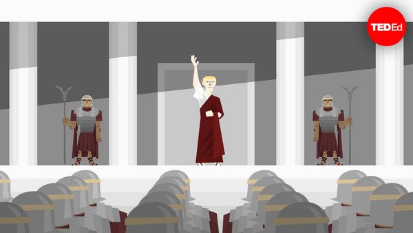
Když byla poprvé v 8. století před naším letopočtem napsána Homérova Illiada, příběh Trojské války byl už tehdy starý. Z existující ústní tradice znali posluchači příběhy o dlouhém obléhání, impozantních soubojích před městskými branami a mazaném triku, který konečně vyhrál válku. Nakonec bylo toto nádherné město vypáleno do základů, aby již nikdy nepovstalo. Ale existovalo vůbec?
When Homer’s Iliad was first written down in the 8th century BCE, the story of the Trojan war was already an old one. From existing oral tradition, audiences knew the tales of the long siege, the epic duels outside the city walls, and the cunning trick that finally won the war. In the end, the magnificent city was burned to the ground, never to rise again. But had it ever existed?
V době, kdy se v 19. století začal utvářet obor archeologie byli mnozí skeptičtí, zda nebyl epos čistou fikcí, dávným mýtem představujícím si dávnou hrdinskou éru. Ale někteří učenci věřili, že za nadlidskými činy a božskými zázraky muselo být zrnko historické pravdy - válka, která opravdu proběhla; a místo, na kterém se skutečně odehrála.
By the time the field of archaeology began to take shape in the 19th century, many were skeptical, considering the epic to be pure fiction, a founding myth imagining a bygone heroic era. But some scholars believed that behind the superhuman feats and divine miracles there must have been a grain of historical truth - a war that was really fought, and a place where it happened.
Frank Calvert byl jedním z těch, kteří tomu věřili. Svoje mládí strávil cestováním a poznáváním dávných civilizací, než se spojil se svým bratrem Frederickem na diplomatické misi do severovýchodního regionu Malé Asie - Çanakkale. Tam popsal Homér řecké ležení v ústí řeky Scamander. A bylo to tam, kde osud přivedl Franka do kontaktu s novinářem a geologem jménem Charles Maclaren.
Frank Calvert was one such believer. He had spent his youth traveling and learning about ancient civilizations before accompanying his brother Frederick on a diplomatic mission to the northwest Anatolian region of Çanakkale. It was here that Homer described the Greek encampment at the mouth of the Scamander river. And it was here that fate brought Frank into contact with a journalist and geologist named Charles Maclaren.
Místní lidé a cestovatelé dlouho spekulovali, že Trója mohla stát na jednom z vrchů v okolí. Ale Maclaren byl jedním z prvních, kdo publikoval detailní topografickou studii dané oblasti. Věřil, že našel to místo - 32 metrů vysoký pahorek jménem Hisarlık, odvozený z tureckého slova pro "pevnost". Brzy po setkání s ním v roce 1847 koupili Calvertovi 2 000 akrů zemědělské půdy, která zahrnovala část pahorku. Než mohli místo prozkoumat více, vypukla Krymská válka, která po několik let bránila jejich archeologickým ambicím.
Locals and travelers had long speculated that Troy might’ve stood on one of the surrounding hilltops. But Maclaren had been one of the first to publish a detailed topographical study of the area. He believed he had found the site – a 32-meter mound known by the name Hisarlık, derived from the Turkish word for “fortress.” Soon after meeting with him in 1847, the Calverts bought 2,000 acres of farmland that included part of the hill. Before they could explore any further, the Crimean War broke out and forestalled their archaeological ambitions for several years.
Na konci války začal Frank Calvert s průzkumem místa, ale chyběly mu peníze na úplné vykopávky. V té době přichází na scénu bohatý německý obchodník a amatérský archeolog Heinrich Schliemann. Na Calvertovo pozvání navštívil Schliemann místo v roce 1868 a rozhodl se začít s vykovávkami.
After the war’s end, Frank Calvert began to survey the site, but lacked the funds for a full excavation. This was where the wealthy German businessman and amateur archaeologist Heinrich Schliemann came in. At Calvert’s invitation, Schliemann visited the grounds in 1868, and decided to excavate.
Horlivý v touze nalézt starobylé město, vykopal Schliemann obrovské zákopy kolem celé paty pahorku. Tam objevil množství cenných artefaktů, šperků a kovových výrobků, včetně dvou diadémů a měděného štítu. Schliemann si připsal všechny zásluhy na objevu, když ohlásil, že našel Tróju a poklad jejího krále Priama. Ale skutečný poklad byl jinde. Když později archeologové místo studovali, zjistili, že se pahorek skládal z nejméně devíti měst, každé postavené na ruinách toho předchozího. Vrstvu, kterou odkryl Schliemann, datovali do období Mykénské civilizace, více než 1 000 let před Homérem.
Eager to find the ancient city, Schliemann tore massive trenches all the way to the base of the hill. There, he uncovered a hoard of precious artifacts, jewelry, and metalwork, including two diadems and a copper shield. Schliemann took full credit for the discovery, announcing that he had found Troy and the treasure of its king Priam. But the real treasure was elsewhere. When later archaeologists studied the site, they realized that the mound consisted of no less than nine cities, each built atop the ruins of the last. The layer Schliemann had uncovered dated back to the Mycenaean Age,
Ale uvnitř pahorku byly skutečně důkazy existence města,
more than 1,000 years too early for Homer.
které bylo na vrcholu během Doby bronzové, s páleným kamenem, zlomenými hroty šípů a poškozenými lidskými kostrami, které naznačovaly násilný konec. Byla to Trója VII, umístěná ve středních vrstvách a nyní podruhé zničená Schliemannovými necitlivými vykopávkami. Osídlení, které se rozkládalo na přibližně 200 000 metrech čtverečních a které bylo domovem až pro 10 000 lidí, vzkvétalo přibližně do roku 1180 před Kristem. Jeho pozice na jižním vstupu do Dardanelské úžiny by znamenala obrovskou strategickou výhodu jak pro obranu, tak pro obchod. A co je nejdůležitější, byly zde zbytky masivní obranné zdi - možná té samé, ze které Priam a Hektór kdysi sledovali příchod Řeků.
But inside the mound was indeed evidence for a city that had thrived during the Bronze Age, with charred stone, broken arrowheads, and damaged human skeletons suggesting a violent end. It was Troy VII, contained in the middle layers and now ravaged for a second time by Schliemann’s careless excavation. The settlement, spanning some 200,000 square meters and home to as many as 10,000 people, thrived until around 1180 BCE. Its position at the southern entrance of the Dardanelles strait would’ve made a formidable strategic location for both defense and trade. Most importantly, there are the remains of a massive fortification wall – perhaps the very same one from which Priam and Hector once watched the Greeks approach.
Nedá se samozřejmě s jistotou říct, že tyto ruiny jsou skutečnými ruinami dávné Tróji, a učenci stále diskutují, zda se vůbec Trójská válka popsaná Homérem skutečně stala. I přesto jsou důkazy tak silné, že UNESCO označilo Hisarlık za archeologické místo Tróji. Nehledě na svou identitu, díky vytrvalosti, kousku víry a mnohému výzkumu, přinášejí archeologové dlouho ukrytá tajemství starobylého ztraceného města na světlo.
Of course, it’s difficult to be certain that these ruins are the true remains of ancient Troy, and scholars still dispute whether the Trojan War as described by Homer ever happened. Yet the evidence is strong enough that UNESCO has labelled Hisarlık the archeological site of Troy. Regardless of its identity, thanks to persistence, a bit of faith, and a lot of research, archaeologists are bringing the long-buried secrets of an ancient, lost city to light.