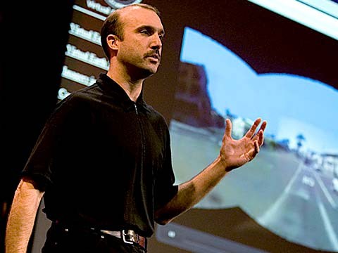
About a year and a half ago, Stephen Lawler, who also gave a talk here at TED in 2007 on Virtual Earth, brought me over to become the architect of Bing Maps, which is Microsoft's online-mapping effort. In the past two and a half, we've been very hard at work on redefining the way maps work online. And we really are seeing this in very different terms from the kind of mapping and direction site that one is used to.
Yaklaşık bir buçuk yıl önce TED 2007'de Sanal Dünya hakkında bir konuşma yapan Stephen Lawler beni Microsoft'un online haritalama çalışması olan Bing Maps'in mimarı olmam için davet etmişti. Son iki buçuk yıldır, online haritaların çalışma şekillerini yeniden tanımlamak için çok çalıştık. Ve gerçekten de buna alıştığımız haritalama ve yön sistemlerinden çok farklı bir açıdan bakıyoruz.
So, the first thing that you might notice about the mapping site is just the fluidity of the zooming and the panning, which, if you're familiar at all with Seadragon, that's where it comes from.
Şimdi, bu haritalama teknolojisi ile ilgili ilk dikkatinizi çekecek şey yakınlaştırma (zoom) ve kaydırma fonksiyonlarindaki akıcılık, ki Seadragon'a aşinaysanız bu oradan gelen bir özellik.
Mapping is, of course, not just about cartography, it's also about imagery. So, as we zoom-in beyond a certain level this resolves into a kind of Sim City-like virtual view at 45 degrees. This can be viewed from any of the cardinal directions to show you the 3D structure of the city, all the facades. Now, we see this space, this three-dimensional environment, as being a canvas on which all sorts of applications can play out, and map's directions are really just one of them.
Haritalama, elbette sadece kartografi ile ilgili degil aynı zamanda hayal gücü ile ilgili. Böylece, belirli bir seviyenin ötesine zoom yaptığımizda bu Sim City benzeri 45 derecelik bir sanal bir görüntü haline dönüşüyor. Bu görüntü, her bir yönden ayrı ayrı gözlenebilir ve size şehrin 3 Boyutlu yapısını, tüm bina yüzlerini gösterebilir. Şimdi, bu alanı, bu üç boyutlu ortamı tüm farklı uygulamaların kendini gösterebileceği bir tuval olarak düşünebiliriz. Ve haritanın yönleri de bunlardan sadece biri.
If you click on this, you'll see some of the ones that we've put out, just in the past couple of months since we've launched. So, for example, a couple of days after the disaster in Haiti, we had an earthquake map that showed before and after pictures from the sky. This wonderful one which I don't have time to show you is taking hyper-local blogs in real time and mapping those stories, those entries to the places that are referred to on the blogs. It's wonderful.
Eğer bunun üzerine tıklarsanız, daha önceden bu ürün satışa çıkardıktan sonraki birkaç ay içinde sisteme koyduklarımızı görebilirsiniz. Örneğin, Haiti'deki felaketten birkaç gün sonra deprem öncesi ve sonrası uydu fotoğraflarını içeren bir haritamız vardı. Size göstermem vakit darlığı nedeniyle mümkün değil ama bir tanesi bölgesel blogları gerçek zamanlı olarak tarıyarak bloglarda yer alan ve bahsedilen bu haber ve hikayeleri haritalandırıyor. Gerçekten harika.
But I'm going to show you some more candy sort of stuff.
Ama ben size daha keyifli olanlarından birkaçını göstereceğim.
So, we see the imagery, of course, not stopping at the sky. These little green bubbles represent photosynths that users have made. I'm not going to dive into them either, but photosynths are integrated into the map. Everything that's cased in blue is an area where we've taken imagery on the ground as well.
Biliyorsunuz, görüntü aslında gökyüzünde bitmiyor. Bu yeşil balonlar kullanıcıların yarattığı foto-sentetik (photosynth) görüntüler. Bunların da detayına girmeyeceğim, ama foto-sentetikler ve harita bütünleşmiş. Mavi renkli görülen yerler ise yerdeki çekilmiş görselleri de eklediğimiz alanları gösteriyor.
And so, when you fly down --
Şimdi öyle ki, aşağıya indiğinizde
(Applause)
(Alkışlar)
Thank you. When you fly down to the ground, and you see this kind of panoramic imagery, the first thing that you might notice is that it's not just a picture, there's just as much three-dimensional understanding of this environment as there is of the three-dimensional city from above, so if I click on something to get a closer view of it, then, the fact that that transition looks as it does, is a function of all of that geometry, all of that 3D understanding behind this model.
Teşekkürler. Aşağıya inip bu tip panaromik bir görüntü gördüğünüzde ilk fark edeceğiniz şey bunun yanlızca bir resimden farklı olduğu. bu üç boyutlu şehrin yukarıdan görünüşünde olduğu gibi bu ortamda da aynı üç boyutlu yapı mevcut, öyleyse, eğer herhangi bir cismi yakından görmek için üzerine tıklarsam, ki aynen göründüğü gibi olan bu geçiş bu modelin 3 boyutlu algılanışının ardındaki geometrinin bir fonksiyonu aslında.
Now, I'll show you a fun app that -- we've been working on a collaboration with our friends at Flickr. This takes Flickr, georegistered imagery and uses photosynth-like processes to connect that imagery to our imagery, so -- I'm not sure if that's the one I actually meant to pull up, but --
Şimdi size bizim Flickr'deki arkadaşlarla birlikte üzerinde çalıştığımız eğlenceli bir uygulama göstereceğim. Bu uygulama, Flickr tarafından geo-register edilmiş görüntüleri foto-sentetik benzeri bir süreç ile bizim görüntülerimizle bağlantılıyor, böylece -- Şu anda göstermek istediğim resmin bu olduğundan çok emin değilim, ama --
(Laughter)
(Kahkahalar)
But notice -- this is, of course, a popular tourist site, and there are lots of photos around here, and these photos are all taken at different times. So this one was taken around five. So that's the Flickr photo, that's our imagery. So you really see how this kind of crowd-sourced imagery is integrating, in a very deep way, into the map itself.
Ama dikkat edin -- burası elbette çok popüler bir turistik mekan, ve burada pek çok resim çekilmiş, bu resimlerin her biri de farklı zamanlarda çekilmiş. Bu resim saat beş civarında çekilmiş. İşte bu Flickr resmi, bizim görüntümüz bu. Böylece kalabalıklar tarafından teker teker oluşturulan bu görüntülerin derinlemesine birleşerek aslında haritayı meydana getirdiğini görebilirsiniz.
(Applause)
(Alkışlar)
Thank you.
Teşekkürler.
(Applause)
(Alkışlar)
There are several reasons why this is interesting and one of them, of course, is time travel. And I'm not going to show you some of the wonderful historic imagery in here, but there are some with horses and carriages and so on as well. But what's cool about this is that, not only is it augmenting this visual representation of the world with things that are coming in from users, but it also is the foundation for augmented reality, and that's something that I'll be showing you more of in just a moment.
Bunun ilginç olmasının birkaç nedeni var. ve bunlardan biri elbette zamanda yolculuk. Ben size burada yer alan bazı harika tarihi görüntüleri göstermeyeceğim ama aralarında içinde at ve at arabaları olan resimler de var. Bunun müthiş olan yanı şu ki bu, bizim dünyayı görsel olarak betimlememizi diğer kullanıcılardan gelen katkılarla artırmakla kalmıyor, aynı zamanda da artırılmış gerçekliğin temellerini de oluşturuyor, ve bu size biraz sonra daha detaylı göstereceğim bir şey.
Now I just made a transition indoors. That's also interesting. OK, notice there's now a roof above us. We're inside the Pike Place Market. And this is something that we're able to do with a backpack camera, so, we're now not only imaging in the street with this camera on tops of cars, but we're also imaging inside. And from here, we're able to do the same sorts of registration, not only of still images, but also of video.
Şimdi iç mekanlara geçtim, bu da oldukça ilginç. Tamam, dikkat edin, burada bir tavan var. Pike Place Market'in içindeyiz. Bu, bizim sırt çantamızda taşıdığımız bir kamera ile yapabileceğimiz bir şey. Öyleyse, arabaların tepesindeki kameralarla sadece sokakları görüntülemekle kalmıyoruz, iç mekanları da görüntüleyebiliyoruz. Ve daha da önemlisi, sadece durgun resimlerle değil, video çekimleri ile de benzer bir şey yapmamız mümkün.
So this is something that we're now going to try for the first time, live, and this is really, truly, very frightening.
Şimdi, ilk defa, canlı olaral bir şey deneyeceğiz. ve bu gerçekten de, çok korkutucu.
(Laughter)
(Gülüşmeler)
OK.
Tamam.
(Ringing)
(Telefon zili)
All right, guys, are you there?
Tamam arkadaşlar, orada mısınız?
(Noise)
(Gürültü)
All right. I'm hitting it. I'm punching play. I'm live. All right. There we go. So, these are our friends in Pike Place Market, the lab.
Tamam. Düğmeye basıyorum, Canlı yayındayım. Tamam. Hadi bakalım. Bu gördükleriniz, Pike Place Market'tekiler bizim arkadaşlarımız,
(Applause)
(Alkışlar)
So they're broadcasting this live. OK, George, can you pan back over to the corner market? Because I want to show points of interest. No, no. The other way. Yeah, yeah, back to the corner, back to the corner. I don't want to see you guys yet. OK, OK, back to the corner, back to the corner, back to the corner. OK, never mind.
Şu anda canlı olarak bunu yayınlıyorlar. Tamam, George, köşedeki markete yaklaşabilir misin? İlginç bir şey göstermek istiyorum. Hayır, hayır, diğer tarafa. Evet, evet, köşeye doğru, köieye doğru. Yok, henüz sizi göstermek istemiyorum. Tamam tamam, köşeye geri dönelim, köşeye, köşeye. Tamam, neyse boşver.
What I wanted to show you was these points of interest over here on top of the image because what that gives you a sense of is the way, if you're actually on the spot, you can think about this -- this is taking a step in addition to augmented reality.
Size bu görüntünün üzerindeki işaretlenmiş noktaları göstermek istiyorum çünkü bu noktalar sanki siz oradaymışsınız gibi hissetmenizi sağlayan şeyler.. bunu çöyle düşünebilirsiniz -- bu, artırılmış gerçeklik için atılan ilave bir adım.
What the hell are you guys -- oh, sorry.
Arkadaşlar siz ne yapıyorsunuz -- ah, pardon.
(Laughter)
(Kahkahalar)
We're doing two different -- OK, I'm hanging up now. We're doing two different things here. One of them is to take that real ...
İki değişik şey yapıyoruz... Tamam, artık kapatıyorum. Burada iki değişik şey yapıyoruz. Bunlar birinde, gerçek olanı alıp...
(Laughter)
(Gülüşmeler)
All right, let me just take a moment and thank the team. They've done a fantastic job of pulling this together.
Tamam, bir dakika izin verin, ekibe teşekkür edeyim. Bunu ortaya koyma konusunda harika bir iş çıkardılar.
(Applause)
(Alkışlar)
I'm going to abandon them now and walk back outside. And while I walk outside, I'll just mention that here we're using this for telepresence, but you can equally well use this on the spot, for augmented reality. When you use it on the spot, it means that you're able to bring all of that metadata and information about the world to you. So here, we're taking the extra step of also broadcasting it. That was being broadcast, by the way, on a 4G network from the market.
Şimdi onlardan ayrılarak tekrar dışarıya çıkıyorum Dışarı doğru yürürken, şunu belirtmek istiyorum şu an bunu tele-sunum için yaptık ama benzer şekilde bunu anında artırılmış gerçeklik için de kullanabilirsiniz. Bunu anında kullanmaktan kastım dünya ile ilgili tüm verilere ve meta-verilere anında ulaşabilecek olmanız. Öyleyse burada, bir adım daha ileri giderek bunu yayınlıyoruz. Bu arada, bu yayın, marketten 4G ağı aracılığıyla yapıldı.
All right, and now there's one last TED talk that Microsoft has given in the past several years. And that's Curtis Wong, WorldWide Telescope. So, we're going to head over to the dumpsters, where it's traditional, after a long day at the market, to go out for a break, but also stare up at the sky. This is the integration of WorldWide Telescope into our maps.
Tamam, geçtiğimiz yıllarda Microsoft tarafından verilen en az bir TED sunumu vardı. Bu sunum Curtis Wong'un yaptığı Dünya Çapında Teleskop (WorldWide Telescope) sunumu. Şimdi, pazar yerindeki uzun bir gün sonunda adet olduğu üzere çöp alanını geçerek, mola veriyor ve bu sırada gök yüzüne bakıyoruz. Dünya Çapında Teleskop'un bizim haritalarımıza entegrasyonu budur.
(Applause)
(Alkışlar)
This is the current -- thank you -- this is the current time. If we scrub the time, then we can see how the sky will look at different times, and we can get all of this very detailed information about different times, different dates: Let's move the moon a little higher in the sky, maybe change the date. I would like to kind of zoom in on the moon. So, this is an astronomically complete representation of the sky integrated right into the Earth.
Bu güncel -- teşekkürler-- Bu şu an, ama zamanı değiştirecek olursak, farklı zamanlarda gökyüzünün neye benzediğini görebiliriz, böylece farklı zamanlar ve farklı tarihlerle ilgili pek çok detaylı bilgiye erişebiliriz. Ay'ı gökyüzünde biraz daha yukarıya çıkaralım. tarihi değiştirebiliriz. Ay'a zoom yapmak ( yakınlaştırmak) istiyorum. Bu, gökyüzünün astronomik olarak Dünya ile bütünleşmiş tam bir temsili.
All right now, I've overrun my time, so I've got to stop. Thank you all very much.
Tamam, vaktimi aştım artık durmam lazım. Çok çok teşekkür ederim.
(Applause)
(Alkışlar)