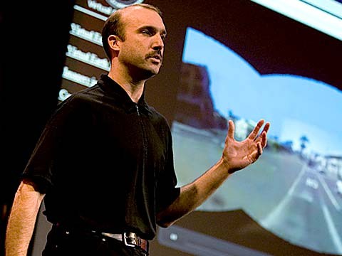
About a year and a half ago, Stephen Lawler, who also gave a talk here at TED in 2007 on Virtual Earth, brought me over to become the architect of Bing Maps, which is Microsoft's online-mapping effort. In the past two and a half, we've been very hard at work on redefining the way maps work online. And we really are seeing this in very different terms from the kind of mapping and direction site that one is used to.
Acum un an jumatate Stepher Lawler, care a avut o prezentare aici la TED in 2007 despre Pamantul Virtual m-a adus ca arhitect al Bing Maps (hartilor Bing) (n.t. Bing - motor de cautare de la Microsoft) care reprezinta efortul Microsoft de a crea harti online. In ultimii 2 ani si jumatate, am lucrat din greu pentru a redefini cum functioneaza hartile online. Si chiar vedem asta in termeni diferiti fata de modul de mapare si siteul de directionare cu care suntem obisnuiti.
So, the first thing that you might notice about the mapping site is just the fluidity of the zooming and the panning, which, if you're familiar at all with Seadragon, that's where it comes from.
Asadar, primul lucru pe care puteti sa il observati pe site-ul de mapare, este fluiditatea cu care se poate face zoom si efectele de miscare laterala care, daca sunteti familiari cu Seadragon,(n.t Technologie de la Microsoft de zoom pentru website-uri) de acolo vine.
Mapping is, of course, not just about cartography, it's also about imagery. So, as we zoom-in beyond a certain level this resolves into a kind of Sim City-like virtual view at 45 degrees. This can be viewed from any of the cardinal directions to show you the 3D structure of the city, all the facades. Now, we see this space, this three-dimensional environment, as being a canvas on which all sorts of applications can play out, and map's directions are really just one of them.
Maparea este, evident, nu doar despre cartografiere, este si despre imagine. Asadar, pe masura ce facem zoom dupa un anumit nivel, se ajunge la un fel de vizualizare de tip Sim City(n.t joc de realitate virtuala cu orase) la un unghi de 45 de grade. Aceasta poate fi vazuta din oricare punct cardinal pentru a vedea structura 3D a orasului, si toate fatadele. Acum, vedem acest spatiu, acest mediu tridimensional ca fiind panza pe care pot sa se desfasoare tot felul de aplicatii. Iar directionarile pe harta sunt doar una dintre ele.
If you click on this, you'll see some of the ones that we've put out, just in the past couple of months since we've launched. So, for example, a couple of days after the disaster in Haiti, we had an earthquake map that showed before and after pictures from the sky. This wonderful one which I don't have time to show you is taking hyper-local blogs in real time and mapping those stories, those entries to the places that are referred to on the blogs. It's wonderful.
Daca apasati pe asta veti vedea unele dintre cele pe care le-am scos doar un ultimele doua luni, de cand ne-am lansat. Asadar, de exemplu, la cateva zile de la dezastrul din Haiti, aveam o harta a cutremurului care arata poze dinainte si de dupa, luate din aer. Una dintre aceste minunate lucruri pe care nu am timp sa vi le arat este sa iei blogurile hiper locale in timp real si sa pui pe harta acele povesti, acele referiri la locurile din povestirile de pe blog. Este minunat.
But I'm going to show you some more candy sort of stuff.
Dar am sa va arat ceva cam ca cireasa de pe tort.
So, we see the imagery, of course, not stopping at the sky. These little green bubbles represent photosynths that users have made. I'm not going to dive into them either, but photosynths are integrated into the map. Everything that's cased in blue is an area where we've taken imagery on the ground as well.
Asadar, vedem imaginea desigur, dar nu ne limitam la cer. Aceste bulinute verzi reprezinta photosynth-uri(n.t colaje de poze utilizand technologia Photosynth de la Microsoft) facute de utilizatori. Nu o sa ma arunc nici in ele, dar photosynth-urile sunt integrate in harta. Tot ce este incastrat in albastru reprezinta zona pe care am facut imagini si la nivelul solului.
And so, when you fly down --
Si astfel, cand zbori in jos --
(Applause)
(Aplauze)
Thank you. When you fly down to the ground, and you see this kind of panoramic imagery, the first thing that you might notice is that it's not just a picture, there's just as much three-dimensional understanding of this environment as there is of the three-dimensional city from above, so if I click on something to get a closer view of it, then, the fact that that transition looks as it does, is a function of all of that geometry, all of that 3D understanding behind this model.
Multumesc. Cand zbori pana la sol, si vezi o asemenea imagine panoramica, primul lucru pe care ai putea sa il observi este ca nu este doar imaginea, exista atat de multa intelegere asupra mediului tridimensional precum exista si asupra orasului tridimensional de deasupra, incat daca apasati pe ceva pentru a primi o imagine mai de aproape, atunci, faptul ca acea tranzitie arata asa, este o functie a intregii geometii, toata acea intelegere 3D din spatele acestui model.
Now, I'll show you a fun app that -- we've been working on a collaboration with our friends at Flickr. This takes Flickr, georegistered imagery and uses photosynth-like processes to connect that imagery to our imagery, so -- I'm not sure if that's the one I actually meant to pull up, but --
Acum, o sa va arat o aplicatie haioasa la care am lucrat in colaborare cu prietenii nostrii de la Flickr. (n.t website baza de date de fotografii) Aceasta ia imaginea geoinregistrata de Flicker si utilizeaza procesele asemanatoare photosynth-ului pentru a conecta acea imagine cu imaginea noastra, asadar-- nu stiu daca aceasta este cea pe care vroiam sa v-o arat, dar--
(Laughter)
(rasete)
But notice -- this is, of course, a popular tourist site, and there are lots of photos around here, and these photos are all taken at different times. So this one was taken around five. So that's the Flickr photo, that's our imagery. So you really see how this kind of crowd-sourced imagery is integrating, in a very deep way, into the map itself.
Dar observati-- acesta este, evident, un loc popular pentru turisti, si sunt o multime de fotografii pe aici, iar aceaste sunt facute la diferite momente. Aceasta a fost facuta in jurul orei 5. Deci aceasta este poza de pe Flicker, aceasta este imaginea noastra. Deci vedeti cum acest fel de imagine cu surse din multime este integrata, intr-un mod foarte profund, in harta insasi,
(Applause)
(aplauze)
Thank you.
Va multumesc.
(Applause)
(aplauze)
There are several reasons why this is interesting and one of them, of course, is time travel. And I'm not going to show you some of the wonderful historic imagery in here, but there are some with horses and carriages and so on as well. But what's cool about this is that, not only is it augmenting this visual representation of the world with things that are coming in from users, but it also is the foundation for augmented reality, and that's something that I'll be showing you more of in just a moment.
Sunt mai multe motive de ce asta este interesant iar unul dintre ele este, evident, calatoria in timp. Si nu o sa va arat cateva imagini minunate din istorie, dar sunt si cativa cai si calesti si asa mai departe, de asemenea. Dar ce este interesant despre asta este ca, nu doar mareste reprezentarea vizuala asupra lumii utilizand lucruri care vin de la utilizatori, dar de asemenea este baza pentru realitatea augmentata, si asta este ceea ce urmeaza sa va arat in doar un moment.
Now I just made a transition indoors. That's also interesting. OK, notice there's now a roof above us. We're inside the Pike Place Market. And this is something that we're able to do with a backpack camera, so, we're now not only imaging in the street with this camera on tops of cars, but we're also imaging inside. And from here, we're able to do the same sorts of registration, not only of still images, but also of video.
Am facut in acest moment o tranzitie in interior. Si asta e interesant. Bine, observati ca acum avem un acoperis deasupra capului. Suntem in Piata Pike Place Si acest lucru putem sa il facem cu o camera de rucsac, asadar, nu doar cream imaginea strazii cu aceasta camera pe acoperisul masinilor, dar de asemenea cream imaginea inauntru. Si de aici, putem sa facem tot felul de registrari, nu doar de imagini statice, ci si video.
So this is something that we're now going to try for the first time, live, and this is really, truly, very frightening.
Deci acesta este un lucru pe care il vom incerca acum pentru prima data, in direct, si aceasta este intr-adevar, foarte inspaimantator.
(Laughter)
(rasete)
OK.
Bine.
(Ringing)
(suna)
All right, guys, are you there?
Bine baieti, sinteti acolo?
(Noise)
(zgomot)
All right. I'm hitting it. I'm punching play. I'm live. All right. There we go. So, these are our friends in Pike Place Market, the lab.
Bine. Apas. Apas pe pornire. Sunt live. Bine, Iata! Deci, acestia sunt prietenii nostrii in Piata Pike Market, laboratorul.
(Applause)
(aplauze)
So they're broadcasting this live. OK, George, can you pan back over to the corner market? Because I want to show points of interest. No, no. The other way. Yeah, yeah, back to the corner, back to the corner. I don't want to see you guys yet. OK, OK, back to the corner, back to the corner, back to the corner. OK, never mind.
Deci ei transmit in direct. Bine, George, poti sa reintorci imaginea asupra coltului de piata? Pentru ca vreau sa arat locuri de interes. Nu, nu. In cealalta directie. Asa, asa, inapoi in colt. Inapoi in colt. Nu vreau sa va vad pe voi inca. Bine. Bine. Inapoi in colt. Inapoi in colt. Inapoi in colt. Bine, lasa.
What I wanted to show you was these points of interest over here on top of the image because what that gives you a sense of is the way, if you're actually on the spot, you can think about this -- this is taking a step in addition to augmented reality.
Ceea ce vroiam sa va atat erau aceste locuri de interes aici deasupra imaginii pentru ca asta va da senzatia ca si cand sunteti chiar acolo prezenti... puteti sa va ganditi la asta -- aceasta este un pas in plus pentru realitatea augmentata.
What the hell are you guys -- oh, sorry.
Ce naiba faceti voi baieti -- oh, scuze.
(Laughter)
(rasete)
We're doing two different -- OK, I'm hanging up now. We're doing two different things here. One of them is to take that real ...
Facem doua lucruri diferite... OK. Inchid acum. Facem doua lucruri diferite aici. Unul este sa luam acest lucru real...
(Laughter)
(rasete)
All right, let me just take a moment and thank the team. They've done a fantastic job of pulling this together.
Bine, lasati-ma un moment sa multumesc echipei. Au facut o treaba fantastica de a pune totul cap la cap.
(Applause)
(aplauze)
I'm going to abandon them now and walk back outside. And while I walk outside, I'll just mention that here we're using this for telepresence, but you can equally well use this on the spot, for augmented reality. When you use it on the spot, it means that you're able to bring all of that metadata and information about the world to you. So here, we're taking the extra step of also broadcasting it. That was being broadcast, by the way, on a 4G network from the market.
Am sa ii las acum si sa merg din nou afara. Si in timp ce merg afara, o sa va mentionez ca aici, folosim asta pentru teleprezenta, dar voi puteti sa utilizati asta in aceeasi masura pe loc, pentru realitate augmentata. Cand il folosesti pe loc, inseamna ca esti capabil sa aduci toata aceste metadate si informatii despre lume, la tine. Deci aici, facem acem pas in plus de a o emite. Aceasta era emisa, apropo, pe o retea 4G din piata.
All right, and now there's one last TED talk that Microsoft has given in the past several years. And that's Curtis Wong, WorldWide Telescope. So, we're going to head over to the dumpsters, where it's traditional, after a long day at the market, to go out for a break, but also stare up at the sky. This is the integration of WorldWide Telescope into our maps.
Bine, si acum mai este o ultima prezentare TED pe care Microsoft a facut-o in ultimii ani. Si acesta este Curtis Wong, de la WorldWide Telescope. Asadar, ne vom indrepta catre containerele de gunoi, unde in mod traditional, dupa o zi lunga de piata, sa te duci pentru o pauza, dar si sa te uiti la cer. Aceasta este integrarea WorldWide Telescope in hartile noastre.
(Applause)
(aplauze)
This is the current -- thank you -- this is the current time. If we scrub the time, then we can see how the sky will look at different times, and we can get all of this very detailed information about different times, different dates: Let's move the moon a little higher in the sky, maybe change the date. I would like to kind of zoom in on the moon. So, this is an astronomically complete representation of the sky integrated right into the Earth.
Acesta este -- va multumesc-- Acesta este timpul real, dar daca stergem timpul, putem sa vedem cum va arata cerul la diferite momente. si putem sa obtinem informatii foarte detaliate despre timpuri diferite, date diferite. Sa mutam luna un pic mai sus pe cer, poate schimbam data. As vrea sa dam zoom pe luna intr-un fel. Asadar, aceasta este o reprezentare completa din punct de vedere astronomic a cerului integrata chiar aici pe Pamant.
All right now, I've overrun my time, so I've got to stop. Thank you all very much.
Bine acum, am ramas fara timp, incat trebuie sa ma opresc. Va multumesc foarte mult.
(Applause)
(aplauze)