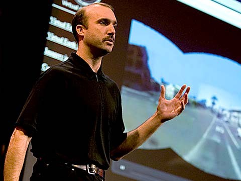
About a year and a half ago, Stephen Lawler, who also gave a talk here at TED in 2007 on Virtual Earth, brought me over to become the architect of Bing Maps, which is Microsoft's online-mapping effort. In the past two and a half, we've been very hard at work on redefining the way maps work online. And we really are seeing this in very different terms from the kind of mapping and direction site that one is used to.
לפני כשנה וחצי סטפן לאוולר שגם העביר הרצאה כאן ב TED ב 2007 על "Virtual Earth" הביא אותי לכאן להיות הארכיטקט של "מפות בינג", שהן ההשקעה של מיקרוסופט במיפוי מקוון. במהלך השנתיים וחצי האחרונות, עבדנו קשה מאוד על הגדרה מחדש של הדרך בה מפות עובדות באופן מקוון. ואנו באמת חושבים על זה במונחים אחרים לגמרי מהסוג של אתר מפוי והכוונה שכל אחד רגיל אליו.
So, the first thing that you might notice about the mapping site is just the fluidity of the zooming and the panning, which, if you're familiar at all with Seadragon, that's where it comes from.
אז, הדבר הראשון שאתם עשויים להבחין באתר המיפוי, הוא פשוט החלקות של הזום וההזחה, ובמידה ואתם מכירים את סידרגון (Seadragon) זהו המקור שלו.
Mapping is, of course, not just about cartography, it's also about imagery. So, as we zoom-in beyond a certain level this resolves into a kind of Sim City-like virtual view at 45 degrees. This can be viewed from any of the cardinal directions to show you the 3D structure of the city, all the facades. Now, we see this space, this three-dimensional environment, as being a canvas on which all sorts of applications can play out, and map's directions are really just one of them.
מיפוי, כמובן, לא עוסק רק בקרטוגרפיה הוא עוסק גם במידע צילומי. אז, בזמן שאנו מבצעים זום מעבר לרמה מסויימת זה הופך להיות למשהו הדומה לסים-סיטי מבט וירטואלי ב 45 מעלות. ניתן לצפות בזה מכל הכיוונים הראשיים כדי להראות לכם את המבנה התלת-מימדי של העיר, את כל החזיתות. עכשיו, אנו רואים את המרחב הזה, את הסביבה התלת-מימדית הזאת כאילו היתה בד ציור שעליו ניתן להציג כל מיני סוגים של אפליקציות. וכיווני ההסתכלות במפה הם באמת רק אחד מהם.
If you click on this, you'll see some of the ones that we've put out, just in the past couple of months since we've launched. So, for example, a couple of days after the disaster in Haiti, we had an earthquake map that showed before and after pictures from the sky. This wonderful one which I don't have time to show you is taking hyper-local blogs in real time and mapping those stories, those entries to the places that are referred to on the blogs. It's wonderful.
אם תקליקו על זה תראו כמה מהאפליקציות שאנחנו שמנו, רק בכמה החודשים האחרונים, מאז שהושקנו. אז, לדוגמא, כמה ימים לאחר האסון בהאיטי, היתה לנו מפת רעידת אדמה שהראתה צילומי אויר של לפני ואחרי. (האפליקציה) הנפלאה הזאת שאין לי זמן להציג לכם לוקחת בלוגים מאוד מקומיים בזמן אמת וממפה את הסיפורים הללו, את הערכים הללו למקומות המיוחסים אליהם בבלוג. זה נפלא.
But I'm going to show you some more candy sort of stuff.
אבל אני עמוד להציג לכם כמה דברים חמודים נוספים.
So, we see the imagery, of course, not stopping at the sky. These little green bubbles represent photosynths that users have made. I'm not going to dive into them either, but photosynths are integrated into the map. Everything that's cased in blue is an area where we've taken imagery on the ground as well.
אז, אנחנו רואים, כמובן, שהצילומים לא מסתיימים באוויר. הבועות הירוקות האלו מייצגות פוטוסינט'ים (photosynths) שמשתמשים יצרו. אני לא עומד לצלול לתוכם גם כן, אבל פוטוסינט'ים משולבים בתוך המפה. כל מה שמוקף בכחול הוא אזור שבו לקחנו צילומים מהקרקע גם כן.
And so, when you fly down --
ואז, כאשר אתה עף למטה
(Applause)
(תשואות)
Thank you. When you fly down to the ground, and you see this kind of panoramic imagery, the first thing that you might notice is that it's not just a picture, there's just as much three-dimensional understanding of this environment as there is of the three-dimensional city from above, so if I click on something to get a closer view of it, then, the fact that that transition looks as it does, is a function of all of that geometry, all of that 3D understanding behind this model.
תודה. כאשר אתה עף למטה, לקרקע, ואתה רואה את מן צילום פאנורמי שכזה, הדבר הראשון שאתה עשוי להבחין הוא שזה לא רק צילום, יש כאן הבנה תלת-מימדית של הסביבה לפחות באותה רמה שיש בעיר התלת-מימדית מלמעלה, אז אם אני מקליק על משהו כדי לקבל מבט קרוב יותר עליו, אז, העובדה שהמעבר נראה כמו שהוא נראה, הוא תוצאה של כל הגיאומטריה הזו, כל ההבנה התלת-מימדית שמאחורי המודל הזה.
Now, I'll show you a fun app that -- we've been working on a collaboration with our friends at Flickr. This takes Flickr, georegistered imagery and uses photosynth-like processes to connect that imagery to our imagery, so -- I'm not sure if that's the one I actually meant to pull up, but --
עכשיו, אני אראה לכם אפליקצייה כיפית שאנחנו עבדנו עליה בשיתוף פעולה עם חברינו בפליקר היא לוקחת צילומים מפליקר עם מידע על מיקום גיאוגרפי ומשתמשת בתהליכים דומים לפוטוסינט' על מנת לחבר את הצילומים האלו לצילומים שלנו, אז -- אני לא בטוח אם זהו האחד שאני באמת התכוונתי לשלוף, אבל --
(Laughter)
(צחוק)
But notice -- this is, of course, a popular tourist site, and there are lots of photos around here, and these photos are all taken at different times. So this one was taken around five. So that's the Flickr photo, that's our imagery. So you really see how this kind of crowd-sourced imagery is integrating, in a very deep way, into the map itself.
אבל שימו לב -- זהו, כמובן, אתר תיירות פופולארי, ויש הרבה תמונות באזור הזה והתמונות האלו צולמו בזמנים שונים. אז, זה צולם בערך בחמש. אז, זוהי התמונה מפליקר, זהו הצילום שלנו. אז אתם באמת רואים איך סוג זה של צילום ממקור קהילתי משולב, בצורה עמוקה מאוד, בתוך המפה עצמה.
(Applause)
(תשואות)
Thank you.
תודה.
(Applause)
(תשואות)
There are several reasons why this is interesting and one of them, of course, is time travel. And I'm not going to show you some of the wonderful historic imagery in here, but there are some with horses and carriages and so on as well. But what's cool about this is that, not only is it augmenting this visual representation of the world with things that are coming in from users, but it also is the foundation for augmented reality, and that's something that I'll be showing you more of in just a moment.
יש כמה סיבות מדוע זה מעניין ואחת מהן, כמובן, היא מסע בזמן. ואני לא עומד להציג לכם כמה מהצילומים ההיסטוריים הנפלאים שיש כאן, אבל יש גם כמה עם סוסים ומרכבות וכך הלאה. אבל מה שנהדר בזה, זה לא רק שזה העשרה של ההצגה הויזואלית הזו של העולם עם דברים שמגיעים ממשתמשים, אלא זה גם היסודות למציאות מתוגברת, וזה משהו שאני אציג לכם ממנו יותר בעוד רגע.
Now I just made a transition indoors. That's also interesting. OK, notice there's now a roof above us. We're inside the Pike Place Market. And this is something that we're able to do with a backpack camera, so, we're now not only imaging in the street with this camera on tops of cars, but we're also imaging inside. And from here, we're able to do the same sorts of registration, not only of still images, but also of video.
עכשיו בדיוק עברתי לתוך מבנה. זה גם מעניין. בסדר, שימו לב שיש כרגע גג מעלינו. אנחנו בתוך השוק של "פייק פלייס". וזה משהו שאנחנו יכולים לעשות עם מצלמה הנישאת בתרמיל גב, אז, אנחנו לא רק מצלמים ברחוב עם המצלמה הזאת על גג המכוניות, אלא אנחנו מצלמים גם בפנים. ומכאן, אנחנו יכולים לעשות את אותו סוג של התאמה לא רק של צילומי סטילס, אלא גם של וידאו.
So this is something that we're now going to try for the first time, live, and this is really, truly, very frightening.
אז זה משהו שאנחנו עומדים לנסות עכשיו בפעם הראשונה, בשידור חי, וזה ברצינות, באמת, מאוד מפחיד.
(Laughter)
(צחוק)
OK.
בסדר.
(Ringing)
(צילצול)
All right, guys, are you there?
בסדר, חבר'ה, האם אתם שם?
(Noise)
(רעש)
All right. I'm hitting it. I'm punching play. I'm live. All right. There we go. So, these are our friends in Pike Place Market, the lab.
בסדר, אני מקיש על זה. אני לוחץ "הפעל". אני בשידור חי. בסדר. הנה זה בא. אז, אלו הם החברים שלנו בשוק של "פייק פלייס", המעבדה.
(Applause)
(תשואות)
So they're broadcasting this live. OK, George, can you pan back over to the corner market? Because I want to show points of interest. No, no. The other way. Yeah, yeah, back to the corner, back to the corner. I don't want to see you guys yet. OK, OK, back to the corner, back to the corner, back to the corner. OK, never mind.
אז הם משדרים את זה בשידור חי. בסדר, ג'ורג', האם אתה יכול לכוון את המצלמה חזרה לפינה של השוק? מפני שאני רוצה להראות נקודות עניין. לא, לא. לכיוון השני. כן, כן. חזרה לפינה. חזרה לפינה. אני לא רוצה לראות אתכם עדיין. בסדר, בסדר. חזרה לפינה. חזרה לפינה. חזרה לפינה. בסדר, תשכח מזה.
What I wanted to show you was these points of interest over here on top of the image because what that gives you a sense of is the way, if you're actually on the spot, you can think about this -- this is taking a step in addition to augmented reality.
מה שרציתי להראות לכם הם נקודות העניין האלו כאן על גבי הצילום מפני שמה שזה שמאפשר לך זה לקבל תחושה על הדרך, אם אתם ממש בנקודה... אתם יכולים לחשוב על זה -- זה לקחת צעד קדימה מעבר למציאות המתוגברת.
What the hell are you guys -- oh, sorry.
מה לעזאזל אתם -- הו, סליחה.
(Laughter)
(צחוק)
We're doing two different -- OK, I'm hanging up now. We're doing two different things here. One of them is to take that real ...
אנחנו עושים שני דברים שונים... בסדר, אני מנתק עכשיו. אנחנו עושים שני דברים שונים כאן. אחד מהם הוא לקחת את המציאות...
(Laughter)
(צחוק)
All right, let me just take a moment and thank the team. They've done a fantastic job of pulling this together.
בסדר, תנו לי רגע להודות לצוות. הם עשו עבודה נפלאה להרים את זה יחד.
(Applause)
(תשואות)
I'm going to abandon them now and walk back outside. And while I walk outside, I'll just mention that here we're using this for telepresence, but you can equally well use this on the spot, for augmented reality. When you use it on the spot, it means that you're able to bring all of that metadata and information about the world to you. So here, we're taking the extra step of also broadcasting it. That was being broadcast, by the way, on a 4G network from the market.
אני הולך לעזוב אותם עכשיו וללכת חזרה החוצה. ובזמן שאני הולך החוצה, אני רק אציין שכאן, אנו משתמשים בזה לנוכחות מרחוק, אבל באותה מידה ניתן להשתמש בזה במקום עצמו, למציאות מתוגברת. כאשר אתה משתמש בזה במקום עצמו, זה אומר שאתה יכול להביא את כל המטדאטה [מידע על המידע] הזה ומידע על העולם - אליך. אז כאן, אנחנו לוקחים את הצעד הנוסף וגם משדרים אותו. זה שודר, דרך אגב, על רשת דור רביעי מתוך השוק.
All right, and now there's one last TED talk that Microsoft has given in the past several years. And that's Curtis Wong, WorldWide Telescope. So, we're going to head over to the dumpsters, where it's traditional, after a long day at the market, to go out for a break, but also stare up at the sky. This is the integration of WorldWide Telescope into our maps.
בסדר, ועכשיו יש הרצאת TED אחת אחרונה שמיקרוסופט העבירה בכמה שנים האחרונות. וזהו קרטיס וונג, טלסקופ כלל-עולמי. אז, אנחנו עומדים לגשת אל מכולת האשפה אשר שם נהוג באופן מסורתי, לאחר יום ארוך בשוק, לצאת החוצה להפסקה, אבל גם לצפות אל השמיים. זהו השילוב של הטלסקופ הכלל-עולמי לתוך המפות שלנו.
(Applause)
(תשואות)
This is the current -- thank you -- this is the current time. If we scrub the time, then we can see how the sky will look at different times, and we can get all of this very detailed information about different times, different dates: Let's move the moon a little higher in the sky, maybe change the date. I would like to kind of zoom in on the moon. So, this is an astronomically complete representation of the sky integrated right into the Earth.
זה הזמן -- תודה -- זה הזמן הנוכחי, אבל אם אנחנו מזיזים את הזמן, אז אנחנו יכולים לראות איך השמיים יראו בזמנים שונים. ואנחנו יכולים לקבל את כל המידע המאוד מפורט על זמנים שונים, תאריכים שונים. בואו נזיז את הירח קצת יותר גבוה בשמיים, אולי נשנה את התאריך. אני רוצה לעשות משהו דומה לזום על הירח. אז, זהו ייצוג אסטרונומי שלם של השמיים משולב ישר לתוך כדור הארץ.
All right now, I've overrun my time, so I've got to stop. Thank you all very much.
בסדר עכשיו, גמרתי את הזמן שלי, אז אני חייב לעצור. תודה רבה לכולכם.
(Applause)
(תשואות)