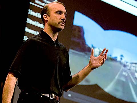
About a year and a half ago, Stephen Lawler, who also gave a talk here at TED in 2007 on Virtual Earth, brought me over to become the architect of Bing Maps, which is Microsoft's online-mapping effort. In the past two and a half, we've been very hard at work on redefining the way maps work online. And we really are seeing this in very different terms from the kind of mapping and direction site that one is used to.
Noin puolitoista vuotta sitten Stephen Lawler, joka myös puhui TED 2007:ssä Virtual Earhista, otti minut mukaan Bing Maps:in suunnittelijaksi, joka on Microsoftin verkossa toimiva karttapalvelu. Viimeisen 2,5 vuoden aikana olemme kovasti työskennelleet parantaaksemme verkon karttapalvelujen toimintatapoja. Me näemme tämän hyvin eri tavalla kuin miten kartta- ja kulkuohjesivustot on perinteisesti tehty.
So, the first thing that you might notice about the mapping site is just the fluidity of the zooming and the panning, which, if you're familiar at all with Seadragon, that's where it comes from.
Ensimmäinen huomattava asia karttapalvelussa, on tarkentamisen ja liikuttamisen sujuvuus joka pohjautuu Seadragon-teknologiaan.
Mapping is, of course, not just about cartography, it's also about imagery. So, as we zoom-in beyond a certain level this resolves into a kind of Sim City-like virtual view at 45 degrees. This can be viewed from any of the cardinal directions to show you the 3D structure of the city, all the facades. Now, we see this space, this three-dimensional environment, as being a canvas on which all sorts of applications can play out, and map's directions are really just one of them.
Kartoitus, sellaisenaan, ei liity vain kartastoihin vaan myös kuvailmaisuun. Eli, kun tarkennamme tietyn rajan yli saamme Sim City:n tapaisen virtuaalisen 45-asteen näkymän. Tätä voidaan katsoa mistä tahansa pääsuunnasta nähdäkseen 3D rakenteen kaupungista julkisivuineen. Me näemme tämän kolmeulotteisen ympäristön hyvänä pohjana, minkä päällä erilaisia sovelluksia voi toimia. Ja kartan kulkuohjeet ovat yksi niistä.
If you click on this, you'll see some of the ones that we've put out, just in the past couple of months since we've launched. So, for example, a couple of days after the disaster in Haiti, we had an earthquake map that showed before and after pictures from the sky. This wonderful one which I don't have time to show you is taking hyper-local blogs in real time and mapping those stories, those entries to the places that are referred to on the blogs. It's wonderful.
Tästä klikkaamalla nähdään joitain sovelluksia, joita olemme julkaisseet viime kuukausina. Esimerkiksi, päiviä Haitin maanjäristyksen jälkeen meillä oli järistyskartta, jossa oli kuvat järistystä ennen ja sen jälkeen. Tämä hieno ratkaisu, hakee paikallisia blogeja reaaliajassa ja yhdistää blogikirjoitukset niissä viitattuihin paikkoihin. Se on hienoa.
But I'm going to show you some more candy sort of stuff.
Mutta esittelen nyt lisää kivoja juttuja.
So, we see the imagery, of course, not stopping at the sky. These little green bubbles represent photosynths that users have made. I'm not going to dive into them either, but photosynths are integrated into the map. Everything that's cased in blue is an area where we've taken imagery on the ground as well.
Näemme, että kuvitus ei suinkaan pysähdy taivaaseen. Nuo pienet vihreät kuplat ilmaisevat kuvayhdistelmiä, joita käyttäjät ovat tehneet. En avaa niitä nyt, mutta nekin ovat linkitettyjä karttaan. Kaikki mikä on kehystetty sinisellä sisältää myös maanpinnan tasolta otettuja kuvia.
And so, when you fly down --
Ja siksi, kun lennetään alemmas --
(Applause)
(Aplodeja)
Thank you. When you fly down to the ground, and you see this kind of panoramic imagery, the first thing that you might notice is that it's not just a picture, there's just as much three-dimensional understanding of this environment as there is of the three-dimensional city from above, so if I click on something to get a closer view of it, then, the fact that that transition looks as it does, is a function of all of that geometry, all of that 3D understanding behind this model.
Kiitoksia. Kun lennetään maan tasoon, ja nähdään tällainen panoraamakuva, ensimmäiseksi huomataan ettei se ole vain kuva -- ympäristö on yhtä vahvasti kolmiulotteinen kuin kaupungin silhuetti, eli jos klikkaan jotain nähdäkseni sen lähempää, niin itse asiassa muutos näyttää oikealta, sillä se mallinnetaan geometrisesti taustalla olevasta kolmiulotteisesta mallista.
Now, I'll show you a fun app that -- we've been working on a collaboration with our friends at Flickr. This takes Flickr, georegistered imagery and uses photosynth-like processes to connect that imagery to our imagery, so -- I'm not sure if that's the one I actually meant to pull up, but --
Nyt näytän teille hauskan sovelluksen, jota olemme työstäneet yhteistyökumppanimme Flickr:n kanssa. Tässä otetaan Flickeristä paikannustiedolla varustettu kuvasto ja käytetään kuvayhdistelmäprosessia yhdistämään kuvat omaan kuvavarastoomme, joten -- en ole varma halusinko näyttää juuri tätä, mutta --
(Laughter)
(Naurua)
But notice -- this is, of course, a popular tourist site, and there are lots of photos around here, and these photos are all taken at different times. So this one was taken around five. So that's the Flickr photo, that's our imagery. So you really see how this kind of crowd-sourced imagery is integrating, in a very deep way, into the map itself.
Mutta huomatkaa -- tämä on, toki, suosittu turistikohde, ja tästä on paljon kuvia, ja nämä kuvat on otettu eri aikoina. Tämä on otettu viiden aikoihin. Eli tämä kuva on Flick:istä, Ja tämä meidän kuvavarastostamme. Eli näette kuinka nämä käyttäjien luomat kuvat integroituvat syvällisellä tasolla itse karttaan.
(Applause)
(Aplodeja)
Thank you.
Kiitos.
(Applause)
(Aplodeja)
There are several reasons why this is interesting and one of them, of course, is time travel. And I'm not going to show you some of the wonderful historic imagery in here, but there are some with horses and carriages and so on as well. But what's cool about this is that, not only is it augmenting this visual representation of the world with things that are coming in from users, but it also is the foundation for augmented reality, and that's something that I'll be showing you more of in just a moment.
On monia syitä miksi tämä on kiinnostavaa, ja yksi niistä on aikamatkustus. En nyt aio esittää upeita historiallisia kuvia, mutta kuvia löytyy hevosista ja kärryistä ja niin edelleen. Tässä on hienoa se, että se ei vain laajenna maailman visuaalista ulkoasua käyttäjien ottamilla kuvilla, vaan toimii myös laajennetun todellisuuden pohjana, ja siitä näytän teille lisää hetken päästä.
Now I just made a transition indoors. That's also interesting. OK, notice there's now a roof above us. We're inside the Pike Place Market. And this is something that we're able to do with a backpack camera, so, we're now not only imaging in the street with this camera on tops of cars, but we're also imaging inside. And from here, we're able to do the same sorts of registration, not only of still images, but also of video.
Menin juuri sisätiloihin. Tämä on mielenkiintoista. Okei, huomatkaa että päällämme on katto. Olemme Pike Place Marketin sisällä. Ja tämä on jotain minkä voimme tehdä reppukameralla, eli emme kuvaa vain katua autoon kiinnitetyllä kameralla, vaan kuvaamme myös sisätiloja. Ja täältä pystymme tekemään samanlaista tiedonkeruuta, ei vain valokuvia, vaan myös videota.
So this is something that we're now going to try for the first time, live, and this is really, truly, very frightening.
Tämä on jotain mitä yritämme tehdä ensimmäistä kertaa reaaliajassa ja se on todella pelottavaa.
(Laughter)
(Naurua)
OK.
Okei.
(Ringing)
(Puhelin soi)
All right, guys, are you there?
No niin kaverit, oletteko siellä?
(Noise)
(Melua)
All right. I'm hitting it. I'm punching play. I'm live. All right. There we go. So, these are our friends in Pike Place Market, the lab.
Selvä juttu. Laitan sen päälle. Olemme valmiita. Mennään. Eli, tässä ovat kaverimme Pike Place Marketilla.
(Applause)
(Aplodeja)
So they're broadcasting this live. OK, George, can you pan back over to the corner market? Because I want to show points of interest. No, no. The other way. Yeah, yeah, back to the corner, back to the corner. I don't want to see you guys yet. OK, OK, back to the corner, back to the corner, back to the corner. OK, never mind.
He lähettävät tätä suorana. Okei George, voitko kääntää takaisin kulmaan? Haluan näyttää mielenkiintoisia juttuja. Ei, ei - toiseen suuntaan. Kyllä, kyllä, takaisin kulmaan. En halua nähdä teitä vielä. Okei, okei. Takaisin kulmaan, takaisin kulmaan. Okei, olkoon.
What I wanted to show you was these points of interest over here on top of the image because what that gives you a sense of is the way, if you're actually on the spot, you can think about this -- this is taking a step in addition to augmented reality.
Halusin näyttää näitä kiintopisteitä täällä kuvan yläreunassa, koska siitä saa kuvaa suunnasta jos todella on paikan päällä ... ajatelkaapa tätä -- tämä ottaa askeleen laajennetun todellisuuden lisäksi.
What the hell are you guys -- oh, sorry.
Mitä hittoa te kaverit -- anteeksi.
(Laughter)
(Naurua)
We're doing two different -- OK, I'm hanging up now. We're doing two different things here. One of them is to take that real ...
Me teemme kahta eri... Okei, minä katkaisen nyt. Teemme kahta eri asiaa tässä. Yksi niistä on ottaa tuo aito ...
(Laughter)
(Naurua)
All right, let me just take a moment and thank the team. They've done a fantastic job of pulling this together.
Okei, haluan tässä vaiheessa kiittää tiimiä. He ovat tehneet hienoa työtä kasatessaan tämän kaiken.
(Applause)
(Aplodeja)
I'm going to abandon them now and walk back outside. And while I walk outside, I'll just mention that here we're using this for telepresence, but you can equally well use this on the spot, for augmented reality. When you use it on the spot, it means that you're able to bring all of that metadata and information about the world to you. So here, we're taking the extra step of also broadcasting it. That was being broadcast, by the way, on a 4G network from the market.
Jätän nyt heidät ja menen takaisin ulos. Ja kun kävelen ulkona, mainitsen vain, että käytimme tätä juuri etäläsnäoloon, mutta tätä voi yhtä hyvin käyttää paikan päällä laajennettuun todellisuuteen. Kun sitä käyttää paikan päällä, se pystyy yhdistämään kaiken tämän metadatan ja tiedon kyseiseen paikkaan. Tässä menemme vielä pidemmälle lähettämällä se reaaliajassa. Lähetys muuten tehtiin 4G-verkon välityksellä.
All right, and now there's one last TED talk that Microsoft has given in the past several years. And that's Curtis Wong, WorldWide Telescope. So, we're going to head over to the dumpsters, where it's traditional, after a long day at the market, to go out for a break, but also stare up at the sky. This is the integration of WorldWide Telescope into our maps.
Lopuksi, Microsoft on pitänyt viime vuosina erään TED esityksen -- Curtis Wongin 'WorldWide Telescope'. Joten suuntaamme nyt roskalaatikoille, mikä on perinteistä, pitkän markkinapäivän jälkeen -- mennä ulos, ja tuijottaa hetki taivaalle. Tämä on integraatio kartastamme WorldWide Telescopeen.
(Applause)
(Aplodeja)
This is the current -- thank you -- this is the current time. If we scrub the time, then we can see how the sky will look at different times, and we can get all of this very detailed information about different times, different dates: Let's move the moon a little higher in the sky, maybe change the date. I would like to kind of zoom in on the moon. So, this is an astronomically complete representation of the sky integrated right into the Earth.
Tämä on -- kiitoksia -- Tämä on tämänhetkisessä ajassa, mutta aikaa muuttamalla näemme taivaan eri aikoina, ja saamme hyvin yksityiskohtaista tietoa eri ajoista ja päivämääristä. Siirretäänpä kuuta keskemmälle taivasta, ja vaihdetaan päivämäärää. Haluaisin tarkentaa kuuhun. Tämä on astronomisesti täydellinen esitys taivaasta integroituna ympäristöön.
All right now, I've overrun my time, so I've got to stop. Thank you all very much.
No niin, aika loppuu joten minun on lopetettava. Kiitoksia paljon.
(Applause)
(Aplodeja)