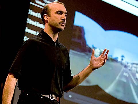
About a year and a half ago, Stephen Lawler, who also gave a talk here at TED in 2007 on Virtual Earth, brought me over to become the architect of Bing Maps, which is Microsoft's online-mapping effort. In the past two and a half, we've been very hard at work on redefining the way maps work online. And we really are seeing this in very different terms from the kind of mapping and direction site that one is used to.
Año y medio atrás Stephen Lawler quien también dio una charla aquí en TED en el 2007 sobre Microsoft Virtual Earth me trajo para ser el arquitecto de Bing Maps, que es el esfuerzo de mapas en línea de Microsoft. En los últimos dos años y medio, hemos trabajado mucho en redefinir el modo de funcionamiento de los mapas en línea. Y, en realidad, estamos viéndolo en términos muy diferentes del tipo de sitio de cartografía y direcciones al que estamos acostumbrados.
So, the first thing that you might notice about the mapping site is just the fluidity of the zooming and the panning, which, if you're familiar at all with Seadragon, that's where it comes from.
Entonces, lo primero que uno observa en el sitio de mapas es la fluidez del zoom y de los paneos que, si conocen Seadragon, es de donde proviene.
Mapping is, of course, not just about cartography, it's also about imagery. So, as we zoom-in beyond a certain level this resolves into a kind of Sim City-like virtual view at 45 degrees. This can be viewed from any of the cardinal directions to show you the 3D structure of the city, all the facades. Now, we see this space, this three-dimensional environment, as being a canvas on which all sorts of applications can play out, and map's directions are really just one of them.
Los mapas son, por supuesto, no sólo cartografía, sino también imágenes. Entonces, si amplificamos después de un cierto nivel esto se convierte en una suerte de "Sim City", una vista virtual a 45 grados. Puede ser visto desde cualquier dirección para enseñar la estructura 3D de la ciudad, las fachadas. Ahora, vemos este espacio, un ambiente tridimensional como un lienzo donde puede representarse todo tipo de aplicaciones. Y la función de direcciones es solamente un ejemplo.
If you click on this, you'll see some of the ones that we've put out, just in the past couple of months since we've launched. So, for example, a couple of days after the disaster in Haiti, we had an earthquake map that showed before and after pictures from the sky. This wonderful one which I don't have time to show you is taking hyper-local blogs in real time and mapping those stories, those entries to the places that are referred to on the blogs. It's wonderful.
Si uno le da clic verá algunas de las que hemos publicado en los últimos meses desde el lanzamiento. Por ejemplo, un par de días después del desastre de Haití, tuvimos un mapa del terremoto que mostraba fotos aéreas de antes y después. Una muy interesante, pero no tengo tiempo para enseñarla, toma blogs hiper-locales en tiempo real y asigna esas historias, esas entradas, a los lugares mencionados en los blogs. Es grandioso.
But I'm going to show you some more candy sort of stuff.
Pero les enseñaré cosas más atractivas.
So, we see the imagery, of course, not stopping at the sky. These little green bubbles represent photosynths that users have made. I'm not going to dive into them either, but photosynths are integrated into the map. Everything that's cased in blue is an area where we've taken imagery on the ground as well.
Podemos ver las imágenes, por supuesto, y estas no paran en el cielo. Esas pequeñas burbujas verdes representan "photosynths" creadas por los usuarios. No voy a abrir una pero las "photosynths" están integradas a los mapas. Todo lo que está delimitado en azul es un área en el que hemos tomado imágenes en el suelo también.
And so, when you fly down --
Entonces, cuando uno vuela hacia abajo...
(Applause)
(Aplausos)
Thank you. When you fly down to the ground, and you see this kind of panoramic imagery, the first thing that you might notice is that it's not just a picture, there's just as much three-dimensional understanding of this environment as there is of the three-dimensional city from above, so if I click on something to get a closer view of it, then, the fact that that transition looks as it does, is a function of all of that geometry, all of that 3D understanding behind this model.
Gracias. Cuando uno vuela hacia el suelo y ve este tipo de imagen panorámica, lo primero de lo que uno se da cuenta es que no es sólo una imagen, hay tanta comprensión tridimensional del entorno como lo debe haber de una ciudad tridimensional. Si selecciono algo para verlo de más cerca, entonces, el hecho que esta transición se vea así es debido a toda esa geometría, a todo ese entendimiento 3D detrás de este modelo.
Now, I'll show you a fun app that -- we've been working on a collaboration with our friends at Flickr. This takes Flickr, georegistered imagery and uses photosynth-like processes to connect that imagery to our imagery, so -- I'm not sure if that's the one I actually meant to pull up, but --
Ahora, les mostraré una aplicación divertida. Hemos estado trabajando en colaboración con nuestros amigos de Flickr. Este toma imágenes geolocalizadas de Flickr y utiliza procesos similares a "photoshynths" para conectarlas con nuestras imágenes. No estoy seguro si esa es la que quería utilizar, pero...
(Laughter)
(Risas)
But notice -- this is, of course, a popular tourist site, and there are lots of photos around here, and these photos are all taken at different times. So this one was taken around five. So that's the Flickr photo, that's our imagery. So you really see how this kind of crowd-sourced imagery is integrating, in a very deep way, into the map itself.
Pero vean... esto es, por supuesto, una atracción turística popular, y hay muchas fotos aquí, y estas fotos fueron tomadas en distintos momentos. Esta fue tomada cerca de las cinco. Esa es una imagen de Flickr, esas son nuestras imágenes. Así pueden ver como todas estas imágenes se integran, de manera muy profunda, dentro del mapa.
(Applause)
(Aplausos)
Thank you.
Gracias.
(Applause)
(Aplausos)
There are several reasons why this is interesting and one of them, of course, is time travel. And I'm not going to show you some of the wonderful historic imagery in here, but there are some with horses and carriages and so on as well. But what's cool about this is that, not only is it augmenting this visual representation of the world with things that are coming in from users, but it also is the foundation for augmented reality, and that's something that I'll be showing you more of in just a moment.
Hay muchas razones por las que esto es interesante y una de ellas, por supuesto, es el viaje en el tiempo. No les mostraré las imágenes históricas y bellas que tenemos pero hay unas con caballos y carruajes, además de otras cosas. Pero lo bueno de esto es que no sólo aumenta esta representación visual del mundo con las cosas de los usuarios, sino también es la base de la realidad aumentada y eso es algo importante que les mostraré en un momento.
Now I just made a transition indoors. That's also interesting. OK, notice there's now a roof above us. We're inside the Pike Place Market. And this is something that we're able to do with a backpack camera, so, we're now not only imaging in the street with this camera on tops of cars, but we're also imaging inside. And from here, we're able to do the same sorts of registration, not only of still images, but also of video.
Ahora hice una transición a los interiores. Eso también es interesante. Vean que ahora hay un techo encima nuestro. Estamos adentro de Pike Place Market. Esto es algo que podemos lograr con una cámara en una mochila, así que no sólo tomamos imágenes en la calle con la cámara encima de los autos sino también tomamos imágenes del interior. Y desde aquí, podemos hacer el mismo tipo de tomas, no sólo de imágenes fijas sino de videos.
So this is something that we're now going to try for the first time, live, and this is really, truly, very frightening.
Esto es algo que vamos a intentar ahora por primera vez, en vivo, y esto es en realidad muy aterrador.
(Laughter)
(Risas)
OK.
Bueno.
(Ringing)
(Sonido de celular)
All right, guys, are you there?
Muy bien, muchachos, ¿están ahí?
(Noise)
(Ruido)
All right. I'm hitting it. I'm punching play. I'm live. All right. There we go. So, these are our friends in Pike Place Market, the lab.
Muy bien. Le voy a dar. Le voy a picar a correr. Estoy en vivo. Muy bien. Aquí vamos. Entonces, aquí están nuestros amigos en Pike Place Market.
(Applause)
(Aplausos)
So they're broadcasting this live. OK, George, can you pan back over to the corner market? Because I want to show points of interest. No, no. The other way. Yeah, yeah, back to the corner, back to the corner. I don't want to see you guys yet. OK, OK, back to the corner, back to the corner, back to the corner. OK, never mind.
Esta transmisión es en vivo. George, ¿puedes moverte hacia la esquina? Porque quiero enseñar unos puntos de interés. No, no. Hacia el otro lado. Sí, sí. Hacia la esquina. Hacia la esquina. No quiero verlos a Uds por ahora. Sí. Sí. En la esquina. Bueno, olvídenlo.
What I wanted to show you was these points of interest over here on top of the image because what that gives you a sense of is the way, if you're actually on the spot, you can think about this -- this is taking a step in addition to augmented reality.
Lo que quería enseñarles eran los puntos de interés de la parte superior de la imagen porque esto es lo que nos da la sensación de que en realidad uno está en ese lugar... piensen en esto... esto es dar un paso más en la realidad aumentada.
What the hell are you guys -- oh, sorry.
Qué demonios hacen... oh, lo siento.
(Laughter)
(Risas)
We're doing two different -- OK, I'm hanging up now. We're doing two different things here. One of them is to take that real ...
Estamos haciendo dos... ...ahora voy a colgar. Estamos haciendo dos cosas distintas aquí. Una de ellas es tomar lo real...
(Laughter)
(Risas)
All right, let me just take a moment and thank the team. They've done a fantastic job of pulling this together.
Un momento, para agradecer al equipo. Ellos han hecho un trabajo fantástico para lograr esto.
(Applause)
(Aplausos)
I'm going to abandon them now and walk back outside. And while I walk outside, I'll just mention that here we're using this for telepresence, but you can equally well use this on the spot, for augmented reality. When you use it on the spot, it means that you're able to bring all of that metadata and information about the world to you. So here, we're taking the extra step of also broadcasting it. That was being broadcast, by the way, on a 4G network from the market.
Los voy a abandonar ahora y caminar hacia afuera. Mientras hago esto, mencionaré que aquí, utilizamos esto para "tele presencia", pero también podemos usar esto en el lugar, para realidad aumentada. Cuando utilizamos esto en el lugar, significa que es posible traer toda esa meta información e información del mundo hacia uno. Entonces aquí estamos dando el paso extra de transmitirlo. Eso fue transmitido utilizando una red de 4G del mercado.
All right, and now there's one last TED talk that Microsoft has given in the past several years. And that's Curtis Wong, WorldWide Telescope. So, we're going to head over to the dumpsters, where it's traditional, after a long day at the market, to go out for a break, but also stare up at the sky. This is the integration of WorldWide Telescope into our maps.
Bueno, hay una última TED talk de Microsoft en los últimos años. La de Curtis Wong y el telescopio virtual WWT (WorldWide Telescope). Vamos a acercarnos a los contenedores de basura, donde es tradicional que después de un largo día en el mercado, uno vaya por un descanso pero también a admirar el cielo. Esto es la integración de nuestros mapas con el WWT.
(Applause)
(Aplausos)
This is the current -- thank you -- this is the current time. If we scrub the time, then we can see how the sky will look at different times, and we can get all of this very detailed information about different times, different dates: Let's move the moon a little higher in the sky, maybe change the date. I would like to kind of zoom in on the moon. So, this is an astronomically complete representation of the sky integrated right into the Earth.
Esto es el tiempo... gracias... Esto es el tiempo actual, pero si borramos el tiempo, podemos ver como se ve el cielo en distintas horas, y así podemos ver todo muy detallado, información de distintas horas, distintas fechas. Vamos a mover la luna un poco más arriba en el cielo, también cambiar la fecha. Me gustaría acercarme más a la luna. Entonces, esto es una representación astronómica completa del cielo integrada con la Tierra.
All right now, I've overrun my time, so I've got to stop. Thank you all very much.
Se ha terminado mi tiempo, así que tengo que parar. Muchas gracias a todos.
(Applause)
(Aplausos)