Recently, I spent several days exploring Kashgar, a city in Xinjiang, northwest China. I got to wander the streets of the old town and visit the bazaar and several mosques and take in the sights. I've never been to Kashgar personally, but through the YouTube videos and Instagram posts of tourists, I was able to experience the city at a key moment in time: October 2017, just as the mass detention campaign in the region was gathering pace. These videos could help us investigate the visual signs of the crackdown. The checkpoints at each intersection with their metal detectors, ID checks and iris scans, the CCTV cameras which pervade the city and the riot police on every corner.
Recentemente, passei vários dias a explorar Kashgar, uma cidade em Xinjiang, no noroeste da China. Pude explorar as ruas da cidade antiga, visitar o bazar e várias mesquitas e absorver os pontos turísticos. Nunca fui a Kashgar pessoalmente, mas através de vídeos de turistas no YouTube e publicações no Instagram, tive a oportunidade de explorar a cidade num momento chave: outubro de 2017, assim que a campanha de detenção em massa começou a acontecer na região. Estes vídeos ajudaram-nos a investigar os sinais visuais da repressão. Os pontos de controlo a cada interseção, com os seus detetores de metais, verificações de identidade e leituras da íris, as câmaras de vigilância que enchem a cidade e a polícia de choque em cada esquina.
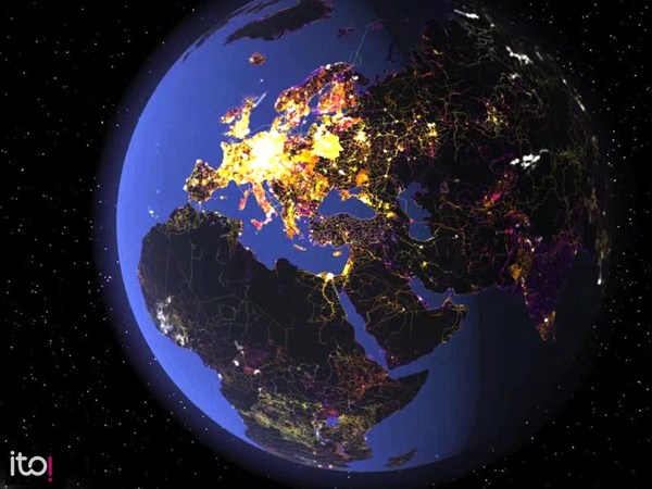
Over the past decade, online and open-source investigations have taken off in the fields of journalism and human rights monitoring, using photographs, videos and the digital traces we leave behind as we use the internet to conduct investigations. Social media data is combined with tools like satellite imagery and 3D modelling, as well as more traditional journalistic techniques like interviews and searches of government documents. It's also brought new kinds of people to journalism. Software developers, animators, archaeologists, or, like me, an architect.
Na última década, investigações online e de código aberto despontaram nas áreas do jornalismo e monitorização de direitos humanos, usando fotografias, vídeos e os traços digitais que deixamos quando usamos a Internet para realizar investigações. Os dados das redes sociais são combinados com ferramentas como imagens de satélite e modelagem 3D, assim como técnicas jornalísticas mais tradicionais como entrevistas e investigações de documentos do governo. Também trouxe novos tipos de pessoas para o jornalismo. Criadores de software, animadores, arqueólogos, ou, como eu, uma arquiteta.
I got involved in investigating Xinjiang in the summer of 2018 when I met Megha Rajagopalan, an American journalist who had been working in China for several years. Over the past few years, China has been carrying out a campaign of oppression in Xinjiang against Turkic Muslims, including the largest group, the Uyghurs. It's part of a campaign of forcible assimilation, and several nations have described it as a genocide. It's estimated that over a million people have been disappeared into detention camps. And while the Chinese government claims that these are part of a benign program of re-education, dozens of former detainees describe being tortured and abused and women being forcibly sterilized.
Envolvi-me com a investigação de Xinjiang no verão de 2018 quando conheci Megha Rajagopalan, uma jornalista americana que trabalhava na China há muitos anos. Nos últimos anos, a China tem executado uma campanha de opressão em Xinjiang contra muçulmanos turcos, incluindo o maior grupo étnico, os Uyghurs. Faz parte de uma campanha de assimilação forçada, e diversos países descreveram a situação como um genocídio. Estima-se que mais de um milhão de pessoas desapareceu em campos de detenção. E embora o governo chinês alegue que os campos fazem parte de um benéfico programa de reeducação, dezenas de ex-detidos descrevem terem sido torturados e abusados e as mulheres terem sido esterilizadas à força.
And yet, for a long time, we lacked information about what was happening in Xinjiang, because the Chinese government controls the internet tightly and restricts journalists' work in the region. Journalists would be followed or detained, and the authorities occasionally even went so far as to set up fake roadworks or stage car crashes to prevent access to certain roads. Local people who did speak to journalists face the risk of being sent to a detention camp for doing so.
E mesmo assim, durante muito tempo, não tínhamos informações sobre o que estava a acontecer em Xinjiang, porque o governo chinês controla firmemente a Internet e restringe o trabalho de jornalistas na região. Os jornalistas eram seguidos ou detidos e as autoridade, ocasionalmente, até montavam obras falsas na estrada ou encenavam acidentes de carro para impedir o acesso a algumas estradas. A população local que falava com jornalistas enfrentava o risco de ser enviada para um campo de detenção por isso.
Megha had been the first journalist to visit one of the camps. But shortly after publishing her article, the Chinese authorities declined to renew her visa, and she had to leave. Other journalists had managed to visit a handful of the camps, but this still represented a fraction of what we believed was out there, and no one knew where the others were. But Megha was keen to find the rest. She just needed to find a way to work effectively from outside China.
Megha foi a primeira jornalista a visitar um dos campos. Mas logo depois de publicar o seu artigo, as autoridades chinesas recusaram renovar o seu visto e ela teve de sair do país. Outros jornalistas conseguiram visitar alguns dos campos, mas ainda representava apenas uma fração do que se acreditava existir, e ninguém sabia onde eram os outros campos. Mas Megha estava disposta a descobrir sobre os outros campos. Só precisava de arranjar uma forma de trabalhar eficazmente de fora da China.
Another challenge was that Xinjiang is huge. It's four times the size of California, and that made it difficult to look for a network of camps that was spread across the region. Satellite imagery could help to solve both of those problems. But more importantly, satellite imagery was a source of information that the Chinese government couldn't control because the satellites and the imagery they produce was owned by US and European organizations. But that still left us with the question of where in that huge amount of satellite imagery to look.
Outro desafio era o facto de Xinjiang ser enorme. É quatro vezes o tamanho da Califórnia, e isso dificultou a procura por uma rede de campos que estava espalhada pela região. As imagens de satélite poderiam ajudar a resolver estes dois problemas. Mas acima de tudo, as imagens de satélite eram uma fonte de informação que o governo chinês não conseguia controlar porque os satélites e as imagens que produzem eram propriedade dos EUA e de organizações europeias. Mas isso ainda nos deixou com a questão sobre onde deveríamos procurar na imensidão de imagens de satélite.
And then I heard about something strange that was happening in Baidu Total View, which is the Chinese equivalent of Google Street View. Photographer Jonathan Browning had discovered that buildings and facilities like industrial estates were being photoshopped out of ground level imagery, often very clumsily. Yeah, it's bizarre, right? At the time, it wasn't clear why this was happening, but I realized that if industrial estates in eastern China were being obscured, then probably the same thing was happening with detention camps in Xinjiang. And I went to look at the imagery there to see what I could find. There were a handful of camps which had been visited by journalists. And so I went to those locations in Baidu to see what the platform showed. There was no street level imagery. But as I zoomed in on the satellite images, this weird thing happened. A light gray square suddenly appeared above the location of the camp and then disappeared just as quickly as I zoomed in further. It was a bit like the map wasn't loading properly, but then I zoomed out and in again only for the same thing to happen. I realized it couldn't be a problem with the map loading because the tiles would have been in the browser's cache. And when I found the same thing happening at the other locations we knew to be camps, I realized that we had a technique we could use to find the rest of the network.
E então ouvi falar sobre algo estranho que estava a acontecer no Baidu Total View, que é o equivalente chinês do Google Street View. O fotógrafo Jonathan Browning descobriu que prédios e instalações como zonas industriais estavam a ser alterados a partir de imagens ao nível do solo, muitas vezes de forma desajeitada. Bizarro, não é? Na época, não era claro o porquê de isto estar a acontecer, mas percebi que se zonas industriais na China Oriental estavam a ser ocultadas, então provavelmente estava a acontecer a mesma coisa com os campos de detenção em Xinjiang. E fui pesquisar as imagens de lá para ver o que poderia encontrar. Apenas alguns campos tinham sido visitados por jornalistas. Então, fui a essas localizações no Baidu para ver o que a plataforma mostrava. Não havia imagens ao nível das ruas. Mas quando aproximei as imagens de satélite, algo de estranho aconteceu. Um quadrado cinzento apareceu de repente em cima da localização do campo e depois desapareceu assim que aproximei ainda mais. Era como se o mapa não estivesse a carregar devidamente, mas então diminuí e aumentei o zoom novamente e aconteceu a mesma coisa. Percebi que não podia ser um problema com o carregamento do mapa porque os quadrados estariam na cache do navegador. E quando vi que a mesma coisa acontecia nas outras localizações que sabíamos serem campos, percebi que tínhamos uma técnica que poderíamos usar para encontrar o resto da rede de campos.
It's quite rare for maps and satellite images to have these blank spots because blank areas tend to draw attention to themselves. But here we got lucky. Obscuring the camps had inadvertently revealed all of their locations.
É muito raro que as imagens de mapas e satélites tenham estes pontos brancos porque os espaços em branco tendem a chamar atenção. Mas nós tivemos sorte. A ocultação dos campos inadvertidamente levou à descoberta das suas localizações.
(Laughter)
(Risos)
(Applause)
(Aplausos)
We worked with developer Christo Buschek, who specializes in documenting human rights issues and building tools for open-source researchers to map the masked-tile locations. We had to work quickly and secretively to map the masked tiles before anyone found out what we were doing and removed them because our investigation relied on access to that information. The idea was that we could go and look at the masked-tile locations and then look at that same location in other unaltered satellite imagery and see what was there. And this is what we saw. This is a former high school that became Kashgar Vocational Skills Education and Training Center. Zooming in on the satellite imagery, we can see the barbed wire in the courtyards that creates exercise pens for the detainees adjacent to the buildings. In other images, we can even see people, all wearing red uniforms, lined up in the courtyard. These features could help us decide whether a location was a camp or not.
Trabalhámos com o criador Christo Buschek, que se especializa na documentação de violações de direitos humanos e na construção de ferramentas para investigadores de fonte aberta para mapear as localizações ocultadas. Tivemos de trabalhar rápida e secretamente para mapear os quadrados antes que alguém descobrisse o que estávamos a fazer e os removesse, porque a nossa investigação dependia do acesso a essa informação. A ideia era podermos procurar as localizações ocultadas pelos quadrados e depois procurar a mesma localização noutras imagens de satélite inalteradas e ver o que realmente estava lá. E foi isto que vimos. Isto é uma antiga escola que se tornou no Centro de Educação e Formação de Competências Vocacionais de Kashgar. Quando aproximamos as imagens de satélite, conseguimos ver o arame farpado nos pátios que cria prisões para os detidos adjacentes aos prédios. Noutras imagens, conseguimos até ver pessoas, que usam todas uniformes vermelhos, em fila no pátio. Estas características podiam ajudar-nos a decidir se uma localização era um campo.
As we investigated further, we realized that the camp's program had evolved away from the early days of makeshift camps in former schools and hospitals, and had become more permanent, that the camps were now larger, higher-security and purpose-built. This is the largest camp that we know of. It's in Dabancheng. The complex is two miles long, and it would cover a quarter of New York's Central Park. In the satellite images, we can see the thick perimeter walls, the guard towers and these blueish buildings, which we believe to be factories. We estimate that this complex can hold over 40,000 people without overcrowding. We corroborated these locations using government documents, many of which mention the camps address, the few media reports which did exist on the camps and our own interviews with former detainees who had managed to leave Xinjiang and are now living in Kazakhstan, Turkey or Europe.
Quando investigámos mais a fundo, percebemos que o programa dos campos tinha evoluído de forma diferente aos dias iniciais de campos improvisados em antigas escolas e hospitais, e eram agora mais permanentes, os campos eram agora maiores, com mais segurança e construídos com um propósito. Este é o maior campo que conhecemos. É em Dabancheng. O complexo tem 3 quilómetros de comprimento, e cobriria um quarto do Central Park em Nova Iorque. Nas imagens de satélite podemos ver paredes perimetrais espessas, torres de vigilância e estes prédios azuis, que acreditamos serem fábricas. Estimamos que este complexo consegue manter mais de 40 000 pessoas sem superlotar. Confirmámos estas localizações usando documentos governamentais, muitos dos quais mencionam o endereço dos campos, as poucas reportagens de imprensa que existiam sobre os campos e as nossas próprias entrevistas com ex-detidos que conseguiram sair de Xinjiang e agora estão a viver no Cazaquistão, na Turquia ou na Europa.
In total, we found 348 locations bearing the hallmarks of camps and prisons. And we believe that this is close to being the full network. We estimate that these facilities have been built to hold more than a million people. That's enough space to detain one in every 25 of Xinjiang's residents. And that doesn't take into account the overcrowding that so many former detainees have described. So that number could be even higher.
No total, encontrámos 348 locais com as marcas de campos e prisões. E acreditamos que isto é quase a rede de campos completa. Estimamos que estas instalações tenham sido construídas para manter mais de um milhão de pessoas. Isso é espaço suficiente para deter um em cada 25 dos residentes de Xinjiang. E isso ainda não considera a superlotação que muitos ex-detidos descreveram. Por isso o número pode ser ainda maior.
And then one morning, a few months after we had published our map, I woke up to a series of messages about a YouTube video that was doing the rounds on Chinese social media. A Chinese vlogger, who goes by the name Guanguan, had taken our map and traveled to Xinjiang. In his video, we see him driving down a main road past a compound with barbed wire on top of the perimeter wall and bars on the windows. Next, he pretends to take a wrong turn down a side street so that he can film the facility at the end. The sign on the gate says "13th Division Detention Center." And then he hurriedly turns his car and drives away. Later, he hangs his camera from his backpack as he walks past this huge prison complex in Ürümqi. From Ürümqi he drove to the Dabancheng, that small town with the enormous detention facility that I showed earlier. He turned off the main road and drove up a gravel track, then got out of his car and climbed up on an earth berm overlooking the new compound. This was a recklessly brave thing to do because, as he notes in the video, tourists don't go to that place. He had no plausible deniability for being there. But this is the view from the top, and it's the first image that I'm aware of of the new camp at Dabancheng.
E então, numa manhã, alguns meses após termos publicado o nosso mapa, acordei com uma série de mensagens sobre um vídeo no YouTube que estava a circular nas redes sociais chinesas. Um vlogger chinês, que usa o nome Guanguan, tinha pegado no nosso mapa e viajado para Xinjiang. No seu vídeo, vemo-lo a conduzir numa estrada principal e a passar por um complexo com arame farpado no topo da parede perimetral e grades nas janelas. Depois, ele finge enganar-se ao virar numa rua secundária para conseguir filmar a instalação no final. A placa no portão diz: “Centro de Detenção da 13ª Divisão”. E depois ele apressadamente desvia o seu carro e afasta-se. Mais tarde, ele pendura a sua câmara na sua mochila e passa em frente a este enorme complexo prisional em Ürümqi. A partir de Ürümqi, conduziu para Dabancheng, aquela cidade pequena com um enorme campo de detenção que mostrei há pouco. Ele saiu da estrada principal, conduziu por um trilho de cascalho, depois saiu do carro e subiu para uma berma de terra que tinha vista para o novo campo. Isto foi uma coisa extremamente corajosa de se fazer porque, como ele comenta no vídeo, os turistas não vão para esse lugar. Ele não tinha nenhuma justificação plausível para estar lá. Mas esta é a sua vista do topo, e é a primeira imagem que conheço do novo campo em Dabancheng.
This video showed us places from ground level that previously we had only seen from above, indicating that our interpretations were correct. Seeing the signs at the gates of the facility, which told us the name and the type of facility, added further evidence that these places were camps. This video helped us to corroborate a series of locations where previously all we had had was satellite imagery.
Este vídeo mostrou-nos lugares ao nível do solo que anteriormente apenas tínhamos visto de cima, indicando que as as nossas interpretações estavam corretas. Ver os sinais nos portões da instalação, que nos disse o nome e o tipo de instalação, aumentou as provas de que estes lugares eram campos. Este vídeo ajudou-nos a corroborar uma série de localizações onde antes apenas tínhamos imagens de satélite.
In Xinjiang, open sources have allowed us to examine and counter the Chinese government's claims about what's happening in the region. But this isn't the only time that open-source data has led to a government losing control of their narrative. At the time, the civil war in Syria was probably the most documented conflict ever, as people filmed bombings and their aftermath and uploaded the videos to social media. Researchers like Bellingcat then used that material to investigate allegations of war crimes, such as the use of chlorine gas against civilians. Open-source data has allowed journalistic work that previously would have been really difficult, either because it happened in a place that you can’t safely go to or because often there previously wouldn't have been adequate evidence to examine.
Em Xinjiang, os códigos abertos permitiram-nos examinar e contrariar as alegações do governo chinês sobre o que está a acontecer na região. Mas não foi a única vez em que dados de código aberto fizeram governos perderem o controlo das suas narrativas. Naquela altura, a guerra civil na Síria era provavelmente o conflito mais documentado de sempre, já que as pessoas filmavam os bombardeamentos e os seus resultados e carregavam os vídeos nas redes sociais. Investigadores como a Bellingcat usaram esse material para investigar as alegações de crimes de guerra, como o uso de gás de cloro contra civis. Os dados de código aberto permitiram trabalho jornalístico que anteriormente teria sido muito difícil, seja por ter acontecido num lugar que não é seguro visitar ou porque, frequentemente, não haveria provas adequadas para examinar.
Now researchers are using these same tools and techniques to monitor the most recent Russian invasion of Ukraine. One of the first signs of the invasion came in Google Maps with a traffic jam created by Russian artillery moving across the border that blocked the roads for civilian traffic. TikTok videos have given away Russian troop movements. Researchers are investigating potential war crimes and aiming to fact-check claims about the war in close to real time.
Agora os investigadores estão a usar as mesmas ferramentas e técnicas para monitorizar a invasão recente da Rússia na Ucrânia. Um dos primeiros sinais da invasão apareceu no Google Maps com um engarrafamento criado pela artilharia russa a atravessar a fronteira que bloqueou as estradas para o tráfego civil. Vídeos no TikTok revelaram os movimentos das tropas russas. Os investigadores estão a investigar possíveis crimes de guerra e a procurar fazer uma verificação factual de alegações sobre a guerra em tempo real.
To do this work, satellite imagery is essential. In Xinjiang, we were lucky enough to have satellite imagery, high-resolution, up-to-date, often taken every month or so and available to us for free. This allowed us to verify potential camp locations and to follow the progress of the camp's construction closely. But this isn't true of everywhere that journalists would want to investigate, and we need affordable access to imagery of those places as well. We also rely on access to other forms of data. We not only need people to take photos and videos, we need them to upload them to a platform where researchers can access them. And then we need that material to be preserved. Often social media platforms have removed material showing violence, even when it's providing key evidence of human rights violations. Civil society actors such as the Syrian Archive have stepped in to download and preserve that material.
Para isto, as imagens de satélite são essenciais. Em Xinjiang, tivemos a sorte de ter imagens de satélite de alta resolução, atualizadas, e muitas vezes tiradas quase todos os meses e disponíveis gratuitamente. Isto permitiu-nos verificar possíveis localizações de campos e seguir de perto o processo da construção dos campos. Mas isto não é assim em todos os casos que os jornalistas gostariam de investigar e também precisamos de ter acesso disponível às imagens desses lugares. Também dependemos do acesso a outras formas de dados. Não precisamos apenas que as pessoas tirem fotos e filmem vídeos, precisamos que elas os carreguem numa plataforma acessível para os investigadores. E precisamos que esse material seja preservado. Frequentemente, as redes sociais removem materiais que mostram violência, mesmo quando fornecem provas fundamentais de violações dos direitos humanos. Agentes da sociedade civil como o Syrian Archive começaram a agir para transferir e preservar esse material.
With social media data and satellite imagery, we can provide evidence of human rights abuses in a way that wasn't possible before. We can move beyond looking at individual instances of human rights violations to show the scale of what's happened. We can corroborate the testimony of eyewitnesses and provide further proof of their stories. We can build a more detailed picture of what's happening to inform policymakers or to provide evidence that can be presented in court. With open-source data, we can provide the evidence needed for accountability and then, hopefully, action.
Com os dados das redes sociais e as imagens de satélite, podemos apresentar provas de violações dos direitos humanos de uma forma que não era possível antes. Podemos ir além de casos individuais de violações dos direitos humanos para mostrar a escala do que aconteceu. Podemos corroborar o depoimento de testemunhas oculares e fornecer provas adicionais às suas histórias. Podemos construir uma imagem mais detalhada do que está a acontecer para informar decisores políticos ou para fornecer provas que possam ser apresentadas em tribunal. Com os dados de código aberto, podemos apresentar as provas necessárias para a responsabilização que esperemos que se tornem em ação.
Thank you.
Obrigada.
(Applause)
(Aplausos)