What I want to talk to you about today is virtual worlds, digital globes, the 3-D Web, the Metaverse. What does this all mean for us? What it means is the Web is going to become an exciting place again. It's going to become super exciting as we transform to this highly immersive and interactive world. With graphics, computing power, low latencies, these types of applications and possibilities are going to stream rich data into your lives. So the Virtual Earth initiative, and other types of these initiatives, are all about extending our current search metaphor.
Hoje quero falar-vos de mundos virtuais, de globos digitais, da Web 3-D, do Metaverso. O que significa tudo isso para nós? Isso significa que a Web vai voltar a ser um lugar apaixonante vai tornar-se muito excitante à medida que a transformarmos num mundo altamente envolvente e interativo. Graças aos gráficos, à capacidade de cálculo, de baixa latência, esses tipos de aplicações e possibilidades estão prestes a transmitir dados valiosos na nossa vida. Assim, a iniciativa Virtual Earth, e outros tipos de iniciativas destas, estão apostadas em alargar o nosso atual poder de pesquisa.
When you think about it, we're so constrained by browsing the Web, remembering URLs, saving favorites. As we move to search, we rely on the relevance rankings, the Web matching, the index crawling. But we want to use our brain! We want to navigate, explore, discover information. In order to do that, we have to put you as a user back in the driver's seat. We need cooperation between you and the computing network and the computer.
Quando pensamos nisso, estamos muito limitados ao navegar na Web. Temos que fixar URL, gravar os nossos favoritos. Quando avançamos na pesquisa, contamos com as avaliações de relevância, as correspondências na Web, o rastreamento do índice. Mas nós queremos usar o nosso cérebro! Queremos navegar, explorar, descobrir informações. Para isso, temos que voltar a colocar o utilizador no comando. Precisamos de cooperação entre vocês, a rede informática e o computador.
So what better way to put you back in the driver's seat than to put you in the real world that you interact in every day? Why not leverage the learnings that you've been learning your entire life? So Virtual Earth is about starting off creating the first digital representation, comprehensive, of the entire world. What we want to do is mix in all types of data. Tag it. Attribute it. Metadata. Get the community to add local depth, global perspective, local knowledge. So when you think about this problem, what an enormous undertaking. Where do you begin? Well, we collect data from satellites, from airplanes, from ground vehicles, from people. This process is an engineering problem, a mechanical problem, a logistical problem, an operational problem.
Então, a melhor maneira de vos colocar de novo no comando não será colocar-vos no mundo real com que vocês interagem todos os dias? Porque não aproveitar as aprendizagens que vocês fizeram durante a vossa vida? Assim, o Virtual Earth começará por criar a primeira representação digital abrangente do mundo inteiro. Queremos misturar todos os tipos de dados. Etiquetá-los, defini-los. Metadados. Pedir à comunidade que adicione profundidade local, conhecimentos globais. Assim, quando vocês pensarem neste problema, que enorme empreendimento! Por onde começar? Nós reunimos dados provenientes de satélites, de aviões, de pessoas, de veículos terrestres. Este processo é um problema de engenharia, um problema mecânico, um problema logístico, um problema operacional.
Here is an example of our aerial camera. This is panchromatic. It's actually four color cones. In addition, it's multi-spectral. We collect four gigabits per second of data, if you can imagine that kind of data stream coming down. That's equivalent to a constellation of 12 satellites at highest res capacity. We fly these airplanes at 5,000 feet in the air. You can see the camera on the front. We collect multiple viewpoints, vantage points, angles, textures. We bring all that data back in.
Este é um exemplo da nossa câmara aérea. É pancromática. São quatro cones de cor. Além disso, é multi-espetral. Recolhemos quatro gigabits de informações por segundo. Tentem imaginar essa torrente de fluxo de dados. Isso é equivalente a uma constelação de 12 satélites com a maior capacidade de resolução. Estes aviões voam a uma altitude de 1500 metros. Vemos a câmara ali na frente. Recolhemos de vários pontos de vista, profundidades, ângulos, texturas. Recuperamos todos esses dados.
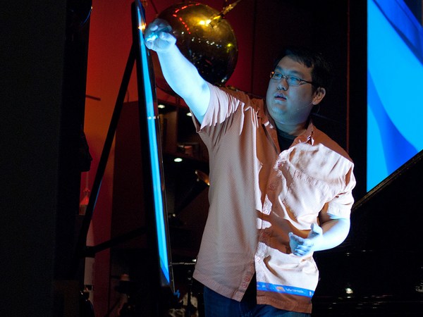
We sit here -- you know, think about the ground vehicles, the human scale -- what do you see in person? We need to capture that up close to establish that what it's like-type experience. I bet many of you have seen the Apple commercials, kind of poking at the PC for their brilliance and simplicity. So a little unknown secret is -- did you see the one with the guy, he's got the Web cam? The poor PC guy. They're duct taping his head. They're just wrapping it on him. Well, a little unknown secret is his brother actually works on the Virtual Earth team. (Laughter). So they've got a little bit of a sibling rivalry thing going on here. But let me tell you -- it doesn't affect his day job.
Aqui sentados — ao nível dos veículos terrestres, à escala humana — o que é que vemos pessoalmente? Temos que captar isso de perto para estabelecer que tipo de experiência é. Eu aposto que muitos de vocês viram a publicidade da Apple, que aparecem no PC com brilhantismo e simplicidade. Há um segredinho desconhecido. Já viram aquele com um tipo que tem uma câmara Web? O pobrezinho tem a câmara presa à cabeça com fita adesiva. Um segredo é que o irmão dele trabalha na equipa do Virtual Earth. (Risos) Há aqui alguma rivalidade entre irmãos. Mas deixem-me dizer, isso não afeta o trabalho diário.
We think a lot of good can come from this technology. This was after Katrina. We were the first commercial fleet of airplanes to be cleared into the disaster impact zone. We flew the area. We imaged it. We sent in people. We took pictures of interiors, disaster areas. We helped with the first responders, the search and rescue. Often the first time anyone saw what happened to their house was on Virtual Earth. We made it all freely available on the Web, just to -- it was obviously our chance of helping out with the cause.
Nós pensamos que esta tecnologia pode fazer coisas boas. Isto foi depois do Katrina. Fomos a primeira frota comercial de aviões a definir a zona de impacto do desastre. Sobrevoámos a área, fotografámo-la, enviámos pessoas. Tirámos fotos de interiores, de áreas de desastre. Ajudámos os primeiros socorristas, de busca e de salvamento. A primeira vez que alguém viu o que acontecera à sua casa foi no Virtual Earth. Publicámos tudo gratuitamente na Web, obviamente era a nossa oportunidade de ajudar aquela causa.
When we think about how all this comes together, it's all about software, algorithms and math. You know, we capture this imagery but to build the 3-D models we need to do geo-positioning. We need to do geo-registering of the images. We have to bundle adjust them. Find tie points. Extract geometry from the images. This process is a very calculated process. In fact, it was always done manual. Hollywood would spend millions of dollars to do a small urban corridor for a movie because they'd have to do it manually. They'd drive the streets with lasers called LIDAR. They'd collected information with photos. They'd manually build each building. We do this all through software, algorithms and math -- a highly automated pipeline creating these cities. We took a decimal point off what it cost to build these cities, and that's how we're going to be able to scale this out and make this reality a dream.
Quando pensamos em como tudo isto se junta, tudo se resume a um "software", algoritmos e matemática. Captamos estas imagens, mas, mas para construir os modelos 3-D, precisamos de fazer o posicionamento geográfico. Precisamos de agrupá-las e ajustá-las, fazer o registo geográfico das imagens, encontrar os pontos de ligação, extrair a geometria das imagens. Este processo exige muitos cálculos. Na verdade, foi sempre feito manualmente. Hollywood gastava milhões de dólares para fazer um pequeno corredor urbano para um filme porque tinham que fazer isso manualmente. Percorriam as ruas com lasers chamados LIDAR. Reuniam informações com fotos. Construíam cada edifício manualmente. Nós fazemos isso com "software", algoritmos e matemática, um canal automatizado que cria essas cidades. Tiramos um ponto decimal ao custo de construir essas cidades,
We think about the user interface. What does it mean to look at it from multiple perspectives? An ortho-view, a nadir-view. How do you keep the precision of the fidelity of the imagery while maintaining the fluidity of the model? I'll wrap up by showing you the -- this is a brand-new peek I haven't really shown into the lab area of Virtual Earth. What we're doing is -- people like this a lot, this bird's eye imagery we work with. It's this high resolution data. But what we've found is they like the fluidity of the 3-D model. A child can navigate with an Xbox controller or a game controller.
e é assim que vamos conseguir tornar o sonho em realidade. Pensamos na interface do utilizador. O que significa olhar para isto de múltiplas perspetivas? Uma visão ortogonal, uma visão de nadir. Como mantemos o rigor da fidelidade das imagens? mantendo a fluidez do modelo? Vou terminar, mostrando-vos. Isto é uma coisa nova que ainda não mostrei no laboratório do Virtual Earth. Estamos a trabalhar — as pessoas adoram isto — com imagens de perspetiva de pássaro. São dados de alta resolução. Mas descobrimos que elas gostam da fluidez do modelo 3D. Uma criança pode navegar com um controlador de Xbox ou de um jogo.
So here what we're trying to do is we bring the picture and project it into the 3-D model space. You can see all types of resolution. From here, I can slowly pan the image over. I can get the next image. I can blend and transition. By doing this I don't lose the original detail. In fact, I might be recording history. The freshness, the capacity. I can turn this image. I can look at it from multiple viewpoints and angles.
Assim, estamos a tentar trazer a imagem e projetá-la no espaço do modelo de 3-D. Podem ver todos tipos de resolução. A partir daqui, posso deslocar a imagem lentamente. Posso pegar na imagem seguinte, posso misturar e fazer a transição. Mas não perco os pormenores originais. Posso estar a registar história. A frescura, a capacidade. Posso rodar esta imagem.
What we're trying to do is build a virtual world. We hope that we can make computing a user model you're familiar with, and really derive insights from you, from all different directions. I thank you very much for your time. (Applause)
Posso olhar para ela de múltiplos pontos de vista e ângulos. Estamos a tentar construir um mundo virtual. Esperamos poder fazer da informática um modelo de utilizador que conheçam e obter perceções de vocês, de todas as direções diferentes. Muito obrigado. (Aplausos)