What I want to talk to you about today is virtual worlds, digital globes, the 3-D Web, the Metaverse. What does this all mean for us? What it means is the Web is going to become an exciting place again. It's going to become super exciting as we transform to this highly immersive and interactive world. With graphics, computing power, low latencies, these types of applications and possibilities are going to stream rich data into your lives. So the Virtual Earth initiative, and other types of these initiatives, are all about extending our current search metaphor.
本日皆さんに仮想世界 デジタル地球儀 3次元ウェブ 3次元仮想世界について話したいと思います これらは私達にどんな意味をもつでしょうか? ウェブが今一度魅力的なものになるということです グラフィック コンピュータパワーを駆使し 待ち時間を削減し 高度な相互作用的世界へと 変形することで このようなアプリや可能性が あなたの生活により密なデータを提供する 魅力的なウェブになるのです バーチャルアースやその他の先駆的なものは そうですね 現在の検索のようなものの 拡張なのです
When you think about it, we're so constrained by browsing the Web, remembering URLs, saving favorites. As we move to search, we rely on the relevance rankings, the Web matching, the index crawling. But we want to use our brain! We want to navigate, explore, discover information. In order to do that, we have to put you as a user back in the driver's seat. We need cooperation between you and the computing network and the computer.
これらを考える際 ウェブブラウジング URLの記憶 お気に入りの登録に束縛されてしまっています 検索といえば検索ランキングや ウェブマッチングやインデックスクローリングに 頼りっきり 私達も考えたいものです 操作し 探して 情報を見つけたいのです そのために 利用者としてあなたを運転席に戻さなければなりません あなたとコンピュータネットワークそしてコンピュータ間の協力が必要です
So what better way to put you back in the driver's seat than to put you in the real world that you interact in every day? Why not leverage the learnings that you've been learning your entire life? So Virtual Earth is about starting off creating the first digital representation, comprehensive, of the entire world. What we want to do is mix in all types of data. Tag it. Attribute it. Metadata. Get the community to add local depth, global perspective, local knowledge. So when you think about this problem, what an enormous undertaking. Where do you begin? Well, we collect data from satellites, from airplanes, from ground vehicles, from people. This process is an engineering problem, a mechanical problem, a logistical problem, an operational problem.
では 日常的な現実世界からあなたを 運転席に戻すにはどうしたら良いのでしょうか 今まで学習したことをもっと有効に利用しませんか? バーチャルアースは全世界の 包括的デジタル表現作成の第一歩なのです 我々は全てのデータの統合を目指しています タグを付け 属性を付与し データに基本情報を与え 地方の情報を提供してもらい 世界的観点で地方の情報も包括します この問題はとてつもない巨大な事業で 何から手をつければよいのか迷ってしまいます 衛星 航空機 地上の乗り物や 人々からデータを収集します この工程は技術的な問題 機械的な問題 物流の問題 操作など様々な問題があります
Here is an example of our aerial camera. This is panchromatic. It's actually four color cones. In addition, it's multi-spectral. We collect four gigabits per second of data, if you can imagine that kind of data stream coming down. That's equivalent to a constellation of 12 satellites at highest res capacity. We fly these airplanes at 5,000 feet in the air. You can see the camera on the front. We collect multiple viewpoints, vantage points, angles, textures. We bring all that data back in.
航空カメラの画像があります 全色性のもので 4色錐です 更に多スペクトル感応性です 想像できるかわかりませんが 我々は 4Gbpsでデータを収集しています この数値は12の衛星の最高速度の合計に値します 我々は航空機で上空約1500mを飛行します 先端にカメラが見えるでしょう さまざまな地点 眺望的視点 角度 テクスチャを採取し持ち帰ります
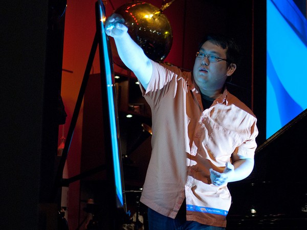
We sit here -- you know, think about the ground vehicles, the human scale -- what do you see in person? We need to capture that up close to establish that what it's like-type experience. I bet many of you have seen the Apple commercials, kind of poking at the PC for their brilliance and simplicity. So a little unknown secret is -- did you see the one with the guy, he's got the Web cam? The poor PC guy. They're duct taping his head. They're just wrapping it on him. Well, a little unknown secret is his brother actually works on the Virtual Earth team. (Laughter). So they've got a little bit of a sibling rivalry thing going on here. But let me tell you -- it doesn't affect his day job.
地上のものは 我々の視点から見ると 何が見えるだろうか? 我々はこのような 経験も組み込む必要があるのです Apple社のCMを皆さん見たことがあるでしょう 利点と使いやすさを見せるためにパソコンをいじくっているやつです ところで あまり知られていない秘密とは... ウェブカメラの男のCMを見たことがありますか? この男は頭にウェブカメラをぐるぐるに巻きつけられてしまいます その秘密とは彼の兄弟がバーチャルアースチームで働いていることです (笑) ここで兄弟間の張り合いが始まってしまいました でも彼の仕事の邪魔にはなってません
We think a lot of good can come from this technology. This was after Katrina. We were the first commercial fleet of airplanes to be cleared into the disaster impact zone. We flew the area. We imaged it. We sent in people. We took pictures of interiors, disaster areas. We helped with the first responders, the search and rescue. Often the first time anyone saw what happened to their house was on Virtual Earth. We made it all freely available on the Web, just to -- it was obviously our chance of helping out with the cause.
この技術はたくさんの利益を提供できるでしょう カトリーナの通過後です 我々は航空機とした災害エリアに 立ち入りを許可された初めての商業団体でした 現地へ飛び 内部や被災地の画像を採取しました 初期対応者の一員として 調査と救助を行いました 彼らの家の状況を初めて見れたのは多くの場合バーチャルアース上でした 無料でウェブ上に公開し というのも 目標を達成しつつ人助けができる絶好の機会でしたから
When we think about how all this comes together, it's all about software, algorithms and math. You know, we capture this imagery but to build the 3-D models we need to do geo-positioning. We need to do geo-registering of the images. We have to bundle adjust them. Find tie points. Extract geometry from the images. This process is a very calculated process. In fact, it was always done manual. Hollywood would spend millions of dollars to do a small urban corridor for a movie because they'd have to do it manually. They'd drive the streets with lasers called LIDAR. They'd collected information with photos. They'd manually build each building. We do this all through software, algorithms and math -- a highly automated pipeline creating these cities. We took a decimal point off what it cost to build these cities, and that's how we're going to be able to scale this out and make this reality a dream.
どのように統合できるかと考えたとき 全てはソフト アルゴリズム 数学に行き着きます 画像を採取します しかし3Dモデルを作るためには 位置情報を決め その情報を画像に登録する必要があります これらをまとめ ポイントを見つけます 画像から正確な位置を割り出します この過程はとても複雑な計算が必要な処理ですが 実はいままで 手作業で行われていました ハリウッドは映画撮影用の小さな通りに何百万ドルも 投じます すべて手作業ですから 彼らは LIDAR というレーザーを搭載した車を走らせ 画像と一緒に情報を集め 手作業でそれぞれの建造物を作ります 我々はソフトウェアを使います アルゴリズムや数理計算で 高度に自動化された処理手順で これらの街を作り上げます 我々はとても安い費用でこれらの街を作ります これこそが現実を夢にすることができる方法です
We think about the user interface. What does it mean to look at it from multiple perspectives? An ortho-view, a nadir-view. How do you keep the precision of the fidelity of the imagery while maintaining the fluidity of the model? I'll wrap up by showing you the -- this is a brand-new peek I haven't really shown into the lab area of Virtual Earth. What we're doing is -- people like this a lot, this bird's eye imagery we work with. It's this high resolution data. But what we've found is they like the fluidity of the 3-D model. A child can navigate with an Xbox controller or a game controller.
我々はユーザインターフェースも考慮してます 多角的に捉えるとはどういうことでしょう? オルソ画像 ナディア画像 モデルの流動性を残して 画像の正確さを 保つにはどうしたらよいでしょうか? 研究室でもまだ未公開の最新の バーチャルアースをお見せして終わりにしたいと思います 皆さん気に入ると思います 我々の高解像鳥瞰図です しかし これは3Dモデルの流動性に適応できると発見しました 子供でもXBoxのようなゲームのコントローラーで操作できます
So here what we're trying to do is we bring the picture and project it into the 3-D model space. You can see all types of resolution. From here, I can slowly pan the image over. I can get the next image. I can blend and transition. By doing this I don't lose the original detail. In fact, I might be recording history. The freshness, the capacity. I can turn this image. I can look at it from multiple viewpoints and angles.
ここでは画像を取り込み3D空間で映し出そうとしています 全ての解像度をご覧いただけます ここからゆっくり画像を拡大していきます 次の画像を取得 配合し移行します こうして 原版の細やかさを保ち 実際に過去の履歴も記録しています 鮮明で豊富な情報表現のおかげで 画像を あらゆる視点や方向から見ることができます
What we're trying to do is build a virtual world. We hope that we can make computing a user model you're familiar with, and really derive insights from you, from all different directions. I thank you very much for your time. (Applause)
我々は仮想世界の構築に取り組んでいます コンピューティングをよりユーザフレンドリーなものにし 皆さんの 色々な視点から見識を引き出せたらと思っています お時間をいただきありがとうございました (拍手)