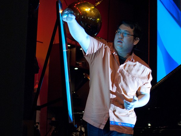
What I want to talk to you about today is virtual worlds, digital globes, the 3-D Web, the Metaverse. What does this all mean for us? What it means is the Web is going to become an exciting place again. It's going to become super exciting as we transform to this highly immersive and interactive world. With graphics, computing power, low latencies, these types of applications and possibilities are going to stream rich data into your lives. So the Virtual Earth initiative, and other types of these initiatives, are all about extending our current search metaphor.
امروز میخوام با شما در مورد جهانهای مجازی، دنیاهای دیجیتال، اینترنت سهبعدی و متاورس (Metaverse) صحبت کنم. ولی این کلمات واقعا چه مفهومی برای ما دارند؟ معنایی که میدهند این است که وب دوباره به یک محیط جذاب تبدیل خواهد شد. در همان حین که ما خودمان را با این جهان تعاملی و شدیداً همهجانبه تطبیق میدهيم، به یک محیط بسیار مهیج تبدیل خواهد شد. با گرافیکها، قدرت پردازش، تاخیرهای کم، این گونه برنامههای کاربردی و امکانات موجب جارى شدن اطلاعات فراوانى به درون زندگی شما مىشوند. بنابراین ابتکار زمین مجازی و انواع دیگری از این ابداعات، همگی در رابطه با گسترش قابلیت فعلی جستجوی ما مىباشد.
When you think about it, we're so constrained by browsing the Web, remembering URLs, saving favorites. As we move to search, we rely on the relevance rankings, the Web matching, the index crawling. But we want to use our brain! We want to navigate, explore, discover information. In order to do that, we have to put you as a user back in the driver's seat. We need cooperation between you and the computing network and the computer.
وقتی در موردش فکر میکنید، ما بواسطه مرور كردن وب، به یاد داشتن URLها، ذخیره کردن علاقهمندیها خيلى محدود شدهایم. وقتی به سراغ جستجو میرویم، به رتبهبندی بر اساس مرتبط بودن، تطبیق وب و گشتن در میان شاخصها تکیه میکنیم. اما ما میخواهیم که از مغزمان استفاده کنیم! ما میخواهيم اطلاعات را پیمایش، کاوش و کشف کنیم. برای این کار، باید شما را به عنوان یه کاربر توی صندلی راننده قرار دهيم. ما نیاز به همکاری در بین شما، شبکه پردازش و پردازشگر داریم.
So what better way to put you back in the driver's seat than to put you in the real world that you interact in every day? Why not leverage the learnings that you've been learning your entire life? So Virtual Earth is about starting off creating the first digital representation, comprehensive, of the entire world. What we want to do is mix in all types of data. Tag it. Attribute it. Metadata. Get the community to add local depth, global perspective, local knowledge. So when you think about this problem, what an enormous undertaking. Where do you begin? Well, we collect data from satellites, from airplanes, from ground vehicles, from people. This process is an engineering problem, a mechanical problem, a logistical problem, an operational problem.
پس چه راهی بهتر از این که شما را توی جای راننده قرار دهيم. به جای این که در دنیای واقعیای که هر روز باآن تعامل دارید قرارتان دهیم؟ چرا اطلاعاتی را که در تمام طول عمرتان یاد میگرفتید را به کار نبریم؟ پس «زمین مجازی» در حال پایهگذاری ساخت اولین نمایش دیجیتال و جامع از کل جهان است. کاری که میخواهیم کنیم این است که همهی انواع دادهها را ترکیب کنیم. تگ بزنیمش. ویژگیهایی را به آن نسبت بدیم. فراداده. از جامعه برای افزودن به عمق محلی، دید جهانی و دانش محلی استفاده کنیم. پس وقتی به این مساله فکر میکنید، عجب مسئولیت عظیمی. از کجا باید شروع کرد؟ خوب، ما دادهها را از ماهواره ها، هواپیماها، وسایط نقلیهی زمینی و از مردم جمعآوری میکنیم. این فرآیند یك مسئلهی مهندسی، یك مسئلهی مکانیکی، یك مسئله لجستیکی و یك مسئلهی عملیاتی است.
Here is an example of our aerial camera. This is panchromatic. It's actually four color cones. In addition, it's multi-spectral. We collect four gigabits per second of data, if you can imagine that kind of data stream coming down. That's equivalent to a constellation of 12 satellites at highest res capacity. We fly these airplanes at 5,000 feet in the air. You can see the camera on the front. We collect multiple viewpoints, vantage points, angles, textures. We bring all that data back in.
این یک نمونه از دوربینهای هوایى ماست. این دوربین نسبت به همه رنگها حساس است. در واقع دارای چهار مخروط رنگی هست. به علاوه، چند طیفی هم هست. ما چهار گیگابیت در ثانیه داده جمعآوری میکنیم، اگر بتونید چنان جریان دادهای را تصور کنید که در حال مخابره شدن است. این حجم معادل مجموع اطلاعات 12 ماهواره با بالاترین وضوح میباشد. ما این هواپیماها را در ارتفاع 5000 فوتی به پرواز در میاوریم. میتوانید دوربین را در جلو ببینید. از زوایای دید مختلف، داده میگیریم، نقاط مزیت، زوایا، بافتها. ما همهی آن دادهها رو یك جا جمع میکنیم.
We sit here -- you know, think about the ground vehicles, the human scale -- what do you see in person? We need to capture that up close to establish that what it's like-type experience. I bet many of you have seen the Apple commercials, kind of poking at the PC for their brilliance and simplicity. So a little unknown secret is -- did you see the one with the guy, he's got the Web cam? The poor PC guy. They're duct taping his head. They're just wrapping it on him. Well, a little unknown secret is his brother actually works on the Virtual Earth team. (Laughter). So they've got a little bit of a sibling rivalry thing going on here. But let me tell you -- it doesn't affect his day job.
به وسایط نقلیه زمینی فکر کنید و مقیاس انسانی. به شخصه چه چیزی را میبینید؟ ما میخواهیم همان را از نزدیک بگیریم تا همان تجربه را برای افراد دیگر فراهم کنیم. حتما خیلیهايتان تبلیغات Apple رو دیدهاید، یك جوراهايى طعنه زدن به كامپيوتر شخصى به خاطر ممتاز بودن و سادگی آنهاست. خب، یك راز کوچیک ناشناخته است، آن شخص رو با آن يارو دیدید، او يك وبکم دارد؟ بیچاره شخص صاحب رايانه شخصى. آنها به كلهاش نوار چسب داكت چسباندهاند. در واقع فقط آن را به سرش بستهاند. خب، راز کوچک ناشناخته این است كه برادرش در واقع در تیم «زمین مجازی» کار میکند. (خنده حضار).خب در واقع در اينجا كمى از رقابت بردارانه را داريم. ولی اجازه دهيدبرايتان بگويم ب -- این تاثیری روی کار روزانهش ندارد.
We think a lot of good can come from this technology. This was after Katrina. We were the first commercial fleet of airplanes to be cleared into the disaster impact zone. We flew the area. We imaged it. We sent in people. We took pictures of interiors, disaster areas. We helped with the first responders, the search and rescue. Often the first time anyone saw what happened to their house was on Virtual Earth. We made it all freely available on the Web, just to -- it was obviously our chance of helping out with the cause.
ما خیلی به چیزهای خوبی که میتوانند از این فناوری حاصل شوند فکر میکنیم. این بعد از طوفان کاترینا بود. ما اولین ناوگان تجاری از هواپیماها بودیم برای این که در منطقه اثر بحران شفاف شود. ما بر فراز منطقه پرواز کردیم. از آن تصویربرداری کردیم. افراد رو به داخل فرستادیم. تصاویری از فضای داخلی منطقهی بحران گرفتیم. به اولین امدادگران برای جستجو و نجات کمک کردیم. غالبا اولین باری که افراد میدیدند چه بلایی سر خانهشان آمده از «زمین مجازی» بود. ما آن راکاملا رایگان روی وب در دسترس قرار دادیم، این قطعا فرصت ما برای کمک کردن در حادثه بود.
When we think about how all this comes together, it's all about software, algorithms and math. You know, we capture this imagery but to build the 3-D models we need to do geo-positioning. We need to do geo-registering of the images. We have to bundle adjust them. Find tie points. Extract geometry from the images. This process is a very calculated process. In fact, it was always done manual. Hollywood would spend millions of dollars to do a small urban corridor for a movie because they'd have to do it manually. They'd drive the streets with lasers called LIDAR. They'd collected information with photos. They'd manually build each building. We do this all through software, algorithms and math -- a highly automated pipeline creating these cities. We took a decimal point off what it cost to build these cities, and that's how we're going to be able to scale this out and make this reality a dream.
وقتی فکر میکنیم چطور همهی اینها کنار هم جمع شد، همهش تو نرمافزار، الگوریتمها و ریاضیات خلاصه میشود. میدانید، ما این تصاویر را گرفتیم، ولی برای ساخت مدل سهبعدی باید مکانیابی جغرافیایی انجام دهیم. باید ثبت جغرافیایی عکسها را انجام دهيم. باید آنها را در دستههایی با هم تطبیق دهيم. نقاط تا خوردگی را پیدا کنیم. هندسه را از تصاویر استخراج کنیم. این فرآیند پردازشى بسیار محاسبه شده است. در واقع، این همیشه به صورت دستی انجام میشد. هالیوود میلیونها دلار خرج میکند تا برای یك فیلم راهروی شهری کوچكى درست کند چون باید دستی انجامش دهند. آنها به خیابانها میروند با لیزرهایی به اسم LIDAR. آنهنا اطلاعات را با عکسها جمعآوری میکنند هر ساختمان را باید دستی بسازند. ما همین را تماماً از طریق نرمافزار، الگوریتمها و ریاضیات انجام میدهیم-- خط لولهی بسیار اتوماتیک شدهای که این شهرها را میسازد. ما يك اعشار از آنچه هزينه ساخت اين شهرها مىشود را بر مىداريم. و به اين ترتيب است كه قادر به سنجيدن و تبديل اين واقعيت به رويا خواهيم شد.
We think about the user interface. What does it mean to look at it from multiple perspectives? An ortho-view, a nadir-view. How do you keep the precision of the fidelity of the imagery while maintaining the fluidity of the model? I'll wrap up by showing you the -- this is a brand-new peek I haven't really shown into the lab area of Virtual Earth. What we're doing is -- people like this a lot, this bird's eye imagery we work with. It's this high resolution data. But what we've found is they like the fluidity of the 3-D model. A child can navigate with an Xbox controller or a game controller.
در در مورد رابط کاربری فکر میکنیم. نگاه كردن به آن از ديدگاههاى متعدد چه معنى مىدهد؟ يك نگاه عمودى، نگاهى از پايينترين نقطه. چطور دقت وفادارى شبيه سازى را حفظ كنيد در حاليكه شناورى مدل را نگه مىكنيد ؟ با نشان دادن اين به شما صحبتم را تمام مىكنم-- اين نگاه زيرزيركى دستِ اولى است كه من واقعاً در حوزه آزمايشگاهى زمين مجازى نشان ندادهام. كارى كه مىكنيم -- آدمها اين را خيلى دوست دارند، اين چشم پرنده خيالى كه با آن كار مىكنيم. اين داده داراى وضوح بالاست. ولی چیزی که ما فهمیدیم این است که آنها شناوری مدل سهبعدی را دوست دارد. یك بچه میتواندبا دستهی Xbox یا هر دستهی بازی هدايت کند.
So here what we're trying to do is we bring the picture and project it into the 3-D model space. You can see all types of resolution. From here, I can slowly pan the image over. I can get the next image. I can blend and transition. By doing this I don't lose the original detail. In fact, I might be recording history. The freshness, the capacity. I can turn this image. I can look at it from multiple viewpoints and angles.
بنابراين اينجا چيزى كه ما سعى داريم انجام دهيم اين است كه تصوير را بياوريم و در درون فضاى مدل سه بعدى قرار دهيم. مىتوانيد همه انواع وضوح را ببينيد. از اينجا، مىتوانم تصوير را به آرامى بكشيم. مىتوانم تصوير بعدى را بگيرم. مىتوانم آن را بياميزم و تغيير دهم. با انجام این کار، جزئیات اصلی را از دست نمیدهم. در واقع، شاید دارم تاریخ را ثبت میکنم. تازگى، قابليت. مىتوانم اين تصوير را برگردانم. مىتوانم به آن از زوايا و نقطهنظرهاى چندگانه بنگرم.
What we're trying to do is build a virtual world. We hope that we can make computing a user model you're familiar with, and really derive insights from you, from all different directions. I thank you very much for your time. (Applause)
چيزى كه ما تلاش در انجام آن داريم، ساختن دنيايى مجازى است. ما اميدواريم كه بتوانيم استفاده از كامپيوتر را بعنوان يك الگوى كاربرى طورى بسازيم كه شما با آن آشناييد، و به واقع استخراج كننده بصيرت از درون شما و از كليه جهتهاى مختلف باشد. از وقتی که گذاشتید بسیار ممنونم. (تشویق حضار)