We know more about other planets than our own, and today, I want to show you a new type of robot designed to help us better understand our own planet. It belongs to a category known in the oceanographic community as an unmanned surface vehicle, or USV. And it uses no fuel. Instead, it relies on wind power for propulsion. And yet, it can sail around the globe for months at a time. So I want to share with you why we built it, and what it means for you.
我們對於其他星球的了解 比我們自己的星球還多, 今天,我想要跟大家介紹 一種新型機器人, 設計來協助我們 更了解我們的星球。 它隸屬的類別 在海洋學的圈子裡稱為 「無人水面載具」,簡稱 USV。 它不需要燃料。 取而代之,它靠風力來推進。 但,它一次就可以 航行全球數個月。 我想要和大家分享的是 我們打造它的原因, 以及它對你們的意義。
A few years ago, I was on a sailboat making its way across the Pacific, from San Francisco to Hawaii. I had just spent the past 10 years working nonstop, developing video games for hundreds of millions of users, and I wanted to take a step back and look at the big picture and get some much-needed thinking time. I was the navigator on board, and one evening, after a long session analyzing weather data and plotting our course, I came up on deck and saw this beautiful sunset. And a thought occurred to me: How much do we really know about our oceans? The Pacific was stretching all around me as far as the eye could see, and the waves were rocking our boat forcefully, a sort of constant reminder of its untold power. How much do we really know about our oceans? I decided to find out.
幾年前,我坐船航行在太平洋上, 從舊金山到夏威夷。 我過去十年不停歇地努力 為數百萬使用者開發電玩遊戲, 我想要退一步,看看整體全局, 留給自己一些很必要的思考時間。 我是船上的領航員, 有天晚上,在花了很長的 時間分析氣象資料 並繪出我們的航線圖之後, 我到甲板上,看到美麗的日落。 我腦中浮現了一個念頭: 我們對於我們的海洋知道多少? 在我視線範圍整個都是 太平洋的延伸, 海浪讓我們的船劇烈搖動, 不時提醒我們 未知的海洋力量有多強大。 我們對海洋知道多少? 我決定要找出答案。
What I quickly learned is that we don't know very much. The first reason is just how vast oceans are, covering 70 percent of the planet, and yet we know they drive complex planetary systems like global weather, which affect all of us on a daily basis, sometimes dramatically. And yet, those activities are mostly invisible to us.
我很快就了解到,我們所知甚少。 第一個原因就只是海洋太廣大了, 覆蓋了地球 70% 的表面, 我們知道它們會帶動 複雜的地球系統, 比如全球天氣,這會影響到 我們的日常生活, 有時影響還很大。 但,那些活動大部分 都是我們看不見的。
Ocean data is scarce by any standard. Back on land, I had grown used to accessing lots of sensors -- billions of them, actually. But at sea, in situ data is scarce and expensive. Why? Because it relies on a small number of ships and buoys. How small a number was actually a great surprise. Our National Oceanic and Atmospheric Administration, better known as NOAA, only has 16 ships, and there are less than 200 buoys offshore globally. It is easy to understand why: the oceans are an unforgiving place, and to collect in situ data, you need a big ship, capable of carrying a vast amount of fuel and large crews, costing hundreds of millions of dollars each, or, big buoys tethered to the ocean floor with a four-mile-long cable and weighted down by a set of train wheels, which is both dangerous to deploy and expensive to maintain.
不論用什麼標準來看, 海洋資料都很稀少。 回到陸地上,我已經很習慣 使用許多感測器—— 其實,是數十億個。 但在海上,現場資料 稀少且昂貴。 為什麼?因為它要仰賴 很少量的船隻和浮標。 數量少到讓人吃驚。 我國的海洋暨大氣總署, 更為人熟知的簡稱 NOAA, 只有十六艘船, 全球近海的浮標還不到兩百個。 原因很容易理解: 海洋是個無情的地方, 要收集現場資料,就需要大船, 要能夠裝載大量的燃料, 很多船員, 每艘船都要花上 數百萬美金的成本, 或者,用四英里纜線 拴在海底的大型浮標 用一組火車車輪壓住, 部署十分危險,維護十分昂貴。
What about satellites, you might ask? Well, satellites are fantastic, and they have taught us so much about the big picture over the past few decades. However, the problem with satellites is they can only see through one micron of the surface of the ocean. They have relatively poor spatial and temporal resolution, and their signal needs to be corrected for cloud cover and land effects and other factors.
你可能會問,那衛星呢? 嗯,衛星很棒, 在過去數十年間,它們讓我們 學到了好多整體的情況。 然而,衛星的問題在於 它們只能看穿海洋表面的一微米。 它們的空間和時間 解析度相對比較差, 且它們的訊號需要根據雲層覆蓋、 陸地效應,及其他因子來做校調。
So what is going on in the oceans? And what are we trying to measure? And how could a robot be of any use?
所以,海洋裡的狀況如何? 我們想要測量的是什麼? 機器人又有什麼用途?
Let's zoom in on a small cube in the ocean. One of the key things we want to understand is the surface, because the surface, if you think about it, is the nexus of all air-sea interaction. It is the interface through which all energy and gases must flow. Our sun radiates energy, which is absorbed by oceans as heat and then partially released into the atmosphere. Gases in our atmosphere like CO2 get dissolved into our oceans. Actually, about 30 percent of all global CO2 gets absorbed. Plankton and microorganisms release oxygen into the atmosphere, so much so that every other breath you take comes from the ocean.
咱們把海洋的一小塊放大來看。 我們想要了解的關鍵之一是表面, 因為如果你細想, 表面是所有空氣和海洋互動的交界處。 它是個介面,所有能量 和氣體都要流過它。 我們的太陽會散發能量, 海洋會將它以熱能的形式吸收, 接著將一部分釋放到大氣當中。 我們大氣中的氣體,如二氧化碳, 會溶解到我們的海洋中。 事實上,全球有大約 30% 的二氧化碳被吸收。 浮游生物和微生物 會把氧氣釋放到大氣中, 量大到你所吸的每兩口氣 就有一口來自海洋。
Some of that heat generates evaporation, which creates clouds and then eventually leads to precipitation. And pressure gradients create surface wind, which moves the moisture through the atmosphere. Some of the heat radiates down into the deep ocean and gets stored in different layers, the ocean acting as some kind of planetary-scale boiler to store all that energy, which later might be released in short-term events like hurricanes or long-term phenomena like El Niño. These layers can get mixed up by vertical upwelling currents or horizontal currents, which are key in transporting heat from the tropics to the poles. And of course, there is marine life, occupying the largest ecosystem in volume on the planet, from microorganisms to fish to marine mammals, like seals, dolphins and whales.
有些熱能會產生蒸發,創造出雲, 最終導致降雨。 壓力梯度會造成地表的風, 讓濕氣透過大氣來移動。 有些熱能向下發散到海洋深處, 儲存在不同層, 海洋就像是地球規模的鍋爐, 將所有那些能量儲存起來, 後續可能會透過 短期事件來釋放,如颶風, 或長期現象,如聖嬰現象。 垂直向上湧出的氣流 可能會將各層混合, 還有水平的氣流,對於將熱能 從熱帶傳送到極地, 扮演了關鍵角色。 當然,還有海洋生物, 佔據了地球上體積 最大的生態系統, 從微生物,到魚類, 到海洋哺乳類動物, 如海豹(seal)、海豚,和鯨魚。
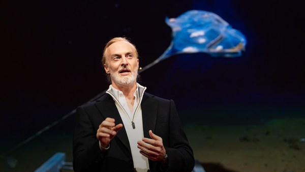
But all of these are mostly invisible to us. The challenge in studying those ocean variables at scale is one of energy, the energy that it takes to deploy sensors into the deep ocean. And of course, many solutions have been tried -- from wave-actuated devices to surface drifters to sun-powered electrical drives -- each with their own compromises. Our team breakthrough came from an unlikely source -- the pursuit of the world speed record in a wind-powered land yacht. It took 10 years of research and development to come up with a novel wing concept that only uses three watts of power to control and yet can propel a vehicle all around the globe with seemingly unlimited autonomy. By adapting this wing concept into a marine vehicle, we had the genesis of an ocean drone.
但,這些大部分是我們看不見的。 大規模研究這些 海洋變量的挑戰是能量, 將感測器部署到海洋深處的能量。 當然,已經有許多 解決方案被嘗試過—— 從浪流驅動裝置, 到衛星追蹤浮球, 到太陽能電子裝置—— 每一種都有它要妥協的地方。 我們團隊的突破,來自 一個很不可能的來源—— 追求打破陸上風帆 速度的世界記錄。 在十年的研究和開發之後, 才出現了一種新穎的機翼概念, 只用三瓦特的電力就可以控制, 但似乎可以非常自主地 將載具推進到全世界各地。 我們把這種機翼概念 用到海洋載具上, 創造出了海洋無人機。
Now, these are larger than they appear. They are about 15 feet high, 23 feet long, seven feet deep. Think of them as surface satellites. They're laden with an array of science-grade sensors that measure all key variables, both oceanographic and atmospheric, and a live satellite link transmits this high-resolution data back to shore in real time. Our team has been hard at work over the past few years, conducting missions in some of the toughest ocean conditions on the planet, from the Arctic to the tropical Pacific. We have sailed all the way to the polar ice shelf. We have sailed into Atlantic hurricanes. We have rounded Cape Horn, and we have slalomed between the oil rigs of the Gulf of Mexico. This is one tough robot.
它們比看起來的還要大。 它們有約十五英尺高, 二十三英尺長,七英尺深。 把它們想成是地表衛星。 它們裝滿了一大堆 科學等級的感測器, 用來測量各種變數, 包括海洋學變數和大氣變數, 還有現場的衛星連結傳輸, 將這些高解析度的資料 即時回傳到岸上。 過去幾年,我們的團隊 一直很努力, 在地球上一些最艱鉅的 海洋條件下執行任務, 從北極圈到熱帶太平洋。 我們曾經一路航行到極地冰架。 我們曾經航行到大西洋颶風中。 我們曾經繞過合恩角, 我們曾經在墨西哥灣的 石油井間迂迴前進。 這是個很強悍的機器人。
Let me share with you recent work that we did around the Pribilof Islands. This is a small group of islands deep in the cold Bering Sea between the US and Russia. Now, the Bering Sea is the home of the walleye pollock, which is a whitefish you might not recognize, but you might likely have tasted if you enjoy fish sticks or surimi. Yes, surimi looks like crabmeat, but it's actually pollock. And the pollock fishery is the largest fishery in the nation, both in terms of value and volume -- about 3.1 billion pounds of fish caught every year.
讓我跟各位分享我們近期 在普里比洛夫群島做了什麼。 這是一小群島嶼, 在寒冷的白令海深處, 位在美國和俄國之間。 白令海是狹鱈的家, 狹鱈是一種白色鱒魚, 你們可能不認得, 但如果你們喜歡吃魚條或魚肉醬, 很可能就有嚐過牠。 是的,魚肉醬看起來像蟹肉, 但其實是狹鱈。 而狹鱈漁業是美國最大的漁業, 在價值上和產量上都是最大的—— 每年會捕獲大約三十一億磅的魚。
So over the past few years, a fleet of ocean drones has been hard at work in the Bering Sea with the goal to help assess the size of the pollock fish stock. This helps improve the quota system that's used to manage the fishery and help prevent a collapse of the fish stock and protects this fragile ecosystem. Now, the drones survey the fishing ground using acoustics, i.e., a sonar. This sends a sound wave downwards, and then the reflection, the echo from the sound wave from the seabed or schools of fish, gives us an idea of what's happening below the surface. Our ocean drones are actually pretty good at this repetitive task, so they have been gridding the Bering Sea day in, day out.
在過去幾年,一支海洋無人機機隊 在白令海努力工作著, 目標是要協助評估 狹鱈魚群到底有多大。 這資訊能協助改善 用來管理漁業的配額系統, 並協助預防這種魚群大量減少, 保護這個脆弱的生態系統。 無人機利用聲學來調查魚場, 也就是聲納。 它會向下發出聲波, 接著反射,碰到海床或魚群時, 聲波會產生回聲, 讓我們知道在海面底下的狀況。 我們的海洋無人機其實很擅長 做這種重覆性的工作任務, 它們一天到晚 在白令海分區辛勤工作。
Now, the Pribilof Islands are also the home of a large colony of fur seals. In the 1950s, there were about two million individuals in that colony. Sadly, these days, the population has rapidly declined. There's less than 50 percent of that number left, and the population continues to fall rapidly. So to understand why, our science partner at the National Marine Mammal Laboratory has fitted a GPS tag on some of the mother seals, glued to their furs. And this tag measures location and depth and also has a really cool little camera that's triggered by sudden acceleration. Here is a movie taken by an artistically inclined seal, giving us unprecedented insight into an underwater hunt deep in the Arctic, and the shot of this pollock prey just seconds before it gets devoured.
普里比洛夫群島 也是許多海狗(fur seal)的家。 在五〇年代,這個聚居地 約有兩百萬隻海狗。 感傷的是,近期數量已快速下降, 只剩下不到一半, 且數量還在持續快速減少。 所以,為了了解原因, 我們在國家海洋哺乳類動物 實驗室的科學夥伴 在一些海狗媽媽的身上 裝上了 GPS 追蹤器, 黏在牠們的毛皮上。 這種追蹤器會測量地點和深度, 還配有一個很酷的小攝影機, 只要突然加速就會啟動它。 這段影片來自一隻優美下潛的海狗, 讓我們能看到北極圈 深處的水下狩獵, 這是前所未有的, 這張照片是被捕食的狹鱈, 幾秒鐘後牠就被吃掉了。
Now, doing work in the Arctic is very tough, even for a robot. They had to survive a snowstorm in August and interferences from bystanders -- that little spotted seal enjoying a ride.
即使對機器人來說, 在北極圈工作也是很艱苦的。 它們得要在八月雪暴中存活下來, 還會受到旁觀者的干涉—— 那隻斑海豹(spotted seal) 很享受搭便車。
(Laughter)
(笑聲)
Now, the seal tags have recorded over 200,000 dives over the season, and upon a closer look, we get to see the individual seal tracks and the repetitive dives. We are on our way to decode what is really happening over that foraging ground, and it's quite beautiful. Once you superimpose the acoustic data collected by the drones, a picture starts to emerge. As the seals leave the islands and swim from left to right, they are observed to dive at a relatively shallow depth of about 20 meters, which the drone identifies is populated by small young pollock with low calorific content. The seals then swim much greater distance and start to dive deeper to a place where the drone identifies larger, more adult pollock, which are more nutritious as fish. Unfortunately, the calories expended by the mother seals to swim this extra distance don't leave them with enough energy to lactate their pups back on the island, leading to the population decline. Further, the drones identify that the water temperature around the island has significantly warmed. It might be one of the driving forces that's pushing the pollock north, and to spread in search of colder regions. So the data analysis is ongoing, but already we can see that some of the pieces of the puzzle from the fur seal mystery are coming into focus.
海狗追蹤器記錄了 當季超過二十萬次潛水, 靠近一點看, 我們可以看到每隻海狗的 個別軌跡和重覆的下潛。 我們正在譯解,來探究 那掠食之地上到底有什麼狀況, 它非常漂亮。 一旦你把無人機收集的 聲學資料疊上去, 就會有一張影像浮現。 當海狗離開島嶼, 從左向右游時, 可以觀察到牠們下潛的深度 相對比較淺,大約二十公尺, 無人機辨識出在這個深度 有小型年輕的狹鱈, 含熱量低。 接著,海狗會游比較遠的距離, 開始潛得比較深, 根據無人機的資訊,牠們 前往的地方有比較大的成年狹鱈, 是比較有營養的魚類。 不幸的是,海狗媽媽 為了游這額外的距離 而消耗的熱量, 導致牠們沒有足夠的能量 回去給島嶼上的小海狗餵奶, 造成族群數量下降。 此外,無人機發現, 島嶼附近的水溫 明顯變暖了。 可能就是這股力量 在驅使狹鱈北移, 並散開來尋找比較冷的區域。 資料分析還在進行中, 但我們已經可以看到海狗之謎 已經有些拼圖片漸漸變清晰了。
But if you look back at the big picture, we are mammals, too. And actually, the oceans provide up to 20 kilos of fish per human per year. As we deplete our fish stocks, what can we humans learn from the fur seal story? And beyond fish, the oceans affect all of us daily as they drive global weather systems, which affect things like global agricultural output or can lead to devastating destruction of lives and property through hurricanes, extreme heat and floods. Our oceans are pretty much unexplored and undersampled, and today, we still know more about other planets than our own.
但,如果你回頭看看整體, 我們也是哺乳類動物。 事實上,海洋每年為每個人 提供高達二十公斤的魚類。 當我們不斷消耗魚群,我們人類 能從海狗的故事裡學到什麼? 除了魚類之外,海洋每天 也影響著我們所有人, 因為海洋會帶動全球天氣系統, 影響比如全球農業產出, 或可能透過颶風、 極度高溫,和洪水, 造成生命的嚴重損失和貧困。 我們的海洋還有太多未被 探索之處,也沒有足夠的採樣, 現今,我們對於其他星球的了解 仍然多於我們的星球。
But if you divide this vast ocean in six-by-six-degree squares, each about 400 miles long, you'd get about 1,000 such squares. So little by little, working with our partners, we are deploying one ocean drone in each of those boxes, the hope being that achieving planetary coverage will give us better insights into those planetary systems that affect humanity.
但,如果把廣大的海洋 切割成 6x6 度的正方形, 每一塊大約四百英里長, 你就會得到大約 一千個這種正方形。 所以,我們和合作夥伴 一點一點來努力, 我們在每一個格中 部署一台海洋無人機, 希望能夠涵蓋整個地球, 讓我們更深入了解 那些會影響人類的地球系統。
We have been using robots to study distant worlds in our solar system for a while now. Now it is time to quantify our own planet, because we cannot fix what we cannot measure, and we cannot prepare for what we don't know.
我們開始用機器人 來研究我們太陽系中 遙遠的世界已經有一段時間了。 該是量化我們星球的時候了。 因為我們無法修復 我們無法測量的東西, 且我們無法準備我們未知的東西。
Thank you.
謝謝。
(Applause)
(掌聲)