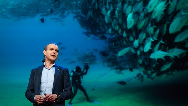
We know more about other planets than our own, and today, I want to show you a new type of robot designed to help us better understand our own planet. It belongs to a category known in the oceanographic community as an unmanned surface vehicle, or USV. And it uses no fuel. Instead, it relies on wind power for propulsion. And yet, it can sail around the globe for months at a time. So I want to share with you why we built it, and what it means for you.
Sabemos mais sobre outros planetas do que sobre o nosso. Hoje vou mostrar um novo tipo de robô concebido para nos ajudar a compreender melhor o nosso planeta. Pertence a uma categoria conhecida na comunidade oceanográfica por veículo de superfície, sem tripulação — um USV. Não precisa de combustível. Em vez disso, usa a energia do vento para a sua propulsão. Contudo, pode dar a volta ao globo durante meses seguidos. Vou contar-vos porque é que o construímos e o que é que significa para todos nós.
A few years ago, I was on a sailboat making its way across the Pacific, from San Francisco to Hawaii. I had just spent the past 10 years working nonstop, developing video games for hundreds of millions of users, and I wanted to take a step back and look at the big picture and get some much-needed thinking time. I was the navigator on board, and one evening, after a long session analyzing weather data and plotting our course, I came up on deck and saw this beautiful sunset. And a thought occurred to me: How much do we really know about our oceans? The Pacific was stretching all around me as far as the eye could see, and the waves were rocking our boat forcefully, a sort of constant reminder of its untold power. How much do we really know about our oceans? I decided to find out.
Há uns anos, eu ia num veleiro a atravessar o Pacífico, de São Francisco até ao Havai. Tinha passado os 10 anos anteriores a trabalhar sem parar, a desenvolver videojogos para centenas de milhões de utilizadores, e queria recuar um pouco para perspetivar a minha vida; sentia necessidade de algum tempo para pensar, A bordo, era o navegador. Uma tarde, depois de uma longa sessão a analisar os dados meteorológicos e a traçar a rota, subi ao convés e vi um pôr-do-sol fascinante. Assaltou-me um pensamento. Até que ponto conhecemos os nossos oceanos? O Pacífico estendia-se por todos os lados, até onde a vista alcançava, e as ondas batiam com força, sacudindo o barco, num lembrete permanente do seu poder indizível. Até que ponto conhecemos os nossos oceanos? Decidi descobrir.
What I quickly learned is that we don't know very much. The first reason is just how vast oceans are, covering 70 percent of the planet, and yet we know they drive complex planetary systems like global weather, which affect all of us on a daily basis, sometimes dramatically. And yet, those activities are mostly invisible to us.
Rapidamente descobri que não conhecemos muita coisa. A primeira razão é porque os oceanos são enormes, cobrem 70% do planeta. No entanto, sabemos que influenciam complexos sistemas do planeta — como o clima mundial — que nos afetam diariamente e, por vezes, de modo dramático. Porém, essas atividades são quase invisíveis.
Ocean data is scarce by any standard. Back on land, I had grown used to accessing lots of sensors -- billions of them, actually. But at sea, in situ data is scarce and expensive. Why? Because it relies on a small number of ships and buoys. How small a number was actually a great surprise. Our National Oceanic and Atmospheric Administration, better known as NOAA, only has 16 ships, and there are less than 200 buoys offshore globally. It is easy to understand why: the oceans are an unforgiving place, and to collect in situ data, you need a big ship, capable of carrying a vast amount of fuel and large crews, costing hundreds of millions of dollars each, or, big buoys tethered to the ocean floor with a four-mile-long cable and weighted down by a set of train wheels, which is both dangerous to deploy and expensive to maintain.
Os dados sobre o oceano são escassos, seja qual for a medida. Em terra, eu estava habituado a utilizar muitos sensores — milhares de milhões de sensores. Mas, no mar, os dados "in situ" são escassos e caros. Porquê? Porque se baseiam num pequeno número de barcos e de boias. Para minha surpresa, esse número era pequeno. A nossa Administração Nacional Oceânica e Atmosférica mais conhecida por NOAA, só tem 16 navios, e há menos de 200 boias no mar alto, a nível mundial. É fácil perceber porquê: os oceanos são um local desfavorável. Para reunir dados "in situ", é preciso um grande navio, capaz de transportar grandes quantidades de combustível e uma grande tripulação. Custa centenas de milhões de dólares cada um. As grandes boias estão ligadas ao fundo do mar por um cabo de 6,5 km de comprimento e presas a um conjunto de rodas de comboio, o que é perigoso de instalar e dispendioso de manter.
What about satellites, you might ask? Well, satellites are fantastic, and they have taught us so much about the big picture over the past few decades. However, the problem with satellites is they can only see through one micron of the surface of the ocean. They have relatively poor spatial and temporal resolution, and their signal needs to be corrected for cloud cover and land effects and other factors.
Podem perguntar: E então os satélites? Bom, os satélites são fantásticos e têm-nos ensinado muito sobre o quadro geral nas últimas décadas. Mas o problema com os satélites é que só veem um micrómetro abaixo da superfície do oceano. Têm uma resolução relativamente fraca espacial e temporal e o sinal precisa de ser corrigido em função das nuvens e dos efeitos sobre a terra e outros fatores.
So what is going on in the oceans? And what are we trying to measure? And how could a robot be of any use?
Então, o que se passa nos oceanos? O que é que estamos a tentar medir? Como é que um robô pode ser útil?
Let's zoom in on a small cube in the ocean. One of the key things we want to understand is the surface, because the surface, if you think about it, is the nexus of all air-sea interaction. It is the interface through which all energy and gases must flow. Our sun radiates energy, which is absorbed by oceans as heat and then partially released into the atmosphere. Gases in our atmosphere like CO2 get dissolved into our oceans. Actually, about 30 percent of all global CO2 gets absorbed. Plankton and microorganisms release oxygen into the atmosphere, so much so that every other breath you take comes from the ocean.
Vamos ampliar um pequeno cubo do oceano. Uma das principais coisas que queremos perceber é a superfície, porque a superfície é o nexo de todas as interações ar-mar. Toda a energia e todos os gases devem passar pela superfície. O Sol radia energia que é absorvida pelo oceano como calor e depois, é libertada parcialmente na atmosfera. Os gases na atmosfera, como o CO2, dissolvem-se no oceano. Cerca de 30% de todo o CO2 mundial é absorvido. O plâncton e os micro-organismos libertam oxigénio para a atmosfera, em tão grande quantidade que, cada inspiração nossa, vem do oceano.
Some of that heat generates evaporation, which creates clouds and then eventually leads to precipitation. And pressure gradients create surface wind, which moves the moisture through the atmosphere. Some of the heat radiates down into the deep ocean and gets stored in different layers, the ocean acting as some kind of planetary-scale boiler to store all that energy, which later might be released in short-term events like hurricanes or long-term phenomena like El Niño. These layers can get mixed up by vertical upwelling currents or horizontal currents, which are key in transporting heat from the tropics to the poles. And of course, there is marine life, occupying the largest ecosystem in volume on the planet, from microorganisms to fish to marine mammals, like seals, dolphins and whales.
Parte desse calor gera a evaporação que cria as nuvens e depois, acaba por provocar chuva. Os gradientes de pressão criam o vento superficial que transporta a humidade pela atmosfera. Parte do calor radia para o fundo do oceano e é armazenado em diferentes camadas. O oceano atua como uma espécie de caldeira à escala planetária para armazenar essa energia toda, que depois pode ser libertada em acontecimentos pontuais, como os furacões ou fenómenos recorrentes como o El Niño. Essas camadas podem misturar-se por correntes verticais de ressurgência ou correntes horizontais, fundamentais para transportar o calor dos trópicos para os polos. Claro que há a vida marinha, que ocupa o maior ecossistema do planeta, em volume, desde os micro-organismos aos peixes e aos mamíferos marinhos, como focas, golfinhos e baleias.
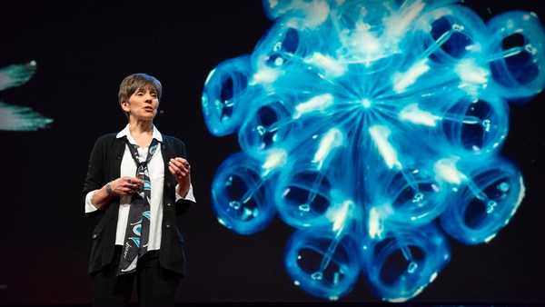
But all of these are mostly invisible to us. The challenge in studying those ocean variables at scale is one of energy, the energy that it takes to deploy sensors into the deep ocean. And of course, many solutions have been tried -- from wave-actuated devices to surface drifters to sun-powered electrical drives -- each with their own compromises. Our team breakthrough came from an unlikely source -- the pursuit of the world speed record in a wind-powered land yacht. It took 10 years of research and development to come up with a novel wing concept that only uses three watts of power to control and yet can propel a vehicle all around the globe with seemingly unlimited autonomy. By adapting this wing concept into a marine vehicle, we had the genesis of an ocean drone.
Mas a maioria deles são invisíveis aos nossos olhos. O problema de estudar estas variáveis oceânicas à escala é a energia, a energia necessária para instalar sensores no oceano profundo. Já se tentaram muitas soluções — desde aparelhos ativados pelas ondas a derivadores de superfície a motores elétricos alimentados a energia solar, cada um com as suas limitações. A inovação da nossa equipa provém duma fonte inesperada — a tentativa do recorde mundial de velocidade num carro à vela movido pelo vento. Foram precisos 10 anos de investigação e desenvolvimento para encontrar um novo tipo de asa que só usa três watts de energia para controlo mas pode impulsionar um veículo à volta do planeta com uma autonomia aparentemente ilimitada. Adaptando este tipo de vela a um veículo marinho tivemos a génese de um "drone" oceânico.
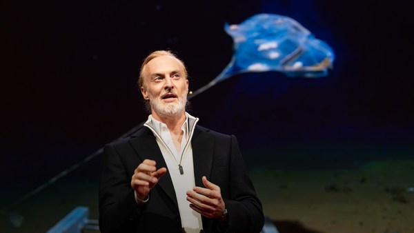
Now, these are larger than they appear. They are about 15 feet high, 23 feet long, seven feet deep. Think of them as surface satellites. They're laden with an array of science-grade sensors that measure all key variables, both oceanographic and atmospheric, and a live satellite link transmits this high-resolution data back to shore in real time. Our team has been hard at work over the past few years, conducting missions in some of the toughest ocean conditions on the planet, from the Arctic to the tropical Pacific. We have sailed all the way to the polar ice shelf. We have sailed into Atlantic hurricanes. We have rounded Cape Horn, and we have slalomed between the oil rigs of the Gulf of Mexico. This is one tough robot.
Estes são maiores do que parece. Têm cerca de 4,5 m de altura, 7,5 m de comprimento e 2 m de grossura. Pensem neles como satélites de superfície. Estão carregados com vários sensores científicos que medem todas as variáveis mais importantes, tanto oceanográficas como atmosféricas, Uma ligação via satélite transmite os dados de alta resolução para terra, em tempo real. A nossa equipa tem trabalhado muito nos últimos anos, realizando missões nalgumas das situações oceânicas mais difíceis do planeta, desde o Ártico ao Pacífico tropical. Navegámos até à calota de gelo polar. Viajámos através dos furacões do Atlântico. Demos a volta ao Cabo Horn e ziguezagueámos por entre os poços de petróleo do Golfo do México. É um robô robusto.
Let me share with you recent work that we did around the Pribilof Islands. This is a small group of islands deep in the cold Bering Sea between the US and Russia. Now, the Bering Sea is the home of the walleye pollock, which is a whitefish you might not recognize, but you might likely have tasted if you enjoy fish sticks or surimi. Yes, surimi looks like crabmeat, but it's actually pollock. And the pollock fishery is the largest fishery in the nation, both in terms of value and volume -- about 3.1 billion pounds of fish caught every year.
Vou falar-vos do trabalho mais recente que fizemos em volta das Ilhas Pribilof. É um pequeno arquipélago no frio Mar de Bering, entre os EUA e a Rússia. O Mar de Bering é a casa do badejo do Alasca que é um peixe branco que talvez não conheçam, mas que provavelmente já saborearam se gostam de douradinhos ou de "surimi". Sim, o "surimi" parece caranguejo mas é badejo. A pesca do badejo é a maior pescaria do país, em termos de valor e de volume — cerca de 1400 milhões de kg de peixe por ano.
So over the past few years, a fleet of ocean drones has been hard at work in the Bering Sea with the goal to help assess the size of the pollock fish stock. This helps improve the quota system that's used to manage the fishery and help prevent a collapse of the fish stock and protects this fragile ecosystem. Now, the drones survey the fishing ground using acoustics, i.e., a sonar. This sends a sound wave downwards, and then the reflection, the echo from the sound wave from the seabed or schools of fish, gives us an idea of what's happening below the surface. Our ocean drones are actually pretty good at this repetitive task, so they have been gridding the Bering Sea day in, day out.
Durante os últimos anos uma frota de "drones" oceânicos tem trabalhado no Mar de Bering com o objetivo de avaliar a dimensão das reservas de badejo. Isso ajuda-nos a melhorar as quotas que se usam para gerir as pescas e ajuda a evitar um colapso das reservas de peixes e proteger este ecossistema frágil. Os "drones" sondam a área da pesca, usando a acústica, ou seja, um sonar. Este envia uma onda sonora para o fundo e depois, o reflexo, o eco da onda sonora do leito marinho ou dos cardumes de peixes dão-nos uma ideia do que está a acontecer abaixo da superfície. Estes "drones" oceânicos são muito bons nesta tarefa repetitiva, e estão a percorrer o Mar de Bering todos os dias.
Now, the Pribilof Islands are also the home of a large colony of fur seals. In the 1950s, there were about two million individuals in that colony. Sadly, these days, the population has rapidly declined. There's less than 50 percent of that number left, and the population continues to fall rapidly. So to understand why, our science partner at the National Marine Mammal Laboratory has fitted a GPS tag on some of the mother seals, glued to their furs. And this tag measures location and depth and also has a really cool little camera that's triggered by sudden acceleration. Here is a movie taken by an artistically inclined seal, giving us unprecedented insight into an underwater hunt deep in the Arctic, and the shot of this pollock prey just seconds before it gets devoured.
Nas Ilhas Pribilof também encontramos uma grande colónia de lobos-marinhos. Nos anos 50, esta colónia tinha cerca de dois milhões de indivíduos. Infelizmente, hoje em dia, a população diminuiu rapidamente. Restam menos de 50% daquele número, e a população continua a diminuir rapidamente. Para percebermos porquê o nosso parceiro cientista no Laboratório Nacional dos Mamíferos Marinhos colocou uma etiqueta GPS nalguns lobos-marinhos mães colada à pelagem. Esta etiqueta mede a localização e a profundidade e também tem uma pequena câmara que é ativada pela aceleração súbita. Este é um filme tirado por um lobo-marinho artisticamente inclinado que nos dá uma visão sem precedentes de uma caçada debaixo de água na profundeza do Ártico e a imagem desta presa, o badejo, segundos antes de ser devorado.
Now, doing work in the Arctic is very tough, even for a robot. They had to survive a snowstorm in August and interferences from bystanders -- that little spotted seal enjoying a ride.
Trabalhar no Ártico é muito difícil, mesmo para um robô. Têm de sobreviver a uma tempestade de neve em agosto e a interferências de transeuntes — aquela pequena foca manchada está a gostar da boleia.
(Laughter)
(Risos)
Now, the seal tags have recorded over 200,000 dives over the season, and upon a closer look, we get to see the individual seal tracks and the repetitive dives. We are on our way to decode what is really happening over that foraging ground, and it's quite beautiful. Once you superimpose the acoustic data collected by the drones, a picture starts to emerge. As the seals leave the islands and swim from left to right, they are observed to dive at a relatively shallow depth of about 20 meters, which the drone identifies is populated by small young pollock with low calorific content. The seals then swim much greater distance and start to dive deeper to a place where the drone identifies larger, more adult pollock, which are more nutritious as fish. Unfortunately, the calories expended by the mother seals to swim this extra distance don't leave them with enough energy to lactate their pups back on the island, leading to the population decline. Further, the drones identify that the water temperature around the island has significantly warmed. It might be one of the driving forces that's pushing the pollock north, and to spread in search of colder regions. So the data analysis is ongoing, but already we can see that some of the pieces of the puzzle from the fur seal mystery are coming into focus.
As etiquetas registaram mais de 200 000 mergulhos durante a estação e, numa observação mais atenta, vemos o trilho individual do lobo-marinho e os seus mergulhos repetidos. Estamos em vias de descodificar o que acontece realmente naquela zona de alimentação e, na verdade, é espantoso. Quando sobrepomos os dados acústicos detetados pelos "drones", começa a aparecer uma imagem. Quando os lobos-marinhos abandonam a ilha e nadam da esquerda para a direita, observamo-los a mergulhar a uma profundidade relativamente baixa de cerca de 20 metros, que, como identificado pelos "drones", é povoado por pequenos badejos jovens com pouco conteúdo de calorias. Os lobos-marinhos nadam a uma distância maior e começam a mergulhar mais fundo, para uma zona onde os "drones" identificam badejos maiores, mais adultos, peixes mais nutritivos. Infelizmente, as calorias gastas pelos lobos-marinhos mães para nadar esta distância adicional não lhes deixam energia suficiente para amamentar as crias, quando voltam à ilha, o que leva ao declínio da população. Mais ainda, os "drones" identificam que a temperatura da água em volta da ilha tem aquecido significativamente. Pode ser uma das forças que leva o badejo a afastar-se para norte e a espalhar-se, à procura de regiões mais frias. A análise dos dados está em curso mas já podemos ver que algumas das peças do "puzzle" do mistério dos lobos-marinhos estão a começar a aparecer.
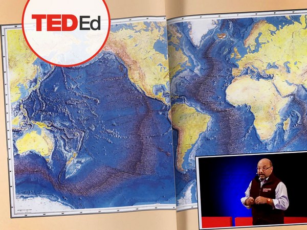
But if you look back at the big picture, we are mammals, too. And actually, the oceans provide up to 20 kilos of fish per human per year. As we deplete our fish stocks, what can we humans learn from the fur seal story? And beyond fish, the oceans affect all of us daily as they drive global weather systems, which affect things like global agricultural output or can lead to devastating destruction of lives and property through hurricanes, extreme heat and floods. Our oceans are pretty much unexplored and undersampled, and today, we still know more about other planets than our own.
Mas se olharmos para o quadro geral, nós também somos mamíferos. Os oceanos fornecem-nos 20 kg de peixe por pessoa por ano. Enquanto esgotamos os nossos "stocks" de peixe, o que é que os homens podem aprender com a história dos lobos-marinhos? Para além dos peixes, os oceanos afetam-nos diariamente, já que impulsionam sistemas climáticos mundiais que afetam coisas como a produção agrícola mundial ou podem causar uma destruição devastadora de vidas e propriedades através dos furações, de calor extremo e de inundações. A maior parte dos oceanos está por explorar e analisar. Hoje ainda, continuamos a conhecer melhor outros planetas do que o nosso.
But if you divide this vast ocean in six-by-six-degree squares, each about 400 miles long, you'd get about 1,000 such squares. So little by little, working with our partners, we are deploying one ocean drone in each of those boxes, the hope being that achieving planetary coverage will give us better insights into those planetary systems that affect humanity.
Mas, se dividirmos este vasto oceano em quadrados com seis graus de lado, ou seja, com 640 m de lado, obtemos cerca de 100 quadrados. Pouco a pouco, trabalhando com os nossos parceiros, estamos a colocar um "drone" oceânico em cada um desses quadrados, na esperança de conseguir a cobertura a nível planetário que nos dê uma visão melhor destes sistemas planetários que afetam a humanidade.
We have been using robots to study distant worlds in our solar system for a while now. Now it is time to quantify our own planet, because we cannot fix what we cannot measure, and we cannot prepare for what we don't know.
Temos usado robôs para estudar mundos distantes do nosso sistema solar de há bastante tempo a esta parte. Chegou a altura de quantificar o nosso planeta, porque não podemos remediar o que não podemos medir e não podemos preparar-nos para o que não conhecemos.
Thank you.
Obrigado.
(Applause)
(Aplausos)