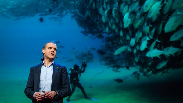
We know more about other planets than our own, and today, I want to show you a new type of robot designed to help us better understand our own planet. It belongs to a category known in the oceanographic community as an unmanned surface vehicle, or USV. And it uses no fuel. Instead, it relies on wind power for propulsion. And yet, it can sail around the globe for months at a time. So I want to share with you why we built it, and what it means for you.
우리는 지구보다 다른 행성에 대해 더 많이 알고 있습니다. 오늘 저는 새로운 종류의 로봇을 여러분께 소개하고자 합니다. 우리 행성을 더 잘 이해할 수 있도록 설계된 로봇이죠. 이 로봇은 해양 학계에서무인 수상정이라고 알려진 범주로 분류할 수 있습니다. 이 로봇은 연료를 사용하지 않습니다. 대신, 풍력을 사용해 앞으로 나아가죠. 그런데 한 번 출항하면 몇 달 동안 전 세계를 항해할 수 있습니다. 저희가 이것을 왜 만들었는지, 또 여러분께 이 로봇이 무엇을 의미하는지 여러분께 말씀드리려 합니다.
A few years ago, I was on a sailboat making its way across the Pacific, from San Francisco to Hawaii. I had just spent the past 10 years working nonstop, developing video games for hundreds of millions of users, and I wanted to take a step back and look at the big picture and get some much-needed thinking time. I was the navigator on board, and one evening, after a long session analyzing weather data and plotting our course, I came up on deck and saw this beautiful sunset. And a thought occurred to me: How much do we really know about our oceans? The Pacific was stretching all around me as far as the eye could see, and the waves were rocking our boat forcefully, a sort of constant reminder of its untold power. How much do we really know about our oceans? I decided to find out.
몇 년 전, 저는 태평양을 가로질러 샌프란시스코에서 하와이로 가는 배에 타고 있었습니다. 저는 10년을 쉬지 않고 일하면서 수억 명의 사용자를 위한 비디오 게임을 개발했었지만, 한 걸음 뒤로 떨어져서 더 큰 그림을 보고 싶었습니다. 또한 생각할 시간도 절실히 필요했었죠. 저는 선상의 탐험가였습니다. 어느 저녁, 한참 동안 기상 정보를 분석하고 항로를 표시하는 일을 한 뒤, 저는 갑판에 올라와 이 아름다운 일몰을 보았습니다. 그 순간 이런 생각이 들더군요. 과연 우리는 바다에 대해 얼마나 알고 있을까? 태평양은 제 시야를 넘어 사방으로 쭉 펼쳐져 있었고, 파도는 저희 배를 강하게 흔들고 있었습니다. 마치 자신이 가진 미지의 힘을 끊임없이 과시하는 것 같았죠. 우리는 바다에 대해 얼마나 알고 있을까요? 저는 답을 찾아내기로 마음먹었습니다.
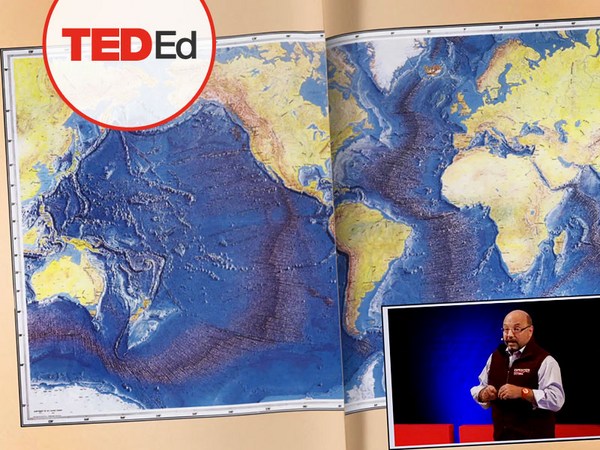
What I quickly learned is that we don't know very much. The first reason is just how vast oceans are, covering 70 percent of the planet, and yet we know they drive complex planetary systems like global weather, which affect all of us on a daily basis, sometimes dramatically. And yet, those activities are mostly invisible to us.
얼마 지나지 않아, 아는 것이 별로 없다는 것을 깨달았습니다. 첫 번째 이유는 바다가 지구의 70%나 차지한다는 데 있습니다. 우리는 바다가 복잡한 지구계를 이루고 있다는 것을 압니다. 예를 들면, 지구의 기후 같은 것 말입니다. 기후는 우리에게 매일 영향을 미치면서 때로는 거대한 영향을 보여 줍니다. 하지만 우리는 이런 영향을 거의 인식하지 못합니다.
Ocean data is scarce by any standard. Back on land, I had grown used to accessing lots of sensors -- billions of them, actually. But at sea, in situ data is scarce and expensive. Why? Because it relies on a small number of ships and buoys. How small a number was actually a great surprise. Our National Oceanic and Atmospheric Administration, better known as NOAA, only has 16 ships, and there are less than 200 buoys offshore globally. It is easy to understand why: the oceans are an unforgiving place, and to collect in situ data, you need a big ship, capable of carrying a vast amount of fuel and large crews, costing hundreds of millions of dollars each, or, big buoys tethered to the ocean floor with a four-mile-long cable and weighted down by a set of train wheels, which is both dangerous to deploy and expensive to maintain.
해양 자료는 절대적으로 부족합니다. 육지에서 저는 많은 센서를 이용하는 것에 익숙했습니다. 실제로 몇십 억 개의 지상 센서가 존재합니다. 하지만 바다에서는, 현장 자료가 부족하고 매우 비쌉니다. 왜 그럴까요? 왜냐하면, 소수의 배와 부표에 의존하기 때문입니다. 충격적일 정도로 적은 수입니다. 미국 해양대기청, NOAA로 더 많이 알려진 이곳은 오로지 16척의 배를 소유하고 있으며, 부표는 전 세계적으로 200개도 채 되지 않습니다. 왜 그런지는 쉽게 이해할 수 있습니다. 바다는 우리 인간이 접근하기에 매우 불리하고 현장 정보를 얻기 위해선 큰 배가 필요한데, 막대한 양의 연료와 많은 선원을 운반할 수 있어야 합니다. 이렇게 되면 각각 수억 달러의 비용이 필요합니다. 아니면, 6,400m 길이의 케이블에 커다란 부표를 부착해 바다로 던져 기차 바퀴 등에 매달아 고정합니다. 설치 자체도 위험하지만 유지 비용도 만만치 않습니다.
What about satellites, you might ask? Well, satellites are fantastic, and they have taught us so much about the big picture over the past few decades. However, the problem with satellites is they can only see through one micron of the surface of the ocean. They have relatively poor spatial and temporal resolution, and their signal needs to be corrected for cloud cover and land effects and other factors.
혹시 여러분 중에 인공위성의 사용을 제안하시는 분이 있을 겁니다. 글쎄요, 인공위성은 최고죠. 그리고 인공위성은 과거 수십 년에 걸쳐 발생한 총체적인 정보를 우리에게 전달해 주고 있습니다. 그러나 이런 인공위성의 단점은 지구 대양 표면을 1마이크론 정도의 구멍으로만 관찰할 수 있다는 점입니다. 공간도 부족하지만 해상도도 일정하지 않습니다. 또한 위성이 받은 신호를 수정해야 하는데 구름 층이나 육지의 영향 등 고려해야 할 많은 요소가 있습니다.
So what is going on in the oceans? And what are we trying to measure? And how could a robot be of any use?
그렇다면 대양에서는 어떤 일이 일어나고 있을까요? 우리가 측정하려고 하는 것은 무엇일까요? 로봇을 사용하면 어떤 점이 유리할까요?
Let's zoom in on a small cube in the ocean. One of the key things we want to understand is the surface, because the surface, if you think about it, is the nexus of all air-sea interaction. It is the interface through which all energy and gases must flow. Our sun radiates energy, which is absorbed by oceans as heat and then partially released into the atmosphere. Gases in our atmosphere like CO2 get dissolved into our oceans. Actually, about 30 percent of all global CO2 gets absorbed. Plankton and microorganisms release oxygen into the atmosphere, so much so that every other breath you take comes from the ocean.
바닷속에 있는 정육면체를 확대해 보겠습니다. 우리가 알고 싶은 가장 중요한 하나는 대양의 표면입니다. 바다 표면은 대기와 바다의 상호 교차점이자 모든 에너지와 기체 등이 반드시 거쳐야 할 접촉면입니다. 태양이 에너지를 방출하면 바다가 이를 열에너지의 형태로 흡수합니다. 그 후 대기로 일부가 방출되기도 합니다. 이산화탄소와 같은 대기 중 기체는 바다 속으로 녹게 됩니다. 전체 이산화 탄소의 30%는 바닷속으로 흡수됩니다. 플랑크톤과 미생물들은 대기 중으로 산소를 배출합니다. 그 양은 실로 엄청나서 우리가 호흡하는 산소가 모두 바다에서 왔다고 할 수 있습니다.
Some of that heat generates evaporation, which creates clouds and then eventually leads to precipitation. And pressure gradients create surface wind, which moves the moisture through the atmosphere. Some of the heat radiates down into the deep ocean and gets stored in different layers, the ocean acting as some kind of planetary-scale boiler to store all that energy, which later might be released in short-term events like hurricanes or long-term phenomena like El Niño. These layers can get mixed up by vertical upwelling currents or horizontal currents, which are key in transporting heat from the tropics to the poles. And of course, there is marine life, occupying the largest ecosystem in volume on the planet, from microorganisms to fish to marine mammals, like seals, dolphins and whales.
그 열의 일부는 수분의 증발을 야기시켜 구름을 생성시키고 최종적으로 비로 순환됩니다. 압력층은 지상풍을 만들고 지상풍은 대기 속으로 수분을 이동시킵니다. 열의 일부가 심해로 들어가면 각기 다른 층에서 흡수가 이루어집니다. 지구가 일종의 초대형 보일러처럼 작동하게 되어 많은 에너지를 저장할 수 있게 됩니다. 저장된 에너지는 나중에 허리케인과 같은 일회성 기상현상으로 배출되거나 장기적인 엘니뇨 현상으로 나타납니다. 이 층들은 수직용승효과로 인해 하나로 합쳐지게 되거나 수평류 현상이 나타나 열을 이동시키는 일을 합니다. 이 과정에서 열은 적도 부근에서부터 극지방까지 이동합니다. 물론, 해양동식물들도 지구의 최대 생태계를 구성하고 있습니다. 그 종류는 미생물부터 어류, 해양 포유류에까지 이르죠. 예를 들면, 돌고래나 고래 등이 있습니다.
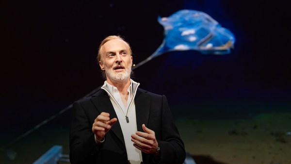
But all of these are mostly invisible to us. The challenge in studying those ocean variables at scale is one of energy, the energy that it takes to deploy sensors into the deep ocean. And of course, many solutions have been tried -- from wave-actuated devices to surface drifters to sun-powered electrical drives -- each with their own compromises. Our team breakthrough came from an unlikely source -- the pursuit of the world speed record in a wind-powered land yacht. It took 10 years of research and development to come up with a novel wing concept that only uses three watts of power to control and yet can propel a vehicle all around the globe with seemingly unlimited autonomy. By adapting this wing concept into a marine vehicle, we had the genesis of an ocean drone.
하지만 이 모든 것들이 우리 눈에는 보이지 않습니다. 해양에서 발생하는 변수들을 연구하는 것의 어려움 중 하나는 에너지의 문제입니다. 각종 센서를 심해에 설치하는 일에 소모되는 에너지를 말합니다. 이를 해결하기 위한 많은 시도가 있었습니다. 파도로 작동하는 기구나 바다 위에 떠다니는 기구에서 태양열로 움직이는 기구에 이르기까지의 수많은 시도에서 각각의 단점이 발견되었습니다. 저희 팀의 돌파구는 전혀 예상치 못했던 곳에서 나왔습니다. 풍력기반 육상 요트의 최고 속력 세계기록을 갱신하기 위한 노력이었죠. 조종하는데 3와트만을 사용하지만 무한한 자율성으로 전 세계를 나아갈 수 있는 새로운 날개를 고안해내기 위한 연구와 개발에 10년이라는 시간이 걸렸습니다. 이러한 날개 개념을 해양 차량에 접목함으로써, 저희는 해양 드론을 탄생시켰습니다.
Now, these are larger than they appear. They are about 15 feet high, 23 feet long, seven feet deep. Think of them as surface satellites. They're laden with an array of science-grade sensors that measure all key variables, both oceanographic and atmospheric, and a live satellite link transmits this high-resolution data back to shore in real time. Our team has been hard at work over the past few years, conducting missions in some of the toughest ocean conditions on the planet, from the Arctic to the tropical Pacific. We have sailed all the way to the polar ice shelf. We have sailed into Atlantic hurricanes. We have rounded Cape Horn, and we have slalomed between the oil rigs of the Gulf of Mexico. This is one tough robot.
해양 드론은 보이는 것보다 훨씬 큽니다. 높이는 15피트, 길이는 23피트 그리고 깊이는 7피트 정도 됩니다. 해양 드론을 표면 위성이라고 생각해보세요. 드론들은 해양 및 대기의 모든 주요 변수를 측정하는 일련의 과학 등급 센서들로 채워져 있고, 실시간 위성 링크는 고해상도 데이터를 실시간으로 다시 해안으로 전송합니다. 저희 팀은 지난 몇 년 간 지구상 가장 힘든 해양 환경인 북극에서 열대 태평양까지 임무를 수행하면서 열심히 일해왔습니다. 저희는 북극 빙상까지 항해했습니다. 대서양 허리케인으로 항해하기도 했고요. 케이프 혼도 돌았습니다. 그리고 멕시코만의 석유 굴착 장치 사이에서 회전 활강하기도 했습니다 아주 튼튼한 로봇이죠.
Let me share with you recent work that we did around the Pribilof Islands. This is a small group of islands deep in the cold Bering Sea between the US and Russia. Now, the Bering Sea is the home of the walleye pollock, which is a whitefish you might not recognize, but you might likely have tasted if you enjoy fish sticks or surimi. Yes, surimi looks like crabmeat, but it's actually pollock. And the pollock fishery is the largest fishery in the nation, both in terms of value and volume -- about 3.1 billion pounds of fish caught every year.
저희가 프리빌로프 제도 주변에서 했던 최근의 일을 여러분께 말씀드리겠습니다. 프리빌로프 제도는 미국과 러시아 사이에 있는 추운 베링 해 속 깊숙이 위치한 섬들입니다. 현재, 베링 해는 명태의 본고장이기도 합니다. 이는 여러분이 모를 수도 있는 화이트 피시의 일종이지만, 피시 스틱이나 연육을 즐겨 드신다면 맛보셨을 겁니다. 맞습니다, 연육은 게살처럼 보이지만 사실은 명태죠. 명태어장은 가치와 양 두 가지 면에서 미국에서 가장 큰 어장이기도 합니다. 매년 약 92억 파운드 정도의 물고기가 잡힙니다.
So over the past few years, a fleet of ocean drones has been hard at work in the Bering Sea with the goal to help assess the size of the pollock fish stock. This helps improve the quota system that's used to manage the fishery and help prevent a collapse of the fish stock and protects this fragile ecosystem. Now, the drones survey the fishing ground using acoustics, i.e., a sonar. This sends a sound wave downwards, and then the reflection, the echo from the sound wave from the seabed or schools of fish, gives us an idea of what's happening below the surface. Our ocean drones are actually pretty good at this repetitive task, so they have been gridding the Bering Sea day in, day out.
지난 몇 년에 걸쳐, 해양 드론들은 명태 어획량을 가늠할 수 있도록 베링 해에서 열심히 일해왔습니다. 이 일은 어장을 관리하는데 사용되는 할당제도를 발전시키며, 어류 자원이 무너지는 것을 예방하고, 손상되기 쉬운 생태계를 보호합니다. 해양 드론은 음향, 즉 수중 음파 탐지기로 어장을 측량합니다. 드론은 음파를 아래쪽으로 전송합니다. 이후, 해저 또는 고기 떼가 만들어내는 울림의 반사가 수면 아래에서 무슨 일이 일어나고 있는지 알려줍니다. 사실 해양 드론은 이 반복적인 작업에 아주 능숙합니다. 그래서 그들은 온종일 베링 해를 탐색하고 있습니다.
Now, the Pribilof Islands are also the home of a large colony of fur seals. In the 1950s, there were about two million individuals in that colony. Sadly, these days, the population has rapidly declined. There's less than 50 percent of that number left, and the population continues to fall rapidly. So to understand why, our science partner at the National Marine Mammal Laboratory has fitted a GPS tag on some of the mother seals, glued to their furs. And this tag measures location and depth and also has a really cool little camera that's triggered by sudden acceleration. Here is a movie taken by an artistically inclined seal, giving us unprecedented insight into an underwater hunt deep in the Arctic, and the shot of this pollock prey just seconds before it gets devoured.
프리빌로프 제도는 물개 군단의 본거지이기도 하죠. 1950년대에, 그곳엔 약 2백만 마리의 물개들이 살았습니다. 안타깝게도, 요즘은 개체 수가 급속도로 감소하고 있죠. 원래의 50% 미만 정도가 남았고, 개체 수는 계속해서 급격히 줄어들고 있습니다. 그 이유를 알기 위해, 저희의 과학 협력 단체인 국립 해양포유류 연구실은 몇몇 엄마 물개의 털에 GPS 태그를 부착하였습니다. 이 태그는 위치와 깊이를 측정하였고 갑작스러운 가속에 반응하는 아주 훌륭한 소형 카메라가 달려있습니다. 이것은 북극 깊숙한 곳에서 일어나는 수중사냥에 대한 새로운 시각을 보여주는 예술가적 성향의 물개가 찍은 영상입니다. 그리고 이 사진은 명태 사냥감이 먹히기 몇 초 전에 찍힌 것입니다.
Now, doing work in the Arctic is very tough, even for a robot. They had to survive a snowstorm in August and interferences from bystanders -- that little spotted seal enjoying a ride.
로봇이라도 북극해에서 일하는 것은 몹시 어렵습니다. 로봇들은 8월의 눈보라를 견뎌야 했고, 구경꾼의 간섭도 받아야 했습니다. 이 어린 점박이 물범 말이죠.
(Laughter)
(웃음)
Now, the seal tags have recorded over 200,000 dives over the season, and upon a closer look, we get to see the individual seal tracks and the repetitive dives. We are on our way to decode what is really happening over that foraging ground, and it's quite beautiful. Once you superimpose the acoustic data collected by the drones, a picture starts to emerge. As the seals leave the islands and swim from left to right, they are observed to dive at a relatively shallow depth of about 20 meters, which the drone identifies is populated by small young pollock with low calorific content. The seals then swim much greater distance and start to dive deeper to a place where the drone identifies larger, more adult pollock, which are more nutritious as fish. Unfortunately, the calories expended by the mother seals to swim this extra distance don't leave them with enough energy to lactate their pups back on the island, leading to the population decline. Further, the drones identify that the water temperature around the island has significantly warmed. It might be one of the driving forces that's pushing the pollock north, and to spread in search of colder regions. So the data analysis is ongoing, but already we can see that some of the pieces of the puzzle from the fur seal mystery are coming into focus.
물개 태그는 계절을 넘어 20만 번의 잠수를 기록했고, 가까이 들여다보면, 우리는 물개 각각의 발자취와 반복적인 잠수를 볼 수 있습니다. 저희는 저 채집지에서 정말로 어떤 일이 일어나고 있는지를 해독하는 과정에 있습니다. 참 아름답죠. 드론들이 수집한 음향 데이터를 겹치게 되면 그림이 나타나기 시작합니다. 물개들이 그 섬을 떠나며 좌우로 수영하면, 그들이 약 20m의 비교적 얕은 수심에서 다이빙하는 것이 관찰됩니다. 저열량 성분을 가진 작고 어린 명태가 거주한다는 것이 드론으로 밝혀진 곳이기도 하죠. 그러고 나면 물개들은 훨씬 먼 거리를 수영하고, 더 깊은 곳으로 다이빙합니다. 더 영양가 있는 크고, 좀 더 자란 명태가 있는 곳으로 말입니다. 안타깝게도, 엄마 물개는 적정 거리를 수영하기 위해 에너지를 많이 써버리기 때문에 다시 섬으로 돌아가 새끼들에게 젖을 줄 체력을 잃곤 합니다. 이러한 점이 개체 감소로 이어지죠. 게다가 섬 주위의 수온이 상당히 따뜻해졌다는 것을 드론으로 확인할 수 있었습니다. 이러한 점이 명태가 북쪽으로 이동하고 더 차가운 곳으로 퍼지는 주된 이유 중 한 가지일지도 모릅니다. 데이터 분석은 계속 진행 중이지만, 우리는 이미 물개에 대한 수수께끼 퍼즐 중 일부는 풀리고 있다는 사실을 알 수 있습니다.
But if you look back at the big picture, we are mammals, too. And actually, the oceans provide up to 20 kilos of fish per human per year. As we deplete our fish stocks, what can we humans learn from the fur seal story? And beyond fish, the oceans affect all of us daily as they drive global weather systems, which affect things like global agricultural output or can lead to devastating destruction of lives and property through hurricanes, extreme heat and floods. Our oceans are pretty much unexplored and undersampled, and today, we still know more about other planets than our own.
하지만 여러분이 큰 그림을 본다면 우리도 역시 포유동물입니다. 사실, 바다는 매년 1인당 20kg의 물고기를 제공합니다. 수산 자원이 점점 고갈되고 있는 가운데, 이 물개 이야기를 통해 우리는 무엇을 배울 수 있을까요? 물고기를 넘어서, 바다는 우리 모두에게 매일 영향을 미칩니다. 전 세계의 기상 시스템으로써 전 세계의 농업 생산에 영향을 주거나 허리케인이나 극심한 더위와 홍수로 우리 생명과 자산에 치명적인 영향을 끼칠 수도 있습니다. 바다는 아직 탐험 되지 않거나 알 수 없는 부분이 많습니다. 그리고 오늘날 우리는 여전히 지구보다 다른 행성에 대해 더 많이 알죠.
But if you divide this vast ocean in six-by-six-degree squares, each about 400 miles long, you'd get about 1,000 such squares. So little by little, working with our partners, we are deploying one ocean drone in each of those boxes, the hope being that achieving planetary coverage will give us better insights into those planetary systems that affect humanity.
하지만 여러분이 이 광활한 바다를 각각 약 400마일 길이의 6x6도 정사각형으로 나누면, 약 1,000개의 정사각형을 얻을 수 있을 겁니다. 저희는 조금씩 조금씩 파트너들와 함께 일하며, 저희는 저기 보이는 네모 마다 해양드론을 배치하고 있습니다. 드론을 전세계에 배치한다면 인류에게 영향을 미치는 행성계에 대해 이해하는 것을 도울 것이라는 희망을 품고 있습니다.
We have been using robots to study distant worlds in our solar system for a while now. Now it is time to quantify our own planet, because we cannot fix what we cannot measure, and we cannot prepare for what we don't know.
우리는 현재 태양계 안의 먼 세상을 연구하기 위해 로봇을 사용하고 있었습니다. 이제 우리는 우리의 지구를 정량화 해야 할 때입니다. 우리는 측정할 수 없는 것을 고칠 수 없고, 우리가 모르는 것에 대비할 수 없기 때문입니다.
Thank you.
감사합니다.
(Applause)
(박수)