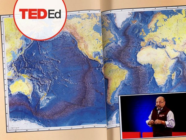
We know more about other planets than our own, and today, I want to show you a new type of robot designed to help us better understand our own planet. It belongs to a category known in the oceanographic community as an unmanned surface vehicle, or USV. And it uses no fuel. Instead, it relies on wind power for propulsion. And yet, it can sail around the globe for months at a time. So I want to share with you why we built it, and what it means for you.
Conosciamo gli altri pianeti meglio del nostro, e oggi vi mostrerò un nuovo tipo di robot ideato per aiutarci a comprendere meglio il nostro pianeta. Fa parte di una categoria nota nella comunità oceanografica come veicolo di superficie senza pilota, o USV. E non ha bisogno di carburante. Al suo posto, si affida all'energia eolica per la propulsione. Eppure, può navigare intorno al mondo per mesi e mesi. Dunque vorrei condividere con voi perché l'abbiamo costruito e cosa significa per voi.
A few years ago, I was on a sailboat making its way across the Pacific, from San Francisco to Hawaii. I had just spent the past 10 years working nonstop, developing video games for hundreds of millions of users, and I wanted to take a step back and look at the big picture and get some much-needed thinking time. I was the navigator on board, and one evening, after a long session analyzing weather data and plotting our course, I came up on deck and saw this beautiful sunset. And a thought occurred to me: How much do we really know about our oceans? The Pacific was stretching all around me as far as the eye could see, and the waves were rocking our boat forcefully, a sort of constant reminder of its untold power. How much do we really know about our oceans? I decided to find out.
Qualche anno fa, stavo attraversando il Pacifico su una barca a vela, da San Francisco alle Hawaii. Avevo passato gli ultimi 10 anni lavorando senza sosta, sviluppando videogiochi per centinaia di milioni di utenti e volevo fare un passo indietro per guardare il quadro generale e prendermi del necessario tempo per pensare. Ero il navigatore a bordo e una sera, dopo un'intensa seduta a studiare le condizioni meteorologiche e a tracciare la nostra rotta, sono salito sul ponte e ho visto questo bellissimo tramonto. Mi sfiorò un pensiero: Quanto conosciamo davvero dei nostri oceani? Il Pacifico si estendeva intorno a me a perdita d'occhio, le onde scuotevano la nostra barca energicamente, come promemoria della loro forza incalcolabile. Quanto conosciamo davvero dei nostri oceani? Ho deciso di scoprirlo.
What I quickly learned is that we don't know very much. The first reason is just how vast oceans are, covering 70 percent of the planet, and yet we know they drive complex planetary systems like global weather, which affect all of us on a daily basis, sometimes dramatically. And yet, those activities are mostly invisible to us.
Ho subito capito che in realtà non li conosciamo molto. Per prima cosa perché sono particolarmente estesi, e ricoprono il 70% del pianeta, però sappiamo che influenzano sistemi planetari complessi come le condizioni meteorologiche globali, che si ripercuotono su di noi ogni giorno, a volte con risvolti drammatici. Eppure quelle attività ci sono invisibili.
Ocean data is scarce by any standard. Back on land, I had grown used to accessing lots of sensors -- billions of them, actually. But at sea, in situ data is scarce and expensive. Why? Because it relies on a small number of ships and buoys. How small a number was actually a great surprise. Our National Oceanic and Atmospheric Administration, better known as NOAA, only has 16 ships, and there are less than 200 buoys offshore globally. It is easy to understand why: the oceans are an unforgiving place, and to collect in situ data, you need a big ship, capable of carrying a vast amount of fuel and large crews, costing hundreds of millions of dollars each, or, big buoys tethered to the ocean floor with a four-mile-long cable and weighted down by a set of train wheels, which is both dangerous to deploy and expensive to maintain.
Le informazioni che abbiamo sugli oceani sono indiscutibilmente scarse. Sulla terra ferma ero abituato ad aver accesso a molti sensori; a miliardi, a dire il vero. Ma in mare, i dati in situ sono scarsi e costosi. Perché? Perché fanno affidamento su un numero esiguo di navi e boe. Il numero effettivo è stato davvero una sorpresa. L'Amministrazione Nazionale Oceanica e Atmosferica statunitense, meglio conosciuta come NOAA, ha soltanto 16 navi, e in tutto il mondo, le boe situate al largo sono meno di 200. È facile capire perché: gli oceani sono un luogo ostile e per raccogliere dati in situ, bisogna avere una nave grande, con un'ingente quantità di carburante e numerosi equipaggi, al prezzo di centinaia di milioni di dollari l'uno, oppure, boe legate sul fondo dell'oceano con cavi lunghi più di sei km ancorati da una serie di ruote ferroviarie, che sono pericolose da installare e costose da mantenere.
What about satellites, you might ask? Well, satellites are fantastic, and they have taught us so much about the big picture over the past few decades. However, the problem with satellites is they can only see through one micron of the surface of the ocean. They have relatively poor spatial and temporal resolution, and their signal needs to be corrected for cloud cover and land effects and other factors.
E i satelliti, vi chiederete? Beh, i satelliti sono fantastici, ci hanno aiutato tanto ad ottenere un quadro generale negli ultimi decenni. Tuttavia, il problema dei satelliti è che possono vedere solamente un micron della superficie oceanica. Hanno una risoluzione spaziale e temporale piuttosto scarsa, il loro segnale deve essere corretto per le nuvole, effetti terrestri e altri fattori.
So what is going on in the oceans? And what are we trying to measure? And how could a robot be of any use?
Quindi cosa succede negli oceani? Cosa stiamo cercando di misurare? E che utilità può avere un robot?
Let's zoom in on a small cube in the ocean. One of the key things we want to understand is the surface, because the surface, if you think about it, is the nexus of all air-sea interaction. It is the interface through which all energy and gases must flow. Our sun radiates energy, which is absorbed by oceans as heat and then partially released into the atmosphere. Gases in our atmosphere like CO2 get dissolved into our oceans. Actually, about 30 percent of all global CO2 gets absorbed. Plankton and microorganisms release oxygen into the atmosphere, so much so that every other breath you take comes from the ocean.
Allarghiamo l'immagine su un piccolo cubo nell'oceano. La superficie è una delle cose principali che vogliamo analizzare, perché, se ci pensate, la superficie è il nesso di tutta l'interazione tra cielo e mare. È l'interfaccia attraverso la quale tutta l'energia e i gas devono fluire. Il sole irradia energia, la quale viene assorbita dagli oceani sotto forma di calore e viene poi rilasciata parzialmente nell'atmosfera. I gas presenti nell'atmosfera come la CO2 vengono dissolti nei nostri oceani. In realtà, solo il 30% di tutta la CO2 viene assorbito. Il plankton e altri microrganismi rilasciano ossigeno nell'atmosfera, al punto tale che, su due respiri, uno viene dall'oceano.
Some of that heat generates evaporation, which creates clouds and then eventually leads to precipitation. And pressure gradients create surface wind, which moves the moisture through the atmosphere. Some of the heat radiates down into the deep ocean and gets stored in different layers, the ocean acting as some kind of planetary-scale boiler to store all that energy, which later might be released in short-term events like hurricanes or long-term phenomena like El Niño. These layers can get mixed up by vertical upwelling currents or horizontal currents, which are key in transporting heat from the tropics to the poles. And of course, there is marine life, occupying the largest ecosystem in volume on the planet, from microorganisms to fish to marine mammals, like seals, dolphins and whales.
Un po' di quel calore evapora, creando così le nuvole e alla fine porta alle precipitazioni. I gradienti di pressione creano il vento di superficie, che fa muovere l'umidità attraverso l'atmosfera. Una parte del calore si propaga nelle profondità dell'oceano dove viene depositato in diversi strati, l'oceano agisce come una sorta di caldaia su scala mondiale conservando tutta quella energia, che in seguito potrebbe essere rilasciata in eventi di breve durata come uragani o in fenomeni di lunga durata come El Niño. Questi strati possono essere mischiati da correnti verticali ascensionali o da correnti orizzontali, essenziali per trasportare il calore dai tropici ai poli. Poi, naturalmente, c'è la vita marina, che, in volume, occupa il più grande ecosistema sul pianeta, dai microrganismi ai pesci fino ai mammiferi marini, come le foche, i delfini e le balene.
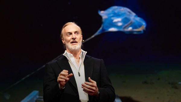
But all of these are mostly invisible to us. The challenge in studying those ocean variables at scale is one of energy, the energy that it takes to deploy sensors into the deep ocean. And of course, many solutions have been tried -- from wave-actuated devices to surface drifters to sun-powered electrical drives -- each with their own compromises. Our team breakthrough came from an unlikely source -- the pursuit of the world speed record in a wind-powered land yacht. It took 10 years of research and development to come up with a novel wing concept that only uses three watts of power to control and yet can propel a vehicle all around the globe with seemingly unlimited autonomy. By adapting this wing concept into a marine vehicle, we had the genesis of an ocean drone.
Ma la maggior parte di essi sono invisibili ai nostri occhi. La sfida di studiare le variabili oceaniche in scala è in termini di energia, l'energia di cui si ha bisogno per installare sensori in profondità. Ovviamente, abbiamo provato molte soluzioni; da dispositivi azionati dal moto ondoso ai drifter di superficie ad azionamenti elettrici fotovoltaici. Ognuno con i propri compromessi. La conquista del nostro team è arrivata in un modo improbabile; volevamo stabilire il record mondiale di velocità con un carro a vela. Ci sono voluti 10 anni di ricerca e sviluppo per concepire un nuovo concetto di ala che per controllarlo utilizza solamente tre watt ed è in grado di azionare un veicolo in ogni parte del mondo con un'autonomia apparentemente illimitata. Adattando questo concetto di ala a un veicolo nautico, è nata la genesi di un drone oceanico.
Now, these are larger than they appear. They are about 15 feet high, 23 feet long, seven feet deep. Think of them as surface satellites. They're laden with an array of science-grade sensors that measure all key variables, both oceanographic and atmospheric, and a live satellite link transmits this high-resolution data back to shore in real time. Our team has been hard at work over the past few years, conducting missions in some of the toughest ocean conditions on the planet, from the Arctic to the tropical Pacific. We have sailed all the way to the polar ice shelf. We have sailed into Atlantic hurricanes. We have rounded Cape Horn, and we have slalomed between the oil rigs of the Gulf of Mexico. This is one tough robot.
Tenete conto che sono più grandi di quello che appaiono. Misurano circa 4,5 metri in altezza, 7 in lunghezza e 1,5 in larghezza. Vedeteli come dei satelliti di superficie. Sono dotati di una serie di sensori calibrati scientificamente che misurano tutte le principali variabili, sia oceanografiche che atmosferiche, e i dati ad alta risoluzione vengono trasmessi a terra in tempo reale da un collegamento satellitare. Il nostro team è stato molto impegnato negli ultimi anni a condurre missioni nelle più rigide condizioni oceaiche sul pianeta, dall'Artico al tropicale Oceano Pacifico. Siamo arrivati fino alla calotta glaciale artica. Abbiamo navigato nel bel mezzo degli uragani atlantici. Abbiamo scovato Capo Horn e fatto lo slalom tra le piattaforme petrolifere nel Golfo del Messico. Questo robot è davvero resistente.
Let me share with you recent work that we did around the Pribilof Islands. This is a small group of islands deep in the cold Bering Sea between the US and Russia. Now, the Bering Sea is the home of the walleye pollock, which is a whitefish you might not recognize, but you might likely have tasted if you enjoy fish sticks or surimi. Yes, surimi looks like crabmeat, but it's actually pollock. And the pollock fishery is the largest fishery in the nation, both in terms of value and volume -- about 3.1 billion pounds of fish caught every year.
Vorrei condividere con voi il recente lavoro condotto nei pressi delle isole Pribilof. Si tratta di un piccolo gruppo di isole situate nel gelido mare di Bering tra Stati Uniti e Russia. Il mare di Bering ospita il merluzzo d'Alaska, un coregone che forse non riconoscerete, ma che avrete assaggiato se vi piacciono i bastoncini di pesce o i surimi. Sì, i surimi sembrano polpa di granchio, ma sono in realtà merluzzo. La pesca del merluzzo è la più grande industria ittica nella nazione, sia in termini di valore che di volume; il pesce pescato ogni anno raggiunge 1,4 milioni di tonnellate.
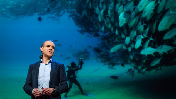
So over the past few years, a fleet of ocean drones has been hard at work in the Bering Sea with the goal to help assess the size of the pollock fish stock. This helps improve the quota system that's used to manage the fishery and help prevent a collapse of the fish stock and protects this fragile ecosystem. Now, the drones survey the fishing ground using acoustics, i.e., a sonar. This sends a sound wave downwards, and then the reflection, the echo from the sound wave from the seabed or schools of fish, gives us an idea of what's happening below the surface. Our ocean drones are actually pretty good at this repetitive task, so they have been gridding the Bering Sea day in, day out.
Così negli ultimi anni, una flotta di droni oceanici ha lavorato duramente nel mare di Bering per aiutare a valutare le dimensioni della popolazione di merluzzo. Questo aiuta a migliorare il regime di quote usato per gestire la pesca, a prevenire un crollo della popolazione ittica e a proteggere questo fragile ecosistema. I droni esaminano la zona di pesca attraverso proprietà acustiche, per esempio un sonar. Questo invia un'onda sonora verso il basso, e poi il riverbero, l'eco dall'onda sonora dal fondo marino o dal banco di pesci, ci dà un'idea della situazione al di sotto della superficie. I nostri droni oceanici sono molto bravi a compiere questo procedimento ripetitivo, così giorno dopo giorno stanno scandagliando il mare di Bering.
Now, the Pribilof Islands are also the home of a large colony of fur seals. In the 1950s, there were about two million individuals in that colony. Sadly, these days, the population has rapidly declined. There's less than 50 percent of that number left, and the population continues to fall rapidly. So to understand why, our science partner at the National Marine Mammal Laboratory has fitted a GPS tag on some of the mother seals, glued to their furs. And this tag measures location and depth and also has a really cool little camera that's triggered by sudden acceleration. Here is a movie taken by an artistically inclined seal, giving us unprecedented insight into an underwater hunt deep in the Arctic, and the shot of this pollock prey just seconds before it gets devoured.
Le isole Pribilof ospitano anche una numerosa colonia di otarie orsine. Negli anni '50, quella colonia contava circa due milioni di esemplari. Tristemente, negli ultimi tempi, la popolazione è rapidamente diminuita. Da allora gli esemplari si sono dimezzati, e la popolazione continua a calare velocemente. Per capire il motivo di tutto ciò, il nostro partner scientifico al National Marine Mammal Laboratory ha sistemato una targhetta GPS su alcune otarie madri, incollate alle loro pellicce. La targhetta misura la posizione e la profondità e inoltre ha una piccola telecamera che viene attivata da accelerazioni improvvise. Ecco un filmato girato da un'otaria con una vena artistica, che ci regala una prospettiva eccezionale di una caccia subacquea nelle profondità dell'Artico e un'istantanea del merluzzo, la preda, pochi secondi prima che venga divorato.
Now, doing work in the Arctic is very tough, even for a robot. They had to survive a snowstorm in August and interferences from bystanders -- that little spotted seal enjoying a ride.
Tuttavia, lavorare nell'Artico è molto duro, anche per un robot. Hanno dovuto sopravvivere a una tormenta in agosto e con interferenze da parte dei passanti; come quella piccola otaria che si sta godendo la corsa.
(Laughter)
(Risate)
Now, the seal tags have recorded over 200,000 dives over the season, and upon a closer look, we get to see the individual seal tracks and the repetitive dives. We are on our way to decode what is really happening over that foraging ground, and it's quite beautiful. Once you superimpose the acoustic data collected by the drones, a picture starts to emerge. As the seals leave the islands and swim from left to right, they are observed to dive at a relatively shallow depth of about 20 meters, which the drone identifies is populated by small young pollock with low calorific content. The seals then swim much greater distance and start to dive deeper to a place where the drone identifies larger, more adult pollock, which are more nutritious as fish. Unfortunately, the calories expended by the mother seals to swim this extra distance don't leave them with enough energy to lactate their pups back on the island, leading to the population decline. Further, the drones identify that the water temperature around the island has significantly warmed. It might be one of the driving forces that's pushing the pollock north, and to spread in search of colder regions. So the data analysis is ongoing, but already we can see that some of the pieces of the puzzle from the fur seal mystery are coming into focus.
Nel corso della stagione, i GPS hanno registrato oltre 200.000 immersioni e con un'analisi più approfondita, possiamo vedere la rotta di ogni otaria e le immersioni ripetute. Stiamo sulla strada per scoprire cosa sta realmente accadendo in quella zona di foraggiamento ed è davvero stupendo. Una volta sovrapposti i dati acustici raccolti dai droni, si comincia ad avere un quadro. Quando le otarie lasciano le isole, nuotando da sinistra a destra, si immergono a una profondità di circa 20 metri, che il drone identifica essere popolata da piccoli merluzzi giovani a basso contenuto calorico. Poi coprono distanze molto più ampie e si immergono più in profondità in una zona dove il drone identifica merluzzi più grossi e più adulti, che sono più nutrienti. Purtroppo, le calorie bruciate dalle otarie madri che nuotano in questa ulteriore distanza non lasciano loro abbastanza energie per allattare i loro piccoli sull'isola, portando così al calo della popolazione. Inoltre, i droni hanno registrato un aumento della temperatura dell'acqua intorno all'isola. Potrebbe essere uno dei fattori che spingono i merluzzi verso nord, in cerca di regioni più fredde. L'analisi dei dati è ancora in corso, ma possiamo già notare che alcuni pezzi del puzzle del mistero delle otarie orsine si stanno congiungendo.
But if you look back at the big picture, we are mammals, too. And actually, the oceans provide up to 20 kilos of fish per human per year. As we deplete our fish stocks, what can we humans learn from the fur seal story? And beyond fish, the oceans affect all of us daily as they drive global weather systems, which affect things like global agricultural output or can lead to devastating destruction of lives and property through hurricanes, extreme heat and floods. Our oceans are pretty much unexplored and undersampled, and today, we still know more about other planets than our own.
Ma tornando indietro al quadro generale, anche noi siamo mammiferi. Gli oceani forniscono fino a 20 kg di pesce per persona all'anno. Mentre esauriamo le scorte di pesce, cosa possiamo imparare dalla storia delle otarie orsine? E a parte questo, gli oceani interessano tutti noi da vicino dato che condizionano i sistemi meteorologici, che influenzano la produzione agricola mondiale o possono portare alla distruzione di vite e di beni materiali attraverso uragani, siccità e inondazioni estreme. C'è ancora molto da esplorare e da studiare nei nostri oceani, e oggigiorno conosciamo gli altri pianeti meglio del nostro.
But if you divide this vast ocean in six-by-six-degree squares, each about 400 miles long, you'd get about 1,000 such squares. So little by little, working with our partners, we are deploying one ocean drone in each of those boxes, the hope being that achieving planetary coverage will give us better insights into those planetary systems that affect humanity.
Ma se dividessimo il vasto oceano in quadrati di 6x6 gradi, ognuno di circa 600 km di lunghezza, ne otterremmo circa 1.000. Così, poco alla volta, lavorando con i nostri partner, stiamo installando un drone oceanico in ognuna di quelle caselle, con la speranza che, raggiungendo una copertura globale, potremo avere una conoscenza maggiore di quei sistemi planetari che influiscono sull'umanità.
We have been using robots to study distant worlds in our solar system for a while now. Now it is time to quantify our own planet, because we cannot fix what we cannot measure, and we cannot prepare for what we don't know.
Usiamo robot per studiare mondi lontani nel nostro sistema solare già da qualche tempo. È ora di quantificare il nostro pianeta, perché non possiamo sistemare ciò che non possiamo misurare e non possiamo prepararci per ciò che non conosciamo.
Thank you.
Grazie.
(Applause)
(Applausi)