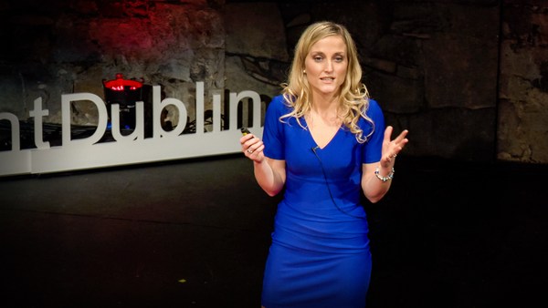
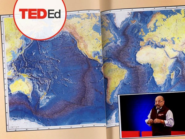
We know more about other planets than our own, and today, I want to show you a new type of robot designed to help us better understand our own planet. It belongs to a category known in the oceanographic community as an unmanned surface vehicle, or USV. And it uses no fuel. Instead, it relies on wind power for propulsion. And yet, it can sail around the globe for months at a time. So I want to share with you why we built it, and what it means for you.
ما از سیارات دیگر بیشتر از سیاره خودمان میدانیم، و امروز میخواهم نوع جدیدی از روبات را به شما نشان دهم که برای کمک به شناخت بهتر سیاره خودمان طراحی شده است. به دستهای تعلق دارد که در محافل اقیانوسشناسی بعنوان وسیله سطحی بدون سرنشین یا USV شناخته میشود. و هیچ سوختی مصرف نمیکند. در عوض، از نیروی باد برای حرکت استفاده میکند. با این وجود میتواند در هر بار ماهها در سرتاسر جهان دریانوردی کند. خب میخواهم بگویم چرا این وسیله را ساختهایم، و این برای شما چه اهمیتی دارد.
A few years ago, I was on a sailboat making its way across the Pacific, from San Francisco to Hawaii. I had just spent the past 10 years working nonstop, developing video games for hundreds of millions of users, and I wanted to take a step back and look at the big picture and get some much-needed thinking time. I was the navigator on board, and one evening, after a long session analyzing weather data and plotting our course, I came up on deck and saw this beautiful sunset. And a thought occurred to me: How much do we really know about our oceans? The Pacific was stretching all around me as far as the eye could see, and the waves were rocking our boat forcefully, a sort of constant reminder of its untold power. How much do we really know about our oceans? I decided to find out.
چند سال قبل، من سوار بر یک قایق بادبانی در اقیانوس آرام مسیر سانفرانسیسکو تا هاوایی را طی میکردم. تا قبل از آن بدون توقف ۱۰ سال در حوزه توسعه بازیهای ویدیویی برای صدها میلیون مشتری کار کرده بودم، و میخواستم یک قدم به عقب برگردم و به تصویر بزرگ نگاه کنم و به زمانی برای تفکر ضروریتر نیاز داشتم. من در قایق، مسیریاب بودم، و یک بعد از ظهر پس از مدت زیادی تحلیل دادههای آب و هوایی و ترسیم مسیرمان، به عرشه آمدم و این غروب زیبا را دیدم. و فکری به ذهنم رسید: ما واقعاً چقدر در مورد اقیانوسها میدانیم؟ دور تا دور من تا جایی که چشم کار میکرد همهاش اقیانوس آرام بود، و امواج داشتند قایق ما را به شدت تکان میدادند، که یادآور قدرت ناگفته آن است. ما واقعاً چقدر در مورد اقیانوسها میدانیم؟ تصمیم گرفتم که قضیه را دریابم.
What I quickly learned is that we don't know very much. The first reason is just how vast oceans are, covering 70 percent of the planet, and yet we know they drive complex planetary systems like global weather, which affect all of us on a daily basis, sometimes dramatically. And yet, those activities are mostly invisible to us.
چیزی که سریع فهمیدم این بود که ما چیز زیادی نمیدانیم. دلیل اول اینکه اقیانوسها اینقدر وسیع هستند، که ۷۰ درصد سطح سیاره را پوشاندهاند، و میدانیم که سیستمهای پیچیده سیارهای را بوجود میآورند مثل آب و هوای جهانی، که روزانه بر همه ما اثر میگذارد، گاهی تأثیرهای بسیار شدید. و همچنان بیشتر این فعالیتها از دیدهها نهان است.
Ocean data is scarce by any standard. Back on land, I had grown used to accessing lots of sensors -- billions of them, actually. But at sea, in situ data is scarce and expensive. Why? Because it relies on a small number of ships and buoys. How small a number was actually a great surprise. Our National Oceanic and Atmospheric Administration, better known as NOAA, only has 16 ships, and there are less than 200 buoys offshore globally. It is easy to understand why: the oceans are an unforgiving place, and to collect in situ data, you need a big ship, capable of carrying a vast amount of fuel and large crews, costing hundreds of millions of dollars each, or, big buoys tethered to the ocean floor with a four-mile-long cable and weighted down by a set of train wheels, which is both dangerous to deploy and expensive to maintain.
با هر معیاری که بسنجیم اطلاعات اقیانوسها کم هستند. برگردیم به خشکی، من با تعداد زیادی حسگر کار کردهام -- در واقع میلیاردها حسگر. اما در مورد دریا، اطلاعات کمیاب است و گرانقیمت. چرا؟ چون تمام اطلاعات حاصل تعداد کمی از کشتیها و شناورهاست. تعداد اینقدر کم است که موجب تعجب میشود. سازمان ملی اقیانوس و جو، یا بهتر بگویم NOAA، فقط ۱۶ کشتی دارد، و در جهان کمتر از ۲۰۰ بویه تحقیقاتی وجود دارد. فهم علت این موضوع آسان است: اقیانوسها مکانی بیرحم هستند، و برای جمعآوری اطلاعات نیازمند یک کشتی بزرگ هستید، که بتواند میزان زیادی سوخت و تعداد زیادی خدمه با خود حمل کند، که هر کشتی صدها میلیون دلار هزینه دارد، یا بویههای بزرگی که به کف اقیانوس با کابلهای چهار مایلی مهار شدهاند و با دستهای از چرخهای قطار لنگر شدهاند، که هم ارسال آن خطرناک است و هم نگهداری آن گران تمام میشود.
What about satellites, you might ask? Well, satellites are fantastic, and they have taught us so much about the big picture over the past few decades. However, the problem with satellites is they can only see through one micron of the surface of the ocean. They have relatively poor spatial and temporal resolution, and their signal needs to be corrected for cloud cover and land effects and other factors.
ممکن است بپرسید اما ماهوارهها چه؟ خب، ماهوارهها خارقالعاده هستند، و چیزهای زیادی در مورد جهان در چند دهه اخیر به ما آموختهاند. به هر حال، مشکل ماهوارهها این است که میتوانند فقط یک میکرون از سطح اقیانوس را ببینند. ماهوارهها رزولوشن مکانی و زمانی پایینی دارند، و سیگنالها نیاز است که به خاطر پوششهای ابر، عوارض زمین و دیگر عوامل تصحیح شوند.
So what is going on in the oceans? And what are we trying to measure? And how could a robot be of any use?
خب در اقیانوسها چه میگذرد؟ و سعی داریم چه چیزی را اندازه بگیریم؟ و یک ربات چه کاربردی میتواند داشته باشد؟
Let's zoom in on a small cube in the ocean. One of the key things we want to understand is the surface, because the surface, if you think about it, is the nexus of all air-sea interaction. It is the interface through which all energy and gases must flow. Our sun radiates energy, which is absorbed by oceans as heat and then partially released into the atmosphere. Gases in our atmosphere like CO2 get dissolved into our oceans. Actually, about 30 percent of all global CO2 gets absorbed. Plankton and microorganisms release oxygen into the atmosphere, so much so that every other breath you take comes from the ocean.
بگذارید روی یک مکعب کوچک در اقیانوس زوم کنیم. یکی از چیزهایی که میخواهیم بدانیم سطح است، چون سطح را اگر در موردش فکر کنید، ارتباطی است بین برهمکنشهای هوا-دریا. محلی است که از طریق آن تمام انرژی و گازها میبایست جریان یابند. خورشید انرژی ساطع میکند، که به شکل گرما توسط اقیانوسها جذب میشود و این گرما سپس به درون جو آزاد میشود. گازهای جو مثل دیاکسیدکربن در اقیانوسها حل میشوند. در واقع، حدود ۳۰ درصد تمام دیاکسیدکربن جهان جذب میشود. پلانکتونها و میکروارگانیسمها اکسیژن را به درون جو آزاد میکنند، تقریباً نفسی که میگیریم یک در میان از اقیانوس میآید.
Some of that heat generates evaporation, which creates clouds and then eventually leads to precipitation. And pressure gradients create surface wind, which moves the moisture through the atmosphere. Some of the heat radiates down into the deep ocean and gets stored in different layers, the ocean acting as some kind of planetary-scale boiler to store all that energy, which later might be released in short-term events like hurricanes or long-term phenomena like El Niño. These layers can get mixed up by vertical upwelling currents or horizontal currents, which are key in transporting heat from the tropics to the poles. And of course, there is marine life, occupying the largest ecosystem in volume on the planet, from microorganisms to fish to marine mammals, like seals, dolphins and whales.
بخشی از آن گرما صرف تبخیر میشود که موجب تشکیل ابرها میشود و سپس در نهایت به بارندگی منجر میشود. و گرادیانهای فشار بادهای سطحی را بوجود میآورد، که رطوبت را به درون جو میبرد. بخشی از گرما به اعماق اقیانوس ساطع میشود و در لایههای مختلف ذخیره میشود، اقیانوس دارد همانند یک بویلر در مقیاس سیاره عمل میکند تا تمام انرژی را ذخیره کند، که بعدها ممکن است به شکل حوادث کوتاه مدتی مثل طوفان و گرداب یا پدیده بلندمدتی مثل النینو آزاد شود. این لایهها میتوانند با جریانهای بالارونده عمودی یا جریانهای افقی ترکیب شده و عاملی باشند برای انتقال گرما از استوا به قطبها. و البته، حیات دریایی را فراموش نکنیم که بزرگترین اکوسیستم روی زمین است، از میکروارگانیسمها تا ماهیها و پستانداران دریایی، مانند فکها، دلفینها و والها.
But all of these are mostly invisible to us. The challenge in studying those ocean variables at scale is one of energy, the energy that it takes to deploy sensors into the deep ocean. And of course, many solutions have been tried -- from wave-actuated devices to surface drifters to sun-powered electrical drives -- each with their own compromises. Our team breakthrough came from an unlikely source -- the pursuit of the world speed record in a wind-powered land yacht. It took 10 years of research and development to come up with a novel wing concept that only uses three watts of power to control and yet can propel a vehicle all around the globe with seemingly unlimited autonomy. By adapting this wing concept into a marine vehicle, we had the genesis of an ocean drone.
اما همه اینها اغلب از دید ما پنهان هستند. چالش مطالعه این متغیرهای بزرگ اقیانوسی از جنس انرژی است، انرژی لازم برای ارسال سنسورها به اعماق اقیانوس. و البته راهحلهای زیادی آزمایش شدهاند -- از دستگاههای عملکننده توسط امواج تا شناورهای سطحی تا تجهیزات الکتریکی خورشیدی -- هر یک با مزایای مختص خودش. دستاورد تیم ما از یک منبع غیرمحتمل آمده است -- دست یافتن به سرعت رکورد جهانی با یک قایق بادبانی. در نتیجه ده سال تحقیق و توسعه به یک شکل جدید از بال دست یافتیم که برای کنترل فقط به سه وات برق نیاز دارد ولی میتواند یک وسیله نقلیه را در سرتاسر جهان و با سطح نامحدود اتوماسیون حرکت دهد. با افزودن این بال به یک وسیله نقلیه دریایی، پیدایش قایقهای بدون سرنشین اقیانوسی را اعلام کردیم.
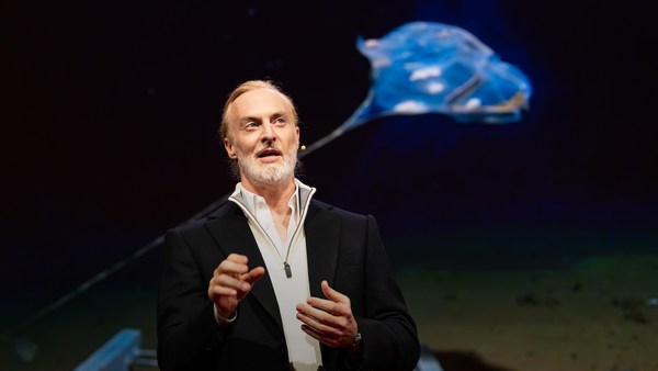
Now, these are larger than they appear. They are about 15 feet high, 23 feet long, seven feet deep. Think of them as surface satellites. They're laden with an array of science-grade sensors that measure all key variables, both oceanographic and atmospheric, and a live satellite link transmits this high-resolution data back to shore in real time. Our team has been hard at work over the past few years, conducting missions in some of the toughest ocean conditions on the planet, from the Arctic to the tropical Pacific. We have sailed all the way to the polar ice shelf. We have sailed into Atlantic hurricanes. We have rounded Cape Horn, and we have slalomed between the oil rigs of the Gulf of Mexico. This is one tough robot.
اینها از چیزی که به نظر میرسد بزرگتر هستند. اینها دارای ۴/۵ متر ارتفاع، ۷ متر طول و ۲/۱ متر عمق هستند. فکر کنید چیزی شبیه ماهواره دریایی. اینها با دستهای از سنسورهای علمی تجهیز شدهاند که تمام متغیرهای کلیدی را اندازه میگیرند، هم اقیانوسشناسی و هم هواشناسی، و یک لینک مستقیم ماهوارهای این اطلاعات دقیق را به صورت لحظهای مخابره میکند. تیم ما چند سال اخیر به شدت کار کرده است، تا مأموریتی را در سختترین شرایط اقیانوسی روی کره زمین، از قطب تا نواحی استوایی اقیانوس آرام انجام دهد. ما تمام مسیر را تا یخچالهای قطبی دریانوردی کردهایم. به درون طوفانهای اقیانوس اطلس رفتهایم. کیپ هورن (جنوب شیلی) را دور زدهایم، از لابهلای سکوهای نفتی خلیج مکزیک عبور کردهایم. رباتی قدرتمند است.
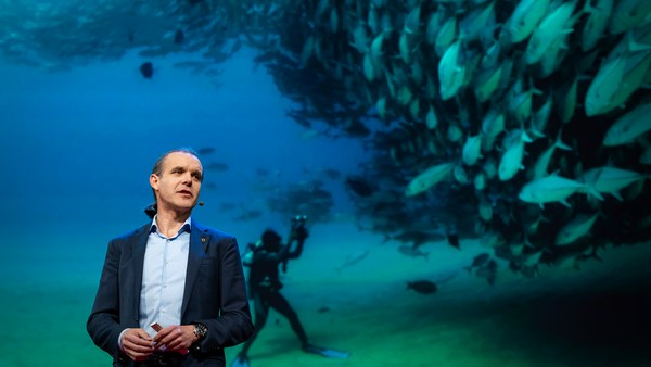
Let me share with you recent work that we did around the Pribilof Islands. This is a small group of islands deep in the cold Bering Sea between the US and Russia. Now, the Bering Sea is the home of the walleye pollock, which is a whitefish you might not recognize, but you might likely have tasted if you enjoy fish sticks or surimi. Yes, surimi looks like crabmeat, but it's actually pollock. And the pollock fishery is the largest fishery in the nation, both in terms of value and volume -- about 3.1 billion pounds of fish caught every year.
بگذارید بخشی از کارهای اخیر را در اطراف جزایر پریبیلف عرض کنم. گروهی از جزایر کوچک در دریای سرد برینگ بین آمریکا و روسیه. اکنون دریای برینگ منزلگاه والی پولاک است، که نوعی ماهی سفید است که ممکن است نشناسید، ولی اگر علاقمند سوریمی یا فیش استیک هستید احتمالاً مزه کردهاید. بله سوریمی شبیه گوشت خرچنگ است ولی در واقع پولاک است. و صید پولاک بزرگترین صیادی کشور هم از لحاظ ارزش و هم از لحاظ حجم است-- حدود ۱/۴ میلیارد کیلوگرم از این ماهی سالانه صید میشود.
So over the past few years, a fleet of ocean drones has been hard at work in the Bering Sea with the goal to help assess the size of the pollock fish stock. This helps improve the quota system that's used to manage the fishery and help prevent a collapse of the fish stock and protects this fragile ecosystem. Now, the drones survey the fishing ground using acoustics, i.e., a sonar. This sends a sound wave downwards, and then the reflection, the echo from the sound wave from the seabed or schools of fish, gives us an idea of what's happening below the surface. Our ocean drones are actually pretty good at this repetitive task, so they have been gridding the Bering Sea day in, day out.
بنابراین چند سال اخیر ناوگانی از قایقهای بدون سرنشین کار سختی را در دریای برینگ داشتهاند به هدف اینکه میزان ذخیره منابع ماهی پولاک را برآورد کنند. این برآورد به نظام سهمیهبندی برای مدیریت ذخایر شیلاتی کمک میکند، از نابودی ذخایر شیلاتی جلوگیری میکند و این اکوسیستم شکننده را حفظ میکند. اکنون، قایقهای بدون سرنشین بستر ماهیگیری را با امواج صوتی یا همان سونار بررسی میکنند. امواج صوتی را به سمت پایین میفرستد، و بازتاب امواج صوتی از بستر دریا یا گروه ماهیها اطلاعاتی از اتفاقاتی که زیر سطح دریا رخ میدهد را به ما میدهد. این قایقهای بدون سرنشین اقیانوسی در کارهای تکرارشدنی خیلی خوب هستند، بنابراین دارند دریای برینگ را روز به روز شبکهبندی میکنند.
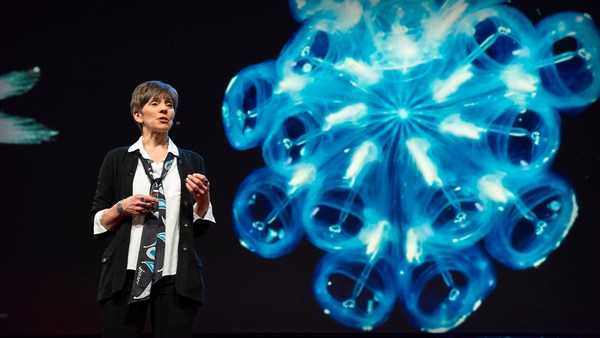
Now, the Pribilof Islands are also the home of a large colony of fur seals. In the 1950s, there were about two million individuals in that colony. Sadly, these days, the population has rapidly declined. There's less than 50 percent of that number left, and the population continues to fall rapidly. So to understand why, our science partner at the National Marine Mammal Laboratory has fitted a GPS tag on some of the mother seals, glued to their furs. And this tag measures location and depth and also has a really cool little camera that's triggered by sudden acceleration. Here is a movie taken by an artistically inclined seal, giving us unprecedented insight into an underwater hunt deep in the Arctic, and the shot of this pollock prey just seconds before it gets devoured.
اکنون، جزایر پریبیلف منزلگاه گروه بزرگی از فکهای خزدار هم هستند. در دهه ۱۹۵۰ حدود دو میلیون از این حیوان وجود داشت. متأسفانه این روزها تعداد آنها به شدت کاهش یافته است. کمتر از ۵۰ درصد آن تعداد باقی ماندهاند، و کاهش جمعیت همچنان به شدت ادامه دارد. برای اینکه علت را دریابیم، همکار دانشمندمان در آزمایشگاه ملی پستانداران دریایی یک برچسب جیپیاس را به تعدادی از فکهای مادر و به خز آنها چسبانده است. و این برچسب موقعیت و عمق را اندازه میگیرد و دارای یک دوربین کوچک است که با تکانههای ناگهانی فعال میشود. این فیلمی است که توسط یک فک در زیر آب تهیه شده است، و نگاهی بیسابقه به شکار زیر آب را به ما عرضه میکند در اعماق قطب شمال، و گرفتن این طعمه پولاک درست ثانیههایی قبل از خورده شدن.
Now, doing work in the Arctic is very tough, even for a robot. They had to survive a snowstorm in August and interferences from bystanders -- that little spotted seal enjoying a ride.
کار کردن در قطب شمال بسیار سخت است حتی برای یک ربات آنها باید در کولاک آگوست دوام بیاورند و مداخله تماشاگرنماها -- این فک خالدار که دارد از سواری لذت میبرد.
(Laughter)
(خنده)
Now, the seal tags have recorded over 200,000 dives over the season, and upon a closer look, we get to see the individual seal tracks and the repetitive dives. We are on our way to decode what is really happening over that foraging ground, and it's quite beautiful. Once you superimpose the acoustic data collected by the drones, a picture starts to emerge. As the seals leave the islands and swim from left to right, they are observed to dive at a relatively shallow depth of about 20 meters, which the drone identifies is populated by small young pollock with low calorific content. The seals then swim much greater distance and start to dive deeper to a place where the drone identifies larger, more adult pollock, which are more nutritious as fish. Unfortunately, the calories expended by the mother seals to swim this extra distance don't leave them with enough energy to lactate their pups back on the island, leading to the population decline. Further, the drones identify that the water temperature around the island has significantly warmed. It might be one of the driving forces that's pushing the pollock north, and to spread in search of colder regions. So the data analysis is ongoing, but already we can see that some of the pieces of the puzzle from the fur seal mystery are coming into focus.
اکنون، برچسب فکها بیش از دویستهزار شیرجه زیرآبی را در طول فصل ثبت کردهاند، و با یک نگاه دقیقتر، ما توانستهایم مسیر هر فک و شیرجههای تکراری را ببینیم. در مسیری برای رمزگشایی اتفاقات در حال وقوع در این محیط غذایی فکها قرار داریم، و این واقعاً زیباست. وقتی با اطلاعات بازتاب امواج صوتی حاصل از قایق بدون سرنشین مواجه میشوید، کمکم تصویری حاصل میشود. فکها جزایر را ترک میکنند و از چپ به راست شنا میکنند، مشاهده میشود که فکها در اعماق نسبتاً کم حدود ۲۰ متر شیرجه میروند، اعماقی که قایق بدون سرنشین محلی از تجمع پولاکهای جوان و با کالری کم تشخیص داده است. سپس فکها فواصل بسیار بیشتری را شنا میکنند و عمیقتر شیرجه میروند به محلی که قایق بدون سرنشین تجمع بزرگتر از پولاکهای بالغتر را تشخیص داده که به عنوان ماهی مغذیتر هستند. متأسفانه کالریها توسط فکهای مادر برای شنای مسافتهای اضافه مصرف میشود و هنگام بازگشت انرژی کافی برای شیر دادن به تولهها باقی نمیماند، که به کاهش جمعیت منجر میشود. بعلاوه قایقها تشخیص دادهاند که دمای آب اطراف جزایر به شدت گرم شده است. این شاید یکی از علتهای مهاجرت پولاکها به سمت شمال باشد، و به دنبال مناطق سردتری باشند. خب تحلیل دادهها ادامه دارد، اما پیشاپیش میتوانیم برخی از قطعات پازل راز فکهای خزدار را ببینیم و بر آن تمرکز کنیم.
But if you look back at the big picture, we are mammals, too. And actually, the oceans provide up to 20 kilos of fish per human per year. As we deplete our fish stocks, what can we humans learn from the fur seal story? And beyond fish, the oceans affect all of us daily as they drive global weather systems, which affect things like global agricultural output or can lead to devastating destruction of lives and property through hurricanes, extreme heat and floods. Our oceans are pretty much unexplored and undersampled, and today, we still know more about other planets than our own.
اما اگر وسیعتر بنگریم، ما هم پستاندار هستیم. و در واقع اقیانوسها سالانه بیش از ۲۰ کیلو ماهی به ازای هر نفر فراهم میکنند. اگر منابع ماهی خود را تمام کنیم از داستان فک خزدار چه میتوانیم بیاموزیم؟ فارغ از بحث ماهی، اقیانوسها هر روز بر ما اثر میگذارند زیرا سیستم آب و هوای جهانی را به وجود میآورند، که روی چیزهایی مثل تولید جهانی کشاورزی اثر میگذارد یا میتواند از طریق طوفانها، گرمای شدید و سیلها به ویرانی نفوس و املاک منجر شود. اقیانوسها به شدت ناشناخته و بررسی نشده هستند، و امروز ما در مورد سیارات دیگر بیش از سیاره خودمان میدانیم.
But if you divide this vast ocean in six-by-six-degree squares, each about 400 miles long, you'd get about 1,000 such squares. So little by little, working with our partners, we are deploying one ocean drone in each of those boxes, the hope being that achieving planetary coverage will give us better insights into those planetary systems that affect humanity.
اما اگر شما این اقیانوس وسیع را به مربعهای درجه شش در شش تقسیم کنید، هر ضلع مربع حدود ۶۴۴ کیلومتر باشد، هزار تا از این مربعها خواهید داشت. و قدم به قدم با همکارانمان کار کنیم، ما داریم در هر یک از این مربعها یک قایق بدون سرنشین میفرستیم، به امید اینکه کل سیاره را پوشش دهیم که به ما دید بهتری از دیگر سیستمهای سیارهای خواهد داد که بر انسانیت ما اثر میگذارد.
We have been using robots to study distant worlds in our solar system for a while now. Now it is time to quantify our own planet, because we cannot fix what we cannot measure, and we cannot prepare for what we don't know.
ما از رباتها برای مطالعه جهانهای دور در منظومه شمسی مدتی است که استفاده میکنیم. الان وقت آن رسیده که سیاره خودمان را کمیتسنجی کنیم، چون نمیتوانیم چیزی را که نمیتوان اندازه گرفت، تعمیر کنیم، و نمیتوانیم برای چیزی که نمیدانیم آماده شویم.
Thank you.
متشکرم.
(Applause)
(تشویق)