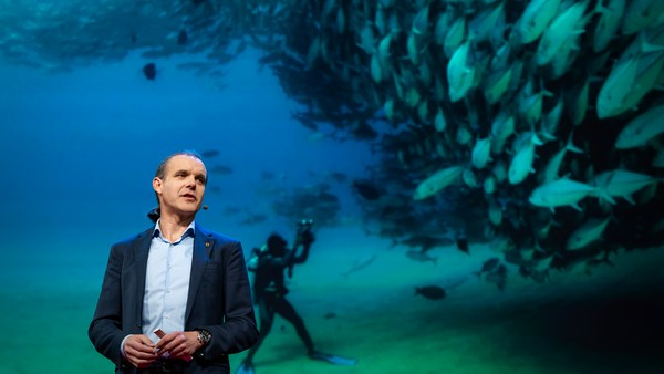
We know more about other planets than our own, and today, I want to show you a new type of robot designed to help us better understand our own planet. It belongs to a category known in the oceanographic community as an unmanned surface vehicle, or USV. And it uses no fuel. Instead, it relies on wind power for propulsion. And yet, it can sail around the globe for months at a time. So I want to share with you why we built it, and what it means for you.
Sabemos más sobre otros planetas que sobre el nuestro, y hoy quiero enseñarles un nuevo tipo de robot diseñado para ayudarnos a entender mejor nuestro planeta. Pertenece a una categoría conocida en la comunidad oceanográfica como vehículo de superficie no tripulado, o VSNT. Y no utiliza combustible. Su método de propulsión se basa en la energía eólica. Y aun así puede navegar por el mundo durante meses. Quiero compartir con Uds. la razón por la que lo construimos, y lo que esto significa para Uds.
A few years ago, I was on a sailboat making its way across the Pacific, from San Francisco to Hawaii. I had just spent the past 10 years working nonstop, developing video games for hundreds of millions of users, and I wanted to take a step back and look at the big picture and get some much-needed thinking time. I was the navigator on board, and one evening, after a long session analyzing weather data and plotting our course, I came up on deck and saw this beautiful sunset. And a thought occurred to me: How much do we really know about our oceans? The Pacific was stretching all around me as far as the eye could see, and the waves were rocking our boat forcefully, a sort of constant reminder of its untold power. How much do we really know about our oceans? I decided to find out.
Hace un par de años, atravesaba el Pacífico en un velero, desde San Francisco a Hawái. Había pasado los 10 años previos trabajando sin parar, desarrollando videojuegos para cientos de millones de usuarios, y quería dar un paso atrás, observar el panorama general y obtener algo del tan necesario tiempo para pensar. Yo era el capitán a bordo y, una tarde, tras una larga sesión analizando datos meteorológicos y planeando nuestro rumbo, subí a la cubierta y vi este atardecer precioso. Y pensé: ¿Cuánto sabemos realmente de nuestros océanos? El Pacífico se extendía a mi alrededor hasta donde llegaba mi vista, y las olas movían nuestro barco con fuerza, como un recordatorio constante de su poder silencioso. ¿Cuánto sabemos realmente de nuestros océanos? Decidí averiguarlo.
What I quickly learned is that we don't know very much. The first reason is just how vast oceans are, covering 70 percent of the planet, and yet we know they drive complex planetary systems like global weather, which affect all of us on a daily basis, sometimes dramatically. And yet, those activities are mostly invisible to us.
Lo que aprendí rápidamente es que no sabemos mucho. La primera razón es que los océanos son muy amplios, cubren el 70 % del planeta. Aun así, sabemos que influyen en los complejos sistemas planetarios, como el clima mundial que nos afecta a todos diariamente, a veces de forma dramática. Y aun así esas actividades nos son mayormente invisibles.
Ocean data is scarce by any standard. Back on land, I had grown used to accessing lots of sensors -- billions of them, actually. But at sea, in situ data is scarce and expensive. Why? Because it relies on a small number of ships and buoys. How small a number was actually a great surprise. Our National Oceanic and Atmospheric Administration, better known as NOAA, only has 16 ships, and there are less than 200 buoys offshore globally. It is easy to understand why: the oceans are an unforgiving place, and to collect in situ data, you need a big ship, capable of carrying a vast amount of fuel and large crews, costing hundreds of millions of dollars each, or, big buoys tethered to the ocean floor with a four-mile-long cable and weighted down by a set of train wheels, which is both dangerous to deploy and expensive to maintain.
Los datos oceánicos son escasos desde cualquier punto de vista. En tierra, me había acostumbrado a tener acceso a muchos sensores, miles de millones, de hecho. Pero en el mar, los datos in situ son escasos y caros. ¿Por qué? Porque dependen de unos pocos barcos y boyas. Fue una gran sorpresa qué fueran tan pocos. Nuestra Administración Nacional Oceánica y Atmosférica, más conocida como NOAA, solo tiene 16 barcos y hay menos de 200 boyas en el agua a nivel global. Es fácil entender por qué: los océanos son implacables y para recoger datos in situ se necesita un barco grande capaz de llevar una gran cantidad de combustible y grandes tripulaciones. Cada uno cuesta millones de dólares. O grandes boyas amarradas al suelo oceánico con un cable de 6 km de largo y sujetadas abajo por un grupo de ruedas de trenes, de peligrosa instalación y caro mantenimiento.
What about satellites, you might ask? Well, satellites are fantastic, and they have taught us so much about the big picture over the past few decades. However, the problem with satellites is they can only see through one micron of the surface of the ocean. They have relatively poor spatial and temporal resolution, and their signal needs to be corrected for cloud cover and land effects and other factors.
Podrían preguntar: ¿Qué hay de los satélites? Bueno, los satélites son fantásticos y nos han enseñado muchísimo sobre el panorama general durante las últimas décadas. Sin embargo, el problema con los satélites es que solo ven una micra de la superficie del océano. Tienen una resolución espacial y temporal relativamente pobre y hay que corregir su señal a causa de las nubes, los efectos terrestres y otros factores.
So what is going on in the oceans? And what are we trying to measure? And how could a robot be of any use?
Pues bien, ¿qué está pasando en los océanos? ¿Qué intentamos medir? ¿Y cómo podría ayudar un robot?
Let's zoom in on a small cube in the ocean. One of the key things we want to understand is the surface, because the surface, if you think about it, is the nexus of all air-sea interaction. It is the interface through which all energy and gases must flow. Our sun radiates energy, which is absorbed by oceans as heat and then partially released into the atmosphere. Gases in our atmosphere like CO2 get dissolved into our oceans. Actually, about 30 percent of all global CO2 gets absorbed. Plankton and microorganisms release oxygen into the atmosphere, so much so that every other breath you take comes from the ocean.
Hagamos zoom en un pequeño cubo en el océano. Uno de los elementos claves que queremos entender es la superficie porque, si lo piensan, la superficie es el nexo de toda interacción aire-mar. Es la interfaz por la que deben pasar toda la energía y los gases. Nuestro Sol irradia energía que es absorbida por los océanos como calor y luego parcialmente expulsada a la atmósfera. Los gases en nuestra atmósfera, como el CO2, se disuelven en los océanos. En efecto, se absorbe alrededor del 30 % del CO2 global. El plancton y los microorganismos liberan tanto oxígeno a la atmósfera, que una de cada dos de nuestras respiraciones proviene del océano.
Some of that heat generates evaporation, which creates clouds and then eventually leads to precipitation. And pressure gradients create surface wind, which moves the moisture through the atmosphere. Some of the heat radiates down into the deep ocean and gets stored in different layers, the ocean acting as some kind of planetary-scale boiler to store all that energy, which later might be released in short-term events like hurricanes or long-term phenomena like El Niño. These layers can get mixed up by vertical upwelling currents or horizontal currents, which are key in transporting heat from the tropics to the poles. And of course, there is marine life, occupying the largest ecosystem in volume on the planet, from microorganisms to fish to marine mammals, like seals, dolphins and whales.
Parte de ese calor genera evaporación, que a su vez crea nubes y finalmente produce precipitaciones. Las variaciones de presión crean viento superficial que mueve la humedad por la atmósfera. Parte de ese calor se irradia hasta la profundidad del océano, se almacena en distintas capas y el océano actúa como una caldera a escala planetaria para almacenar toda esa energía, que más tarde se liberará en eventos de corto plazo como los huracanes o fenómenos más largos como 'El Niño'. Estas capas se pueden mezclar con corrientes verticales ascendentes o corrientes horizontales, que son esenciales para transportar el calor de los trópicos a los polos. Y por supuesto está la vida marina, que constituye el ecosistema más grande del planeta e incluye microorganismos, peces, mamíferos marinos como las focas, los delfines y las ballenas.
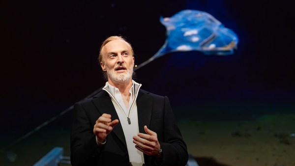
But all of these are mostly invisible to us. The challenge in studying those ocean variables at scale is one of energy, the energy that it takes to deploy sensors into the deep ocean. And of course, many solutions have been tried -- from wave-actuated devices to surface drifters to sun-powered electrical drives -- each with their own compromises. Our team breakthrough came from an unlikely source -- the pursuit of the world speed record in a wind-powered land yacht. It took 10 years of research and development to come up with a novel wing concept that only uses three watts of power to control and yet can propel a vehicle all around the globe with seemingly unlimited autonomy. By adapting this wing concept into a marine vehicle, we had the genesis of an ocean drone.
Pero todo esto nos es mayormente invisible. El reto de estudiar las variables oceánicas a escala tiene que ver con la energía, la energía que demanda desplegar sensores en la profundidad oceánica. Por supuesto se han ideado muchas soluciones, desde aparatos impulsados por las olas hasta derivadores y artefactos a energía solar; cada uno de los cuales tiene sus limitaciones. El gran avance de nuestro equipo llegó a través de una fuente insospechada: la búsqueda del récord mundial de velocidad con un yate de energía eólica. Llevó 10 años de investigación y desarrollo inventar un nuevo tipo de vela que solo necesita tres vatios de energía para funcionar, y aun así puede propulsar un vehículo alrededor de la Tierra con una autonomía aparentemente ilimitada. Al adaptar este concepto de las velas a un vehículo marino, dimos origen al dron oceánico.
Now, these are larger than they appear. They are about 15 feet high, 23 feet long, seven feet deep. Think of them as surface satellites. They're laden with an array of science-grade sensors that measure all key variables, both oceanographic and atmospheric, and a live satellite link transmits this high-resolution data back to shore in real time. Our team has been hard at work over the past few years, conducting missions in some of the toughest ocean conditions on the planet, from the Arctic to the tropical Pacific. We have sailed all the way to the polar ice shelf. We have sailed into Atlantic hurricanes. We have rounded Cape Horn, and we have slalomed between the oil rigs of the Gulf of Mexico. This is one tough robot.
Son más grandes de lo que parecen. Tienen unos 4 metros de alto, 7 de largo y 2 de profundidad. Son como satélites de superficie. Están cargados con un conjunto de sensores de graduación científica que miden todas las variables clave, tanto oceanográficas como atmosféricas; y con un enlace satelital que transmite en vivo los datos en alta resolución a la orilla y en tiempo real. Nuestro equipo ha trabajado mucho en los últimos años, realizando misiones en algunas de las condiciones oceánicas más duras del planeta, desde el Ártico hasta el Pacífico tropical. Hemos navegado hasta los casquetes polares. Hemos navegado en medio de huracanes en el Atlántico. Hemos bordeado el Cabo de Hornos y hemos hecho slalom entre las plataformas petrolíferas del Golfo de México. Este robot es resistente.
Let me share with you recent work that we did around the Pribilof Islands. This is a small group of islands deep in the cold Bering Sea between the US and Russia. Now, the Bering Sea is the home of the walleye pollock, which is a whitefish you might not recognize, but you might likely have tasted if you enjoy fish sticks or surimi. Yes, surimi looks like crabmeat, but it's actually pollock. And the pollock fishery is the largest fishery in the nation, both in terms of value and volume -- about 3.1 billion pounds of fish caught every year.
Déjenme enseñarles nuestro trabajo más reciente alrededor de las islas Pribilof. Se trata de un pequeño grupo de islas en lo profundo del frío mar de Bering, entre EE. UU. y Rusia. El mar de Bering es el hogar del abadejo de Alaska, un pez blanco que puede que no reconozcan, pero que hayan probado si les gustan los palitos de pescado o el surimi. Sí, el surimi parece cangrejo, pero en realidad es abadejo. Y la pesquería de abadejo es la más grande de la nación, tanto en valor como en volumen, con alrededor de 1 400 millones de kg de pescado cada año.
So over the past few years, a fleet of ocean drones has been hard at work in the Bering Sea with the goal to help assess the size of the pollock fish stock. This helps improve the quota system that's used to manage the fishery and help prevent a collapse of the fish stock and protects this fragile ecosystem. Now, the drones survey the fishing ground using acoustics, i.e., a sonar. This sends a sound wave downwards, and then the reflection, the echo from the sound wave from the seabed or schools of fish, gives us an idea of what's happening below the surface. Our ocean drones are actually pretty good at this repetitive task, so they have been gridding the Bering Sea day in, day out.
Durante los últimos años, una flota de drones oceánicos ha estado trabajando arduamente en el mar de Bering con el objetivo de ayudar a evaluar el tamaño de los cardúmenes de abadejos. Esto ayuda a mejorar el sistema de cuotas que se usa para gestionar la pesca, ayudar a prevenir el colapso de los suministros y protege el frágil ecosistema. Los drones analizan la zona de pesca usando la acústica, es decir, un sonar. Esto envía una onda sonora hacia abajo y luego la reverberación, el eco de la onda sonora en el fondo del mar o en los cardúmenes, nos da una idea de lo que sucede bajo la superficie. Nuestros drones oceánicos son bastante buenos en esta tarea repetitiva, así que han estado mapeando el mar de Bering todos los días.
Now, the Pribilof Islands are also the home of a large colony of fur seals. In the 1950s, there were about two million individuals in that colony. Sadly, these days, the population has rapidly declined. There's less than 50 percent of that number left, and the population continues to fall rapidly. So to understand why, our science partner at the National Marine Mammal Laboratory has fitted a GPS tag on some of the mother seals, glued to their furs. And this tag measures location and depth and also has a really cool little camera that's triggered by sudden acceleration. Here is a movie taken by an artistically inclined seal, giving us unprecedented insight into an underwater hunt deep in the Arctic, and the shot of this pollock prey just seconds before it gets devoured.
Las islas Pribilof también albergan una gran colonia de lobos marinos. En los 50, había unos dos millones de especímenes en esa colonia. Lamentablemente, hoy en día la población ha disminuido drásticamente. Quedan menos del 50 % y la población continúa disminuyendo a gran velocidad. Para entender por qué, nuestro colega científico del Laboratorio Nacional de Mamíferos Marinos ha colocado un rastreador GPS a algunas de las lobas madres, pegado en su pelaje. Este rastreador registra la ubicación y la profundidad, y también tiene una cámara muy buena que se enciende con la aceleración repentina. Esto es una película de la cámara de una foca con tendencias artísticas que nos ha ofrecido una demostración sin precedentes de la caza subacuática en lo profundo del Ártico, y la fotografía de este abadejo unos segundos antes de ser devorado.
Now, doing work in the Arctic is very tough, even for a robot. They had to survive a snowstorm in August and interferences from bystanders -- that little spotted seal enjoying a ride.
Trabajar en el Ártico es muy duro, incluso para los robots. Sobrevivieron a una tormenta de nieve en agosto y a interferencias de transeúntes. Esa pequeña foca manchada estaba disfrutando el paseo.
(Laughter)
(Risas)
Now, the seal tags have recorded over 200,000 dives over the season, and upon a closer look, we get to see the individual seal tracks and the repetitive dives. We are on our way to decode what is really happening over that foraging ground, and it's quite beautiful. Once you superimpose the acoustic data collected by the drones, a picture starts to emerge. As the seals leave the islands and swim from left to right, they are observed to dive at a relatively shallow depth of about 20 meters, which the drone identifies is populated by small young pollock with low calorific content. The seals then swim much greater distance and start to dive deeper to a place where the drone identifies larger, more adult pollock, which are more nutritious as fish. Unfortunately, the calories expended by the mother seals to swim this extra distance don't leave them with enough energy to lactate their pups back on the island, leading to the population decline. Further, the drones identify that the water temperature around the island has significantly warmed. It might be one of the driving forces that's pushing the pollock north, and to spread in search of colder regions. So the data analysis is ongoing, but already we can see that some of the pieces of the puzzle from the fur seal mystery are coming into focus.
Los rastreadores de las focas han registrado unas 200 000 zambullidas en la temporada y, si miramos más de cerca, podemos ver los rastros individuales y las zambullidas repetitivas. Estamos intentando descifrar qué está pasando realmente en la búsqueda de alimento, y es muy hermoso. Una vez que se superponen los datos acústicos recogidos por los drones, empieza a aparecer una imagen. Cuando las focas se van de las islas y nadan de un lado a otro, se ha visto que bucean a una profundidad relativamente superficial, de unos 20 m, que, según registra el dron, está poblada por abadejos pequeños y jóvenes, con bajo contenido calórico. Luego las focas nadan mucho más lejos y bucean más hondo hasta un lugar donde el dron identifica abadejos más grandes y adultos, que están más nutritivos. Desgraciadamente, las calorías gastadas por las focas madre para nadar la distancia extra no les deja energía suficiente para amamantar a sus crías en la isla. En consecuencia, la población disminuye. Además, los drones han registrado que la temperatura del agua que rodea las islas ha aumentado significativamente. Quizás sea una de las principales causas que está llevando a los abadejos al norte y que hace que se dispersen en busca de regiones más frías. El análisis de los datos todavía está en curso, pero ya podemos ver que algunas de las piezas del rompecabezas del misterio de los lobos marinos están empezando a encajar.
But if you look back at the big picture, we are mammals, too. And actually, the oceans provide up to 20 kilos of fish per human per year. As we deplete our fish stocks, what can we humans learn from the fur seal story? And beyond fish, the oceans affect all of us daily as they drive global weather systems, which affect things like global agricultural output or can lead to devastating destruction of lives and property through hurricanes, extreme heat and floods. Our oceans are pretty much unexplored and undersampled, and today, we still know more about other planets than our own.
Pero si miran el panorama general, nosotros también somos mamíferos. Y, de hecho, los océanos nos brindan 20 kg de pescado por humano al año. Mientras agotamos los suministros de pescado, ¿qué podemos aprender de la historia de los lobos marinos? Y más allá de los peces, los océanos nos afectan a todos a diario pues influyen en los sistemas climáticos globales que afectan el producto de la agricultura mundial, o pueden ocasionar destrucciones devastadoras de vidas y de propiedades a través de huracanes, calor extremo e inundaciones. Casi no hemos explorado ni recogido muestras de nuestros océanos, y hoy en día seguimos sabiendo más sobre otros planetas que sobre el nuestro.
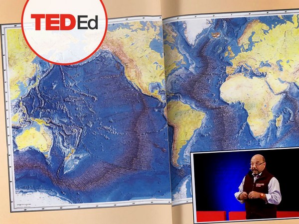
But if you divide this vast ocean in six-by-six-degree squares, each about 400 miles long, you'd get about 1,000 such squares. So little by little, working with our partners, we are deploying one ocean drone in each of those boxes, the hope being that achieving planetary coverage will give us better insights into those planetary systems that affect humanity.
Pero si dividen este amplio océano en cuadrados de seis por seis, cada uno de 600 km de largo, obtendrían unos 1000 cuadrados. Así que poco a poco, trabajando con nuestros compañeros, desplegaremos un dron oceánico en cada uno de esos cuadrados, con la esperanza de que, si cubrimos todo el planeta, tendremos una mejor visión de esos sistemas planetarios que afectan a la humanidad.
We have been using robots to study distant worlds in our solar system for a while now. Now it is time to quantify our own planet, because we cannot fix what we cannot measure, and we cannot prepare for what we don't know.
Hemos usado robots para estudiar mundos distantes en el sistema solar durante varios años ya. Ahora es el momento de cuantificar nuestro propio planeta, porque no podemos arreglar lo que no podemos medir y no podemos prepararnos para lo que no conocemos.
Thank you.
Gracias.
(Applause)
(Aplausos)