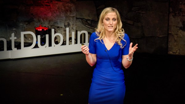
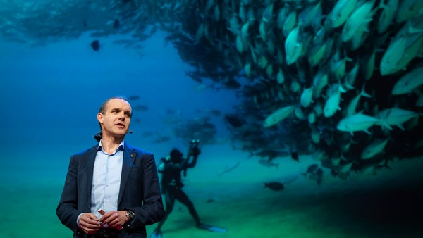
نحن نعرف عن الكواكب الأخرى أكثر ممّا نعرفه عن كوكبنا، واليوم أريد أن أعرض عليكم نوعًا جديدًا من الآليين والذي صممّ ليساعدنا على فهم كوكبنا بشكل أفضل. ينتمي هذا الآلي للفئة المعروفة في أوساط مجتمع علم المحيطات بمركبة سطح دون سائق. وهي لا تحتاج لأي وقود. بدلًا من ذلك، تعتمد على طاقة الرياح من أجل الدفع. ورغم ذلك يمكنها الإبحار حول العالم لعدة أشهر في المرة الواحدة. لذلك أود مشاركتكم أسباب بنائنا لها، وما تعنيه بالنسبة لكم.
We know more about other planets than our own, and today, I want to show you a new type of robot designed to help us better understand our own planet. It belongs to a category known in the oceanographic community as an unmanned surface vehicle, or USV. And it uses no fuel. Instead, it relies on wind power for propulsion. And yet, it can sail around the globe for months at a time. So I want to share with you why we built it, and what it means for you.
منذ بضع شهور خلت، كنت على متن قارب شراعي يشق طريقه عبر المحيط الهادئ، متجهًا من (سان فرانسيسكو) إلى (هاواي). كنت قد قضيت العشر سنوات الماضية أعمل بلا توقف، على تطوير ألعاب فيديو لأجل مئات الملايين من المستخدمين، وأردت أن أرجع خطوة للخلف وألقي نظرة على المشهد الكلي للحصول على حاجتي من الوقت للتفكير. كنت الملّاح على القارب، وذات مساء، وبعد جلسة طويلة من تحليل بيانات الطقس والتخطيط لمساراتنا، صعدت إلى السطح ورأيت مشهد الغروب الجميل هذا. فخطرت ببالي فكرة: إلى أيّ قدر نعرف حقًا عن محيطاتنا؟ كان المحيط الهادئ يمتدّ من حولي على بعد النظر، وكان القارب يهتزّ بعنف بفعل الموجات، كنوع من التذكير المستمرّ لطاقتها التي يعجز عنها الوصف. إلى أيّ قدر نعرف حقًا عن محيطاتنا؟ قررت أن أكتشف.
A few years ago, I was on a sailboat making its way across the Pacific, from San Francisco to Hawaii. I had just spent the past 10 years working nonstop, developing video games for hundreds of millions of users, and I wanted to take a step back and look at the big picture and get some much-needed thinking time. I was the navigator on board, and one evening, after a long session analyzing weather data and plotting our course, I came up on deck and saw this beautiful sunset. And a thought occurred to me: How much do we really know about our oceans? The Pacific was stretching all around me as far as the eye could see, and the waves were rocking our boat forcefully, a sort of constant reminder of its untold power. How much do we really know about our oceans? I decided to find out.
كان ما عرفته سريعًا هو أنّنا لا نعرف الكثير. والسبب الأول هو مدى اتّساع المحيطات، حيث تغطي 70 بالمائة من مساحة الكوكب، وحتى الآن نحن نعلم أن لهم تحكم في أنظمة الكوكب المعقدة كالطقس العالمي، والذي يؤثر علينا جميعًا بشكل يوميّ، وإلى حد كبير أحيانًا. وللآن، تعد تلك الأنشطة في الغالب غير مرئية بالنسبة لنا.
What I quickly learned is that we don't know very much. The first reason is just how vast oceans are, covering 70 percent of the planet, and yet we know they drive complex planetary systems like global weather, which affect all of us on a daily basis, sometimes dramatically. And yet, those activities are mostly invisible to us.
بيانات المحيطات تعتبر نادرة بكل المقاييس. عودةً للأرض، لقد اعتدت على الوصول إلى الكثير من أجهزة الاستشعار... المليارات منهم، حقيقةً. لكن في البحر، بيانات الموقع نادرة ومكلفة. لماذا؟ لاعتمادها على عدد قليل من السفن والعوامات. مدى ضآلة العدد كان في الواقع بمثابة صدمة كبيرة. إدارتنا الوطنية لدراسة المحيطات والغلاف الجوي، المعروفة باسم "NOAA"، لديها فقط 16 مركب، وأقل من 200 عوامة بحرية على الصعيد العالمي. إذًا من السهل فهم لماذا: فالمحيطات مكان لا يرحم، ولتجميع بيانات الموقع، تحتاج إلى سفينة كبيرة، قادرة على تخزين كمية هائلة من الوقود، وأعداد غفيرة من العاملين، مما يكلف مئات الملايين من الدولارات للسفينة الواحدة، أو عوامات كبيرة مربوطة إلى قاع المحيط بوصلات يصل طولها لستة كيلومترات. ومجموعة من عجلات قطار لإبقائها مثبتة في الأسفل، والذي من الخطر تطبيقه ومن المكلف الإبقاء عليه.
Ocean data is scarce by any standard. Back on land, I had grown used to accessing lots of sensors -- billions of them, actually. But at sea, in situ data is scarce and expensive. Why? Because it relies on a small number of ships and buoys. How small a number was actually a great surprise. Our National Oceanic and Atmospheric Administration, better known as NOAA, only has 16 ships, and there are less than 200 buoys offshore globally. It is easy to understand why: the oceans are an unforgiving place, and to collect in situ data, you need a big ship, capable of carrying a vast amount of fuel and large crews, costing hundreds of millions of dollars each, or, big buoys tethered to the ocean floor with a four-mile-long cable and weighted down by a set of train wheels, which is both dangerous to deploy and expensive to maintain.
ماذا عن الأقمار الصناعية، كما قد تتساءلون؟ حسنًا، إنها رائعة، وقد علمتنا الكثير عن المشهد الكلي على مر العقود القليلة المنصرمة. ومع ذلك، فمشكلة الأقمار الصناعية هي عجزها عن الرؤية من خلال سطح المحيط لأبعد من ميكرون واحد. نسبيًا إمكانياتها محدودة زمانيًا ومكانيًا، وشبكتها تحتاج للتعديل بما يتناسب مع الغطاء السحابي وتأثيرات اليابسة وعوامل أخرى.
What about satellites, you might ask? Well, satellites are fantastic, and they have taught us so much about the big picture over the past few decades. However, the problem with satellites is they can only see through one micron of the surface of the ocean. They have relatively poor spatial and temporal resolution, and their signal needs to be corrected for cloud cover and land effects and other factors.
إذًا، ما الذي يحدث في المحيطات؟ وما الذي نحاول قياسه؟ وبم سيفيد الآلي؟
So what is going on in the oceans? And what are we trying to measure? And how could a robot be of any use?
دعونا نقترب أكثر لنركز على مكعب بعينه في المحيط. أحد الأشياء الأساسية التي علينا فهمها هو السطح، لأنك إن تأملت السطح، ستجده همزة الوصل فيما يخص شتى التفاعلات بين البحر والجو. إنه الواجهة التي من خلالها يفترض للطاقة والغازات أن يتدفقوا. شمسنا تشع طاقة، والتي تمتصها المحيطات كحرارة ثم تطلق جزئيًا في الجو. الغازات الجوية كثاني أكسيد الكربون مثلًا، ذائبة في المحيطات. في الواقع، حوالي 30 بالمائة من ثاني أكسيد الكربون في العالم يتم امتصاصه. تطلق العوالق والكائنات المجهرية الأكسجين في الجو، لدرجة أن كل نفس آخر تأخذه يأتي من المحيط.
Let's zoom in on a small cube in the ocean. One of the key things we want to understand is the surface, because the surface, if you think about it, is the nexus of all air-sea interaction. It is the interface through which all energy and gases must flow. Our sun radiates energy, which is absorbed by oceans as heat and then partially released into the atmosphere. Gases in our atmosphere like CO2 get dissolved into our oceans. Actually, about 30 percent of all global CO2 gets absorbed. Plankton and microorganisms release oxygen into the atmosphere, so much so that every other breath you take comes from the ocean.
بعض هذه الحرارة تولد بخارًا، والذي بدوره يشكل غيومًا وأخيرًا يؤدي لهطول الأمطار. وتخلق التدرجات في الضغط رياحًا سطحية، والتي بدورها تثير الرطوبة في الجو. شيء من هذه الحرارة يتشعب نزولًا لأعماق المحيط ومن ثم تخزن في طبقات مختلفة، ويتفاعل المحيط بوصفه مرجل كوني لتخزين كل هذه الطاقة، حيث سيتم إطلاقها في أحداث قصيرة المدى كالأعاصير، أو طويلة المدى كظاهرة (إل نينيو). هذه الطبقات التي يمكن أن تختلط بواسطة التيارات العمودية أو الأفقية، والتي تمثّل الأساس في عملية نقل الحرارة من المناطق المدارية إلى القطبين. وبالطبع، توجد حياة بحرية، تحتل الجزء الأكبر من النظام البيئي على هذا الكوكب، من المجهريات وصولًا للأسماك، وحتى الثدييات البحرية، كالفقمات، والدلافين، وأسماك القرش.
Some of that heat generates evaporation, which creates clouds and then eventually leads to precipitation. And pressure gradients create surface wind, which moves the moisture through the atmosphere. Some of the heat radiates down into the deep ocean and gets stored in different layers, the ocean acting as some kind of planetary-scale boiler to store all that energy, which later might be released in short-term events like hurricanes or long-term phenomena like El Niño. These layers can get mixed up by vertical upwelling currents or horizontal currents, which are key in transporting heat from the tropics to the poles. And of course, there is marine life, occupying the largest ecosystem in volume on the planet, from microorganisms to fish to marine mammals, like seals, dolphins and whales.
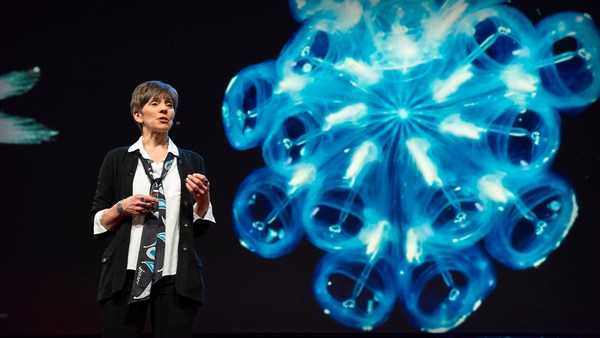
لكن كلّ هؤلاء لا يلاحَظون من قبَلنا. ويتمثل التحدي لدراسة متغيرات المحيط تلك على نطاق واسع في الطاقة، الطاقة التي تستغل لتوزيع المستشعرات خلال أعماق المحيط. وبالطبع، تم تجربة العديد من الحلول - من محركات حثّ الموجات إلى الأجهزة العائمة وحتى المحركات الكهربائية التي تعمل بالطاقة الشمسية - كل منهم كحل وسط كان لابد معه من تنازلات. تقدم فريقنا كان بفضل مصدر غير متوقع... السعي إلى تحقيق سرعة قياسية عالمية بواسطة سفينة شراعية تعمل بطاقة الرياح. تطلب 10 سنوات من البحث والتطوير من أجل ابتكار فكرة (نوفل وينج) والذي يستخدم 3 وات فقط من الطاقة للتحكم ومع ذلك يستطيع تحريك المركبة حول العالم بأسره باستقلالية لا حدود لها على ما يبدو. من خلال تكييف فكرة الجناح تلك مع المركبة البحرية، أنشأنا مركبة المحيط المسيرة.
But all of these are mostly invisible to us. The challenge in studying those ocean variables at scale is one of energy, the energy that it takes to deploy sensors into the deep ocean. And of course, many solutions have been tried -- from wave-actuated devices to surface drifters to sun-powered electrical drives -- each with their own compromises. Our team breakthrough came from an unlikely source -- the pursuit of the world speed record in a wind-powered land yacht. It took 10 years of research and development to come up with a novel wing concept that only uses three watts of power to control and yet can propel a vehicle all around the globe with seemingly unlimited autonomy. By adapting this wing concept into a marine vehicle, we had the genesis of an ocean drone.
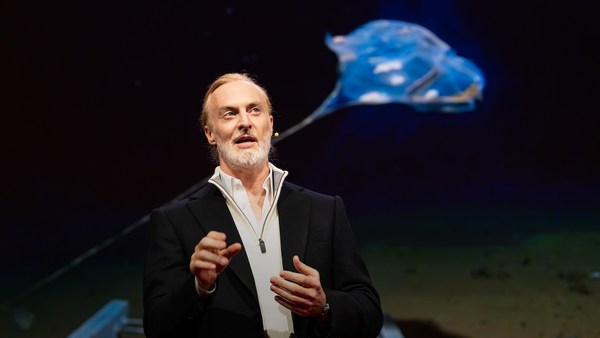
الآن، هي أكبر مما تبدو عليه. حيث يبلغ ارتفاعها حوالي 4,5 متر، وطول 7 متر، وبعمق 2 متر. فكروا فيهم كأقمار صناعية خاصة بالسطح. محمّلين بمجموعة من أجهزة الاستشعار العلمية التي تقيس شتّى المتغيرات الأساسية، الخاصة بكل من المحيط والجو، وتنقل وصلة الأقمار الصناعية المباشرة هذه البيانات عالية الدقة عودة للساحل إبانها. فريقنا كان قد عمل بجد في السنوات القليلة الماضية، يؤدي عددًا من المهام خلال بعض من أصعب ظروف المحيط على الكوكب، من القطب الشمالي وحتى المحيط الهادئ الاستوائي. لقد أبحرنا الطريق بأكمله إلى جرف الجليد القطبي. وأبحرنا عبر عواصف المحيط الأطلنطي. درنا حول (كايب هورن)، وعرجنا على منصات التنقيب عن النفط في خليج المكسيك. هذا الآلي شديد البأس.
Now, these are larger than they appear. They are about 15 feet high, 23 feet long, seven feet deep. Think of them as surface satellites. They're laden with an array of science-grade sensors that measure all key variables, both oceanographic and atmospheric, and a live satellite link transmits this high-resolution data back to shore in real time. Our team has been hard at work over the past few years, conducting missions in some of the toughest ocean conditions on the planet, from the Arctic to the tropical Pacific. We have sailed all the way to the polar ice shelf. We have sailed into Atlantic hurricanes. We have rounded Cape Horn, and we have slalomed between the oil rigs of the Gulf of Mexico. This is one tough robot.
دعوني أشارككم آخر إنجازاتنا حول جزر (بريبيلوف). وهي مجموعة من الجزر الصغيرة في الأعماق الباردة لبحر (بيرنغ) بين الولايات المتحدة وروسيا. الآن، بحر (بيرنغ) هو موطن أسماك البلوق، وهي سمكة بيضاء ربما لا تتعرفون عليها، لكنكم على الأرجح قد تذوقتموها إن كنتم تفضلون عصي الأسماك أو ال(سوريمي). نعم، تبدو ال(سوريمي) كلحم سلطعون، لكنها في الحقيقة بلوق. ومصائد البلوق من أكبر المصائد في البلاد، سواءً من حيث القيمة أو الحجم... حوالي 1,4 مليون طن من السمك يتم صيده سنويًا.
Let me share with you recent work that we did around the Pribilof Islands. This is a small group of islands deep in the cold Bering Sea between the US and Russia. Now, the Bering Sea is the home of the walleye pollock, which is a whitefish you might not recognize, but you might likely have tasted if you enjoy fish sticks or surimi. Yes, surimi looks like crabmeat, but it's actually pollock. And the pollock fishery is the largest fishery in the nation, both in terms of value and volume -- about 3.1 billion pounds of fish caught every year.
خلال السنوات القليلة الماضية، أسطول من المراكب المسيرة كان يعمل بجد في بحر (بيرنغ) في محاولة لتحديد مقدار المخزون السمكي من البلوق. مما يساعد في تحسين نظام الحصص المستخدم في إدارة المصائد، كما يساعد على منع تدهور المخزون السمكي وحماية هذا النظام البيئي الهش. الآن، تراقب تلك المراكب المسيرة مناطق الصيد باستخدام أنظمة صوتية، أي السونار. والتي ترسل موجة الصوت لأسفل، ومن ثمّ الانعكاس، أو صدى الموجة الصوتية من قاع البحر أو مزارع الأسماك، يعطينا فكرة عمّا يحدث أسفل السطح. مراكبنا المسيرة تلك جيدة بحق فيما يخص إنجاز تلك المهمة المتكررة، لذلك كانوا يبنون مصفوفة أرقام من البيانات الخاصة بذلك البحر يوميًا.
So over the past few years, a fleet of ocean drones has been hard at work in the Bering Sea with the goal to help assess the size of the pollock fish stock. This helps improve the quota system that's used to manage the fishery and help prevent a collapse of the fish stock and protects this fragile ecosystem. Now, the drones survey the fishing ground using acoustics, i.e., a sonar. This sends a sound wave downwards, and then the reflection, the echo from the sound wave from the seabed or schools of fish, gives us an idea of what's happening below the surface. Our ocean drones are actually pretty good at this repetitive task, so they have been gridding the Bering Sea day in, day out.
الآن، جزر (بريبيلوف) هي أيضًا موطن لمستعمرة ضخمة من الفقمات الفرائية. في خمسينيات القرن العشرين، كان هناك حوالي 2 مليون فقمة في تلك المستعمرة. حاليًا، للأسف، أخذ تعدادها في الانخفاض بشكل متسارع. تبقى الآن أقل من 50 بالمائة من هذا العدد، وما زال العدد آخذ في الانخفاض. وحتى نفهم السبب، قام شريكنا العلمي في المختبر الوطني للثدييات البحرية بتثبيت أجهزة تتبع على بعض الفقمات الأم، بلصقها على فرائهم. لتقوم بقياس الموقع والعمق، كذلك مرفق بها كاميرا صغيرة لطيفة تعمل عند حدوث تسارع مفاجئ. هنا مقطع صور بواسطة فقمة ذات ميول فنّية، يعطينا رؤية غير مسبوقة لمطاردة تحت الماء في أعماق القطب الشمالي، ولقطة لفريسة البلوق هذه قبل ثوان فحسب من التهامها.
Now, the Pribilof Islands are also the home of a large colony of fur seals. In the 1950s, there were about two million individuals in that colony. Sadly, these days, the population has rapidly declined. There's less than 50 percent of that number left, and the population continues to fall rapidly. So to understand why, our science partner at the National Marine Mammal Laboratory has fitted a GPS tag on some of the mother seals, glued to their furs. And this tag measures location and depth and also has a really cool little camera that's triggered by sudden acceleration. Here is a movie taken by an artistically inclined seal, giving us unprecedented insight into an underwater hunt deep in the Arctic, and the shot of this pollock prey just seconds before it gets devoured.
الآن، العمل في القطب الشمالي ليس بالشيء الهين، حتى بالنسبة لآلي. كان عليهم مقاومة عاصفة ثلجية في أغسطس فضلًا عن تدخلات المارّة... تلك الفقمة المراقبة تستمتع بالركوب.
Now, doing work in the Arctic is very tough, even for a robot. They had to survive a snowstorm in August and interferences from bystanders -- that little spotted seal enjoying a ride.
(ضحك)
(Laughter)
الآن، سجلت إشارات الفقمة أكثر من 200 ألف غطسة خلال الموسم، ومن خلال نظرة أقرب، تمكننا من مشاهدة المسارات الفردية للفقمات كما الغطسات المتكررة. نحن الآن في طريقنا لفك شفرة ما يحدث فعلًا على مساحات العلف تلك، وهي جميلة بحق. فبمجرد تثبيت البيانات الصوتية المجمعة بواسطة المراكب المسيرة، تشرع الصورة في الظهور. حينما تغادر الفقمات الجزر وتسبح من اليسار لليمين، لوحظ أنها تغوص في عمق ضحل نسبيًا يبلغ تقريبًا 20 مترًا، وهو كما حددته المراكب المسيرة، مأهول بأسماك البلوق الشابة الصغيرة التي تحوي سعرات حرارية منخفضة. ثم تعوم الفقمات لمسافة أبعد وتبدأ في الغوص عميقًا أكثر نحو مكان يظهر فيه للمراكب المسيرة أسماك بلوق أضخم وأكبر سنًا، والتي كأسماك، تعد مغذية أكثر. وللأسف، فإن السعرات الحرارية التي استهلكتها الفقمات الأم لقطع هذه المسافة الإضافية سباحةً لا تتركهم مع ما يكفي من الطاقة لإرضاع صغارهم إثر العودة للجزيرة، مما يؤدي لانخفاض التعداد السكّاني. علاوةً على ذلك، تحدد المراكب المسيرة أن درجة حرارة الماء حول الجزيرة قد ارتفعت بشكل ملحوظ. وقد يكون ذلك أحد القوى التي تدفع البلوق للاتجاه شمالًا، والانتشار بحثًا عن مناطق أكثر برودة. لذلك، تحليل البيانات جارٍ الآن، لكننا بالفعل نستطيع أن نرى أن بعضًا من أجزاء اللغز فيما يخص غموض فقمة الفرو سيزول شيئًا فشيئًا.
Now, the seal tags have recorded over 200,000 dives over the season, and upon a closer look, we get to see the individual seal tracks and the repetitive dives. We are on our way to decode what is really happening over that foraging ground, and it's quite beautiful. Once you superimpose the acoustic data collected by the drones, a picture starts to emerge. As the seals leave the islands and swim from left to right, they are observed to dive at a relatively shallow depth of about 20 meters, which the drone identifies is populated by small young pollock with low calorific content. The seals then swim much greater distance and start to dive deeper to a place where the drone identifies larger, more adult pollock, which are more nutritious as fish. Unfortunately, the calories expended by the mother seals to swim this extra distance don't leave them with enough energy to lactate their pups back on the island, leading to the population decline. Further, the drones identify that the water temperature around the island has significantly warmed. It might be one of the driving forces that's pushing the pollock north, and to spread in search of colder regions. So the data analysis is ongoing, but already we can see that some of the pieces of the puzzle from the fur seal mystery are coming into focus.
لكن إن نظرتم إلى الصورة الكبيرة، نحن أيضًا ضمن تصنيف الثدييات. وفي الواقع، توفر المحيطات ما يصل إلى 20 كيلو من الأسماك لكل إنسان سنويًا. وبينما نستنفد مخزوننا السمكي، ما الذي يمكننا تعلمه كبشر من قصة فقمة الفرو؟ وما وراء السمك، تؤثر المحيطات علينا بشكل يومي إذ أنها توجّه أنظمة الطقس العالمي، والذي يؤثّر بدوره على أمور كالإنتاج الزراعي كما يمكن أن يؤدي لتدمير الأرواح والممتلكات من خلال العواصف، والحرارة الشديدة، والفيضانات. محيطاتنا غير مستكشفة أو مستغلة إلى حد بعيد. واليوم، ما زلنا نعرف عن الكواكب الأخرى أكثر ممّا نعرف عن كوكبنا.
But if you look back at the big picture, we are mammals, too. And actually, the oceans provide up to 20 kilos of fish per human per year. As we deplete our fish stocks, what can we humans learn from the fur seal story? And beyond fish, the oceans affect all of us daily as they drive global weather systems, which affect things like global agricultural output or can lead to devastating destruction of lives and property through hurricanes, extreme heat and floods. Our oceans are pretty much unexplored and undersampled, and today, we still know more about other planets than our own.
لكن إن قمتم بتقسيم هذا المحيط الواسع إلى مربعات، لكل منها طول يقدر ب 644 كيلومتر، سينتج لديكم حوالي 1000 من هذه المربعات. وخطوة فخطوة، وبالعمل مع شركائنا، نوزّع مركبة محيط مسيرة في كل مربع من تلك المربعات، على أمل أن تغطية الكوكب بالكامل سوف تمنحنا فهمًا أفضل لهذه النظم الكوكبية التي تؤثر على البشرية.
But if you divide this vast ocean in six-by-six-degree squares, each about 400 miles long, you'd get about 1,000 such squares. So little by little, working with our partners, we are deploying one ocean drone in each of those boxes, the hope being that achieving planetary coverage will give us better insights into those planetary systems that affect humanity.
نحن نستخدم الآليين لدراسة عوالم بعيدة في نظامنا الشمسي منذ فترة من الوقت. الآن، حان الوقت لسبر أغوار كوكبنا، حيث لا يمكننا إصلاح ما لا يمكننا قياسه، كما لا يمكننا الاستعداد لما نجهله.
We have been using robots to study distant worlds in our solar system for a while now. Now it is time to quantify our own planet, because we cannot fix what we cannot measure, and we cannot prepare for what we don't know.
شكرًا.
Thank you.
(تصفيق)
(Applause)