All right, let's get up our picture of the earth. The earth is pretty awesome. I'm a geologist, so I get pretty psyched about this, but the earth is great. It's powerful, it's dynamic, it's constantly changing. It's a pretty exciting place to live. But I want to share with you guys today my perspective as a geologist in how understanding earth's past can help inform and guide decisions that we make today about how to sustainably live on earth's surface.
Давайте посмотрим на снимок Земли. Она потрясающая. Я геолог, поэтому немного помешана на этом, но всё равно — Земля великолепна. Она олицетворяет собой мощь, динамику, она постоянно меняется. Это довольно захватывающее место для жизни. И сегодня я как геолог хочу поделиться с вами своим видением того, как понимание прошлого планеты может подсказать, как сегодня принимать решения, для поддержания жизни на планете Земля.
So there's a lot of exciting things that go on on the surface of the earth. If we zoom in here a little bit, I want to talk to you guys a little bit about one of the things that happens. Material get shuffled around earth's surface all the time, and one of the big thing that happens is material from high mountains gets eroded and transported and deposited in the sea. And this process is ongoing all the time, and it has huge effects on how the landscape works. So this example here in south India -- we have some of the biggest mountains in the world, and you can see in this satellite photo rivers transporting material from those mountains out to the sea. You can think of these rivers like bulldozers. They're basically taking these mountains and pushing them down towards the sea.
На поверхности Земли происходит много интересного. Увеличим масштаб, я хочу рассказать, об одной из вещей, которая происходит на нашей планете. Материя постоянно перемещается по земной поверхности, в глобальном масштабе происходит то, что горы разрушаются, а горные породы перемещаются и накапливаются в морях. Этот процесс не прекращается ни на минуту, и существенно влияет на изменение всего ландшафта Земли. Например, в Южной Индии находятся самые высокие в мире горы. На фото, полученном со спутника, хорошо видны реки, по которым горные породы перемещаются с гор в море. Можно представить эти реки в виде бульдозеров. Они фактически захватывают эти горы и толкают их вниз, в море.
We'll give you guys an example here. So we zoom in a little bit. I want to talk to you guys specifically about a river. We can see these beautiful patterns that the rivers make as they're pushing material down to the sea, but these patterns aren't static. These rivers are wiggling and jumping around quite a bit, and it can have big impacts on our lives.
Вот ещё один пример. Немного увеличим масштаб. Хочу рассказать именно о реке. Здесь хорошо видны красивые узоры рек, по которым горные породы попадают в море, но эти узоры не статичны. Реки извиваются, меняют направление, и это может очень сильно повлиять на нашу жизнь.
So an example of this is this is the Kosi River. So the Kosi River has this nice c-shaped pathway, and it exits the big mountains of Nepal carrying with it a ton of material, a lot of sediments that's being eroded from the high mountains, and it spreads out across India and moves this material. So we're going to zoom in to this area and I'm going to tell you a little bit about what happened with the Kosi. It's an example of how dynamic these systems can be. So this is a satellite image from August of 2008, and this satellite image is colored so that vegetations or plants show up as green and water shows up as blue. So here again you can see that c-shaped pathway that this river takes as it exits Nepal. And now this is monsoon season. August is monsoon season in this region of the world, and anyone that lives near a river is no stranger to flooding and the hazards and inconveniences at minimum that are associated with that. But something interesting happened in 2008, and this river moved in a way that's very different. It flooded in a way that's very different than it normally does. So the Kosi River is flowing down here, but sometimes as these rivers are bulldozing sediment, they kind of get clogged, and these clogs can actually cause the rivers to shift their course dramatically. So this satellite image is from just two weeks later. Here's the previous pathway, that c-shaped pathway, and you notice it's not blue anymore. But now what we have is this blue pathway that cuts down the middle of the field of view here. What happened is the Kosi River jumped its banks, and for reference, the scale bar here is 40 miles. This river moved over 30 miles very abruptly. So this river got clogged and it jumped its banks. Here's an image from about a week later, and you can see these are the previous pathways, and you can see this process of river-jumping continues as this river moves farther away from its major course.
Например, река Коси. Река Коси имеет красивое С-образное русло, она берёт начало в горах Непала и переносит в своих водах тонны грунта, отложений, явившихся результатом разрушения пород в высокогорьях. Она растекается по всей Индии и переносит этот материал. Увеличу масштаб этого участка и расскажу вам, что же происходит с рекой Коси. Это пример того, насколько подвижной может быть эта система. Этот снимок со спутника получен в августе 2008 года, фото цветное, поэтому вся растительность показана зелёным цветом, а вода — синим. Снова мы видим С-образное русло реки на территории Непала. Сейчас сезон муссонов. В этом регионе в августе это обычное дело, и тем, кто живёт возле реки, не привыкать к наводнениям, а также к опасностям и неудобствам, которые неизбежно их сопровождают. Но в 2008 году случилось кое-что интересное: река повела себя странным образом. Она разлилась в несвойственной ей манере. Река Коси спускается сюда вниз, иногда, когда её воды переносят мусор, они как бы засоряются, и эти заторы фактически меняют русло рек кардинальным образом. А этот снимок сделан две недели спустя. Вот первоначальное русло С-образной формы, здесь видно, что оно уже не синего цвета. А сейчас мы видим синий цвет русла, здесь в середине изображения. Случилось так, что Коси вышла из берегов, для сравнения, масштаб здесь 1:65 км. Через 48 километров река резко прерывается. То есть произошёл затор, и река вышла из берегов. Этот снимок сделан ещё одну неделю спустя, на нём видны предыдущие русла, а также то, что процесс изменения русла продолжается по мере того, как река удаляется от своего истока.
So you can imagine in landscapes like this, where rivers move around frequently, it's really important to understand when, where and how they're going to jump. But these kinds of processes also happen a lot closer to home as well. So in the United States, we have the Mississippi River that drains most of the continental US. It pushes material from the Rocky Mountains and from the Great Plains. It drains it and moves it all the way across America and dumps it out in the Gulf of Mexico. So this is the course of the Mississippi that we're familiar with today, but it didn't always flow in this direction. If we use the geologic record, we can reconstruct where it went in the past. So for example, this red area here is where we know the Mississippi River flowed and deposited material about 4,600 years ago. Then about 3,500 years ago it moved to follow the course outlined here in orange. And it kept moving and it keeps moving. So here's about 2,000 years ago, a thousand years ago, 700 years ago. And it was only as recently as 500 years ago that it occupied the pathway that we're familiar with today. So these processes are really important, and especially here, this delta area, where these river-jumping events in the Mississippi are building land at the interface of the land and the sea. This is really valuable real estate, and deltas like this are some of the most densely populated areas on our planet. So understanding the dynamics of these landscapes, how they formed and how they will continue to change in the future is really important for the people that live there.
Вы видите, что в такой местности, где реки часто меняют своё течение, особенно важно понимать, где и когда они изменят своё направление. Подобные процессы происходят и в наших регионах. В Соединённых Штатах река Миссиссипи протекает почти по всей территории страны. Она переносит горные породы со Скалистых гор и Великих равнин. Она вымывает и несёт их через всю Америку, и сбрасывает их в Мексиканский залив. Это современное русло Миссиссипи, которое мы привыкли видеть, но именно такое направление было у него не всегда. Если обратиться к геологическим данным, можно воссоздать, каким оно было в прошлом. Например, это участок, выделенный красным, показывает нам, где Миссиссипи располагалась и куда несла свои воды 4 600 лет назад. Около 3 500 лет назад её русло сдвинулось, это отмечено оранжевым цветом. С тех пор оно продолжало меняться вплоть до нынешних времён. Так было 2 000 лет назад и тысячу лет назад, 700 лет назад. И только 500 лет назад русло приобрело современные и привычные нам очертания. Эти процессы имеют огромное значение, особенно в этой дельте, где изменение русла Миссиссипи сформировало ландшафт суши и моря. Недвижимость здесь в цене, не зря дельты рек всегда имеют высокую плотность населения по всему миру. Понимание процессов формирования ландшафта и его изменений в будущем очень важно для живущих здесь людей.
So rivers also wiggle. These are sort of bigger jumps that we've been talking about. I want to show you guys some river wiggles here. So we're going to fly down to the Amazon River basin, and here again we have a big river system that is draining and moving and plowing material from the Andean Mountains, transporting it across South America and dumping it out into the Atlantic Ocean. So if we zoom in here, you guys can see these nice, curvy river pathways. Again, they're really beautiful, but again, they're not static. These rivers wiggle around. We can use satellite imagery over the last 30 or so years to actually monitor how these change. So take a minute and just watch any bend or curve in this river, and you'll see it doesn't stay in the same place for very long. It changes and evolves and warps its pattern. If you look in this area in particular, I want you guys to notice there's a sort of a loop in the river that gets completely cut off. It's almost like a whip cracking and snaps off the pathway of the river at a certain spot. So just for reference, again, in this location, that river changed its course over four miles over the course of a season or two.
Итак, реки меняют своё русло. Я сейчас рассказала о крупных изменениях. И хочу показать несколько примеров. Давайте спустимся в бассейн реки Амазонки. Здесь мы снова видим крупную речную систему, которая фильтрует, перемещает и перемалывает горные породы Анд, распределяя их по всей Южной Америке и сбрасывая в Атлантический океан. Если приблизить изображение, можно увидеть эти замысловатые красивые русла рек. Повторюсь: они очень красивые, но не постоянные. Реки извиваются. Чтобы наблюдать за их изменениями, мы используем снимки со спутников за последние 30 лет. Просто посмотрите на любой завиток или изгиб этой реки, и вы увидите, что он не остаётся в одном положении надолго. Он меняется, развивается и меняет форму. Если внимательно посмотреть на эту часть, вы заметите некую петлю реки, которая полностью отделяется. Словно взмахом хлыста часть русла была отрезана в определённом месте. Для сравнения: река изменила свой курс на четыре мили всего лишь за один-два сезона.
So the landscapes that we live in on earth, as this material is being eroded from the mountains and transported to the sea, are wiggling around all the time. They're changing all the time, and we need to be able to understand these processes so we can manage and live sustainably on these landscapes. But it's hard to do if the only information we have is what's going on today at earth's surface. Right? We don't have a lot of observations. We only have 30 years' worth of satellite photos, for example. We need more observations to understand these processes more. And additionally, we need to know how these landscapes are going to respond to changing climate and to changing land use as we continue to occupy and modify earth's surface.
Поэтому ландшафты, которые мы сегодня наблюдаем на нашей планете, за счёт перемещения твёрдых пород с гор в моря изменяются постоянно. Они меняются беспрерывно, и мы обязаны понимать эти процессы, чтобы поддерживать стабильность жизни на планете. Но этого сложно добиться, имея в распоряжении только современную информацию. Правда? Мы не располагаем больши́м количеством наблюдений. Например, фото со спутников делались только последние 30 лет. Нужно значительно больше наблюдений для понимания этих процессов. Кроме того, нам необходимо знать, как изменения в ландшафте повлияют на изменение климата и землепользование, так как мы продолжаем осваивать и изменять новые территории.
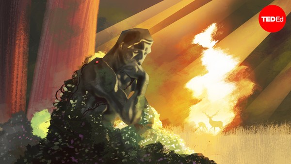
So this is where the rocks come in. So as rivers flow, as they're bulldozing material from the mountains to the sea, sometimes bits of sand and clay and rock get stuck in the ground. And that stuff that gets stuck in the ground gets buried, and through time, we get big, thick accumulations of sediments that eventually turn into rocks. What this means is that we can go to places like this, where we see big, thick stacks of sedimentary rocks, and go back in time and see what the landscapes looked like in the past. We can do this to help reconstruct and understand how earth landscapes evolve. This is pretty convenient, too, because the earth has had sort of an epic history. Right? So this video here is a reconstruction of paleogeography for just the first 600 million years of earth's history. So just a little bit of time here. So as the plates move around, we know climate has changed, sea level has changed, we have a lot of different types of landscapes and different types of environments that we can go back -- if we have a time machine -- we can go back and look at, and we do indeed have a time machine because we can look at the rocks that were deposited at these times.
Здесь вступают в игру горы. Реки текут, и когда они переносят горные породы в море, иногда песок, глина и камни могут застревать в земле. Затем весь этот застрявший мусор покрывается слоем почвы, со временем из них образуются больши́е скопления отложений, которые в итоге превращаются в горы. Это означает, что когда мы обнаруживаем места скопления мусора, превратившегося в горы, мы можем посмотреть в прошлое и понять, как раньше выглядел ландшафт нашей планеты. Это позволяет нам воссоздать и понять, как менялась поверхность Земли. Это очень удобно. ведь история Земли довольно эпична. Так? На этом видео представлена реконструкция палеографии первых 600 миллионов лет развития Земли. Это лишь небольшой промежуток времени. Нам известно, что в результате сдвига плит изменились климат и уровень воды в океане и появилось много видов ландшафта, а также различные типы окружающей среды. Если бы мы вернулись в прошлое с помощью машины времени, а у нас есть такая возможность, потому что мы можем взглянуть на горы, сформировавшиеся в то время.
So I'm going to give you an example of this and take you to a special time in earth's past. About 55 million years ago, there was a really abrupt warming event, and what happened was a whole bunch of carbon dioxide was released into earth's atmosphere, and it caused a rapid and pretty extreme global warming event. And when I say warm, I mean pretty warm, that there were things like crocodiles and palm trees as far north as Canada and as far south as Patagonia. So this was a pretty warm time and it happened really abruptly. So what we can do is we can go back and find rocks that were deposited at this time and reconstruct how the landscape changed in response to this warming event.
Я приведу пример того, как это возможно, и мы совершим путешествие в прошлое Земли. Около 55 миллионов лет назад произошло очень резкое потепление, что привело к большому выходу углекислого газа в атмосферу, что, в свою очередь, вызвало резкое и сильное глобальное потепление. И говоря о тепле, я имею в виду жару, а это значит, что крокодилы и пальмы были распространены от Канады на Севере и до Патагонии на Юге. Это действительно было жаркое время, и оно закончилось внезапно. И что мы можем сделать? Мы можем вернуться в прошлое и обнаружить горы, сформировавшиеся в то время, и воспроизвести изменение ландшафта в соответствии с этим потеплением.
So here, yay, rocks.
Ах да, горы.
(Laughter)
(Смех)
Here's a pile of rocks. This yellow blob here, this is actually a fossil river, so just like this cartoon I showed, these are deposits that were laid down 55 million years ago. As geologists, we can go and look at these up close and reconstruct the landscape. So here's another example. The yellow blob here is a fossil river. Here's another one above it. We can go and look in detail and make measurements and observations, and we can measure features. For example, the features I just highlighted there tell us that this particular river was probably about three feet deep. You could wade across this cute little stream if you were walking around 55 million years ago. The reddish stuff that's above and below those channels, those are ancient soil deposits. So we can look at those to tell us what lived and grew on the landscape and to understand how these rivers were interacting with their floodplains. So we can look in detail and reconstruct with some specificity how these rivers flowed and what the landscapes looked like. So when we do this for this particular place at this time, if we look what happened before this abrupt warming event, the rivers kind of carved their way down from the mountains to the sea, and they looked maybe similar to what I showed you in the Amazon River basin. But right at the onset of this climate change event, the rivers change dramatically. All of a sudden they got much broader, and they started to slide back and forth across the landscape more readily. Eventually, the rivers reverted back to a state that was more similar to what they would have looked like before this climate event, but it took a long, long time.
Груда камней. Вот это жёлтое пятно — фактически это ископаемая река, как в том ролике, который я показывала, эти отложения появились здесь 55 миллионов лет назад. Геологи могут досконально их изучить и восстановить былой ландшафт. Вот другой пример. Жёлтое пятно — это ископаемая река. Чуть выше — ещё одна. Мы можем рассмотреть все детали, произвести вычисления и наблюдения и измерить характеристики. Например, упомянутые мной характеристики говорят о том, что глубина этой конкретной реки составляла около метра. Вы смогли бы перейти вброд этот небольшой поток, если бы вышли на прогулку 55 миллионов лет назад. Красноватые участки повыше — это древние отложения почвы. Эта информация позволит нам узнать об обитателях и растениях тех времён, а также понять, как реки вели себя в поймах. Мы можем детально всё рассмотреть и подробно воссоздать характер течений рек и внешний вид ландшафтов. Когда мы это делаем для конкретного места и конкретного времени, если посмотреть, что происходило до того неожиданного потепления, рисунок стекающих к морю рек вре́зался в землю, он был похож на бассейн реки Амазонки, который я уже показывала. Но с началом эпохи потепления реки крайне изменились. Внезапно они разлились, и их русла стали чаще меняться. В конечном итоге реки вернулись в то первоначальное состояние, в каком они были до начала этого климатического явления, но на это потребовалось много времени.
So we can go back in earth's time and do these kinds of reconstructions and understand how earth's landscape has changed in response to a climate event like this or a land use event. So some of the ways that rivers change or the reasons that rivers change their pattern and their movements is because of things like with extra water falling on the land's surface when climate is hotter, we can move more sediment and erode more sediment, and that changes how rivers behave.
Мы можем вернуться в прошлое земли, воссоздать историю и понять, как ландшафт земли изменился в ответ на подобное климатическое событие или освоение земель людьми. Вот некоторые причины, почему реки меняют своё направление и русла: в результате того, что при потеплении климата на землю выпадает больше осадков, осадочные породы больше перемещаются и разрушаются, и всё это влияет на поведение рек.
So ultimately, as long as earth's surface is our home, we need to carefully manage the resources and risks associated with living in dynamic environments. And I think the only way we can really do that sustainably is if we include information about how landscapes evolved and behaved in earth's past.
Итак, поверхность Земли — это наш дом, и мы должны бережно управлять ресурсами и предотвращать риски, связанные с жизнедеятельностью в меняющемся мире. И я думаю, что единственный способ поддержать эту стабильность — использовать информацию о том, как ландшафты развивались и вели себя в прошлом.
Thank you.
Спасибо.
(Applause)
(Аплодисменты)