حسنًا، دعونا نعرضُ الصورة التي التقطناها للأرض. إن الأرض مذهلة بحق. أنا عالمة جيولوجيا، لذا فأنا متحمسة جدا بشأن هذا. لكن الأرض رائعة. فهي قوية وفعالة ودائمة التغيّر. إنها مكان مثير للغاية للعيش فيه. ولكنني أرغبُ اليوم أن أشارككم وجهة نظري كجيولوجية حول كيفية فهم ماضي الأرض الذي بإمكانه مساعدتنا في تحديد وتوجيه قراراتنا التي نتخذها اليوم حول كيفية العيش المستديم على سطح الأرض.
All right, let's get up our picture of the earth. The earth is pretty awesome. I'm a geologist, so I get pretty psyched about this, but the earth is great. It's powerful, it's dynamic, it's constantly changing. It's a pretty exciting place to live. But I want to share with you guys today my perspective as a geologist in how understanding earth's past can help inform and guide decisions that we make today about how to sustainably live on earth's surface.
فهناك العديد من الأشياء المثيرة التي تحدثُ على سطح الأرض. إذا ما كبّرنا الصورة قليلًا، أريد أن أحدثكم قليلًا عن أحد الأشياء التي تحدث. يحصلُ أن تمتزجُ المواد حول سطح الأرض طوال الوقت. والشيء الكبير الذي يحدثُ هو أن المواد من الجبال العالية تتآكل وتُنقل وتستقر في البحر. ويستمرُ حدوث هذه العملية طوال الوقت، ولها آثار كبيرة على كيفية تشكّل المناطق الطبيعية. فهذا المثال في جنوب (الهند) -- لدينا بعض أكبر الجبال في العالم، ويمكنكم النظر في صورة القمر الصناعي هذه حيثُ تنقل الأنهار المواد من تلك الجبال إلى البحر. يمكن التفكير في الأنهار كالجرافات. فهي أساساً تحملُ تلك الجبال وتدفعُ بها تجاه البحر.
So there's a lot of exciting things that go on on the surface of the earth. If we zoom in here a little bit, I want to talk to you guys a little bit about one of the things that happens. Material get shuffled around earth's surface all the time, and one of the big thing that happens is material from high mountains gets eroded and transported and deposited in the sea. And this process is ongoing all the time, and it has huge effects on how the landscape works. So this example here in south India -- we have some of the biggest mountains in the world, and you can see in this satellite photo rivers transporting material from those mountains out to the sea. You can think of these rivers like bulldozers. They're basically taking these mountains and pushing them down towards the sea.
سنعطيكم مثالًا على ذلك، فلنكبر الصورة قليلًا، أرغبُ في الحديث إليكم عن نهر تحديدًا. يمكننا رؤية الأنماط الجميلة التي تشكّلها الأنهار وهي تدفعُ المواد نحو البحر، ولكن هذه الأنماط ليست ثابتة. تتحرك هذه الأنهار سريعًا، وتنحرف قليلاً من هنا وهناك، وقد يكون لها تأثيرات كبيرة على حياتنا.
We'll give you guys an example here. So we zoom in a little bit. I want to talk to you guys specifically about a river. We can see these beautiful patterns that the rivers make as they're pushing material down to the sea, but these patterns aren't static. These rivers are wiggling and jumping around quite a bit, and it can have big impacts on our lives.
فمثال ذلك (نهر كوسي). لدى نهر (كوسي) مسار جميل على شكل حرف سي (C)، ويخرج من الجبال الكبيرة من (نيبال) حاملًا معه أطنانًا من المواد، والكثير من الرواسب المتآكلة من الجبال العالية، وتنتشر في كل أنحاء (الهند) وتنقل هذه المواد. سنقوم بتكبير هذه المنطقة وسأخبركم القليل عمّا جرى مع نهر (كوسي). إنه مثال عن كيف يمكنُ لهذه الأنظمة أن تكون فعّالة. فهذه صورة قمر صناعي في آب/أغسطس عام 2008، وصورة القمر الصناعي ملونة لذا تظهر الأغطية النباتية أو النباتات خضراء وتظهر المياه زرقاء. يمكنكم مجددًا رؤية ذلك المسارعلى شكل (C) الذي يتخذه هذا النهر وهو يخرجُ من نيبال. وهذا هو الآن موسم الرياح الموسمية. يعتيرُ شهر آب/أغسطس موعدًا للرياح الموسمية في هذا الجزء من العالم، وأي أحد يعيش بالقرب من النهر ليس غريبًا عن الفيضانات وأقل المخاطر والصعاب المتعلقة به. لكن شيئًا مهمًا حدث في 2008، وتحرك هذا النهر في مسار مختلف تمامًا. وفاض بطريقة مختلفة عن المعتاد. يتدفق نهر (كوسي) إلى الأسفل هنا ولكن مثلما تجرفُ هذه الأنهار الرواسب في بعض الأحيان، إلا أنها تنسدُ نوعًا ما. ويمكنُ لهذه الإنسدادات في الواقع أن تجعل الأنهار تغيرُ مسارها بشكل كبير. تم التقاط صورة القمر الصناعي هذه بعد أسبوعين. هنا هو المسار السابق، المسار على شكل (C)، وتلاحظون أنه لم يعد أزرق اللون. لكن ما لدينا الآن هو هذا المسار الأزرق الذي يقطع منتصف مجال الرؤية هنا. ما حدث هو أن مياه نهر (كوسي) قد فاضت على ضفتيه. وللإشارة، يبلغُ مقياس الشريط 40 ميلًا، تحرك النهر أكثر من 30 ميلًا بشكل مفاجىء. فانسد النهر وفاض على ضفتيه. هنا صورة بعد أسبوع تقريبًا، ويمكنكم أن تروا هذه المسارات السابقة، ويمكنكم أن تروا استمرار عملية انتقال النهر بسرعة حيث يتحرك النهر بعيدًا عن مجراه الرئيسي.
So an example of this is this is the Kosi River. So the Kosi River has this nice c-shaped pathway, and it exits the big mountains of Nepal carrying with it a ton of material, a lot of sediments that's being eroded from the high mountains, and it spreads out across India and moves this material. So we're going to zoom in to this area and I'm going to tell you a little bit about what happened with the Kosi. It's an example of how dynamic these systems can be. So this is a satellite image from August of 2008, and this satellite image is colored so that vegetations or plants show up as green and water shows up as blue. So here again you can see that c-shaped pathway that this river takes as it exits Nepal. And now this is monsoon season. August is monsoon season in this region of the world, and anyone that lives near a river is no stranger to flooding and the hazards and inconveniences at minimum that are associated with that. But something interesting happened in 2008, and this river moved in a way that's very different. It flooded in a way that's very different than it normally does. So the Kosi River is flowing down here, but sometimes as these rivers are bulldozing sediment, they kind of get clogged, and these clogs can actually cause the rivers to shift their course dramatically. So this satellite image is from just two weeks later. Here's the previous pathway, that c-shaped pathway, and you notice it's not blue anymore. But now what we have is this blue pathway that cuts down the middle of the field of view here. What happened is the Kosi River jumped its banks, and for reference, the scale bar here is 40 miles. This river moved over 30 miles very abruptly. So this river got clogged and it jumped its banks. Here's an image from about a week later, and you can see these are the previous pathways, and you can see this process of river-jumping continues as this river moves farther away from its major course.
لذا يمكنكم تخيل منطقة طبيعية مثل هذه، حيث تتحرك الأنهار هنا وهناك في كثيرٍ من الأحيان، من المهم حقًا فهم متى، وأين، وكيف تنحرف. لكن مثل هذه العمليات تحدثُ أيضًا قريبًا جدًا من الوطن. ففي الولايات المتحدة الأمريكية، لدينا نهر (الميسيسيبي) الذي يستنزف معظم الولايات المتحدة المتجاورة. حيث يدفع بالمواد من جبال (روكي) ومن (السهول العظمى). يستنزفها وينقلها في كل أنحاء أمريكا ويقذفُ بها داخل الخليج المكسيكي. فهذا هو مسار (المسيسيبي) المألوف لنا اليوم، لكنه لا يتدفق دومًا في هذا الاتجاه. إذا ما استخدمنا السجل الجيولوجي، يمكننا إعادة تشكيله إلى حيثُ ذهب في الماضي. فعلى سبيل المثال، هذه المنطقة الحمراء هنا هي المكان الذي نعرف أن نهر (المسيسيبي) تدفق وترسبت المواد فيه قبل حوالي 4600 سنة. ثم تحرّك بعد حوالي 3500 سنة ليتبع المسار الموضح هنا باللون البرتقالي. وواصل التحرك مرارًا وتكرارًا. فهنا بعد حوالي 2,000 سنة، بعد ألف سنة، بعد 700 سنة. وكان ذلك مؤخرًا قبل حوالي 500 سنة فقط الذي اتخذ فيه مساره المألوف لدينا اليوم. لذا فهذه العمليات مهمة جدًا، وخاصة هنا، منطقة الدلتا هذه، حيث أن حالات انحراف النهر السريع في (المسيسيبي) تُشكًل أرضًا على سطح الأرض والبحر. هذه عقارات ثابتة قيّمة حقًا، ومثل تلك الدلتاوات هي من أكثر المناطق المكتظة بالسكان في كوكبنا الأرض. لذلك، فهم فعالية هذه المناظر الطبيعية، كيف تشكلّت وكيف ستواصل التغير مستقبلًا هو مهم جدًا بالنسبة للناس الذين يعيشون هنا.
So you can imagine in landscapes like this, where rivers move around frequently, it's really important to understand when, where and how they're going to jump. But these kinds of processes also happen a lot closer to home as well. So in the United States, we have the Mississippi River that drains most of the continental US. It pushes material from the Rocky Mountains and from the Great Plains. It drains it and moves it all the way across America and dumps it out in the Gulf of Mexico. So this is the course of the Mississippi that we're familiar with today, but it didn't always flow in this direction. If we use the geologic record, we can reconstruct where it went in the past. So for example, this red area here is where we know the Mississippi River flowed and deposited material about 4,600 years ago. Then about 3,500 years ago it moved to follow the course outlined here in orange. And it kept moving and it keeps moving. So here's about 2,000 years ago, a thousand years ago, 700 years ago. And it was only as recently as 500 years ago that it occupied the pathway that we're familiar with today. So these processes are really important, and especially here, this delta area, where these river-jumping events in the Mississippi are building land at the interface of the land and the sea. This is really valuable real estate, and deltas like this are some of the most densely populated areas on our planet. So understanding the dynamics of these landscapes, how they formed and how they will continue to change in the future is really important for the people that live there.
لذا فالأنهار تتحرك أيضًا. هذه بعض من أشكال الانحرفات الضخمة التي كنا نتحدث عنها. أريد أن أخبركم عن نهر يتحرك هنا. لذا سننتقل جنوبًا إلى حوض نهر( الآمازون)، ولدينا مرةً أخرى نظام نهري كبير والذي يستنزفُ وينقلُ ويجرفُ المواد من جبال (الأنديز)، ناقلًا إياها عبر (جنوب أمريكا) ويفرغها في (المحيط الأطلنطي). فإذا ما كبّرنا هنا، بإمكانكم أن تروا مسارات النهر المنحنية الجميلة. مرة أخرى، إنها جميلة حقًا، ولكن مرة أخرى، ليست ساكنة. فهذه الأنهار تتحرك هنا وهناك. بإمكاننا استخدام صور الأقمار الصناعية على مدار 30 سنة الأخيرة تقريبًا لمراقبة كيف تغيرت هذه الأنهار فعليًا. انظروا لدقيقة لأي التواء أو منحنى في هذا النهر، وستروا أنها لا تبقى في المكان ذاته لوقتٍ طويل. فهي تتغيرُ وتتطورُ وتنعطفُ عن مسارها. إذا ما نظرتم إلى هذه المنطقة بالتحديد، أريد منكم ملاحظة أن هناك نوع من الحلقة في النهر التي قطعت تمامًا. إنها مثل منحنيات السوط وينفصل عن مسار النهر في نقطة معينة. ومرة أخرى، للإشارة فقط، في هذا الموقع، غير ذاك النهر مساره على مدار أربعة أميال وعلى مدار موسم أو اثنين.
So rivers also wiggle. These are sort of bigger jumps that we've been talking about. I want to show you guys some river wiggles here. So we're going to fly down to the Amazon River basin, and here again we have a big river system that is draining and moving and plowing material from the Andean Mountains, transporting it across South America and dumping it out into the Atlantic Ocean. So if we zoom in here, you guys can see these nice, curvy river pathways. Again, they're really beautiful, but again, they're not static. These rivers wiggle around. We can use satellite imagery over the last 30 or so years to actually monitor how these change. So take a minute and just watch any bend or curve in this river, and you'll see it doesn't stay in the same place for very long. It changes and evolves and warps its pattern. If you look in this area in particular, I want you guys to notice there's a sort of a loop in the river that gets completely cut off. It's almost like a whip cracking and snaps off the pathway of the river at a certain spot. So just for reference, again, in this location, that river changed its course over four miles over the course of a season or two.
لذا فالمناطق الطبيعية التي نعيش فيها على الأرض، مثل هذه المواد تآكلت من الجبال ونُقلت الى البحر، فهي تتحرك هنا وهناك طوال الوقت. إنها تتغير طوال الوقت، ونحتاج أن نفهم هذه العمليات حتى يمكننا التحكم والعيش المستديم في هذه المناطق الطبيعية. لكنه من الصعب القيام بهذا إذا كانت المعلومات التى لدينا هي فقط عمّا يجرى اليوم على سطح الأرض. ليس لدينا الكثير من الملاحظات، أليس كذلك؟ لدينا فقط صور لأقمار صناعية قيّمة من 30 سنة، على سبيل المثال. نحتاج إلى المزيد من الملاحظات لفهم هذه العمليات أكثر. وبالإضافة إلى ذلك، نحتاج أن نعرف كيف ستستجيب تلك المناطق الطبيعية لتغير المناخ ولتغير استخدام الأرض طالما نواصل احتلال سطح الارض للسكن، وتعديله أيضًا.
So the landscapes that we live in on earth, as this material is being eroded from the mountains and transported to the sea, are wiggling around all the time. They're changing all the time, and we need to be able to understand these processes so we can manage and live sustainably on these landscapes. But it's hard to do if the only information we have is what's going on today at earth's surface. Right? We don't have a lot of observations. We only have 30 years' worth of satellite photos, for example. We need more observations to understand these processes more. And additionally, we need to know how these landscapes are going to respond to changing climate and to changing land use as we continue to occupy and modify earth's surface.
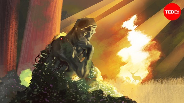
هنا المكان الذي تدخل فيه الصخور. لذا عندما تتدفق الأنهار، وهي تجرف المواد من الجبال إلى البحر، تلتصق أحياناً أجزاء من الرمل، والطين والصخور في الأرضية. ويحصلُ أن تُغمر تلك الأشياء الملتصفة في الأرضية، وبمرور الوقت، نحصلُ على تراكمات رواسب كبيرة وسميكة والتي بالنهاية تتحول إلى صخور. هذا يعني أننا يمكن أن نذهب إلى أماكن مثل هذه، حيث نرى أكوام كبيرة وسميكة من الصخور الرسوبية، وبالعودة بالزمن إلى الوراء ورؤية كيف بدت المناطق الطبيعية في الماضي. يمكننا القيام بذلك للمساعدة في إعادة بناء وفهم كيف تتطور المناظر الطبيعية للأرض. هذا ملائم تمامًا، أيضًا، لأن الأرض لديها تاريخ ملحمي. أليس كذلك؟ فهذا الفيديو هنا هو بمثابة إعادة بناء الجغرافيا القديمة لأول 600 مليون سنة من تاريخ الأرض فقط. إذن فقط قليلًا من الوقت هنا. وكما أن الصفائح تتحرك، نعرف أن المناخ قد تغير، ومستوى سطح الأرض كذلك، لدينا العديد من أنواع المناطق الطبيعية المختلفة والبيئات المختلفة التي يمكنُ أن نعود -- إذا كان لدينا آلة زمن -- يمكننا أن نعود وننظر فيها، ولدينا بالتأكيد آلة الزمن لأننا يمكننا النظر إلى الصخور التي ترسبت في تلك الأوقات.
So this is where the rocks come in. So as rivers flow, as they're bulldozing material from the mountains to the sea, sometimes bits of sand and clay and rock get stuck in the ground. And that stuff that gets stuck in the ground gets buried, and through time, we get big, thick accumulations of sediments that eventually turn into rocks. What this means is that we can go to places like this, where we see big, thick stacks of sedimentary rocks, and go back in time and see what the landscapes looked like in the past. We can do this to help reconstruct and understand how earth landscapes evolve. This is pretty convenient, too, because the earth has had sort of an epic history. Right? So this video here is a reconstruction of paleogeography for just the first 600 million years of earth's history. So just a little bit of time here. So as the plates move around, we know climate has changed, sea level has changed, we have a lot of different types of landscapes and different types of environments that we can go back -- if we have a time machine -- we can go back and look at, and we do indeed have a time machine because we can look at the rocks that were deposited at these times.
سأعطيكم مثالًا لهذا وسآخذكم إلى وقت مميز في ماضي الأرض. قبل حوالي 55 مليون سنة، كان هناك حدث حراري مفاجئ حقًا، وكان ما حدث هو أن مجموعة كاملة من ثاني أكسيد الكربون أُطلقت في الغلاف الجوي للأرض، وكانت سببًا في حدوث احتباس حراري عالمي سريع وشديد جدًا. وعندما أقول حراري، فأنا أعني حراري بدرجة كبيرة، حيث وُجدت هناك أشياء مثل التماسيح وأشجار النخيل في أقصى الشمال مثل (كندا) وفي أقصى الجنوب مثل (باتاغونيا). لذا فأن هذا كان وقت شديد الحرارة وقد حدث بشكل مفاجئ حقًا. فما يمكننا القيام به هو أن نرجع للوراء ونجد الصخور التي ترسبت في ذلك الوقت ونعيدُ بناء كيفية تغير المناظر الطبيعية ردًا على ذلك الحدث الاحتراري.
So I'm going to give you an example of this and take you to a special time in earth's past. About 55 million years ago, there was a really abrupt warming event, and what happened was a whole bunch of carbon dioxide was released into earth's atmosphere, and it caused a rapid and pretty extreme global warming event. And when I say warm, I mean pretty warm, that there were things like crocodiles and palm trees as far north as Canada and as far south as Patagonia. So this was a pretty warm time and it happened really abruptly. So what we can do is we can go back and find rocks that were deposited at this time and reconstruct how the landscape changed in response to this warming event.
هنا، مرحى، صخور.
So here, yay, rocks.
(ضحك)
(Laughter)
هنا كومة من الصخور. هذا الخط الأصفر هنا، هذا في الواقع نهر إحفوري، فهو كالرسم الكارتوني الذي عرضته، هذه رواسب قد تكونت قبل 55 مليون سنة. كعلماء جيولوجيا، يمكننا الذهاب والنظرعن قرب وإعادة بناء المناظر الطبيعية. فهاكم مثالًا آخر. إن الخط الأصفر هنا هو نهر إحفوري. فهنا واحدًا أعلاه. يمكننا الذهاب والتمعن في التفاصيل، وأخذ القياسات والملاحظات. ويمكننا تقدير الخصائص. مثالًا، الخصائص التي حددتها هناك تخبرنا أن هذا النهر بعينه ربما كان بعمق ثلاثة أقدام. كان بامكانكم التقدم بصعوبة من خلال هذا النهر الصغير إذا كنتم تسيرون هناك قبل حوالى 55 مليون سنة. الأشياء الحمراء التي أعلى وأسفل تلك القنوات، هذه رواسب التربة القديمة. لذا بإمكاننا النظر إلى تلك لنعرف منهم ما عاش وما نما في هذه المناطق الطبيعية ولنفهم كيف أن هذه الأنهار كانت تتفاعل مع السهول الفيضية. يمكننا النظر في التفاصيل وإعادة البناء مع بعض الخصوصية النوعية كيف تدفقت هذه الأنهار، وما بدت عليه المناطر الطبيعية. لذا عندما نقوم بهذا لهذا الموقع بعينه في هذا الوقت، إذا نظرنا إلى ما جرى قبل هذا الحدث الحراري المفاجئ، فإن الأنهار قد شقّت مسارها إلى الأسفل من الجبال إلى البحر، وربما بدت مثلما أوضحتُ لكم في حوض نهر (الأمازون). لكن تمامًا مع بداية حدث تغير المناخ هذا، تغيرت الأنهار تغيرًا كبيرًا. اتسعت جميعها فجأة، وبدأت بالانزلاق للأمام والخلف عبر المناطق الطبيعية بسرعة أكبر. في النهاية،عادت الأنهار لحالتها التي تشبه شبهًا كبيرًا حالتها قبل حدث تغيّر المناخ، ولكن استغرق الأمر وقتًا طويلًا جدًا.
Here's a pile of rocks. This yellow blob here, this is actually a fossil river, so just like this cartoon I showed, these are deposits that were laid down 55 million years ago. As geologists, we can go and look at these up close and reconstruct the landscape. So here's another example. The yellow blob here is a fossil river. Here's another one above it. We can go and look in detail and make measurements and observations, and we can measure features. For example, the features I just highlighted there tell us that this particular river was probably about three feet deep. You could wade across this cute little stream if you were walking around 55 million years ago. The reddish stuff that's above and below those channels, those are ancient soil deposits. So we can look at those to tell us what lived and grew on the landscape and to understand how these rivers were interacting with their floodplains. So we can look in detail and reconstruct with some specificity how these rivers flowed and what the landscapes looked like. So when we do this for this particular place at this time, if we look what happened before this abrupt warming event, the rivers kind of carved their way down from the mountains to the sea, and they looked maybe similar to what I showed you in the Amazon River basin. But right at the onset of this climate change event, the rivers change dramatically. All of a sudden they got much broader, and they started to slide back and forth across the landscape more readily. Eventually, the rivers reverted back to a state that was more similar to what they would have looked like before this climate event, but it took a long, long time.
يمكننا العودة إلى الأرض في الماضي والقيام بهذه الأنواع من إعادة البناء وفهم كيف تغيرت المناطق الطبيعية في الأرض استجابة لمثل هذا الحدث المناخي أو نتيجة استخدام الأرض. لذا فإن بعض الطرق التي غيرتها الأنهار أو أسباب تغيير الأنهار لأنماط مسارها وحركتها هو بسبب أشياء مثل تساقط المياه الزائد على سطح الأرض عندما يكون المناخ أكثر حرارة، فيمكننا تحريك المزيد من الرواسب ونحت المزيد منها، وهذا يغير النمط الذي تتخذه الأنهار.
So we can go back in earth's time and do these kinds of reconstructions and understand how earth's landscape has changed in response to a climate event like this or a land use event. So some of the ways that rivers change or the reasons that rivers change their pattern and their movements is because of things like with extra water falling on the land's surface when climate is hotter, we can move more sediment and erode more sediment, and that changes how rivers behave.
ففي النهاية، طالما أن سطح الأرض هو موطننا، نحتاج أن نتحكم بعناية بالموارد والمخاطر المتعلقة بالعيش في بيئات فعالة قوية. وأعتقد أن السبيل الوحيد الذي يمكن أن نسلكه دائمًا هو إذا قمنا بتضمين معلومات حول كيف تتطورت المناطق الطبيعية وتحركت وأثرت في ماضي الأرض.
So ultimately, as long as earth's surface is our home, we need to carefully manage the resources and risks associated with living in dynamic environments. And I think the only way we can really do that sustainably is if we include information about how landscapes evolved and behaved in earth's past.
شكرًا لكم.
Thank you.
(تصفيق)
(Applause)