In 1992, a cargo ship carrying bath toys got caught in a storm. Shipping containers washed overboard, and the waves swept 28,000 rubber ducks and other toys into the North Pacific. But they didn’t stick together. Quite the opposite– the ducks have since washed up all over the world, and researchers have used their paths to chart a better understanding of ocean currents.
1992년 욕조용 장난감을 실은 화물선이 폭풍을 만났습니다. 컨테이너들이 배 밖으로 쓸려 나갔고 28,000개의 고무 오리와 다른 장난감들이 파도에 쓸려 북태평양에 쏟아졌습니다. 그들은 서로 붙어 다니지 않았고 정 반대로 전 세계로 흩어져 쓸려갔고 연구진들은 오리들이 쓸려온 길을 통하여
Ocean currents are driven by a range of sources: the wind, tides, changes in water density, and the rotation of the Earth. The topography of the ocean floor and the shoreline modifies those motions, causing currents to speed up, slow down, or change direction.
해류를 더 잘 이해하게 되었습니다. 해류가 움직이는 원인들로는: 바람, 파도, 수밀도의 변화 그리고 지구의 자전 등 다양합니다. 해저 지형과 해안선이 이러한 움직임을 변형시켜 해류의 속도를 높이거나
Ocean currents fall into two main categories: surface currents and deep ocean currents. Surface currents control the motion of the top 10 percent of the ocean’s water, while deep-ocean currents mobilize the other 90 percent. Though they have different causes, surface and deep ocean currents influence each other in an intricate dance that keeps the entire ocean moving.
속도를 낮추고 방향을 바꾸기도 합니다. 해류는 크게 두 가지 나뉩니다: 표층 해류와 심해 해류 표층 해류는 바닷물의 위쪽 10%의 움직임을 제어하는 반면, 심해 해류는 나머지 90%를 움직입니다. 그 둘은 서로 다른 원인들로 움직이지만 서로에게 복잡하게 영향을 주어 해양 전체가 끊임없이 움직이게 합니다.
Near the shore, surface currents are driven by both the wind and tides, which draw water back and forth as the water level falls and rises. Meanwhile, in the open ocean, wind is the major force behind surface currents. As wind blows over the ocean, it drags the top layers of water along with it. That moving water pulls on the layers underneath, and those pull on the ones beneath them. In fact, water as deep as 400 meters is still affected by the wind at the ocean’s surface.
해안가에서는, 바람과 파도에 의해 표층 해류가 움직이는데, 수면이 상승 하강하면서 물을 앞뒤로 움직입니다. 그러나, 바다 한가운데에서는 바람이 표층 해류의 주된 동력입니다. 대양에 바람이 불게 되면 해수 표층부를 함께 끌고 움직입니다. 이런 움직임이 그 하층부를 끌어당기고, 다시 더 아래의 하층부를 끌어당깁니다. 결국 400미터 깊이의 해수까지는 수면 위의 바람에 영향을 받게 됩니다.
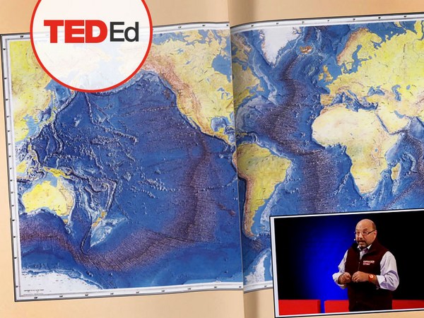
If you zoom out to look at the patterns of surface currents all over the earth, you’ll see that they form big loops called gyres, which travel clockwise in the northern hemisphere and counter-clockwise in the southern hemisphere. That’s because of the way the Earth’s rotation affects the wind patterns that give rise to these currents.
거시적으로 지구 전체 표층 해류가 움직이는 패턴을 보게 되면 거대한 고리 형태의 환류(GYRES)를 발견할 수 있고 그 환류가 북반구에서는 시계 방향으로 그리고 남반구에서는 반시계 방향으로 돕니다. 이는 지구의 자전 방향 때문인데 이 자전 방향이 바람의 패턴에 영향을 주어 해류를 일으킵니다.
If the earth didn’t rotate, air and water would simply move back and forth between low pressure at the equator and high pressure at the poles. But as the earth spins, air moving from the equator to the North Pole is deflected eastward, and air moving back down is deflected westward. The mirror image happens in the southern hemisphere, so that the major streams of wind form loop-like patterns around the ocean basins. This is called the Coriolis Effect. The winds push the ocean beneath them into the same rotating gyres. And because water holds onto heat more effectively than air, these currents help redistribute warmth around the globe.
만일 지구의 자전이 없다면 대기와 해류는 단순하게 저기압인 적도와 고기압인 양극 사이를 왔다 갔다만 할 것입니다. 그러나 지구의 자전으로 인해 적도에서 북극으로 부는 바람은 동쪽으로 휘게 되고 반대로 아래로 부는 바람은 서쪽으로 휘게 됩니다. 남반구에서는 반전 효과의 현상이 일어나서 주된 바람들은 대양 분지 근처에서 고리 모양을 형성합니다. 이러한 현상을 코리올리 효과라고 합니다. 바람으로 인해 동일한 방향의 환류가 생기고 물이 공기보다 열을 더 잘 보존하기 때문에 이 환류들이 지구상의 열을 재분배하는 역할을 합니다.
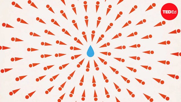
Unlike surface currents, deep ocean currents are driven primarily by changes in the density of seawater. As water moves towards the North Pole, it gets colder. It also has a higher concentration of salt, because the ice crystals that form trap water while leaving salt behind. This cold, salty water is more dense, so it sinks, and warmer surface water takes its place, setting up a vertical current called thermohaline circulation.
표층 해류와는 달리 심해 해류는 주로 바닷물의 밀도 차이에 의해 움직입니다. 바닷물은 북극으로 갈수록 차가워지고 염분 농도 또한 높아지는데 그 이유는 얼음이 어는 과정에서 소금은 빠지고 물만 얼기 때문입니다. 이렇게 차고 짠 물은 밀도가 높아서 아래로 가라앉게 되고 따뜻한 물이 그 자리를 차지하면서 열염 순환이라는 수직 운동을 합니다. 심해의 열염 순환과 바람에 의한 표층 해류가 결합하여
Thermohaline circulation of deep water and wind-driven surface currents combine to form a winding loop called the Global Conveyor Belt. As water moves from the depths of the ocean to the surface, it carries nutrients that nourish the microorganisms which form the base of many ocean food chains.
"대순환 해류"라는 거대 순환 고리를 형성합니다. 바닷물이 심해에서 표면으로 움직이면서 미생물을 위한 영양분들을 이동시킴으로써 해양 먹이 사슬의 기본 틀을 형성합니다. 대순환 해류는 지구상의 가장 긴 해류로서
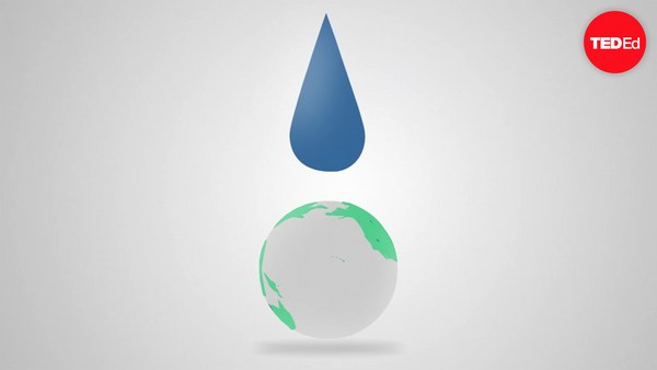
The global conveyor belt is the longest current in the world, snaking all around the globe. But it only moves a few centimeters per second. It could take a drop of water a thousand years to make the full trip. However, rising sea temperatures are causing the conveyor belt to seemingly slow down. Models show this causing havoc with weather systems on both sides of the Atlantic, and no one knows what would happen if it continues to slow or if it stopped altogether. The only way we’ll be able to forecast correctly and prepare accordingly will be to continue to study currents and the powerful forces that shape them.
지구 전체를 휘감습니다. 그러나 이 해류는 초 당 몇 센티미터씩만 움직여서 전체 한 바퀴를 다 돌려면 천 년 정도 걸릴 것입니다. 그러나 수온이 올라가면서 이 순환이 느려지고 있습니다. 이러한 변화가 대서양 주변 대륙의 기후 체계에 재앙을 일으킨다는 것을 모델을 통해 예측할 수 있고 만약 이 순환이 계속 더 늦춰지거나 혹은 완전히 멈추게 된다면 어떤 일이 생길지 아무도 알 수 없습니다. 단지 정확하게 예측하여 적절히 대비할 수 있는 유일한 방법은 해류와 이를 움직이는 강력한 힘들에 대해서 끊임없이 연구하는 것입니다.