So I'm here to talk to you about the walkable city. What is the walkable city? Well, for want of a better definition, it's a city in which the car is an optional instrument of freedom, rather than a prosthetic device. And I'd like to talk about why we need the walkable city, and I'd like to talk about how to do the walkable city.
Я тут, щоб розповісти про пішохідне місто. Що ж таке це «пішохідне місто»? Найкраще пояснення: це місто, у якому авто — додатковий інструмент свободи, а не протез. Я хочу поговорити про те, нащо нам пішохідне місто, і про те, як зробити його реальним.
Most of the talks I give these days are about why we need it, but you guys are smart. And also I gave that talk exactly a month ago, and you can see it at TED.com. So today I want to talk about how to do it. In a lot of time thinking about this, I've come up with what I call the general theory of walkability. A bit of a pretentious term, it's a little tongue-in-cheek, but it's something I've thought about for a long time, and I'd like to share what I think I've figured out.
Більшість моїх промов наразі якраз про те, нащо нам такі міста, але ви ж, друзі, розумні. Я про це вже говорив місяць тому, ви можете подивитися цю доповідь на TED.com. Тож сьогодні я розповім, як створити пішохідне місто. За довгий час міркувань на цю тему я додумався до головної теорії пішохідності. Доволі химерного терміну, навіть іронічного, але я дуже довго обмірковував це і хотів би поділитися думками, які збагнув.
In the American city, the typical American city -- the typical American city is not Washington, DC, or New York, or San Francisco; it's Grand Rapids or Cedar Rapids or Memphis -- in the typical American city in which most people own cars and the temptation is to drive them all the time, if you're going to get them to walk, then you have to offer a walk that's as good as a drive or better. What does that mean? It means you need to offer four things simultaneously: there needs to be a proper reason to walk, the walk has to be safe and feel safe, the walk has to be comfortable and the walk has to be interesting. You need to do all four of these things simultaneously, and that's the structure of my talk today, to take you through each of those.
В американському місті, типовому американському місті... Тобто не у Вашингтоні, округ Колумбія, чи Нью-Йорку, чи Сан-Франциско... А напевно, у Гранд-Рапідсі, чи Сідар-Рапідсі, чи Мемфісі. У типовому американському місті, де усі мають машини і існує спокуса постійного перебування за кермом. Якщо ви хочете витягти їх на прогулянку, то маєте переконати, що вона — краща за водіння, значно краща. Що це означає? Це означає, що треба одночасно переконати їх у чотирьох речах: має бути розумна причина для прогулянки, вона має бути безпечною і відчуватися такою, вона має бути комфортною, а ще — цікавою. Треба виконати ці 4 пункти одночасно. Це структура мого виступу сьогодні: розповісти про кожен з них.
The reason to walk is a story I learned from my mentors, Andrés Duany and Elizabeth Plater-Zyberk, the founders of the New Urbanism movement. And I should say half the slides and half of my talk today I learned from them. It's the story of planning, the story of the formation of the planning profession. When in the 19th century people were choking from the soot of the dark, satanic mills, the planners said, hey, let's move the housing away from the mills. And lifespans increased immediately, dramatically, and we like to say the planners have been trying to repeat that experience ever since.
Про причину для прогулянок я дізнався від моїх наставників, Андреса Дуані та Елізабет Плейтер-Зайберк, засновників руху Нового Урбанізму. Половина моїх слайдів та власне розповіді – інформація від них. Це історія планування, історія створення професії планувальника. Коли у 19 сторіччі люди задихалися від кіптяви темних сатанинських заводів, планувальники запропонували винести житло за межі заводів. Відразу ж зросла тривалість життя, можна сказати, що відтоді проектувальники намагалися повторити цей досвід.
So there's the onset of what we call Euclidean zoning, the separation of the landscape into large areas of single use. And typically when I arrive in a city to do a plan, a plan like this already awaits me on the property that I'm looking at. And all a plan like this guarantees is that you will not have a walkable city, because nothing is located near anything else. The alternative, of course, is our most walkable city, and I like to say, you know, this is a Rothko, and this is a Seurat. It's just a different way -- he was the pointilist -- it's a different way of making places. And even this map of Manhattan is a bit misleading because the red color is uses that are mixed vertically.
Це початок так званого Евклідового зонування, відділення від ландшафту великих монофункціональних зон. Зазвичай, як не приїду до міста, аби зробити планування, на моїй ділянці вже чекає на мене схожий план. Такий план – запорука того, що у вас не буде пішохідного міста. Бо ніщо не знаходиться поруч з чим-небудь ще. Альтернатива – найпішохідніші міста: ось Ротко, а це Сере. Це лишень інший спосіб, пуанталістичний, це інший підхід у створенні міст. Навіть ця мапа Манхеттену трохи оманлива, адже червоний колір сконцентрований вертикально.
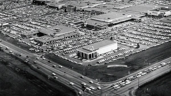
So this is the big story of the New Urbanists -- to acknowledge that there are only two ways that have been tested by the thousands to build communities, in the world and throughout history. One is the traditional neighborhood. You see here several neighborhoods of Newburyport, Massachusetts, which is defined as being compact and being diverse -- places to live, work, shop, recreate, get educated -- all within walking distance. And it's defined as being walkable. There are lots of small streets. Each one is comfortable to walk on. And we contrast that to the other way, an invention that happened after the Second World War, suburban sprawl, clearly not compact, clearly not diverse, and it's not walkable, because so few of the streets connect, that those streets that do connect become overburdened, and you wouldn't let your kid out on them. And I want to thank Alex Maclean, the aerial photographer, for many of these beautiful pictures that I'm showing you today.
Тож це велика подія Нового Урбанізму – усвідомити, що в світі протягом усієї історії людства існувало лише два шляхи збудувати суспільство, протестовані тисячами. Одне з них – традиційні райони. Тут ви бачите декілька районів Ньюберипорту в Массачусетсі, насправді вони різноманітні та компактні. Зони для проживання, роботи, покупок, відпочинку, навчання – все у пішохідній доступності. Ці райони і є пішохідними. Тут багато малих вуличок, по кожній з них зручно ходити. Давайте порівняємо з винаходом, що з'явився після Другої світової війни – передмістя. Абсолютно не компактне, одноманітне та не пішохідне. Адже так мало вулиць перетинаються, а ті, що поєднуються – перевантажені, й ви не дозволите дітям гуляти ними. Я хочу подякувати Алексу Макліну, аерофотографу, за ці чудові знімки.
So it's fun to break sprawl down into its constituent parts. It's so easy to understand, the places where you only live, the places where you only work, the places where you only shop, and our super-sized public institutions. Schools get bigger and bigger, and therefore, further and further from each other. And the ratio of the size of the parking lot to the size of the school tells you all you need to know, which is that no child has ever walked to this school, no child will ever walk to this school. The seniors and juniors are driving the freshmen and the sophomores, and of course we have the crash statistics to prove it.
Так кумедно ділити передмістя на виборчі частини. Легко зрозуміти, місця, де ти лише проживаєш, де ти лише працюєш, де лише скуповуєшся та величезні державні установи. Школи стають все більшими, а тому все далі одна від одної. А співвідношення між паркомісцями та розміром школи каже про все: немає дітей, які б йшли до цієї школи, жодна дитина ніколи не прийде сюди пішки. Дорослі й малі вже на першому та другому курсі - водії. В нас навіть є статистика автоаварій, аби це довести.
And then the super-sizing of our other civic institutions like playing fields -- it's wonderful that Westin in the Ft. Lauderdale area has eight soccer fields and eight baseball diamonds and 20 tennis courts, but look at the road that takes you to that location, and would you let your child bike on it? And this is why we have the soccer mom now. When I was young, I had one soccer field, one baseball diamond and one tennis court, but I could walk to it, because it was in my neighborhood.
А величезні державні установи, немов гральні поля. Це чудово, що територія Вестін Форт-Лодердейл включає вісім футбольних полів та вісім бейсбольних, а ще 20 тенісних кортів, але ж подивіться на дорогу туди, чи ви дозволите своїй дитині прокататися на велосипеді там? Тому ми зараз і маємо футбольних мамочок. Коли я був малим, я мав одне футбольне поле, одне бейсбольне та одне для тенісу, але ж я міг до них дійти, адже вони розташовувались по сусідству.
Then the final part of sprawl that everyone forgot to count: if you're going to separate everything from everything else and reconnect it only with automotive infrastructure, then this is what your landscape begins to look like. The main message here is: if you want to have a walkable city, you can't start with the sprawl model. you need the bones of an urban model. This is the outcome of that form of design, as is this. And this is something that a lot of Americans want. But we have to understand it's a two-part American dream. If you're dreaming for this, you're also going to be dreaming of this, often to absurd extremes, when we build our landscape to accommodate cars first. And the experience of being in these places --
Остання частина розростання, про яку всі забувають: якщо ви хочете відокремити щось від всього іншого та підключити його лише за допомогою автомобільної інфраструктури – ось як виглядає такий краєвид. Головне в цьому те, що якщо ви створюєте піше місто – не можна починати з моделі розростання. Необхідно мати скелет із міської моделі. Результат такої форми проектування виглядає так. Це саме те, чого хоче більшість американців. Ми маємо усвідомити, що це друга частина американської мрії. Якщо ви мрієте про це, ви також мрієте й про таке; часто доходить до абсурду, коли ми будуємо ландшафт, аби в першу чергу розмістити машини. І досвід перебування в таких місцях...
(Laughter)
(Сміх)
This is not Photoshopped. Walter Kulash took this slide. It's in Panama City. This is a real place. And being a driver can be a bit of a nuisance, and being a pedestrian can be a bit of a nuisance in these places. This is a slide that epidemiologists have been showing for some time now,
Це не фотошоп. Це зняв Уолтер Кулас. Це Панама-Сіті. Це місце насправді існує. Тут неприємно не лише водіям, але й пішоходам також. (Сміх) Епідеміологи вже давно кажуть,
(Laughter)
(Сміх)
The fact that we have a society where you drive to the parking lot to take the escalator to the treadmill shows that we're doing something wrong. But we know how to do it better.
що ми маємо суспільство, де ви їдете до паркомісця, підіймаєтеся по ескалатору – для того, аби позайматися на біговій доріжці. Щось з нами не так. Ми знаємо, як це змінити.
Here are the two models contrasted. I show this slide, which has been a formative document of the New Urbanism now for almost 30 years, to show that sprawl and the traditional neighborhood contain the same things. It's just how big are they, how close are they to each other, how are they interspersed together and do you have a street network, rather than a cul-de-sac or a collector system of streets?
Ось два контрастних рішення. Я покажу слайд, це документ, що формує Новий Урбанізм вже протягом 30 років, аби показати, що передмістя та традиційні райони містять ті самі речі. Наскільки вони великі, наскільки близько один до одного, і як вони змішані між собою, чи мають вуличну мережу, а не глухі кути, або сконцентровану систему вулиць?
So when we look at a downtown area, at a place that has a hope of being walkable, and mostly that's our downtowns in America's cities and towns and villages, we look at them and say we want the proper balance of uses. So what is missing or underrepresented? And again, in the typical American cities in which most Americans live, it is housing that is lacking. The jobs-to-housing balance is off. And you find that when you bring housing back, these other things start to come back too, and housing is usually first among those things. And, of course, the thing that shows up last and eventually is the schools, because the people have to move in, the young pioneers have to move in, get older, have kids and fight, and then the schools get pretty good eventually.
Дивлячись на центр міста, на місця, які можуть бути пішохідними, в основному, це наші американські міста, поселення та села, ми дивимось на них та вимагаємо збалансованості використання. Тож чого не вистачає? Знову, у типових американських містах, де живе більшість американців, є нестача в житлі. Балансу між шляхом дім-робота не існує. Виявляється, коли постає постає питання про житло, решта цих проблем теж нагадує про себе, житлове питання зазвичай перше серед них. Звісно, останньою з'являється школа, адже люди мають заїхати у житло, молоді першопрохідці мають заїхати, подорослішати, завести дітей, посваритися, а потім вже школи стануть хорошими.
The other part of this part, the useful city part, is transit, and you can have a perfectly walkable neighborhood without it. But perfectly walkable cities require transit, because if you don't have access to the whole city as a pedestrian, then you get a car, and if you get a car, the city begins to reshape itself around your needs, and the streets get wider and the parking lots get bigger and you no longer have a walkable city. So transit is essential. But every transit experience, every transit trip, begins or ends as a walk, and so we have to remember to build walkability around our transit stations.
Інший підпункт – користь міста – це транзит. Ви можете мати чудове пішохідне місто без нього. Але ідеально пішохідні міста потребують транзиту. Адже якщо ви не маєте доступу до всього міста, як пішохід – ви берете машину. Якщо ви берете машину – місто змінюється відповідно до ваших потреб, вулиці стають ширшими, парковки більшими. Ви вже не маєте пішохідного міста. Тож транзит потрібен. Але кожна транзитна поїздка починається чи закінчується прогулянкою, тож ми маємо пам'ятати, що варто будувати пішохідність навколо транзитних зупинок.
Next category, the biggest one, is the safe walk. It's what most walkability experts talk about. It is essential, but alone not enough to get people to walk. And there are so many moving parts that add up to a walkable city.
Наступне, найбільше, це безпечність прогулянок. Про це найбільше торочать експерти. Безпечність необхідна, але її не достатньо, щоб людина гуляла. Так багато факторів, що треба врахувати для пішохідного міста.
The first is block size. This is Portland, Oregon, famously 200-foot blocks, famously walkable. This is Salt Lake City, famously 600-foot blocks, famously unwalkable. If you look at the two, it's almost like two different planets, but these places were both built by humans and in fact, the story is that when you have a 200-foot block city, you can have a two-lane city, or a two-to-four lane city, and a 600-foot block city is a six-lane city, and that's a problem. These are the crash statistics. When you double the block size -- this was a study of 24 California cities -- when you double the block size, you almost quadruple the number of fatal accidents on non-highway streets.
Перший розміром з квартал. Це Портленд, Орегон, знамениті 60-ти метрові квартали, відомі пішохідністю. Це Солт-Лейк-Сіті, відомі 180-ти метрові квартали, відомі непішохідністю. Якщо ви порівняєте їх, здається, ніби вони різні, але обидва побудовані людиною. Суть у тому, що якщо ви маєте 60-ти метрові квартали, ви маєте місто з двома смугами руху, чи від 2 до 4 смуг руху. А 180-метрові квартали – 6 смуг. У цьому й проблема. Ось статистика аварій. Якщо ви подвоюєте розмір кварталу, це дослідження 24-ох міст Каліфорнії, при подвоєнні розміру кварталу у чотири рази збільшується кількість нещасних випадків на не магістральних дорогах.
So how many lanes do we have? This is where I'm going to tell you what I tell every audience I meet, which is to remind you about induced demand. Induced demand applies both to highways and to city streets. And induced demand tells us that when we widen the streets to accept the congestion that we're anticipating, or the additional trips that we're anticipating in congested systems, it is principally that congestion that is constraining demand, and so that the widening comes, and there are all of these latent trips that are ready to happen. People move further from work and make other choices about when they commute, and those lanes fill up very quickly with traffic, so we widen the street again, and they fill up again. And we've learned that in congested systems, we cannot satisfy the automobile.
Так скільки смуг у нас є? Це я й хочу вам розповісти. Це я кажу на кожному виступі, аби нагадати про спричинений попит. Такий попит стосується й магістралей, й міських вулиць. Спричинений попит показує, що коли ми розширюємо вулиці, аби впоратися із очікуваними заторами, чи додатковими поїздками у перевантаженій системі – в основному, це перевантаження спричинене попитом. Якщо розширити вулицю, ці приховані поїздки готові відбутися. Люди переїжджають подалі від роботи і вибирають інші маршрути добирання. Ці смуги швидко заповнюються, тож ми знов розширюємо дорогу й вона заповнюється. Ми дізналися, що у перевантаженій системі ми не задовільняємо автомобільний рух.
This is from Newsweek Magazine -- hardly an esoteric publication: "Today's engineers acknowledge that building new roads usually makes traffic worse." My response to reading this was, may I please meet some of these engineers, because these are not the ones that I -- there are great exceptions that I'm working with now -- but these are not the engineers one typically meets working in a city, where they say, "Oh, that road is too crowded, we need to add a lane." So you add a lane, and the traffic comes, and they say, "See, I told you we needed that lane." This applies both to highways and to city streets if they're congested.
Це з журналу Newsweek, геть не рідкісне видання: «Сьогодні інженери визнали, що нові дороги роблять міста гіршими». Моєю відповіддю було: «Чи можу я зустрітися з кимось з них?», тому що це не типово, є великі винятки, з якими я зараз працюю, але це не ті інженери, які зазвичай збираються працювати в місті, де вони кажуть: «О, ця дорога багатолюдна, нам потрібно додати смугу». Тож ви додаєте смугу, відбувається дорожній рух й вони кажуть: «Я ж тобі казав, що ця смуга необхідна». Це стосується й магістралей, й міських вулиць, якщо вони перевантажені.
But the amazing thing about most American cities that I work in, the more typical cities, is that they have a lot of streets that are actually oversized for the congestion they're currently experiencing. This was the case in Oklahoma City, when the mayor came running to me, very upset, because they were named in Prevention Magazine the worst city for pedestrians in the entire country. Now that can't possibly be true, but it certainly is enough to make a mayor do something about it. We did a walkability study, and what we found, looking at the car counts on the street -- these are 3,000-, 4,000-, 7,000-car counts and we know that two lanes can handle 10,000 cars per day. Look at these numbers -- they're all near or under 10,000 cars, and these were the streets that were designated in the new downtown plan to be four lanes to six lanes wide. So you had a fundamental disconnect between the number of lanes and the number of cars that wanted to use them.
Але дивним є те, що в більшості американських міст, в яких я працював, найтиповіших міст, є те, що вони мають багато вже завеликих вулиць для заторів, які в них є. Це було в Оклахома-Сіті, коли мер підбіг до мене, дуже засмучений, адже у журналі Prevention його місто назвали найгіршим для пішоходів містом у всій країні. Це не може бути правдою, але цього досить, щоб змусити мера щось зробити. Ми дослідили пішохідність, ми порахували кількість машин на вулицях. Їх було 3000, 4000, 7000 машин; ми знали, що двосмугова дорога вміщає 10 000 машин на день. Подивіться на ці числа. Всі вони менші за 10 000 машин, це те, для чого вулиці призначалися у новому плані центру міста, аби було 4 смуги руху до 6 шириною. Немає взаємозв'язку між існуючою та необхідною кількістю смуг.
So it was my job to redesign every street in the downtown from curb face to curb face, and we did it for 50 blocks of streets, and we're rebuilding it now. So a typical oversized street to nowhere is being narrowed, and now under construction, and the project is half done. The typical street like this, you know, when you do that, you find room for medians. You find room for bike lanes. We've doubled the amount of on-street parking. We've added a full bike network where one didn't exist before.
Моєю роботою було перепроектування кожної вулиці в центрі міста від узбіччя до узбіччя. Ми це зробили для 50 кварталів вулиць, і зараз вони перебудовуються. Типові завеликі вулиці в нікуди були звужені, й зараз там іде будівництво, проект наполовину готовий. Типові вулиці, як ця, роблячи так, ви знайдете місце для розділюючої смуги. Ви знайдете місце для велосипедної доріжки. Ми подвоїли кількість паркомісць на дорогах. Ми додали мережу доріг для велосипедів, де її не було.
But not everyone has the money that Oklahoma City has, because they have an extraction economy that's doing quite well. The typical city is more like Cedar Rapids, where they have an all four-lane system, half one-way system. And it's a little hard to see, but what we've done -- what we're doing; it's in process right now, it's in engineering right now -- is turning an all four-lane system, half one-way into an all two-lane system, all two-way, and in so doing, we're adding 70 percent more on-street parking, which the merchants love, and it protects the sidewalk. That parking makes the sidewalk safe, and we're adding a much more robust bicycle network.
Але не кожне місто має гроші, як Оклахома-Сіті. Бо у них є економіка видобутку, що працює досить добре. Типове місто більше схоже на Сідар-Рапідс, де в них є лише 4 смуги руху, наполовину однобічний рух. Це важко побачити, ось що ми зробили: це робочий етап, зараз відбувається проектування, замінюється вся 4-смугова напіводнобічна дорога на двосмугову та повністю двобічну. Ми додали 70% паркомісць на дорогах, які торговці обожнюють, вони ще й захищають тротуар. Такі парковки роблять тротуар безпечним, й ми додали якісну мережу велодоріжок.
Then the lanes themselves. How wide are they? That's really important. The standards have changed such that, as Andrés Duany says, the typical road to a subdivision in America allows you to see the curvature of the Earth.
Тепер конкретно про смуги руху. Наскільки вони широкі? Це справді важливо. Стандарти змінилися, як каже Андрес Дуані: «Типова дорога поділеної Америки дозволяє нам побачити кривизну Землі.
(Laughter)
(Сміх)
This is a subdivision outside of Washington from the 1960s. Look very carefully at the width of the streets. This is a subdivision from the 1980s. 1960s, 1980s. The standards have changed to such a degree that my old neighborhood of South Beach, when it was time to fix the street that wasn't draining properly, they had to widen it and take away half our sidewalk, because the standards were wider. People go faster on wider streets. People know this. The engineers deny it, but the citizens know it, so that in Birmingham, Michigan, they fight for narrower streets. Portland, Oregon, famously walkable, instituted its "Skinny Streets" program in its residential neighborhood. We know that skinny streets are safer. The developer Vince Graham, in his project I'On, which we worked on in South Carolina, he goes to conferences and he shows his amazing 22-foot roads. These are two-way roads, very narrow rights of way, and he shows this well-known philosopher, who said, "Broad is the road that leads to destruction ... narrow is the road that leads to life."
Це поділ за межами Вашингтона від 1960-х років. Подивіться дуже уважно на ширину вулиць. Це поділ з 1980-х років. 1960-х, 1980-х. Стандарти змінилися до такої міри, що мій старий квартал Південного пляжу, коли прийшов час виправити вулицю з поганим дренажем, довелося розширити її і забрати половину тротуару, адже стандарти розширились. Люди йдуть швидше по ширших вулицях. Люди це знають. Інженери це заперечують, але містяни це знають, тож у Бірмінгемі, Мічіган, борються за вузькі вулиці. У Портленді, Орегон, що відомий пішохідністю, заснували програму «вузькі вулички» в одному житловому районі. Ми знаємо, що вузькі вулиці безпечніші. Забудовник Вінс Грем зі своїм проектом «Я на», над яким він працював у Південній Кароліні, виступив на конференції й показав дивовижні 6,7 метрові дороги (22 фути). Це двобічна дорога з вузькими вуличними зонами. Він розповів про відомого філософа, що сказав: «Широка дорога веде до руйнування ... вузька – до життя».
(Laughter)
(Сміх)
(Applause)
(Оплески)
This plays very well in the South.
Це добре працює на Півдні.
Now: bicycles. Bicycles and bicycling are the current revolution underway in only some American cities. But where you build it, they come. As a planner, I hate to say that, but the one thing I can say is that bicycle population is a function of bicycle infrastructure. I asked my friend Tom Brennan from Nelson\Nygaard in Portland to send me some pictures of the Portland bike commute. He sent me this. I said, "Was that bike to work day?" He said, "No, that was Tuesday." When you do what Portland did and spend money on bicycle infrastructure -- New York City has doubled the number of bikers in it several times now by painting these bright green lanes. Even automotive cities like Long Beach, California: vast uptick in the number of bikers based on the infrastructure. And of course, what really does it, if you know 15th Street here in Washington, DC -- please meet Rahm Emanuel's new bike lanes in Chicago, the buffered lane, the parallel parking pulled off the curb, the bikes between the parked cars and the curb -- these mint cyclists. If, however, as in Pasadena, every lane is a bike lane, then no lane is a bike lane. And this is the only bicyclist that I met in Pasadena, so ...
А тепер про велосипеди. Велосипеди та катання на них – революція руху у багатьох американських містах. Де ви їх не побудуйте – вони приїдуть. Як планувальник, я ненавиджу це, але скажу: велосипедисти виконують функцію велоінфраструктури. Я попросив мого друга Тома Бреннана з Нельсона/Найгарда в Портленді надіслати декілька фото портлендських велопоїздок. Він надіслав це. Я відповів: «Це на вихідних?» Він відповів: «Ні, це вівторок». Коли ви чините, як Портленд, і витрачаєте гроші на велосипедну інфраструктуру, - Нью-Йорк подвоїв кількість велосипедистів вдвічі кілька разів, намалювавши ці зелені лінії. Навіть автомобільні міста, як Лонг Біч, штат Каліфорнія: стався величезний сплеск у кількості велосипедистів завдяки інфраструктурі. Якщо ви знаєте, на 15-ій вулиці в Вашингтоні, округ Колумбія, нові велосипедні смуги Рахма Емануеля в Чикаго, буферна смуга, паралельна стоянка знята з бордюру, велосипедисти між паралельною парковкою та бордюром – там велика кількість велосипедистів. Проте якщо, як в Пасадені, кожна смуга – велосипедна, то жодна з них не є такою. Це єдиний велосипедист, якого я зустрів в Пасадені, тож...
(Laughter)
(Сміх)
The parallel parking I mentioned -- it's an essential barrier of steel that protects the curb and pedestrians from moving vehicles. This is Ft. Lauderdale; one side of the street, you can park, the other side of the street, you can't. This is happy hour on the parking side. This is sad hour on the other side. And then the trees themselves slow cars down. They move slower when trees are next to the road, and, of course, sometimes they slow down very quickly. All the little details -- the curb return radius. Is it one foot or is it 40 feet? How swoopy is that curb to determine how fast the car goes and how much room you have to cross. And then I love this, because this is objective journalism. "Some say the entrance to CityCenter is not inviting to pedestrians." When every aspect of the landscape is swoopy, is aerodynamic, is stream-form geometrics, it says: "This is a vehicular place." So no one detail, no one speciality, can be allowed to set the stage. And here, you know, this street: yes, it will drain within a minute of the hundred-year storm, but this poor woman has to mount the curb every day.
Паралельне паркування, про яке я згадував, це основний бар'єр зі сталі, що захищає бордюр та громадян від проїжджаючих вантажівок. Це Форт-Лодердейл. На одній стороні вулиць можна припаркуватись, на іншій – ні. Це «щаслива година» на стоянці. Це сумний час на іншій. Самі дерева уповільнюють авто. Вони їздять повільніше, коли дерева біля доріг, іноді сповільнюються занадто швидко. Усі дрібні деталі: радіус бруківки. 300 міліметрів, чи 12 метрів? Наскільки крутим є цей бордюр, щоб визначити швидкість авто, й скільки місця, аби його перетнути. Мені це подобається, бо це об'єктивна журналістика. «Деякі кажуть, що вхід до центру міста не запрошує пішоходів». Коли кожен аспект ландшафту стрімкий, аеродинамічний, як геометричний потік, він заявляє: «Це автотранспортне місце». Тож не можна дозволити жодній деталі чи рисі створити таке уявлення. А ось тут, гляньте: тут за хвилину може стекти вода з величезної зливи, але ця бідна жінка має підійматися на бордюр кожного дня.
So then quickly, the comfortable walk has to do with the fact that all animals seek, simultaneously, prospect and refuge. We want to be able to see our predators, but we also want to feel that our flanks are covered. And so we're drawn to places that have good edges, and if you don't supply the edges, people won't want to be there. What's the proper ratio of height to width? Is it one to one? Three to one? If you get beyond one to six, you're not very comfortable anymore. You don't feel enclosed. Now, six to one in Salzburg can be perfectly delightful. The opposite of Salzburg is Houston. The point being the parking lot is the principal problem here. However, missing teeth, those empty lots can be issues as well, and if you have a missing corner because of an outdated zoning code, then you could have a missing nose in your neighborhood. That's what we had in my neighborhood. This was the zoning code that said I couldn't build on that site. As you may know, Washington, DC is now changing its zoning to allow sites like this to become sites like this. We needed a lot of variances to do that. Triangular houses can be interesting to build, but if you get one built, people generally like it. So you've got to fill those missing noses.
Комфортний піший рух має брати до уваги факт, що всі тварини одночасно шукають перспективу та сховок. Ми хочемо бачити наших хижаків, але також хочемо відчувати, що наші фланги прикриті. І тому нас тягне в місця з чіткими межами, а якщо меж немає, люди не захочуть бути там. Яке правильне співвідношення висоти до ширини? Один до одного? Три до одного? Якщо ви поза 1:6, це вже некомфортно. Ви не почуваєтесь за безпечною огорожею. 6:1 в Зальцбурзі – ідеально. В Х'юстоні цілком протилежне до Зальцбурга. Справа в тому, що основні проблеми тут у стоянках. Тут як з вирваними зубами, ці порожні ділянки можуть стати проблемою. Якщо бракує одного кутка через застарілі норми зонування, це наче відірвати ніс вашому району. Це те, що відбулося в моєму районі. У зонувальних нормах було сказано, що не можна будувати на тій ділянці. Як ви знаєте, Вашингтон, Колумбія зараз змінюють зонування, аби дозволити такій ділянці стати такою. Нам потрібно багато варіантів, щоб це зробити. Трикутні будівлі взагалі цікаво будувати. Але якщо ви таку побудуєте, людям в цілому подобається. Отже, ми повинні заповнити ці відсутні кути.
And then, finally, the interesting walk: signs of humanity. We are among the social primates. Nothing interests us more than other people. We want signs of people. So the perfect one-to-one ratio, it's a great thing. This is Grand Rapids, a very walkable city, but nobody walks on this street that connects the two best hotels together, because if on the left, you have an exposed parking deck, and on the right, you have a conference facility that was apparently designed in admiration for that parking deck, then you don't attract that many people. Mayor Joe Riley, in his 10th term, Mayor of Charleston, South Carolina, taught us it only takes 25 feet of building to hide 250 feet of garage. This one I call the Chia Pet Garage. It's in South Beach. That active ground floor.
І ось, нарешті, цікавинка: ознаки людства. Ми – соціальні примати. Ніщо нас так не цікавить, як інші люди. Ми хочемо мати ознаки людей. Тож ідеальне співвідношення 1:1 – чудова річ. Це Гранд Рапідс, пішохідне місто, але ніхто не гуляє по цій вулиці, що сполучає два найкращих готелі, адже зліва відкрита автостоянка, а справа – конференц-зал, Очевидно, спроектований для цієї парковки-палуби, тож вам не залучити багато людей. Джо Райлі, в його 10-й термін, мер Чарлстона, Південна Кароліна, казав, що достатньо 7,6-метрової будівлі, аби перекрити 76 метрів гаражів. Цей я називаю гаражем-улюбленцем чіа. Це на Південному пляжі. Цей активний перший поверх.
I want to end with this project that I love to show. It's by Meleca Architects. It's in Columbus, Ohio. To the left is the convention center neighborhood, full of pedestrians. To the right is the Short North neighborhood -- ethnic, great restaurants, great shops, struggling. It wasn't doing very well because this was the bridge, and no one was walking from the convention center into that neighborhood. Well, when they rebuilt the highway, they added an extra 80 feet to the bridge. Sorry -- they rebuilt the bridge over the highway. The city paid 1.9 million dollars, they gave the site to a developer, the developer built this and now the Short North has come back to life. And everyone says, the newspapers, not the planning magazines, the newspapers say it's because of that bridge.
Я хотів би завершити проектом, який люблю показувати. Його створили Meleca Architects. В Коламбусі, штат Огайо. Зліва – конференц-центр, повен пішоходів. Справа – малий Північний район: тут виборюють місце етнічні, чудові ресторани, чудові магазини. Справи йшли кепсько через цей міст. Ніхто не йшов з конференц-залу у цей район. Тож коли вони ремонтували магістраль, додали ще 24 метри до мосту. Вибачте, вони перебудували міст над магістраллю. Місто заплатило 1,9 мільйонів доларів, дало ділянку забудовнику, а забудовник побудував це. Зараз Північний район повернувся до життя. Усі стверджують, газети, не журнали з планування, газети пишуть, що це завдяки мосту.
So that's it. That's the general theory of walkability. Think about your own cities. Think about how you can apply it. You've got to do all four things at once. So find those places where you have most of them and fix what you can, fix what still needs fixing in those places.
Ось воно. Це основна теорія прохідності. Подумайте про власні міста. Подумайте, як це можна застосувати. Ви повинні робити всі чотири речі одночасно. Тож знайдіть місця, які потребують цього та виправте те, що можете, виправте те, що потребує виправлень.
I really appreciate your attention, and thank you for coming today.
Я дуже ціную вашу увагу, і дякую за те, що прийшли сьогодні.
(Applause)
(Оплески)