So I'm here to talk to you about the walkable city. What is the walkable city? Well, for want of a better definition, it's a city in which the car is an optional instrument of freedom, rather than a prosthetic device. And I'd like to talk about why we need the walkable city, and I'd like to talk about how to do the walkable city.
Estou aqui para falar sobre a cidade "caminhável". O que é a cidade caminhável? Bem, na falta de uma definição melhor, é uma cidade na qual o carro é um instrumento opcional de liberdade, em vez de um equipamento indispensável. Vou falar por que precisamos da cidade caminhável, e como se faz uma cidade caminhável.
Most of the talks I give these days are about why we need it, but you guys are smart. And also I gave that talk exactly a month ago, and you can see it at TED.com. So today I want to talk about how to do it. In a lot of time thinking about this, I've come up with what I call the general theory of walkability. A bit of a pretentious term, it's a little tongue-in-cheek, but it's something I've thought about for a long time, and I'd like to share what I think I've figured out.
A maioria das palestras que tenho dado são sobre por que precisamos dela, mas vocês são espertos. Além disso, dei uma palestra sobre isso exatamente há um mês, e vocês podem assisti-la no TED.com. Então hoje quero falar sobre como fazer a cidade caminhável. Depois de pensar muito nisso, cheguei ao que eu chamo de teoria geral da "caminhabilidade". Um termo um pouco pretensioso, quase um trava-língua, mas é algo em que tenho pensado há muito tempo e gostaria de compartilhar o que descobri.
In the American city, the typical American city -- the typical American city is not Washington, DC, or New York, or San Francisco; it's Grand Rapids or Cedar Rapids or Memphis -- in the typical American city in which most people own cars and the temptation is to drive them all the time, if you're going to get them to walk, then you have to offer a walk that's as good as a drive or better. What does that mean? It means you need to offer four things simultaneously: there needs to be a proper reason to walk, the walk has to be safe and feel safe, the walk has to be comfortable and the walk has to be interesting. You need to do all four of these things simultaneously, and that's the structure of my talk today, to take you through each of those.
Na cidade norte-americana típica... a cidade norte-americana típica não é Washington, Nova Iorque ou São Francisco, é Grand Rapids, Cedar Rapids ou Memphis. Na cidade norte-americana típica, na qual a maioria das pessoas têm carro e a tentação é dirigir o tempo todo, se você quer que as pessoas caminhem, você tem que oferecer uma caminhada tão boa ou melhor que uma volta de carro. O que isso significa? Significa que deve oferecer quatro coisas ao mesmo tempo: um motivo adequado para caminhar, a caminhada deve ser segura e transmitir sensação de segurança, deve ser confortável e deve ser interessante. Você precisa dessas quatro coisas simultaneamente, e a estrutura da minha palestra de hoje leva vocês por cada um desses pontos. O motivo para caminhar é algo que aprendi com meus mentores,
The reason to walk is a story I learned from my mentors, Andrés Duany and Elizabeth Plater-Zyberk, the founders of the New Urbanism movement. And I should say half the slides and half of my talk today I learned from them. It's the story of planning, the story of the formation of the planning profession. When in the 19th century people were choking from the soot of the dark, satanic mills, the planners said, hey, let's move the housing away from the mills. And lifespans increased immediately, dramatically, and we like to say the planners have been trying to repeat that experience ever since.
Andrés Duany e Elizabeth Plater-Zyberk, os fundadores do movimento Novo Urbanismo. E devo dizer que metade dos slides e da minha palestra de hoje, aprendi com eles. É a história do planejamento, a história da formação da profissão de urbanista. No século 19, quando as pessoas se asfixiavam com a fuligem dos moinhos satânicos, os urbanistas disseram: "Vamos mudar as casas para longe dos moinhos". E a expectativa de vida aumentou imediatamente, drasticamente, e gostamos de dizer que os urbanistas tentam repetir a experiência desde então. Teve início então o chamado zoneamento euclidiano,
So there's the onset of what we call Euclidean zoning, the separation of the landscape into large areas of single use. And typically when I arrive in a city to do a plan, a plan like this already awaits me on the property that I'm looking at. And all a plan like this guarantees is that you will not have a walkable city, because nothing is located near anything else. The alternative, of course, is our most walkable city, and I like to say, you know, this is a Rothko, and this is a Seurat. It's just a different way -- he was the pointilist -- it's a different way of making places. And even this map of Manhattan is a bit misleading because the red color is uses that are mixed vertically.
a divisão da paisagem em grandes áreas de uso único. E quando chego a uma cidade para fazer um planejamento, um plano como este espera por mim no local que estou analisando. E tudo que um plano como esse garante é que você não terá uma cidade caminhável, pois nada fica perto de qualquer outra coisa. A alternativa, é claro, é nossa cidade caminhável, e eu gostaria de dizer que isto é um Rothko, e isto é um Seurat. É só uma forma diferente, ele era um pontilhista, uma forma diferente de criar lugares. E mesmo este mapa de Manhattan é um pouco enganoso devido à cor vermelha pincelada verticalmente.
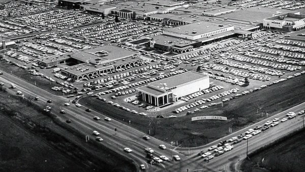
So this is the big story of the New Urbanists -- to acknowledge that there are only two ways that have been tested by the thousands to build communities, in the world and throughout history. One is the traditional neighborhood. You see here several neighborhoods of Newburyport, Massachusetts, which is defined as being compact and being diverse -- places to live, work, shop, recreate, get educated -- all within walking distance. And it's defined as being walkable. There are lots of small streets. Each one is comfortable to walk on. And we contrast that to the other way, an invention that happened after the Second World War, suburban sprawl, clearly not compact, clearly not diverse, and it's not walkable, because so few of the streets connect, that those streets that do connect become overburdened, and you wouldn't let your kid out on them. And I want to thank Alex Maclean, the aerial photographer, for many of these beautiful pictures that I'm showing you today.
Então essa é a grande questão dos Novos Urbanistas, reconhecer que só duas entre milhares de formas de construir comunidades foram testadas no mundo e através da história. Uma são os bairros tradicionais. Aqui você vê diversos bairros de Newburyport, em Massachusetts, caracterizados por serem compactos e diversificados, lugares para viver, trabalhar, comprar, se divertir, estudar, tudo a uma caminhada de distância. Esta forma é definida por ser caminhável. Há muitas ruazinhas, todas elas confortáveis para caminhar. E contrasta com a outra forma, uma invenção que surgiu depois da Segunda Guerra Mundial, o alastramento urbano, claramente não compacto, não diversificado e não caminhável, porque tão poucas ruas se conectam, que aquelas que se conectam ficam superlotadas, e você não deixaria suas crianças saírem nelas. Quero agradecer a Alex Maclean, o fotógrafo aéreo, por muitas dessas lindas fotos que estou apresentando.
So it's fun to break sprawl down into its constituent parts. It's so easy to understand, the places where you only live, the places where you only work, the places where you only shop, and our super-sized public institutions. Schools get bigger and bigger, and therefore, further and further from each other. And the ratio of the size of the parking lot to the size of the school tells you all you need to know, which is that no child has ever walked to this school, no child will ever walk to this school. The seniors and juniors are driving the freshmen and the sophomores, and of course we have the crash statistics to prove it.
É divertido separar esse alastramento em suas diferentes partes. É fácil de entender: os lugares onde só se mora, os lugares onde só se trabalha, os lugares onde só se compra, e nossas instituições públicas enormes. As escolas ficam cada vez maiores e cada vez mais distantes umas das outras. E a proporção entre o tamanho do estacionamento da escola e o tamanho da escola diz tudo o que precisamos saber: nenhuma criança já veio nem virá caminhando para esta escola. Os alunos do ensino médio dão carona aos alunos do fundamental, e as estatísticas de acidentes comprovam isso.
And then the super-sizing of our other civic institutions like playing fields -- it's wonderful that Westin in the Ft. Lauderdale area has eight soccer fields and eight baseball diamonds and 20 tennis courts, but look at the road that takes you to that location, and would you let your child bike on it? And this is why we have the soccer mom now. When I was young, I had one soccer field, one baseball diamond and one tennis court, but I could walk to it, because it was in my neighborhood.
E o tamanho enorme das outras instituições cívicas, como os parques... É maravilhoso que o parque Westin na área de Fort Lauderdale tenha 8 quadras de futebol, 8 de beisebol e 20 de tênis, mas veja a estrada que leva até lá. Você deixaria seu filho ir de bicicleta? Por isso temos as mães do futebol, agora. Quando eu era jovem, eu tinha uma quadra de futebol, uma de beisebol e uma de tênis, mas eu caminhava até lá, porque ficavam no meu bairro.
Then the final part of sprawl that everyone forgot to count: if you're going to separate everything from everything else and reconnect it only with automotive infrastructure, then this is what your landscape begins to look like. The main message here is: if you want to have a walkable city, you can't start with the sprawl model. you need the bones of an urban model. This is the outcome of that form of design, as is this. And this is something that a lot of Americans want. But we have to understand it's a two-part American dream. If you're dreaming for this, you're also going to be dreaming of this, often to absurd extremes, when we build our landscape to accommodate cars first. And the experience of being in these places --
E a parte final do alastramento, da qual todos se esquecem: se você separar tudo de tudo e reconectar tudo só com infraestrutura automotiva, sua paisagem começa a se parecer com isto. A principal mensagem aqui é: se queremos uma cidade caminhável, não podemos começar com o modelo de alastramento, precisamos da estrutura de um modelo urbano. Isto é o resultado desse tipo de projeto, assim como isto. E isto é algo que muitos americanos querem, mas temos que entender que é um sonho de dois lados. Se você sonha com isto, também está sonhando com isto, geralmente chegando a absurdos extremos, quando projetamos a paisagem para acomodar primeiro os carros. E a experiência de estar nesses lugares... (Risos)
(Laughter)
Esta foto não foi editada.
This is not Photoshopped. Walter Kulash took this slide. It's in Panama City. This is a real place. And being a driver can be a bit of a nuisance, and being a pedestrian can be a bit of a nuisance in these places. This is a slide that epidemiologists have been showing for some time now,
Walter Kulash tirou esta foto. Isso fica na cidade do Panamá. É um lugar real. Ser um motorista pode ser um pouco enlouquecedor, e ser um pedestre pode ser um pouco enlouquecedor nesses lugares. Esta é uma foto que os epidemiologistas têm mostrado há algum tempo...
(Laughter)
(Risos)
The fact that we have a society where you drive to the parking lot to take the escalator to the treadmill shows that we're doing something wrong. But we know how to do it better.
O fato de termos uma sociedade na qual você dirige até um estacionamento e pega uma escada rolante até a esteira, mostra que estamos fazendo algo errado. Mas sabemos como melhorar isso. Estes são os dois modelos em contraste.
Here are the two models contrasted. I show this slide, which has been a formative document of the New Urbanism now for almost 30 years, to show that sprawl and the traditional neighborhood contain the same things. It's just how big are they, how close are they to each other, how are they interspersed together and do you have a street network, rather than a cul-de-sac or a collector system of streets?
Eu mostro esta foto, que tem sido um documento formativo do Novo Urbanismo, por quase 30 anos, para mostrar que o alastramento e o bairro tradicional têm as mesmas coisas. A questão é só o tamanho, a proximidade entre elas, como elas se intercalam, e se há uma rede de ruas em vez de ruas sem saída e um sistema de vias coletoras.
So when we look at a downtown area, at a place that has a hope of being walkable, and mostly that's our downtowns in America's cities and towns and villages, we look at them and say we want the proper balance of uses. So what is missing or underrepresented? And again, in the typical American cities in which most Americans live, it is housing that is lacking. The jobs-to-housing balance is off. And you find that when you bring housing back, these other things start to come back too, and housing is usually first among those things. And, of course, the thing that shows up last and eventually is the schools, because the people have to move in, the young pioneers have to move in, get older, have kids and fight, and then the schools get pretty good eventually.
Então quando olhamos uma área central, um lugar que espera-se que seja caminhável, e é assim na maioria das cidades norte-americanas, grandes e pequenas, olhamos para elas e queremos o equilíbrio apropriado de usos. Então o que está faltando ou está mal representado? E nas típicas cidades norte-americanas, onde mora a maioria dos norte-americanos, há escassez de habitação. Não há equilíbrio entre empregos e habitação. E quando se traz à tona a questão da habitação, essas outras coisas vêm junto também, e a habitação, normalmente, vem em primeiro lugar. E, é claro, o que aparece por último são as escolas, pois as pessoas precisam instalar-se, os desbravadores precisam instalar-se, ficar mais velhos, ter filhos e batalhar, e então finalmente as escolas ficam boas.
The other part of this part, the useful city part, is transit, and you can have a perfectly walkable neighborhood without it. But perfectly walkable cities require transit, because if you don't have access to the whole city as a pedestrian, then you get a car, and if you get a car, the city begins to reshape itself around your needs, and the streets get wider and the parking lots get bigger and you no longer have a walkable city. So transit is essential. But every transit experience, every transit trip, begins or ends as a walk, and so we have to remember to build walkability around our transit stations.
Outro aspecto disso, a parte útil da cidade, é o transporte, e pode-se ter um bairro perfeitamente caminhável sem ele. Mas cidades perfeitamente caminháveis precisam de transporte, porque se você, como pedestre, não tiver acesso a toda a cidade, vai pegar o carro; e se pegar o carro, a cidade se remodela em função das suas necessidades: as ruas ficam mais largas, os estacionamentos ficam maiores, e não há mais uma cidade caminhável, então o transporte é essencial. Mas todo transporte, todo deslocamento, começa ou termina como uma caminhada, então é preciso pensar a caminhabilidade ao redor dos terminais de transporte.
Next category, the biggest one, is the safe walk. It's what most walkability experts talk about. It is essential, but alone not enough to get people to walk. And there are so many moving parts that add up to a walkable city.
A próxima categoria, e a maior delas, é a caminhada segura. A maioria dos especialistas em caminhada fala sobre isso. Ela é essencial, mas sozinha não garante que as pessoas caminhem. São muitas coisas que se somam para termos a uma cidade caminhável.
The first is block size. This is Portland, Oregon, famously 200-foot blocks, famously walkable. This is Salt Lake City, famously 600-foot blocks, famously unwalkable. If you look at the two, it's almost like two different planets, but these places were both built by humans and in fact, the story is that when you have a 200-foot block city, you can have a two-lane city, or a two-to-four lane city, and a 600-foot block city is a six-lane city, and that's a problem. These are the crash statistics. When you double the block size -- this was a study of 24 California cities -- when you double the block size, you almost quadruple the number of fatal accidents on non-highway streets.
A primeira é o tamanho das quadras. Esta é Portland, no Oregon: com famosas quadras de 60 m, reconhecidamente caminhável. Esta é Salt Lake City, com famosas quadras de 180 m, reconhecidamente não caminhável. Se olharmos as duas, são quase dois planetas diferentes, mas as duas foram construídas por humanos; o fato é que, em uma cidade com quadras de 60 m, as ruas podem ter duas pistas, ou de duas a quatro pistas; uma cidade com quadras de 180 m, tem seis pistas, e isso é um problema. Estas são as estatísticas de acidentes em estudo feito em 24 cidades da Califórnia: ao dobrar o tamanho das quadras, o número de acidentes fatais quase quadruplica nas ruas da cidade.
So how many lanes do we have? This is where I'm going to tell you what I tell every audience I meet, which is to remind you about induced demand. Induced demand applies both to highways and to city streets. And induced demand tells us that when we widen the streets to accept the congestion that we're anticipating, or the additional trips that we're anticipating in congested systems, it is principally that congestion that is constraining demand, and so that the widening comes, and there are all of these latent trips that are ready to happen. People move further from work and make other choices about when they commute, and those lanes fill up very quickly with traffic, so we widen the street again, and they fill up again. And we've learned that in congested systems, we cannot satisfy the automobile.
Então quantas pistas temos? Vou dizer a vocês o que digo a todas as plateias: vou relembrá-los da demanda induzida. A demanda induzida se aplica tanto a autoestradas quanto a ruas da cidade. A demanda induzida nos diz que, quando alargamos as ruas para comportar o congestionamento que estamos antecipando, ou as viagens adicionais que estamos antecipando em sistemas congestionados, é principalmente esse congestionamento que está limitando a demanda; então alargam-se as ruas, e todas essas viagens latentes podem ocorrer. As pessoas se deslocam mais até o trabalho, mudam os horários de deslocamento, e rapidamente essas pistas se enchem com o tráfego, então são alargadas de novo e se enchem de novo. E aprendemos que, em sistemas congestionados, não podemos satisfazer o automóvel.
This is from Newsweek Magazine -- hardly an esoteric publication: "Today's engineers acknowledge that building new roads usually makes traffic worse." My response to reading this was, may I please meet some of these engineers, because these are not the ones that I -- there are great exceptions that I'm working with now -- but these are not the engineers one typically meets working in a city, where they say, "Oh, that road is too crowded, we need to add a lane." So you add a lane, and the traffic comes, and they say, "See, I told you we needed that lane." This applies both to highways and to city streets if they're congested.
Isto saiu na revista Newsweek, que não é uma publicação esotérica: "Os engenheiros de hoje reconhecem que construir novas ruas, em geral, piora o trânsito". Minha reação ao ler isso, foi querer conhecer alguns desses engenheiros, pois esses não são os que usualmente... há exceções, como alguns com quem estou trabalhando, mas os engenheiros que costumam trabalhar nas cidades, dizem: "Esta via está lotada, vamos construir mais uma pista". Constroem mais uma pista, o tráfego vem, e eles dizem: "Eu disse que precisava de mais uma pista". Isso se aplica tanto a vias rápidas quanto a ruas congestionadas.
But the amazing thing about most American cities that I work in, the more typical cities, is that they have a lot of streets that are actually oversized for the congestion they're currently experiencing. This was the case in Oklahoma City, when the mayor came running to me, very upset, because they were named in Prevention Magazine the worst city for pedestrians in the entire country. Now that can't possibly be true, but it certainly is enough to make a mayor do something about it. We did a walkability study, and what we found, looking at the car counts on the street -- these are 3,000-, 4,000-, 7,000-car counts and we know that two lanes can handle 10,000 cars per day. Look at these numbers -- they're all near or under 10,000 cars, and these were the streets that were designated in the new downtown plan to be four lanes to six lanes wide. So you had a fundamental disconnect between the number of lanes and the number of cars that wanted to use them.
Mas o mais interessante, na maioria das cidades em que trabalhei, as cidades mais típicas têm muitas ruas muito maiores que seu congestionamento atual. Foi o caso de Oklahoma, quando o prefeito veio falar comigo muito chateado porque ela foi declarada pela revista Prevention como a pior cidade para pedestres em todo o país. Isso não deve ser verdade, mas certamente é o suficiente para um prefeito fazer algo a respeito. Fizemos um estudo de caminhabilidade e descobrimos que a quantidade de carros nas ruas, era de até 3, 4 e 7 mil carros, e sabemos que duas pistas dão conta de 10 mil carros por dia. Vejam estes números, todos próximos ou abaixo de 10 mil carros, e estas eram as ruas projetadas, no novo plano do centro da cidade, para ter de quatro a seis pistas. Então havia uma desconexão entre o número de pistas e o número de carros que iriam usá-las.
So it was my job to redesign every street in the downtown from curb face to curb face, and we did it for 50 blocks of streets, and we're rebuilding it now. So a typical oversized street to nowhere is being narrowed, and now under construction, and the project is half done. The typical street like this, you know, when you do that, you find room for medians. You find room for bike lanes. We've doubled the amount of on-street parking. We've added a full bike network where one didn't exist before.
Então minha tarefa era reprojetar cada rua no centro da cidade de um meio-fio a outro; fizemos isso para 50 quadras e estamos reconstruindo-as agora. Assim, uma rua que não vai a lugar nenhum, tipicamente superdimensionada, está sendo estreitada; e o projeto está na metade. Ao fazer isso numa rua típica como esta, surge espaço para canteiros. Surge espaço para ciclofaixas. Dobramos a quantidade de vagas de estacionamento na rua. Adicionamos uma rede completa de ciclovias que não havia antes.
But not everyone has the money that Oklahoma City has, because they have an extraction economy that's doing quite well. The typical city is more like Cedar Rapids, where they have an all four-lane system, half one-way system. And it's a little hard to see, but what we've done -- what we're doing; it's in process right now, it's in engineering right now -- is turning an all four-lane system, half one-way into an all two-lane system, all two-way, and in so doing, we're adding 70 percent more on-street parking, which the merchants love, and it protects the sidewalk. That parking makes the sidewalk safe, and we're adding a much more robust bicycle network.
Mas nem todos têm o dinheiro que Oklahoma tem, pois sua economia extrativista está indo muito bem. Uma cidade típica se parece mais com Cedar Rapids, onde também há um sistema de quatro pistas de mão única. É um pouco difícil de ver, mas o que fizemos, ou o que estamos fazendo, pois está em construção no momento, é transformar o sistema de quatro pistas de mão única em um sistema de duas pistas de mão dupla, e com isso aumentar em 70% as vagas de estacionamento na rua, o que os comerciantes adoram, e protege a calçada; essas vagas tornam a calçada segura. E estamos adicionando uma rede de ciclovias mais robusta.
Then the lanes themselves. How wide are they? That's really important. The standards have changed such that, as Andrés Duany says, the typical road to a subdivision in America allows you to see the curvature of the Earth.
E as pistas propriamente ditas, qual é a largura delas? Isso é realmente importante. Os padrões mudaram tanto que, como diz Andrés Duany: uma estrada típica para uma subdivisão nos EUA permite que você veja a curvatura da Terra.
(Laughter)
(Risos)
This is a subdivision outside of Washington from the 1960s. Look very carefully at the width of the streets. This is a subdivision from the 1980s. 1960s, 1980s. The standards have changed to such a degree that my old neighborhood of South Beach, when it was time to fix the street that wasn't draining properly, they had to widen it and take away half our sidewalk, because the standards were wider. People go faster on wider streets. People know this. The engineers deny it, but the citizens know it, so that in Birmingham, Michigan, they fight for narrower streets. Portland, Oregon, famously walkable, instituted its "Skinny Streets" program in its residential neighborhood. We know that skinny streets are safer. The developer Vince Graham, in his project I'On, which we worked on in South Carolina, he goes to conferences and he shows his amazing 22-foot roads. These are two-way roads, very narrow rights of way, and he shows this well-known philosopher, who said, "Broad is the road that leads to destruction ... narrow is the road that leads to life."
Esta é uma subdivisão da década de 60, fora de Washington. Vejam com atenção a largura das ruas. Esta é uma subdivisão da década de 80. Década de 60 e de 80. Os padrões mudaram tanto que em meu antigo bairro, South Beach, quando foi preciso consertar a rua que não estava drenando adequadamente, tiveram que alargá-la e retirar metade da calçada, pois os padrões eram mais largos. As pessoas andam mais rápido em ruas mais largas. As pessoas sabem disso. Os engenheiros negam, mas os cidadãos sabem disso, por isso em Birmingham, no Michigan, eles lutam por ruas mais estreitas. Portland, no Oregon, sabidamente caminhável, instituiu o programa "Ruas estreitas" nos bairros residenciais. Sabemos que ruas mais estreitas são mais seguras. O desenvolvedor Vince Graham, em seu projeto I'On, no qual trabalhamos na Carolina do Sul, vai a conferências e mostra suas maravilhosas ruas de 6 metros. São ruas de mão dupla muito estreitas, e ele cita um conhecido filósofo, que disse: "Larga é a estrada que leva à destruição... estreita é a estrada que leva à vida".
(Laughter)
(Risos)
(Applause)
(Aplausos)
This plays very well in the South.
Isso funciona muito bem no sul.
Now: bicycles. Bicycles and bicycling are the current revolution underway in only some American cities. But where you build it, they come. As a planner, I hate to say that, but the one thing I can say is that bicycle population is a function of bicycle infrastructure. I asked my friend Tom Brennan from Nelson\Nygaard in Portland to send me some pictures of the Portland bike commute. He sent me this. I said, "Was that bike to work day?" He said, "No, that was Tuesday." When you do what Portland did and spend money on bicycle infrastructure -- New York City has doubled the number of bikers in it several times now by painting these bright green lanes. Even automotive cities like Long Beach, California: vast uptick in the number of bikers based on the infrastructure. And of course, what really does it, if you know 15th Street here in Washington, DC -- please meet Rahm Emanuel's new bike lanes in Chicago, the buffered lane, the parallel parking pulled off the curb, the bikes between the parked cars and the curb -- these mint cyclists. If, however, as in Pasadena, every lane is a bike lane, then no lane is a bike lane. And this is the only bicyclist that I met in Pasadena, so ...
Agora, bicicletas. As bicicletas são uma revolução em andamento em apenas algumas cidades norte-americanas. Mas se você construir, elas vêm. Como planejador, odeio dizer isso, mas só posso dizer que a quantidade de bicicletas se dá em função da infraestrutura para bicicletas. Pedi ao meu amigo Tom Brennan da Nelson\Nygaard em Portland algumas fotos do tráfego de bicicletas em Portland e recebi isto. Perguntei: "Era dia de ir de bicicleta ao trabalho?" Ele disse: "Não, era terça-feira". Quando você faz o que Portland fez e investe dinheiro em infraestrutura para bicicletas... Nova Iorque agora aumentou várias vezes o número de ciclistas pintando estas faixas verdes brilhantes. Mesmo cidades automotivas, como Long Beach na California: teve enorme aumento no número de ciclistas baseado na infraestrutura. E, claro, o que realmente dá certo, se vocês conhecem a rua 15 em Washington, DC... por favor conheçam as novas ciclovias de Rahm Emanuel em Chicago: as ciclovias protegidas, o estacionamento junto ao meio-fio, as bicicletas entre os carros estacionados e o meio-fio... os ciclistas impecáveis. Entretanto, se for como em Pasadena, em que toda pista é para bicicletas, então nenhuma pista é para bicicletas. E este é o único ciclista que encontrei em Pasadena, então...
(Laughter)
(Risos)
The parallel parking I mentioned -- it's an essential barrier of steel that protects the curb and pedestrians from moving vehicles. This is Ft. Lauderdale; one side of the street, you can park, the other side of the street, you can't. This is happy hour on the parking side. This is sad hour on the other side. And then the trees themselves slow cars down. They move slower when trees are next to the road, and, of course, sometimes they slow down very quickly. All the little details -- the curb return radius. Is it one foot or is it 40 feet? How swoopy is that curb to determine how fast the car goes and how much room you have to cross. And then I love this, because this is objective journalism. "Some say the entrance to CityCenter is not inviting to pedestrians." When every aspect of the landscape is swoopy, is aerodynamic, is stream-form geometrics, it says: "This is a vehicular place." So no one detail, no one speciality, can be allowed to set the stage. And here, you know, this street: yes, it will drain within a minute of the hundred-year storm, but this poor woman has to mount the curb every day.
O estacionamento paralelo que mencionei, é uma barreira de aço essencial que protege o meio-fio e os pedestres dos veículos em movimento. Esta é Fort Lauderdale; de um lado da rua pode-se estacionar, do outro não. Aqui, uma "happy hour" no lado com estacionamento. E aqui uma "sad hour", ou hora triste, do outro lado. E as próprias árvores reduzem a velocidade dos carros. Eles andam mais devagar, quando as árvores estão próximas à rua, e, claro, às vezes eles reduzem bruscamente. Cada pequeno detalhe... a área para conversão. É de 30 cm ou de 12 metros? A curvatura do meio-fio determina a velocidade dos carros e a distância que deve ser percorrida. E isso, que eu amo, pois é jornalismo objetivo: "Dizem que a entrada para o CityCenter não é convidativa para pedestres". Quando todos os aspectos do entorno são curvos, aerodinâmicos, e de formas fluidas, ele diz: "Este é um lugar para veículos". Nenhum detalhe, nenhuma especialidade é permitida no cenário. Vejam esta rua: sim, ela estará drenada um minuto depois da tormenta do século, mas esta pobre mulher precisa subir o meio-fio todos os dias.
So then quickly, the comfortable walk has to do with the fact that all animals seek, simultaneously, prospect and refuge. We want to be able to see our predators, but we also want to feel that our flanks are covered. And so we're drawn to places that have good edges, and if you don't supply the edges, people won't want to be there. What's the proper ratio of height to width? Is it one to one? Three to one? If you get beyond one to six, you're not very comfortable anymore. You don't feel enclosed. Now, six to one in Salzburg can be perfectly delightful. The opposite of Salzburg is Houston. The point being the parking lot is the principal problem here. However, missing teeth, those empty lots can be issues as well, and if you have a missing corner because of an outdated zoning code, then you could have a missing nose in your neighborhood. That's what we had in my neighborhood. This was the zoning code that said I couldn't build on that site. As you may know, Washington, DC is now changing its zoning to allow sites like this to become sites like this. We needed a lot of variances to do that. Triangular houses can be interesting to build, but if you get one built, people generally like it. So you've got to fill those missing noses.
Rapidamente: a caminhada confortável tem a ver com o fato de todos os animais buscarem, simultaneamente, perspectiva e refúgio. Queremos poder ver nossos predadores, mas também queremos sentir nosso flanco protegido. Assim somos levados a lugares com bordas, e se não fornecermos bordas, as pessoas não vão querer estar ali. Qual é a proporção ideal entre altura e largura? É um para um? Três para um? Se você for além de um para seis, você deixará de sentir-se confortável. Você não se sentirá protegido. Seis para um em Salzburg pode ser perfeitamente agradável. O oposto de Salzburg é Houston. O principal problema aqui é este lugar ser um estacionamento. No entanto, essas vagas vazias podem ser um problema também, e se faltar uma esquina, por causa de um plano diretor desatualizado, é como se faltasse um nariz em seu bairro. É isso que tínhamos no meu bairro. Este era o plano diretor que dizia que não se podia construir naquele local. Como você talvez saiba, Washington DC está mudando seu plano diretor para permitir que lugares como este se tornem lugares como este. Foram necessárias muitas mudanças para isso. Casas triangulares podem ser interessantes, se você constrói uma, as pessoas costumam gostar. Então precisamos preencher esses espaços.
And then, finally, the interesting walk: signs of humanity. We are among the social primates. Nothing interests us more than other people. We want signs of people. So the perfect one-to-one ratio, it's a great thing. This is Grand Rapids, a very walkable city, but nobody walks on this street that connects the two best hotels together, because if on the left, you have an exposed parking deck, and on the right, you have a conference facility that was apparently designed in admiration for that parking deck, then you don't attract that many people. Mayor Joe Riley, in his 10th term, Mayor of Charleston, South Carolina, taught us it only takes 25 feet of building to hide 250 feet of garage. This one I call the Chia Pet Garage. It's in South Beach. That active ground floor.
E, finalmente, a caminhada interessante: sinais de humanidade. Estamos entre primatas sociais. Nada nos interessa mais do que outras pessoas. Queremos sinais de pessoas. Então a proporção perfeita de um para um é muito boa. Esta é Grand Rapids, uma cidade muito caminhável, mas ninguém caminha nesta rua que conecta seus dois melhores hotéis. Se à esquerda você tem um edifício-garagem, e à direita você tem um prédio para convenções que aparentemente foi projetado para apreciar o edifício-garagem, você não atrai muita gente. O prefeito Joe Riley, no seu décimo mandato em Charleston, Carolina do Sul, nos ensinou que precisamos de apenas 7,5 m construídos para esconder 76 m de garagem. Esta fica em South Beach e chamo de garagem "cabeça de grama". Um andar térreo ativo.
I want to end with this project that I love to show. It's by Meleca Architects. It's in Columbus, Ohio. To the left is the convention center neighborhood, full of pedestrians. To the right is the Short North neighborhood -- ethnic, great restaurants, great shops, struggling. It wasn't doing very well because this was the bridge, and no one was walking from the convention center into that neighborhood. Well, when they rebuilt the highway, they added an extra 80 feet to the bridge. Sorry -- they rebuilt the bridge over the highway. The city paid 1.9 million dollars, they gave the site to a developer, the developer built this and now the Short North has come back to life. And everyone says, the newspapers, not the planning magazines, the newspapers say it's because of that bridge.
Quero terminar mostrando um projeto que adoro. Ele é de Meleca Architects. Fica em Columbus, Ohio. À esquerda, a vizinhança do centro de convenções, cheia de pedestres. À direita, o bairro Short North: étnico, ótimos restaurantes e lojas, tentando sobreviver. Ele não ia muito bem, pois esta era a ponte, e ninguém caminhava do centro de convenções para o bairro. Bem, quando reconstruíram a autoestrada, adicionaram 24 m à ponte. Desculpem. Reconstruíram a ponte sobre a autoestrada. A cidade pagou US$ 1,9 milhão, entregou o local a um desenvolvedor que construiu isto, e agora Short North retornou à vida. E todos dizem, os jornais, não as revistas de planejamento, os jornais dizem que é por causa daquela ponte.
So that's it. That's the general theory of walkability. Think about your own cities. Think about how you can apply it. You've got to do all four things at once. So find those places where you have most of them and fix what you can, fix what still needs fixing in those places.
Então essa é a teoria geral da caminhabilidade. Pense em sua própria cidade. Pense sobre como pode aplicar isso. Você precisa das quatro coisas de uma vez. Então encontre locais que tenham a maioria delas e conserte o que você puder, conserte o que ainda precisa de conserto nesses lugares.
I really appreciate your attention, and thank you for coming today.
Eu realmente aprecio sua atenção e agradeço por estarem aqui hoje.
(Applause)
(Aplausos)