So I'm here to talk to you about the walkable city. What is the walkable city? Well, for want of a better definition, it's a city in which the car is an optional instrument of freedom, rather than a prosthetic device. And I'd like to talk about why we need the walkable city, and I'd like to talk about how to do the walkable city.
저는 오늘 '걷기 좋은 도시'에 대해 이야기 하려고 합니다. '걷기 좋은 도시'란 무엇일까요? 좀 더 정의를 내려보자면 도시를 자유로이 다니기 위해 자동차를 선택하기보다 의족을 선택하는 도시입니다. 그리고 저는 그러한 도시가 왜 필요한지 말하고 싶습니다. 그리고 어떻게 그런 도시를 만들 수 있는지도요.
Most of the talks I give these days are about why we need it, but you guys are smart. And also I gave that talk exactly a month ago, and you can see it at TED.com. So today I want to talk about how to do it. In a lot of time thinking about this, I've come up with what I call the general theory of walkability. A bit of a pretentious term, it's a little tongue-in-cheek, but it's something I've thought about for a long time, and I'd like to share what I think I've figured out.
요즘 제가 하는 대부분의 강연은 이 도시의 필요성에 관한 것입니다. 하지만 여러분들은 똑똑하시죠. 그리고 저는 정확히 한달 전에 필요성에 대한 강연을 했습니다. TED.com에서 그 강연 내용을 볼 수 있습니다. 그래서 오늘은 그 방법에 대해 이야기하려고 합니다. 오랫동안 이것을 생각하면서 저는 '보행 편의성의 일반 이론' 이라는 것을 생각해냈습니다. 조금은 잘난척하는 용어죠. 약간은 장난스럽기도 하고요. 하지만 그 이론은 제가 오랫동안 생각해오던 이론입니다. 오늘 그에 대한 제 생각을 말씀드리고 싶습니다.
In the American city, the typical American city -- the typical American city is not Washington, DC, or New York, or San Francisco; it's Grand Rapids or Cedar Rapids or Memphis -- in the typical American city in which most people own cars and the temptation is to drive them all the time, if you're going to get them to walk, then you have to offer a walk that's as good as a drive or better. What does that mean? It means you need to offer four things simultaneously: there needs to be a proper reason to walk, the walk has to be safe and feel safe, the walk has to be comfortable and the walk has to be interesting. You need to do all four of these things simultaneously, and that's the structure of my talk today, to take you through each of those.
미국의 도시, 즉 정말 전형적인 미국의 도시는- 전형적인 미국의 도시는 워싱턴 DC나 뉴욕이나, 샌프란시스코가 아닙니다. 그런 도시들은 그랜드 래피즈나 시더 래피즈, 멤피스 같은 곳이죠. 대부분의 사람들이 차를 갖고 있는 이런 곳이 전형적인 미국의 도시죠. 그리고 언제나 운전을 하고 싶게 만들기도 하고요. 사람들을 걷게 하려면 걷는 것이 운전만큼이나 즐겁다는 걸 알게 해줘야 합니다. 그건 무슨 의미일까요? 그건 네 가지가 동시에 만족되어야 한다는 것입니다. 걷는 것에 적당한 이유가 있어야 하고 걷는 것이 안전해야 하고, 또 안전하게 느껴져야 합니다. 또한 편안해야 하고요. 걷는 것이 즐거워야 합니다. 이 네 가지가 동시에 충족되어야 하죠. 이것이 오늘 제 강연의 내용입니다. 여러분들께 하나씩 설명드리죠.
The reason to walk is a story I learned from my mentors, Andrés Duany and Elizabeth Plater-Zyberk, the founders of the New Urbanism movement. And I should say half the slides and half of my talk today I learned from them. It's the story of planning, the story of the formation of the planning profession. When in the 19th century people were choking from the soot of the dark, satanic mills, the planners said, hey, let's move the housing away from the mills. And lifespans increased immediately, dramatically, and we like to say the planners have been trying to repeat that experience ever since.
왜 걸어야 하는지에 대해 제 멘토에게 배운 이야기가 있습니다. 그 분들은 Andrés Duany 와 Elizabeth Plater-Zyberk 입니다. 보행자 중심 도시화 운동의 선구자들이죠. 오늘 강연의 절반은 그분들 이야기이고 나머지 반이 제 이야기입니다. 그들로부터 배웠거든요. 바로 계획에 관한 것입니다. 도시계획 전문직의 구성에 관한 이야기죠. 19세기 즈음에 사람들은 어둡고 음습한 공장의 그을음에 숨막혀 하고 있었습니다. 도시 계획가들은 집들을 공장에서 먼 곳으로 옮기자고 주장했죠. 그러자 즉시 사람들의 수명이 비약적으로 증가하였습니다. 거기에 덧 붙여서 그 후로 도시 계획가들은 그러한 경험을 계속 반복하려고 하고 있습니다.
So there's the onset of what we call Euclidean zoning, the separation of the landscape into large areas of single use. And typically when I arrive in a city to do a plan, a plan like this already awaits me on the property that I'm looking at. And all a plan like this guarantees is that you will not have a walkable city, because nothing is located near anything else. The alternative, of course, is our most walkable city, and I like to say, you know, this is a Rothko, and this is a Seurat. It's just a different way -- he was the pointilist -- it's a different way of making places. And even this map of Manhattan is a bit misleading because the red color is uses that are mixed vertically.
그로부터 "유클리드 지역제"라는 도시를 목적에 따라 큰 구획으로 나누는 것이 시작되었습니다. 보통 제가 어느 도시의 도시 계획을 세울 때 대상 지역의 도시 계획이 이미 준비되어 있곤 합니다. 그런데 그런 계획으로는 걷기 좋은 도시를 만들 수 없죠. 왜냐하면 주위에 어떤 것도 가까이 있지 않기 때문입니다. 대안은, 물론, 우리가 원하는 걷기 좋은 도시를 만드는 것입니다. 말하자면 이건 로스코 방식이고요. (마크 로스코, 추상화가) 그리고 이건 쇠라의 방식입니다. (조르주 쇠라, 19세기 점묘화가) 방법이 다르죠. 그는 점묘화가였습니다. 지역을 구성하는 방법이 다르죠. 이 맨하탄의 지도는 조금 잘못 그려져 있습니다. 왜냐하면 붉은 색이 수직적으로 섞여서 사용되어 있기 때문이죠.
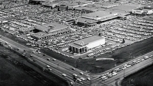
So this is the big story of the New Urbanists -- to acknowledge that there are only two ways that have been tested by the thousands to build communities, in the world and throughout history. One is the traditional neighborhood. You see here several neighborhoods of Newburyport, Massachusetts, which is defined as being compact and being diverse -- places to live, work, shop, recreate, get educated -- all within walking distance. And it's defined as being walkable. There are lots of small streets. Each one is comfortable to walk on. And we contrast that to the other way, an invention that happened after the Second World War, suburban sprawl, clearly not compact, clearly not diverse, and it's not walkable, because so few of the streets connect, that those streets that do connect become overburdened, and you wouldn't let your kid out on them. And I want to thank Alex Maclean, the aerial photographer, for many of these beautiful pictures that I'm showing you today.
오늘 이야기는 보행자 중심 도시계획가들의 이야기입니다. 오직 두 가지의 방법만 존재함을 깨닫게 된 것이죠. 이 방법들은 수천 년 동안 적용되어 전세계 인류 역사를 거쳐 우리 사회를 만들어 왔습니다. 하나는 전통적인 마을 방식입니다. 여기 보시면 여러 마을이 있습니다. 뉴베리포트나 매사추세츠죠. 집약적이고 다양함을 대표하는 도시입니다. 생활하고, 일하고, 쇼핑하고 놀고, 교육받는 장소들이 걸어 다닐 수 있는 거리에 위치하고 있습니다. 보행 편의적이라고 정의되죠. 작은 길들이 아주 많고 각각의 길은 걷기에 아주 편합니다. 다른 방식으로 그것을 조명해볼까요. 2차 세계대전이 끝난 뒤에 도시 외곽의 난개발이 일어났습니다. 집약적이지도 않고, 다양하지도 않으며 걸을 수 있을 만한 것도 아니었죠. 왜냐하면 연결된 길이 매우 적기 때문입니다. 그리고 그렇게 연결된 길들은 이용자들이 너무 많기 때문에 여러분 자녀들이 그 길에서 놀지 않도록 만들게 됩니다. 감사드릴 분이 있는데요. 항공사진가인 알렉스 매클린 입니다. 오늘 보여드리는 이 멋진 사진들을 찍어 주신 분입니다.
So it's fun to break sprawl down into its constituent parts. It's so easy to understand, the places where you only live, the places where you only work, the places where you only shop, and our super-sized public institutions. Schools get bigger and bigger, and therefore, further and further from each other. And the ratio of the size of the parking lot to the size of the school tells you all you need to know, which is that no child has ever walked to this school, no child will ever walk to this school. The seniors and juniors are driving the freshmen and the sophomores, and of course we have the crash statistics to prove it.
이러한 난개발 지역을 구성 단위로 나누어 보는 것도 재미있습니다. 이해하기에도 쉽죠. 여러분이 사는 곳, 일하는 곳. 여러분이 쇼핑만 하는 곳. 그리고 거대한 규모의 공공기관들. 학교도 점점 커지고 그 결과로 서로 점점 멀어지게 되죠. 그리고 주차장 면적이 학교 면적과 거의 같아졌습니다. 그리고 알아두셔야 할 것은 학교에 걸어서 등교하는 아이는 없다는 것입니다. 앞으로도 그런 아이는 없을 거예요. 고등학교 3학년과 4학년 아이들이 운전해서 1, 2학년을 데리고 오죠. 교통사고 통계를 보면 알 수 있습니다.
And then the super-sizing of our other civic institutions like playing fields -- it's wonderful that Westin in the Ft. Lauderdale area has eight soccer fields and eight baseball diamonds and 20 tennis courts, but look at the road that takes you to that location, and would you let your child bike on it? And this is why we have the soccer mom now. When I was young, I had one soccer field, one baseball diamond and one tennis court, but I could walk to it, because it was in my neighborhood.
한편으론 거대한 도시 시설물도 있죠. 운동장 같은 것이요. 포트 로더데일 시의 웨스틴 같은 곳은 대단합니다. 8개의 축구장과 8개의 야구장 20개의 테니스장이 있죠. 하지만 그곳으로 가는 도로를 보세요. 아이들이 자전거로 다니게 두시겠어요? 이런 것들이 아이들을 축구교실에 보내는 이유입니다. 제가 어릴 때는 축구장 하나와 야구장 하나, 테니스장 하나뿐이었죠. 하지만 그곳까지 걸어다녔습니다. 모두 마을 근처에 있었거든요.
Then the final part of sprawl that everyone forgot to count: if you're going to separate everything from everything else and reconnect it only with automotive infrastructure, then this is what your landscape begins to look like. The main message here is: if you want to have a walkable city, you can't start with the sprawl model. you need the bones of an urban model. This is the outcome of that form of design, as is this. And this is something that a lot of Americans want. But we have to understand it's a two-part American dream. If you're dreaming for this, you're also going to be dreaming of this, often to absurd extremes, when we build our landscape to accommodate cars first. And the experience of being in these places --
그리고 난개발의 마지막 부분은 숫자세기를 잊어버린다는 것입니다. 모든 것들을 서로 분리하고 자동차를 위한 기반시설로 다시 연결하면 여러분이 보게 될 풍경은 이러한 모습일 것입니다. 제가 얘기하려는 건 걷기 좋은 도시는 난개발상의 도시 모델에서는 출발할 수 없다는 것입니다. 도시 모델의 뼈대를 바꿔야하죠. 이것이 그러한 디자인의 결과입니다. 이것도 마찬가지죠. 이런 것들이 대부분의 미국인들이 원하는 것입니다. 하지만 우리는 아메리칸 드림의 두 가지 측면을 이해해야 합니다. 이런 것들을 꿈꾸는 반면에 이런 모습도 꿈꾸고 있죠. 정말 터무니없는 건 도시 계획을 세울 때, 자동차를 위한 공간을 먼저 생각하는 것입니다. 이런 곳에서 우리가 살고 있는 거예요. (웃음)
(Laughter)
포토샵으로 수정한 사진이 아닙니다.
This is not Photoshopped. Walter Kulash took this slide. It's in Panama City. This is a real place. And being a driver can be a bit of a nuisance, and being a pedestrian can be a bit of a nuisance in these places. This is a slide that epidemiologists have been showing for some time now,
월터 쿨라쉬가 찍은 사진입니다. 파나마시입니다. 진짜로 있는 곳이죠. 운전하는 것이 성가신 동네입니다. 보행자로서도 성가신 동네죠. 이런 곳은 그렇습니다. 이 사진은 얼마 전에 임상역학자들이 찍은 것입니다.
(Laughter)
(웃음)
The fact that we have a society where you drive to the parking lot to take the escalator to the treadmill shows that we're doing something wrong. But we know how to do it better.
우리 사회의 실상은 주자장까지 차를 타고 와서 러닝머신까지 에스컬레이터를 탑니다. 무엇인가 잘못된 모습이죠. 하지만 우리는 이걸 바꾸는 방법을 알고 있습니다.
Here are the two models contrasted. I show this slide, which has been a formative document of the New Urbanism now for almost 30 years, to show that sprawl and the traditional neighborhood contain the same things. It's just how big are they, how close are they to each other, how are they interspersed together and do you have a street network, rather than a cul-de-sac or a collector system of streets?
이와 대조되는 두 사례가 있습니다. 이 사진은 보행자 중심 도시 계획의 문서입니다. 약 30년 동안 도시 확장의 방식과 전통적인 마을 방식이 같은 것들을 포함하고 있죠. 규모를 볼 수 있죠. 그리고 얼마나 가까운지도요. 서로 어떻게 배치되는지와 길들이 막힌 골목 없이 연결되어 있죠. 집약된 거리 체계라고 할 수 있습니다.
So when we look at a downtown area, at a place that has a hope of being walkable, and mostly that's our downtowns in America's cities and towns and villages, we look at them and say we want the proper balance of uses. So what is missing or underrepresented? And again, in the typical American cities in which most Americans live, it is housing that is lacking. The jobs-to-housing balance is off. And you find that when you bring housing back, these other things start to come back too, and housing is usually first among those things. And, of course, the thing that shows up last and eventually is the schools, because the people have to move in, the young pioneers have to move in, get older, have kids and fight, and then the schools get pretty good eventually.
번화가 지역의 경우에는 걸을만한 장소라는 기대감을 갖게 되죠. 그런데 미국 도시와 마을의 번화가 대부분을 보면 우리는 이용상의 적절한 균형이 필요하다고 생각합니다. 무엇이 고려되지 않았을까요? 대부분의 미국인들이 살고 있는 전형적인 미국 도시들은 주택 공급이 부족합니다. 직장과 주택의 균형이 무너졌죠. 그리고 주택을 고려하자면 부수적으로 따라오는 것들이 있습니다. 일반적으로 주택을 먼저 고려하면 결국 마지막으로 고려할 것은 학교입니다. 왜냐하면 사람들이 이사를 오고 젊은 사람들이 이사를 와서 나이가 들면 아이를 갖게 되고 다투기도 하며 학교도 결국 좋아질 겁니다.
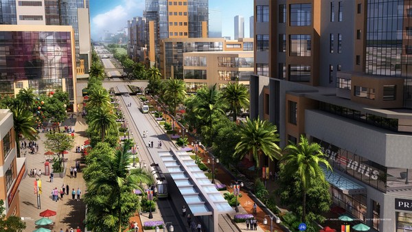
The other part of this part, the useful city part, is transit, and you can have a perfectly walkable neighborhood without it. But perfectly walkable cities require transit, because if you don't have access to the whole city as a pedestrian, then you get a car, and if you get a car, the city begins to reshape itself around your needs, and the streets get wider and the parking lots get bigger and you no longer have a walkable city. So transit is essential. But every transit experience, every transit trip, begins or ends as a walk, and so we have to remember to build walkability around our transit stations.
이 이야기의 또 다른 면은 도시의 유용한 부분인데요. 바로 대중교통입니다. 물론 이것이 없어도 근처를 걸어다닐 수는 있죠. 하지만 완벽한 걷기 좋은 도시는 대중교통이 필요합니다. 왜냐하면 도시의 모든 곳을 걸어서 접근할 수 없다면 차를 사야겠죠. 차를 사게 된다면 도시는 그 수요에 따라 재구성될 것입니다. 거리들은 넓어지고 주차장은 커지겠죠. 그러면 더이상 걷기 좋은 도시가 아니게 될 것입니다. 그래서 대중교통은 필수적입니다. 하지만 모든 대중교통을 통한 이동은 그 시작과 끝이 걷기입니다. 그러므로 대중교통 역 근처에는 보행 편의성이 보장되어야 합니다.
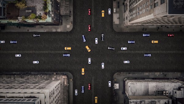
Next category, the biggest one, is the safe walk. It's what most walkability experts talk about. It is essential, but alone not enough to get people to walk. And there are so many moving parts that add up to a walkable city.
다음 항목은 가장 중요한 부분이죠. 바로 안전한 걷기입니다. 보행 편의성 전문가들 대부분이 주장하는 부분입니다. 필수적이지만 그것만으로는 사람들을 걷게 만들지 못하죠. 그것과 관련된 여러가지 부분들이 걷기 좋은 도시에 고려되어야 합니다.
The first is block size. This is Portland, Oregon, famously 200-foot blocks, famously walkable. This is Salt Lake City, famously 600-foot blocks, famously unwalkable. If you look at the two, it's almost like two different planets, but these places were both built by humans and in fact, the story is that when you have a 200-foot block city, you can have a two-lane city, or a two-to-four lane city, and a 600-foot block city is a six-lane city, and that's a problem. These are the crash statistics. When you double the block size -- this was a study of 24 California cities -- when you double the block size, you almost quadruple the number of fatal accidents on non-highway streets.
첫 번째는 도시 구획의 크기입니다. 이곳은 오레곤주의 포틀랜드시인데요. 약 60m로 구획이 나뉘어져 걷기 좋은 곳으로 유명하죠. 이곳은 솔트레이크시티입니다. 구획이 약 180m로 나뉘어져 걷기에 나쁜 것으로 악명높죠. 이 두 경우를 비교해보면 거의 다른 행성같지만 두 지역 모두 사람들이 지은 곳입니다. 그리고 사실, 여러분이 사는 도시가 60m로 구획이 나뉘어져 있다면 도로 차선은 2차선일 겁니다. 혹은 2에서 4차선일 수도 있고요. 그리고 도시 구획이 180m라면 6차선 도로일 겁니다. 그러면 문제가 있죠. 이건 교통사고 통계인데요. 구획 크기를 두 배로 늘리면 말이죠. 캘리포니아 24개 도시를 대상으로 한 조사결과인데요. 구획 크기를 두 배로 늘리면 치명적 교통사고 건수는 네 배로 증가합니다. 고속도로가 아님에도 말이죠.
So how many lanes do we have? This is where I'm going to tell you what I tell every audience I meet, which is to remind you about induced demand. Induced demand applies both to highways and to city streets. And induced demand tells us that when we widen the streets to accept the congestion that we're anticipating, or the additional trips that we're anticipating in congested systems, it is principally that congestion that is constraining demand, and so that the widening comes, and there are all of these latent trips that are ready to happen. People move further from work and make other choices about when they commute, and those lanes fill up very quickly with traffic, so we widen the street again, and they fill up again. And we've learned that in congested systems, we cannot satisfy the automobile.
그럼 몇 차선으로 해야 할까요? 바로 이 부분이 지금까지의 모든 청중과 여러분들께 하고 싶은 이야기입니다. 유발 통행을 생각하시면 됩니다. 유발 통행은 고속도로와 도시의 거리에 모두 적용됩니다. 유발통행이 미치는 영향은 우리가 도로의 폭을 넓혀서 예상되는 교통혼잡을 수용하고 추가 통행량을 받아들이도록 해도 통행이 밀집된 도로 시스템에서는 그 밀집도 때문에 통행이 제한된다는 것입니다. 즉, 도로의 폭을 넓히면 숨어 있던 통행량들이 기다렸다는 듯이 나타나는 거죠. 사람들은 더 먼 곳으로 출퇴근하고 통근 수단을 바꿀 수도 있습니다. 그러면 도로는 차량들로 빠르게 채워질 것입니다. 그래서 다시 도로를 넓히면 또 다시 차들로 채워지죠. 그러므로 혼잡한 도로 시스템에서는 차량들을 충분히 수용할 수 없음을 알게 되었습니다.
This is from Newsweek Magazine -- hardly an esoteric publication: "Today's engineers acknowledge that building new roads usually makes traffic worse." My response to reading this was, may I please meet some of these engineers, because these are not the ones that I -- there are great exceptions that I'm working with now -- but these are not the engineers one typically meets working in a city, where they say, "Oh, that road is too crowded, we need to add a lane." So you add a lane, and the traffic comes, and they say, "See, I told you we needed that lane." This applies both to highways and to city streets if they're congested.
뉴스위크지에 이런 기사가 실렸습니다. - 난해한 잡지죠. "기술자들이 이제야 깨달은 것은 새로운 도로를 건설하는 것이 오히려 교통상황을 더 나쁘게 한다는 점이다." 저는 이 기사를 읽고 이런 기술자들을 만나보고 싶다는 생각을 했습니다. 왜냐하면 지금까지 그런 기술자을 만난 적이 없거든요. 물론 예외도 있겠지만 제가 일했던 도시에서 만난 보통의 기술자들은 이런 말을 하지 않았습니다. "도로가 붐비네요. 새 도로를 만들어야겠어요." 그리고 차선을 추가하고 교통량이 증가하게 되죠. 그러면 또 이렇게 말하겠죠. "보셨죠? 새 차선이 필요했다구요." 이 이론은 밀집된 도시의 거리나 고속도로 모두 적용될 수 있습니다.
But the amazing thing about most American cities that I work in, the more typical cities, is that they have a lot of streets that are actually oversized for the congestion they're currently experiencing. This was the case in Oklahoma City, when the mayor came running to me, very upset, because they were named in Prevention Magazine the worst city for pedestrians in the entire country. Now that can't possibly be true, but it certainly is enough to make a mayor do something about it. We did a walkability study, and what we found, looking at the car counts on the street -- these are 3,000-, 4,000-, 7,000-car counts and we know that two lanes can handle 10,000 cars per day. Look at these numbers -- they're all near or under 10,000 cars, and these were the streets that were designated in the new downtown plan to be four lanes to six lanes wide. So you had a fundamental disconnect between the number of lanes and the number of cars that wanted to use them.
하지만 제가 연구하는 대부분 미국 도시들의 놀라운 점은 전형적인 도시일수록 과도하게 넓은 도로가 너무 많다는 것입니다. 현재 겪고 있는 교통혼잡 때문이죠. 이건 오클라호마시의 경우입니다. 어느 날 시장이 무척 화가 난 채로 저를 찾아 왔습니다. 왜냐하면 그 도시가 프리벤션지에서 선정한 전국에서 걸어다니기 가장 나쁜 도시로 선정되었기 때문이었죠. 사실이 아니었을지도 모르지만 시장이 뭔가 조치를 취하기에 충분한 동기가 되어 주었습니다. 우리는 보형 편의성을 조사했고 도로에 차들이 얼마나 많은지 세어봤습니다. 차들이 3,000대, 4,000대, 7,000대까지 있었어요. 그리고 2차선 도로로 하루에 1만 대의 차량을 감당할 수 있음을 알았습니다. 이 숫자들을 보세요. 10,000대에 가까운 수치입니다. 신도시 계획에 따라 설계된 도로를 살펴보면 4차선이나 6차선 정도의 폭이죠. 기본적으로 도로 차선과 통행하는 차들의 수치가 맞지 않았습니다.
So it was my job to redesign every street in the downtown from curb face to curb face, and we did it for 50 blocks of streets, and we're rebuilding it now. So a typical oversized street to nowhere is being narrowed, and now under construction, and the project is half done. The typical street like this, you know, when you do that, you find room for medians. You find room for bike lanes. We've doubled the amount of on-street parking. We've added a full bike network where one didn't exist before.
그래서 저는 시내의 모든 거리를 새롭게 구상해야 했습니다. 모든 연석들 하나하나를요. 50개의 구획을 대상으로 지금 다시 짓고 있습니다. 전형적인 큰 폭의 도로를 없애고 도로 폭을 좁혀서 다시 건설하고 있고 반쯤 완성되었습니다. 이와 같은 전형적인 도로에 사업이 완료된 이후에는 시민을 위한 공간이 생길 것입니다. 자전거를 위한 공간도 찾을 수 있죠. 우리는 도로변 주차 공간도 두 배로 늘렸습니다. 이전에는 없었던 완전한 자전거 도로망을 추가했죠.
But not everyone has the money that Oklahoma City has, because they have an extraction economy that's doing quite well. The typical city is more like Cedar Rapids, where they have an all four-lane system, half one-way system. And it's a little hard to see, but what we've done -- what we're doing; it's in process right now, it's in engineering right now -- is turning an all four-lane system, half one-way into an all two-lane system, all two-way, and in so doing, we're adding 70 percent more on-street parking, which the merchants love, and it protects the sidewalk. That parking makes the sidewalk safe, and we're adding a much more robust bicycle network.
하지만 모든 도시가 오클라호마시처럼 재원을 갖고 있지는 않습니다. 오클라호마시는 잘 돌아가는 수출산업이 있기 때문에 가능했죠. 전형적인 도시는 오히려 시더 래피즈시같은 곳입니다. 모든 차선이 4차선이고 반쯤은 편도인 도로 사정을 갖고 있죠. 다소 드문 경우지만 우리가 지금껏 해왔던대로 동일한 과정에 있습니다. 지금은 기술 검토를 진행하고 있죠. 도시의 모든 편도 4차선 도로를 양방향 통행의 2차선 도로로 바꾸고 있습니다. 이를 통해 노변 주차 공간을 70%나 증가시켰습니다. 상인들이 바랐던대로 말이죠. 그리고 인도를 보호할 수도 있습니다. 그러한 노변 주차공간이 인도를 보호하는 역할을 하죠. 그리고 거기에 탄탄한 자전거 교통망도 더하고 있습니다.
Then the lanes themselves. How wide are they? That's really important. The standards have changed such that, as Andrés Duany says, the typical road to a subdivision in America allows you to see the curvature of the Earth.
그렇다면 차선 그 자체는 얼마나 넓으면 될까요? 그건 정말 중요합니다. 앙드레 두아니가 말했듯이 기준은 이제 바뀌었습니다. 그는 미국의 구획에 따른 도로를 보면 지구의 곡률도 볼 수 있다고 말했죠. (웃음)
(Laughter)
이 사진은 1960년대의 워싱턴 외곽의 구획입니다.
This is a subdivision outside of Washington from the 1960s. Look very carefully at the width of the streets. This is a subdivision from the 1980s. 1960s, 1980s. The standards have changed to such a degree that my old neighborhood of South Beach, when it was time to fix the street that wasn't draining properly, they had to widen it and take away half our sidewalk, because the standards were wider. People go faster on wider streets. People know this. The engineers deny it, but the citizens know it, so that in Birmingham, Michigan, they fight for narrower streets. Portland, Oregon, famously walkable, instituted its "Skinny Streets" program in its residential neighborhood. We know that skinny streets are safer. The developer Vince Graham, in his project I'On, which we worked on in South Carolina, he goes to conferences and he shows his amazing 22-foot roads. These are two-way roads, very narrow rights of way, and he shows this well-known philosopher, who said, "Broad is the road that leads to destruction ... narrow is the road that leads to life."
도로 폭을 주의깊게 보세요. 이 사진은 1980년대의 구획입니다. 1960년대와 1980년대죠. 기준은 그 정도로 바뀌었습니다. 제 어린시절의 사우스비치에서는 배수가 잘 안되는 도로를 고쳐야 할 때가 오자 도로를 넓히고 인도를 반이나 없애버렸어요. 왜냐하면 기준이 더 넓어졌기 때문이었죠. 사람들은 넓은 도로에서 더 빨리 다닙니다. 사람들은 이걸 알고 있어요. 기술자는 부정하지만 사람들은 알고 있습니다. 그래서 미시건주 버밍엄시에서는 도로를 좁히는 데 노력하고 있습니다. 걷기 좋은 곳으로 유명한 오레곤주의 포틀랜드시는 지역사회 안에 "좁은 도로" 프로그램을 만들었습니다. 우리는 좁은 도로가 더 안전하다는 것을 압니다. 도시개발자인 빈스 그래햄은 사우스 캐롤라이나의 아이온(I'On) 신도시 개발 프로젝트를 하면서 학회에서 약 7m 너비의 도로에 대해 발표했습니다. 양방향 통행의 좁은 도로죠. 그리고 그는 저명한 철학자의 말을 빌어 이렇게 말했죠. "멸망으로 이끄는 길은 넓지만 "생명으로 이끄는 길은 좁다." (성경 마태복음 7장 13-14절)
(Laughter)
(웃음)
(Applause)
(박수)
This plays very well in the South.
이건 남부에서는 잘 먹혀들었습니다.
Now: bicycles. Bicycles and bicycling are the current revolution underway in only some American cities. But where you build it, they come. As a planner, I hate to say that, but the one thing I can say is that bicycle population is a function of bicycle infrastructure. I asked my friend Tom Brennan from Nelson\Nygaard in Portland to send me some pictures of the Portland bike commute. He sent me this. I said, "Was that bike to work day?" He said, "No, that was Tuesday." When you do what Portland did and spend money on bicycle infrastructure -- New York City has doubled the number of bikers in it several times now by painting these bright green lanes. Even automotive cities like Long Beach, California: vast uptick in the number of bikers based on the infrastructure. And of course, what really does it, if you know 15th Street here in Washington, DC -- please meet Rahm Emanuel's new bike lanes in Chicago, the buffered lane, the parallel parking pulled off the curb, the bikes between the parked cars and the curb -- these mint cyclists. If, however, as in Pasadena, every lane is a bike lane, then no lane is a bike lane. And this is the only bicyclist that I met in Pasadena, so ...
다음은, 자전거입니다. 지금 자전거와 자전거 타기는 혁명적 인기를 끌고 있습니다. 몇몇의 미국 도시에서는 그렇죠. 하지만 도로를 만들어야 탈 사람도 생기겠죠. 계획자로서, 정말 말하기 싫지만, 제가 말할 수 있는 한가지는 자전거를 타는 사람의 수는 기반시설과 정비례한다는 겁니다. 저는 포틀랜드의 넬슨 나이가드 출신인 제 친구 톰 브래넌에게 포틀랜드의 자전거 통근을 찍은 사진을 보내달라고 헀습니다. 저는 이 사진을 받고 물었죠. "자전거로 출근하기의 날이야?" 그는 이렇게 대답했습니다. "아니 그냥 화요일인데." 포틀랜드시만큼 자전거 기반시설에 노력하고 투자하면 이렇게 되겠죠. 뉴욕시가 자전거 이용자 수를 두 배나 늘릴 수 있었던 것은 이렇게 밝은 초록색 차선을 칠했기 때문입니다. 자동차의 도시였던 캘리포니아주 롱비치도 자전거 인프라를 통해서 자전거 이용자 수를 크게 늘렸습니다. 그리고 그 방법을 말씀드리면 워싱턴 DC의 15번가를 아시는지 모르겠습니다만 람 엠마누엘이 시카고에 기획한 자전거 도로를 한번 보시죠. 연석과 평행한 주차공간을 두고 완충 구간을 만든 차선입니다. 자전거는 주차된 차와 연석 사이를 달리게 됩니다. 자전거 타면서 좋아하는 거 보세요. 한편 패서디나에서는 모든 차선이 자전거 차선입니다. 자전거 전용도로가 없다는 뜻이죠. 그리고 이 사람이 제가 패서디나에서 만난 유일한 자전거 이용인입니다.
(Laughter)
(웃음)
The parallel parking I mentioned -- it's an essential barrier of steel that protects the curb and pedestrians from moving vehicles. This is Ft. Lauderdale; one side of the street, you can park, the other side of the street, you can't. This is happy hour on the parking side. This is sad hour on the other side. And then the trees themselves slow cars down. They move slower when trees are next to the road, and, of course, sometimes they slow down very quickly. All the little details -- the curb return radius. Is it one foot or is it 40 feet? How swoopy is that curb to determine how fast the car goes and how much room you have to cross. And then I love this, because this is objective journalism. "Some say the entrance to CityCenter is not inviting to pedestrians." When every aspect of the landscape is swoopy, is aerodynamic, is stream-form geometrics, it says: "This is a vehicular place." So no one detail, no one speciality, can be allowed to set the stage. And here, you know, this street: yes, it will drain within a minute of the hundred-year storm, but this poor woman has to mount the curb every day.
평행 주차공간을 말씀드렸는데요. 그건 필수적인 강철로 된 방패입니다. 인도와 보행자를 달리는 차로부터 보호하죠. 이곳은 포트 로더데일시입니다. 도로 한쪽은 주차할 수 있고, 다른 쪽은 주차할 수 없습니다. 주차 공간 쪽은 행복한 시간을 보내지만 반대 쪽에서는 우울한 시간이죠. 그리고 나무들이 자동차들의 속력을 줄이게 합니다. 도로 옆에 나무가 있을 때는 자동차는 천천히 달리죠. 물론 빠르게 속력을 줄일 때도 있습니다. 세세한 내용을 보자면, 인도의 곡률 반지름입니다. 30cm면 될까요? 12m여야 할까요? 도로의 곡선 반경이 얼마나 급한지와 횡단 폭이 얼마나 넓은지에 따라서 차들은 얼마나 빨리 갈지를 결정합니다. 이건 제가 좋아하는 기사인데요. 객관적으로 보도했기 때문입니다. "시청 입구의 도로는 보행자들을 배려하지 않는다고 말하는 사람도 있다." 도시 경관을 멋있게 한다는 것은 공기역학과 흐름의 기하학을 고려합니다. 그러면 자동차 친화적 환경이라고 할 수 있죠. 그러므로 어떠한 특별함이나 세부사항이 없어도 무대를 만들 수 있습니다. 그리고 이 거리를 보시면, 몇십년동안의 폭풍이 와도 물을 몇분안에 배출할 수 있을겁니다. 하지만 이 불쌍한 여성은 이 연석을 매일 등산해야하죠.
So then quickly, the comfortable walk has to do with the fact that all animals seek, simultaneously, prospect and refuge. We want to be able to see our predators, but we also want to feel that our flanks are covered. And so we're drawn to places that have good edges, and if you don't supply the edges, people won't want to be there. What's the proper ratio of height to width? Is it one to one? Three to one? If you get beyond one to six, you're not very comfortable anymore. You don't feel enclosed. Now, six to one in Salzburg can be perfectly delightful. The opposite of Salzburg is Houston. The point being the parking lot is the principal problem here. However, missing teeth, those empty lots can be issues as well, and if you have a missing corner because of an outdated zoning code, then you could have a missing nose in your neighborhood. That's what we had in my neighborhood. This was the zoning code that said I couldn't build on that site. As you may know, Washington, DC is now changing its zoning to allow sites like this to become sites like this. We needed a lot of variances to do that. Triangular houses can be interesting to build, but if you get one built, people generally like it. So you've got to fill those missing noses.
그러므로 빠르게 드는 생각은 편안한 걷기는 모든 동물들이 찾고 동시에 전망하고 도망갈 수 있는 사실에 기반합니다. 우리는 우리의 포식자들의 모습을 볼 수 있길 원합니다. 하지만 우리는 또한 보호되고 있다는 것을 느끼고 싶어합니다. 그래서 우리는 좋은 가장자리를 가진 곳을 꿈꿉니다. 그러한 가장자리가 없는 곳엔 사람들이 잘 가려하지 않죠. 높이와 너비의 가장 좋은 비율은 어느 정도일까요? 1:1? 혹은 3:1 일까요? 여러분이 1:6을 넘어선다면 편안함을 느끼지 못할겁니다. 여러분은 포근함을 느끼지 못하겠죠. 6:1인 찰츠부르크는 완벽히 안심됩니다. 찰츠부르크의 반대는 휴스턴입니다. 이곳에서는 주차장이 가장 주요한 문제입니다. 하지만 사람들이 고려치 않는 것은 빈 공간 또한 문제가 될 수 있다는 겁니다. 그리고 여러분이 구식의 구역번호 때문에 잃어버린 코너를 얻게된다면 여러분은 마을에서 잃어버린 코를 얻게될 것입니다. 이 사진은 우리 동네의 모습입니다. 이건 제가 그곳에 건물을 지을 수 없음을 의미하는 구역번호입니다. 알고계시는지 모르지만, 워싱턴 DC는 이제 구역들을 바꿔나가고 있습니다. 이러한 모습을 가진 장소들을 이런 모습으로 바꾸려고요. 이걸 하려면 우린 여러 개의 불화들을 해결해야하죠. 삼각형의 집들은 짓기에 매우 흥미롭습니다. 여러분이 하나를 짓게되면, 사람들은 보통 그걸 좋아합니다. 그러므로 여러분은 그 빈 코를 채울 수 있게 되죠.
And then, finally, the interesting walk: signs of humanity. We are among the social primates. Nothing interests us more than other people. We want signs of people. So the perfect one-to-one ratio, it's a great thing. This is Grand Rapids, a very walkable city, but nobody walks on this street that connects the two best hotels together, because if on the left, you have an exposed parking deck, and on the right, you have a conference facility that was apparently designed in admiration for that parking deck, then you don't attract that many people. Mayor Joe Riley, in his 10th term, Mayor of Charleston, South Carolina, taught us it only takes 25 feet of building to hide 250 feet of garage. This one I call the Chia Pet Garage. It's in South Beach. That active ground floor.
그리고 마지막으로 흥미로운 걷기입니다. 인간성의 지표죠 우리는 사회적동물들입니다. 다른사람들보다 우리를 더 흥미롭게 하는 건 없죠. 우리는 다른사람들의 표현들을 원합니다. 그러므로 완벽한 1대1의 비율이 훌륭한 겁니다. 이 사진은 Grand Rapids 입니다. 매우 걷기좋은 도시죠. 하지만 누구도 걷지않습니다. 이 멋진 두 개의 호텔이 연결된 곳에서는요. 왜냐하면 왼쪽에는 개방형의 주차공간이 있고 오른쪽에는 회의건물이 있기 때문입니다. 이 구성은 명백하게 주차공간을 위해 지어진 것으로 보입니다. 그러므로 많은 사람들이 흥미를 느끼지 못하죠. 조 라일리 시장은 그의 10번째 임기를 사우스캐롤라이나 주의 찰스톤에서 보내고 있습니다. 그는 25피트의 빌딩이면 250피트의 주차장을 가리기에 충분함을 우리에게 알려줬죠. 이건 제가 Chia Pet 차고라고 부르는 곳으로 사우스 비치에 있죠. 활동적인 1층을 보시죠.
I want to end with this project that I love to show. It's by Meleca Architects. It's in Columbus, Ohio. To the left is the convention center neighborhood, full of pedestrians. To the right is the Short North neighborhood -- ethnic, great restaurants, great shops, struggling. It wasn't doing very well because this was the bridge, and no one was walking from the convention center into that neighborhood. Well, when they rebuilt the highway, they added an extra 80 feet to the bridge. Sorry -- they rebuilt the bridge over the highway. The city paid 1.9 million dollars, they gave the site to a developer, the developer built this and now the Short North has come back to life. And everyone says, the newspapers, not the planning magazines, the newspapers say it's because of that bridge.
끝으로 여러분께 보여드리고 싶은 게 있습니다. 이 곳은 Meleca 설계자들이 지었는데 오하이오의 콜럼버스에 있죠. 왼쪽에는 컨벤션센터가 있는 보행자들로 가득한 마을이 있고 오른쪽에는 옛스러운 Short North 마을이 있습니다. 좋은 음식점과, 좋은 상점들이 있는 곳입니다. 이 연결은 생각보다 잘 되지 않았습니다. 왜냐하면 이것은 다리이고 누구도 컨벤션센터에서 다리를 건너 그 마을로 가지 않았기 때문이죠. 그들이 고속도로를 다시 지을 때, 다리에 80피트의 추가공간을 더했습니다. 죄송합니다. 그들이 고속도로를 가로지르는 다리를 다시 지을 때요. 시에서는 190만 달러를 지불했고 이 장소를 건설사에게 주었습니다. 건설사는 이걸 지었죠. 그리고나서 Short North는 다시 활기를 찾았습니다. 그리고 모두가 말하길, 신문에서도요. 도시계획 잡지는 아니고요. 신문에서 말하길 저 다리 덕분이라고 했습니다.
So that's it. That's the general theory of walkability. Think about your own cities. Think about how you can apply it. You've got to do all four things at once. So find those places where you have most of them and fix what you can, fix what still needs fixing in those places.
이게 답니다. 이것이 "보행편의성의 보통이론"이죠 여러분 자신의 도시를 생각해보십시오. 어떻게 적용할 수 있을지도 생각해보세요. 여러분은 이 네 가지를 동시에 해야합니다. 그러므로 그것들중에 가장 많은 것을 가진 곳을 찾아 여러분이 고칠 수 있는 것을 고치세요. 그리고 수정이 필요한 곳은 계속 수정해나가세요.
I really appreciate your attention, and thank you for coming today.
경청해주셔서 감사합니다. 그리고 모두 와주셔서 감사합니다.
(Applause)
(박수)