So I'm here to talk to you about the walkable city. What is the walkable city? Well, for want of a better definition, it's a city in which the car is an optional instrument of freedom, rather than a prosthetic device. And I'd like to talk about why we need the walkable city, and I'd like to talk about how to do the walkable city.
אני כאן כדי לספר לכם על עיר שמתאימה להליכה. מהי עיר שמתאימה להליכה? ובכן, בהיעדר הגדרה טובה יותר, זוהי עיר בה הרכב הוא כלי אופציונלי לחירות, ולא מכשיר הכרחי. ואני רוצה לדבר על למה אנחנו צריכים עיר שאפשר ללכת בה, ואני רוצה לדבר על איך אפשר לבנות עיר שאפשר ללכת בה,
Most of the talks I give these days are about why we need it, but you guys are smart. And also I gave that talk exactly a month ago, and you can see it at TED.com. So today I want to talk about how to do it. In a lot of time thinking about this, I've come up with what I call the general theory of walkability. A bit of a pretentious term, it's a little tongue-in-cheek, but it's something I've thought about for a long time, and I'd like to share what I think I've figured out.
רוב ההרצאות שלי כיום מתמקדות בלמה אנחנו זקוקים לעיר כזו, אבל אתם חכמים. וגם העברתי שיחה כזאת לפני חודש בדיוק, ואתם יכולים לצפות בה ב-TED.com. אז היום אני רוצה לדבר על איך לעשות את זה. בהרבה זמן שחשבתי על זה וגיבשתי את מה שאני מכנה התאוריה של העיר שמתאימה להליכה. קצת יומרני, קצת קצת חצוף, אבל זה משהו שחשבתי עליו הרבה זמן, והייתי רוצה לחלוק את מה שאני חושב שהבנתי.
In the American city, the typical American city -- the typical American city is not Washington, DC, or New York, or San Francisco; it's Grand Rapids or Cedar Rapids or Memphis -- in the typical American city in which most people own cars and the temptation is to drive them all the time, if you're going to get them to walk, then you have to offer a walk that's as good as a drive or better. What does that mean? It means you need to offer four things simultaneously: there needs to be a proper reason to walk, the walk has to be safe and feel safe, the walk has to be comfortable and the walk has to be interesting. You need to do all four of these things simultaneously, and that's the structure of my talk today, to take you through each of those.
בעיר האמריקאית, העיר האמריקאית הטיפוסית -- העיר האמריקאית הטיפוסית היא לא וושינגטון או ניו יורק או סן פרנסיסקו; זה גרנד רפידס או סידר רפידס או ממפיס -- בעיר האמריקאית הטיפוסית בה לרוב האנשים יש רכב והפיתוי הוא לנסוע בהם כל הזמן, אם אתם רוצים שהם יתחילו ללכת, אתם צריכים להציע הליכה שהיא טובה כמו נסיעה או יותר ממנה. מה הכוונה? הכוונה היא שאתה צריך להציע ארבעה דברים במקביל: צריך שתהיה סיבה טובה ללכת, שההליכה תהיה בטוחה ותרגיש בטוחה, ההליכה צריכה להיות נוחה, וההליכה צריכה להיות מעניינת. אתה צריך את כל ארבעת הדברים האלה במקביל, וזה המבנה של השיחה שלי היום. להסביר כל אחד מהדברים האלה.
The reason to walk is a story I learned from my mentors, Andrés Duany and Elizabeth Plater-Zyberk, the founders of the New Urbanism movement. And I should say half the slides and half of my talk today I learned from them. It's the story of planning, the story of the formation of the planning profession. When in the 19th century people were choking from the soot of the dark, satanic mills, the planners said, hey, let's move the housing away from the mills. And lifespans increased immediately, dramatically, and we like to say the planners have been trying to repeat that experience ever since.
הסיבה ללכת היא סיפור שלמדתי מהמנטורים שלי, אנדרס דואני ואליזבת' פלאטר-זיברק, מייסדי תנועת האורבניזם החדשה. ועלי לציין שחצי מהשקופיות וחצי מההרצאה שלי היום למדתי מהם. זה הסיפור של תכנון, הסיפור של התגבשות מקצוע התכנון. כשבמאה ה-19 אנשים נחנקו מהאפר במפעלים האפלים והשטניים, המתכננים אמרו, היי, בא נזיז את בתי המגורים הרחק מהמפעלים. ותוחלת החיים עלתה באופן מיידי ודרמטי, ואנחנו אוהבים לומר שהמתכננים מנסים לחזור על החוויה הזו מאז.
So there's the onset of what we call Euclidean zoning, the separation of the landscape into large areas of single use. And typically when I arrive in a city to do a plan, a plan like this already awaits me on the property that I'm looking at. And all a plan like this guarantees is that you will not have a walkable city, because nothing is located near anything else. The alternative, of course, is our most walkable city, and I like to say, you know, this is a Rothko, and this is a Seurat. It's just a different way -- he was the pointilist -- it's a different way of making places. And even this map of Manhattan is a bit misleading because the red color is uses that are mixed vertically.
אז יש את הבסיס של מה שאנחנו מכנים חלוקה אוקלידית, החלוקה של השטח לאזורים גדולים בעלי שימוש אחד. ובאופן טיפוסי כשאני מגיע לעיר כדי לתכנן, תכנית כזו כבר מחכה לי, עבור המגרש שאני עובד עליו. וכל מה שתכנית כזו מבטיחה הוא שלא תהיה לך עיר שמתאימה להליכה, כי שום דבר אינו ממוקם בסמוך למשהו אחר. האלטרנטיבה, כמובן, היא העיר המתאימה להליכה שלנו, ואני אוהב לומר, אתם יודעים, שזאת יצירה של רותקו, וזאת יצירה של סרה. זאת פשוט דרך אחרת -- הוא היה פוינטיליסט -- זאת דרך שונה ליצור מקומות. ואפילו המפה הזאת של מנהטן היא קצת מטעה כי הצבע האדום מציין שימושים המעורבבים באופן אנכי
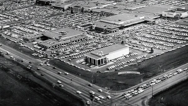
So this is the big story of the New Urbanists -- to acknowledge that there are only two ways that have been tested by the thousands to build communities, in the world and throughout history. One is the traditional neighborhood. You see here several neighborhoods of Newburyport, Massachusetts, which is defined as being compact and being diverse -- places to live, work, shop, recreate, get educated -- all within walking distance. And it's defined as being walkable. There are lots of small streets. Each one is comfortable to walk on. And we contrast that to the other way, an invention that happened after the Second World War, suburban sprawl, clearly not compact, clearly not diverse, and it's not walkable, because so few of the streets connect, that those streets that do connect become overburdened, and you wouldn't let your kid out on them. And I want to thank Alex Maclean, the aerial photographer, for many of these beautiful pictures that I'm showing you today.
אז זה הסיפור הכללי של האורבניים החדשים. להכיר בכך שישנן רק שתי דרכים שנבחנו על ידי אלפים לבנות קהילות בעולם ובמהלך ההיסטוריה. האחת היא השכונה המסורתית. אתם רואים כאן מספר שכונות בניובריפורט, מסצ'וסטס, שמוגדרת כצפופה ומגוונת, מקומות לחיות, לעבוד, לצאת לקניות, לבלות, להשיג השכלה, הכל במרחק הליכה. והיא מוגדרת כמתאימה להליכה, ישנם הרבה רחובות קטנים. כל אחד מהם נוח להליכה. לעומת זאת, הדרך השניה, המצאה שהתרחשה אחרי מלחמת העולם השניה, המרחב הפרוורי, ברור שהוא לא מצומצם, לא מגוון ולא מתאים להליכה, כי מעט מאוד מהרחובות מתחברים, כך שהרחובות שכן מתחברים הופכים לעמוסים, ולא הייתם נותנים לילד שלכם ללכת בהם. ואני רוצה להודות לאלכס מקלין, הצלם האווירי, על הרבה מהתמונות היפות האלה שאני מראה לכם היום.
So it's fun to break sprawl down into its constituent parts. It's so easy to understand, the places where you only live, the places where you only work, the places where you only shop, and our super-sized public institutions. Schools get bigger and bigger, and therefore, further and further from each other. And the ratio of the size of the parking lot to the size of the school tells you all you need to know, which is that no child has ever walked to this school, no child will ever walk to this school. The seniors and juniors are driving the freshmen and the sophomores, and of course we have the crash statistics to prove it.
אז זה כיף לפרק את הפרוור לחלקי המרכיבים שלו. זה כל כך קל להבנה, מקומות בהם רק גרים מקומות בהם רק עובדים, המקומות בהם רק קונים, והמוסדות הענקיים שלנו. בתי ספר הולכים וגדלים, וכתוצאה, מתרחקים יותר ויותר זה מזה. והיחס בין גודל מגרש החניה של ביה"ס, ובין גודל בית הספר מספר את כל מה שאתם צריכים לדעת, שזה שאף ילד לא הלך ברגל לביה"ס הזה, אף ילד לא ילך ברגל אי פעם לביה"ס הזה. תלמידי י"א וי"ב מסיעים את תלמידי י' ו-ט', וכמובן יש לנו את סטטיסטיקת התאונות להוכיח את זה.
And then the super-sizing of our other civic institutions like playing fields -- it's wonderful that Westin in the Ft. Lauderdale area has eight soccer fields and eight baseball diamonds and 20 tennis courts, but look at the road that takes you to that location, and would you let your child bike on it? And this is why we have the soccer mom now. When I was young, I had one soccer field, one baseball diamond and one tennis court, but I could walk to it, because it was in my neighborhood.
ואז ההגדלה של שאר המוסדות האזרחיים שלנו כמו מגרשי משחקים, זה מדהים שבווסטין, באזור פורט לודרדייל (פלורידה) יש שמונה מגרשי כדורגל ושמונה מגרשי בייסבול ו-20 מגרשי טניס, אבל תסתכלו בכביש שמוביל אתכם למיקום הזה, הייתם נותנים לילד שלכם לרכב בו על אופניים? ולכן יש לנו כיום את אמא שמסיעה לכדורגל. כשהייתי צעיר, היה לי מגרש כדורגל אחד, מגרש בייסבול אחד ומגרש טניס אחד, אבל יכולתי ללכת אליו, כי הוא היה בשכונה שלי.
Then the final part of sprawl that everyone forgot to count: if you're going to separate everything from everything else and reconnect it only with automotive infrastructure, then this is what your landscape begins to look like. The main message here is: if you want to have a walkable city, you can't start with the sprawl model. you need the bones of an urban model. This is the outcome of that form of design, as is this. And this is something that a lot of Americans want. But we have to understand it's a two-part American dream. If you're dreaming for this, you're also going to be dreaming of this, often to absurd extremes, when we build our landscape to accommodate cars first. And the experience of being in these places --
והתוצאה האחרונה של ההתפרסות בשטח, שכולם שוכחים : הוא שאם אתה הולך להפריד הכל מהכל ואז לחבר ביניהם בעזרת תשתיות לרכבים בלבד, אז הנוף שלכם יראה ככה. המסר העיקרי כאן הוא: אם אתם רוצים שתהיה לכם עיר הליכה אתם לא יכולים להתחיל במודל הפרוורים. אתה צריך את הבסיס של המודל האורבני. זאת התוצאה של סוג התכנון הזה, כמו גם זה. וזה משהו שהרבה אמריקאים רוצים. אבל אנחנו צריכים להבין שזהו חלום אמריקאי בן שני חלקים. אם אתה שואף לזה, אתה גם הולך לשאוף לזה, לעתים בקיצוניות מוגזמת, כשאנחנו בונים את המרחב שלנו כך שיתאים קודם כל לרכבים. והחוויה של השהייה במקומות כאלה --
(Laughter)
(צחוק)
This is not Photoshopped. Walter Kulash took this slide. It's in Panama City. This is a real place. And being a driver can be a bit of a nuisance, and being a pedestrian can be a bit of a nuisance in these places. This is a slide that epidemiologists have been showing for some time now,
[כתוב:הרמזור הזה אף פעם לא ירוק] זה לא בפוטושופ. וולטר קולאש צילם את השקופית הזאת. זה בפנמה סיטי. זה מקום אמיתי. להיות נהג יכול להיות קצת מטרד, ולהיות הולך רגל יכול להיות קצת מטרד במקומות כאלה. זאת שקופית שאפידימיולוגים (חוקרי מחלות) מציגים כבר כמה זמן,
(Laughter)
(צחוק)
The fact that we have a society where you drive to the parking lot to take the escalator to the treadmill shows that we're doing something wrong. But we know how to do it better.
העובדה שיש לנו חברה בה אתה נוסע למגרש חניה כדי לעלות במדרגות הנעות להליכון מראה שאנחנו עושים כאן משהו לא נכון. אבל אנחנו יודעים איך לשפר את זה.
Here are the two models contrasted. I show this slide, which has been a formative document of the New Urbanism now for almost 30 years, to show that sprawl and the traditional neighborhood contain the same things. It's just how big are they, how close are they to each other, how are they interspersed together and do you have a street network, rather than a cul-de-sac or a collector system of streets?
הנה שני המודלים זה לצד זה. אני מציג את השקופית הזאת, שהיוותה מסמך מעצב עבור האורבניזם החדש כבר כמעט שלושים שנה, המציגה שהפרוור והשכונה המסורתית שניהם מכילים את אותם הדברים. השאלה רק באיזה גודל הם, עד כמה הם קרובים זה לזה, איך הם משתלבים יחד והאם יש לך מארג רחובות במקום מבוי סתום או מערכת רחובות לדוגמה?
So when we look at a downtown area, at a place that has a hope of being walkable, and mostly that's our downtowns in America's cities and towns and villages, we look at them and say we want the proper balance of uses. So what is missing or underrepresented? And again, in the typical American cities in which most Americans live, it is housing that is lacking. The jobs-to-housing balance is off. And you find that when you bring housing back, these other things start to come back too, and housing is usually first among those things. And, of course, the thing that shows up last and eventually is the schools, because the people have to move in, the young pioneers have to move in, get older, have kids and fight, and then the schools get pretty good eventually.
אז כשאנחנו מסתכלים על העיר התחתית, מקום שיש לו סיכוי להיות מתאים להליכה, ובדרך כלל אלה הם אזורי המגורים בערים של אמריקה, בעיירות ובכפרים, אנחנו מסתכלים עליהם ואומרים אנחנו רוצים איזון מתאים של שימושים. אז מה חסר או לא מיוצג? ושוב, בערים האמריקאיות הטיפוסיות בהן רוב האמריקאים חיים, מה שחסר הם בתי מגורים. היחס בין מקומות עבודה ובתי מגורים לקוי. ותמצאו שכשאתם מחזירים את הדיור, גם הדברים האחרים מתחילים לחזור, והדיור הוא הדבר הראשון מבין כל אלה. ברור שהדבר שמופיע אחרון בסופו של דבר הוא בתי הספר, כיוון שאנשים צריכים לעבור לגור, הצעירים הראשונים שצריכים לעבור לגור, להתבגר, ללדת ילדים, ולהלחם, ואז בתי הספר ישתפרו בסופו של דבר.
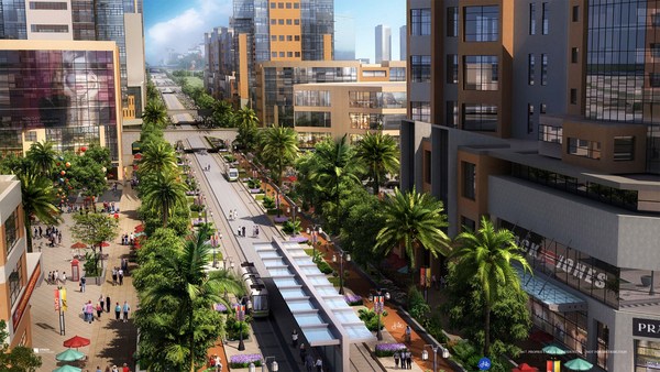
The other part of this part, the useful city part, is transit, and you can have a perfectly walkable neighborhood without it. But perfectly walkable cities require transit, because if you don't have access to the whole city as a pedestrian, then you get a car, and if you get a car, the city begins to reshape itself around your needs, and the streets get wider and the parking lots get bigger and you no longer have a walkable city. So transit is essential. But every transit experience, every transit trip, begins or ends as a walk, and so we have to remember to build walkability around our transit stations.
החלק השני כאן, החלק של העיר השימושית, הוא תחבורה. אתם יכולים שתהיה לכם שכונה מתאימה להליכה גם בלי זה. אבל ערים שמתאימות להליכה, זקוקות לתחבורה, כי אם אין לך גישה לכל העיר כהולך רגל, אז אתה רוכש רכב, ואם אתה רוכש רכב, העיר מתחילה לעצב את עצמה מחדש סביב הצרכים שלך, והרחובות מתרחבים, מגרשי החניה גדלים, וכבר אין לך עיר שמתאימה להליכה. אז התחבורה היא הכרחית. אבל כל חוויית תחבורה, כל נסיעה, מתחילה או מסתיימת כהליכה. אנחנו צריכים לזכור לבנות אפשרויות להליכה סביב התחנות שלנו.
Next category, the biggest one, is the safe walk. It's what most walkability experts talk about. It is essential, but alone not enough to get people to walk. And there are so many moving parts that add up to a walkable city.
הקטגוריה הבאה, הגדולה ביותר, היא הליכה בטוחה. זה הדבר שרוב מומחי הבניה להליכה מדברים עליו. היא הכרחית, אבל בפני עצמה אין בה מספיק כדי לגרום לאנשים ללכת. ישנם כל כך הרבה חלקים נעים שתורמים לעיר שאפשר ללכת בה,
The first is block size. This is Portland, Oregon, famously 200-foot blocks, famously walkable. This is Salt Lake City, famously 600-foot blocks, famously unwalkable. If you look at the two, it's almost like two different planets, but these places were both built by humans and in fact, the story is that when you have a 200-foot block city, you can have a two-lane city, or a two-to-four lane city, and a 600-foot block city is a six-lane city, and that's a problem. These are the crash statistics. When you double the block size -- this was a study of 24 California cities -- when you double the block size, you almost quadruple the number of fatal accidents on non-highway streets.
הראשון הוא גודל הבלוק. זאת היא פורטלנד, אורגון, הבלוקים הידועים באורך 60 מטר, מפורסמת באפשרות להליכה בה. זאת היא סולט לייק סיטי, הבלוקים הידועים באורך 180 מטר, עיר מפורסמת בזה שאי אפשר ללכת בה. אם תתבוננו בשתיהן, הן נראות כמו שני עולמות שונים. אבל שני המקומות האלה נבנו בידי בני-אדם, ולמעשה, הטענה היא שכשיש לך עיר בה בלוקים באורך 60 מטר, תהיה לך עיר של 2 מסלולים, או 2-4 מסלולים, ועיר עם בלוקים באורך 180 מטר, היא עיר של 6 מסלולים, וזו בעיה. אלה הם נתוני תאונות הרכבים. כשאתה מכפיל את אורך הבלוק- - זה היה מחקר שחקר 24 ערים בקליפורניה - כשאתה מכפיל את אורך הבלוק, אתה כמעט מכפיל פי ארבע את מספר התאונות הקטלניות ברחובות שאינם כביש מהיר.
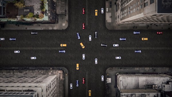
So how many lanes do we have? This is where I'm going to tell you what I tell every audience I meet, which is to remind you about induced demand. Induced demand applies both to highways and to city streets. And induced demand tells us that when we widen the streets to accept the congestion that we're anticipating, or the additional trips that we're anticipating in congested systems, it is principally that congestion that is constraining demand, and so that the widening comes, and there are all of these latent trips that are ready to happen. People move further from work and make other choices about when they commute, and those lanes fill up very quickly with traffic, so we widen the street again, and they fill up again. And we've learned that in congested systems, we cannot satisfy the automobile.
אז, כמה מסלולים יש לנו? כאן אני הולך לספר לכם מה שאני מספר לכל קהל שאני פוגש, שזה להזכיר לכם את העניין של ביקוש והיצע. ביקוש והיצע נכון לכביש מהיר וגם לרחובות עירוניים. כלל הביקוש והיצע מספר לנו שכשאנחנו מרחיבים את הרחובות כדי להכיל את עומס התחבורה הצפוי, או הנסיעות הנוספות הצפויות במערכות עמוסות, בעיקרון, הצפיפות היא מה שמגביל את הביקוש. וכך שכשההתרחבות באה, וכל הנסיעות פוטנציאליות שמוכנות להתרחש, - אנשים עוברים לגור רחוק מהעבודה ומבצעים החלטות אחרות לגבי צורת הנסיעה שלהם, והנתיבים האלה מתמלאים מהר מאוד במכוניות, אז מרחיבים את הרחובות שוב, והם מיד מתמלאים שוב. ולמדנו שבמערכת עמוסה, אנחנו לא יכולים להשביע את הרכב.
This is from Newsweek Magazine -- hardly an esoteric publication: "Today's engineers acknowledge that building new roads usually makes traffic worse." My response to reading this was, may I please meet some of these engineers, because these are not the ones that I -- there are great exceptions that I'm working with now -- but these are not the engineers one typically meets working in a city, where they say, "Oh, that road is too crowded, we need to add a lane." So you add a lane, and the traffic comes, and they say, "See, I told you we needed that lane." This applies both to highways and to city streets if they're congested.
זה ממגזין ניוזוויק - עיתון חשוב, "המהנדסים של היום מודים שבניית כבישים חדשים בדרך כלל מחריפה את בעיית הפקקים". התגובה שלי לזה הייתה, האם אוכל לפגוש חלק מהמהנדסים האלה, כי אלה לא המהנדסים הטיפוסיים שאני - ישנם יוצאי דופן גדולים שאני עובד אתם עכשיו - אבל אלה אינם המהנדסים הרגילים שפוגשים בעבודה בעיר, שאומרים, "או, הרחוב הזה עמוס מדי, אנחנו צריכים להוסיף מסלול". אז אתה מוסיף מסלול, והמכוניות מגיעות, והם אומרים, "רואים, אמרנו לכם שצריך את המסלול הזה". הדבר נכון גם לגבי כבישים מהירים וגם לרחובות אם הם פקוקים.
But the amazing thing about most American cities that I work in, the more typical cities, is that they have a lot of streets that are actually oversized for the congestion they're currently experiencing. This was the case in Oklahoma City, when the mayor came running to me, very upset, because they were named in Prevention Magazine the worst city for pedestrians in the entire country. Now that can't possibly be true, but it certainly is enough to make a mayor do something about it. We did a walkability study, and what we found, looking at the car counts on the street -- these are 3,000-, 4,000-, 7,000-car counts and we know that two lanes can handle 10,000 cars per day. Look at these numbers -- they're all near or under 10,000 cars, and these were the streets that were designated in the new downtown plan to be four lanes to six lanes wide. So you had a fundamental disconnect between the number of lanes and the number of cars that wanted to use them.
אבל הדבר המדהים ברוב הערים האמריקאיות שאני עובד בהן, הערים הטיפוסיות יותר, הוא שיש להן הרבה רחובות שהם למעשה רחבים מדי ביחס לתנועה שהם חווים כרגע. הדבר נכון לגבי אוקלהומה סיטי, כשראש העיר בא אלי מוטרד מאוד כי הם הוכתרו במגזין ידוע כעיר הגרועה ביותר להולכי רגל בכל המדינה. זה לא יכול להיות נכון, אבל זה בהחלט מספיק כדי לגרום לראש העיר לעשות משהו בנדון. עשינו מחקר אפשרויות הליכה, ומה שגילינו הוא שבשקלול מספר הרכבים ברחובות, ספרנו 3,000-4,000-7,000 רכבים ואנחנו יודעים שרחוב בעל 2 מסלולים יכול להתמודד עם 10,000 כלי רכב מדי יום. תסתכלו במספרים האלה, הם כולם בסביבות או מתחת ל-10,000 מכוניות. ואלה היו הרחובות שהיו אמורים להיות לפי תכנית מרכז העיר החדש להיות, ברוחב של 4-6 מסלולים. אז יש כאן חוסר קשר מהותי בין מספר המסלולים ומספר המכוניות שרצו לנסוע בהם.
So it was my job to redesign every street in the downtown from curb face to curb face, and we did it for 50 blocks of streets, and we're rebuilding it now. So a typical oversized street to nowhere is being narrowed, and now under construction, and the project is half done. The typical street like this, you know, when you do that, you find room for medians. You find room for bike lanes. We've doubled the amount of on-street parking. We've added a full bike network where one didn't exist before.
זה היה התפקיד שלי לתכנן מחדש כל רחוב במרכז העיר ממדרכה למדרכה, ועשינו את זה ב-50 רחובות, ואנחנו בונים אותם מחדש כעת. אז רחוב טיפוסי רחב מדי שמוביל לשומקום עכשיו עובר הצרה, ונמצא בבניה, והפרויקט כמעט גמור. רחוב טיפוסי כזה, אתם יודעים, כשאתה עושה דבר כזה, אתה מוצא מקום לכל מיני דברים אתה מוצא מקום לנתיבי אופניים. הכפלנו את כמות מקומות החניה ברחוב. הוספנו מערכת אופניים מלאה שלא היתה קיימת לפני כן.
But not everyone has the money that Oklahoma City has, because they have an extraction economy that's doing quite well. The typical city is more like Cedar Rapids, where they have an all four-lane system, half one-way system. And it's a little hard to see, but what we've done -- what we're doing; it's in process right now, it's in engineering right now -- is turning an all four-lane system, half one-way into an all two-lane system, all two-way, and in so doing, we're adding 70 percent more on-street parking, which the merchants love, and it protects the sidewalk. That parking makes the sidewalk safe, and we're adding a much more robust bicycle network.
אבל לא לכולם יש את התקציבים שיש לאוקלהומה סיטי, כיוון שיש להם כלכלה שמצליחה לא רע. העיר הטיפוסית היא יותר דומה לסידר רפידס, שם יש להם מערכת כבישים של ארבעה נתיבים, חצי מהם חד סתריים. וזה קצת קשה לראות אבל מה שעשינו -מה שאנחנו עושים עכשיו; זה נמצא בתהליך כרגע, זה בתכנון כרגע -- הוא להפוך את מערכת ארבעת הנתיבים, שחציים חד סתריים למערכת דו-נתיבית, כולה דו-סתרית. ובכך אנחנו מוסיפים 70 אחוזים יותר מקומות חניה ברחוב, דבר שהסוחרים מתים עליו, וזה מגן על המדרכה. החניות האלה הופכות את המדרכה לבטוחה, ואנחנו מוסיפים מערכת שבילי אופניים הרבה יותר רחבה.
Then the lanes themselves. How wide are they? That's really important. The standards have changed such that, as Andrés Duany says, the typical road to a subdivision in America allows you to see the curvature of the Earth.
אז הנתיבים עצמם, מה הרוחב שלהם? זה עניין מאוד חשוב. הסטנדרטים השתנו עד כדי כך, שכפי שאנדרס דואני אומר, הרחוב הטיפוסי המוביל לפרוור באמריקה מאפשר לך לראות את עיקול כדור הארץ.
(Laughter)
(צחוק)
This is a subdivision outside of Washington from the 1960s. Look very carefully at the width of the streets. This is a subdivision from the 1980s. 1960s, 1980s. The standards have changed to such a degree that my old neighborhood of South Beach, when it was time to fix the street that wasn't draining properly, they had to widen it and take away half our sidewalk, because the standards were wider. People go faster on wider streets. People know this. The engineers deny it, but the citizens know it, so that in Birmingham, Michigan, they fight for narrower streets. Portland, Oregon, famously walkable, instituted its "Skinny Streets" program in its residential neighborhood. We know that skinny streets are safer. The developer Vince Graham, in his project I'On, which we worked on in South Carolina, he goes to conferences and he shows his amazing 22-foot roads. These are two-way roads, very narrow rights of way, and he shows this well-known philosopher, who said, "Broad is the road that leads to destruction ... narrow is the road that leads to life."
זהו פרוור מחוץ לוושינגטון שנבנה בשנות ה-60. התבוננו היטב ברוחב של הרחובות. זהו פרוור משנות ה-80. שנות ה-60, שנות ה-80. הסטנדרטים השתנו במידה כזאת שבשכונה הישנה שלי בסאות' ביץ' (פלורידה) כשהגיע הזמן לתקן את הרחוב שהניקוז בו כבר לא פעל, הם היו צריכים להרחיב אותו, ולהוריד חצי מהמדרכות שלנו, כיוון שהסטנדרטים היו רחבים יותר. אנשים הולכים מהר יותר ברחובות רחבים יותר. אנשים יודעים את זה. המהנדסים מכחישים את זה, אבל התושבים יודעים את זה, עד כדי כך שבבירמינגהם מישיגן, הם נלחמים בעד רחובות צרים יותר. פורטלנד אורגון, עיר שמפורסמת בהיותה מתאימה להליכה, מיסדה את תכנית "הרחובות הצרים" בשכונות המגורים שלה. אנחנו יודעים שרחובות צרים הם בטוחים יותר. הקבלן וינס גרהאם בפרויקט שלו אייאון, עליו עבדנו בדרום קרולינה, הוא הולך לכנסים והוא מציג את הרחובות המדהימים שלו ברוחב 7 מטר. אלה רחובות דו-סתריים, בעלי זכות קדימה מאוד צרים, והוא מציג את הפילוסוף המפורסם שאמר "כי רחב הפתח ומרווח דרך האבדון... וצר הדרך ומוצק דרך החיים". (הבשורה ע"פ מתי)
(Laughter)
(צחוק)
(Applause)
(מחיאות כפיים)
This plays very well in the South.
זה ממש מצליח בדרום.
Now: bicycles. Bicycles and bicycling are the current revolution underway in only some American cities. But where you build it, they come. As a planner, I hate to say that, but the one thing I can say is that bicycle population is a function of bicycle infrastructure. I asked my friend Tom Brennan from Nelson\Nygaard in Portland to send me some pictures of the Portland bike commute. He sent me this. I said, "Was that bike to work day?" He said, "No, that was Tuesday." When you do what Portland did and spend money on bicycle infrastructure -- New York City has doubled the number of bikers in it several times now by painting these bright green lanes. Even automotive cities like Long Beach, California: vast uptick in the number of bikers based on the infrastructure. And of course, what really does it, if you know 15th Street here in Washington, DC -- please meet Rahm Emanuel's new bike lanes in Chicago, the buffered lane, the parallel parking pulled off the curb, the bikes between the parked cars and the curb -- these mint cyclists. If, however, as in Pasadena, every lane is a bike lane, then no lane is a bike lane. And this is the only bicyclist that I met in Pasadena, so ...
עכשיו: אופניים. אופניים ונסיעה באופניים הם מהפכה שמתרחשת כרגע רק בחלק מהערים באמריקה. אבל היכן שתבנה את זה, הם יבואו. כמתכנן, אני שונא להודות בכך, אבל הדבר היחיד שאני יכול לומר הוא ש"אוכלוסיית אופניים" היא תוצאה של שבילי אופניים. ביקשתי מהחבר שלי, תום ברנן מחברת נלסון ניגארד בפורטלנד לשלוח לי כמה תמונות של הנסיעה באופניים בפורטלנד. הוא שלח לי את זה. אמרתי האם זה היה "יום סע באופניים לעבודה"?" והוא ענה, "לא, זה היה יום שלישי". כשאתה עושה מה שפורטלנד עשתה ומוציא כסף על תשתית לאופניים, העיר ניו יורק הכפילה את מספר רוכבי האופניים בה פי כמה, בכך שצבעה את המסלולים הירוקים זוהרים האלה. אפילו ערי רכב כמו לונג ביץ', קליפורניה: חלה עליה חדה במספר רוכבי האופניים כתוצאה של התשתית הזו. וכמובן, מה שבאמת עושה את זה, אם אתם מכירים את רחוב 15 כאן בוושינגטון, בבקשה הכירו את נתיבי האופניים החדשים של רם עמנואל בשיקגו, הנתיב המוגדר, החניה המקבילה לצד המדרכה, האופניים בין הרכבים החונים והמדרכה -- הרוכבים המצוינים האלה. אם, לעומת זאת, כמו בפסדינה, כל מסלול נחשב למסלול אופניים, אז אף מסלול אינו מסלול אופניים. וזה רוכב האופניים היחיד שפגשתי בפסדינה, אז...
(Laughter)
(צחוק)
The parallel parking I mentioned -- it's an essential barrier of steel that protects the curb and pedestrians from moving vehicles. This is Ft. Lauderdale; one side of the street, you can park, the other side of the street, you can't. This is happy hour on the parking side. This is sad hour on the other side. And then the trees themselves slow cars down. They move slower when trees are next to the road, and, of course, sometimes they slow down very quickly. All the little details -- the curb return radius. Is it one foot or is it 40 feet? How swoopy is that curb to determine how fast the car goes and how much room you have to cross. And then I love this, because this is objective journalism. "Some say the entrance to CityCenter is not inviting to pedestrians." When every aspect of the landscape is swoopy, is aerodynamic, is stream-form geometrics, it says: "This is a vehicular place." So no one detail, no one speciality, can be allowed to set the stage. And here, you know, this street: yes, it will drain within a minute of the hundred-year storm, but this poor woman has to mount the curb every day.
החניה המקבילה שהזכרתי -- היא אזור חיץ הכרחי מברזל שמגן על המדרכה ועל הולכי הרגל מרכבים נעים. זאת היא פורט לודרדייל; בחלק אחד של הרחוב אפשר לחנות, בחלק השני אי אפשר. הנה Happy Hour בצד המותר לחניה. הנה שעה חלשה בצד השני. ואז העצים עצמם מאיטים את הרכבים. הם זזים לאט יותר שיש עצים לצד הכביש. וכמובן, לפעמים הם מאיטים מהר מדי. כל הפרטים הקטנים -- רדיוס הפניה של המדרכה. האם הוא חצי מטר או 12 מטר? מידת העיקול החלק של המדרכה תקבע את מהירות הרכב וכמה מקום יש לך לחצות את הכביש. ואז אני אוהב את זה, כיוון שזאת דוגמה לעיתונות אובייקטיבית. "יש שאומרים שהכניסה למרכזי הערים אינה מזמינה להולכי רגל". כשכל היבט בנוף מעוצב באופן חלק, הוא אירודינמי, מעוצב בצורה גיאומטרית זורמת, המסר הוא: "זהו מרחב לרכבים". אז אין פרט אחד, או מומחיות אחת, שמותר לה להכתיב את המרחב. וכאן, אתם יודעים, הרחוב הזה: נכון, הוא יוכל לנקז את סופת המאה בשניה, אבל האישה המסכנה הזו צריכה לטפס על שפת המדרכה כל יום.
So then quickly, the comfortable walk has to do with the fact that all animals seek, simultaneously, prospect and refuge. We want to be able to see our predators, but we also want to feel that our flanks are covered. And so we're drawn to places that have good edges, and if you don't supply the edges, people won't want to be there. What's the proper ratio of height to width? Is it one to one? Three to one? If you get beyond one to six, you're not very comfortable anymore. You don't feel enclosed. Now, six to one in Salzburg can be perfectly delightful. The opposite of Salzburg is Houston. The point being the parking lot is the principal problem here. However, missing teeth, those empty lots can be issues as well, and if you have a missing corner because of an outdated zoning code, then you could have a missing nose in your neighborhood. That's what we had in my neighborhood. This was the zoning code that said I couldn't build on that site. As you may know, Washington, DC is now changing its zoning to allow sites like this to become sites like this. We needed a lot of variances to do that. Triangular houses can be interesting to build, but if you get one built, people generally like it. So you've got to fill those missing noses.
אז במהירות, ההליכה הנוחה קשורה לעובדה שכולם רוצים גם אפשרות לראות קדימה, וגם בטחון. אנחנו רוצים להיות מסוגלים לראות את הטורפים שלנו, אבל אנחנו גם רוצים להרגיש שהצד האחורי שלנו מוגן. ולכן אנחנו נמשכים לאזורים שיש להם גבולות טובים, ואם אתה לא מספק את הגבולות, אנשים לא ירצו להיות שם. מה היחס הנכון בין גובה ורוחב? האם זה אחד לאחד? שלוש לאחד? אם תחרוג מעבר ליחס של אחד לשש, כבר לא ממש נוח לך. אתה לא מרגיש מוכל. עכשיו, יחס של שש לאחד בזלצבורג יכול להיות מתאים לחלוטין. ההפך מזלצבורג היא יוסטון. הנקודה היא שמגרש החניה הוא הבעיה המרכזית כאן. מקומות החניה הריקים האלה, יכולים להוות בעיה. ואם יש לך פינה חסרה בגלל תקנת ייעוד קרקע לא עדכני אז אפשר שיחסר לך אף בשכונה שלך. זה מה שקרה בשכונה שלי. זאת היתה תקנת ייעוד הקרקע שקבעה שלא יכולתי לבנות באתר הזה. כפי שאתם אולי יודעים, וושינגטון משנה כיום את תקנות ייעוד הקרקע שלה כדי לאפשר לאתרים כמו אלה להפוך לאתרים כמו אלה. היינו זקוקים להרבה משתנים לעשות זאת. בית משולשים אולי מעניינים לבניה, אבל אם אתה בונה אחד כזה, אנשים בדרך כלל אוהבים אותו. אז אתה צריך למלא את האפים החסרים האלה.
And then, finally, the interesting walk: signs of humanity. We are among the social primates. Nothing interests us more than other people. We want signs of people. So the perfect one-to-one ratio, it's a great thing. This is Grand Rapids, a very walkable city, but nobody walks on this street that connects the two best hotels together, because if on the left, you have an exposed parking deck, and on the right, you have a conference facility that was apparently designed in admiration for that parking deck, then you don't attract that many people. Mayor Joe Riley, in his 10th term, Mayor of Charleston, South Carolina, taught us it only takes 25 feet of building to hide 250 feet of garage. This one I call the Chia Pet Garage. It's in South Beach. That active ground floor.
ואז, לבסוף, ההליכה המעניינת: סימנים של אנושות. אנחנו חלק מהפרימטים החברתיים. אין דבר שמעניין אותנו יותר מאנשים אחרים. אנחנו רוצים סימנים של אנשים. אז היחס אחד לאחד המושלם הוא דבר מדהים. זאת היא גרנד רפידס, עיר שמתאימה מאוד להליכה. אבל אף אחד לא הולך ברחוב הזה המחבר בין שני בתי המלון הטובים ביותר, כיוון שאם מצד שמאל יש לך אזור חניה חשוף, ומימין יש לך מבנה כנסים שבברור תוכנן בהשראת אותו מגרש חניה, אז אתה לא מושך כל כך הרבה אנשים. ראש העיר ג'ו ריי, בכהונתו העשירית, ראש העיר צ'רלסטון, דרום קרולינה, לימד אותנו שדרוש רק 75 מטרים של בניה לכסות 750 מטרים של חניה מקורה. לזה אני קורא חנית ראש דשא. זה נמצא בסאות' ביץ'. קומת הקרקע הפעילה הזו.
I want to end with this project that I love to show. It's by Meleca Architects. It's in Columbus, Ohio. To the left is the convention center neighborhood, full of pedestrians. To the right is the Short North neighborhood -- ethnic, great restaurants, great shops, struggling. It wasn't doing very well because this was the bridge, and no one was walking from the convention center into that neighborhood. Well, when they rebuilt the highway, they added an extra 80 feet to the bridge. Sorry -- they rebuilt the bridge over the highway. The city paid 1.9 million dollars, they gave the site to a developer, the developer built this and now the Short North has come back to life. And everyone says, the newspapers, not the planning magazines, the newspapers say it's because of that bridge.
אני רוצה לסיים בפרויקט הזה שאני אוהב להראות, הוא של חברת הארכיטקטים "מלקה", הוא נמצא בעיר קולומבוס באוהיו. משמאל שכונת מרכז הכנסים, מלאה בהולכי רגל. מימין שכונת שורט נורת' - אתנית, מסעדות מעולות, חנויות מעולות, מתקשה. היא לא הצליחה להתרומם בגלל שזה הגשר, ואף אחד לא רצה ללכת ממרכז הכנסים לתוך השכונה הזו. ובכן, כשהם בנו מחדש את הכביש המהיר, הם הוסיפו עוד 24 מטרים לגשר. מצטער - הם בנו מחדש את הגשר מעל לכביש המהיר. העיר הוציאה 1.9 מיליון דולר, הם נתנו את האתר לקבלן, הקבלן בנה את זה ועכשיו שורט נורת' חזרה לחיים. וכולם אומרים, העיתונים, לא מגזיני תכנון, העיתונים אומרים שזה בזכות הגשר הזה.
So that's it. That's the general theory of walkability. Think about your own cities. Think about how you can apply it. You've got to do all four things at once. So find those places where you have most of them and fix what you can, fix what still needs fixing in those places.
אז זהו. זאת התאוריה של עיר שנוחה להליכה. תחשבו על הערים שלכם. תחשבו איך אתם יכולים ליישם את זה. אתם צריכים לבצע את כל ארבעת הדברים ביחד. אז תמצאו את המקומות האלה בהם יש לכם את רובם ותתקנו את מה שאפשר, תתקנו את מה שזקוק לתיקון באותם מקומות.
I really appreciate your attention, and thank you for coming today.
אני ממש מעריך את תשומת הלב שלכם, ותודה רבה לכם שבאתם היום.
(Applause)
(מחיאות כפיים)