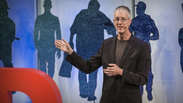
So I'm here to talk to you about the walkable city. What is the walkable city? Well, for want of a better definition, it's a city in which the car is an optional instrument of freedom, rather than a prosthetic device. And I'd like to talk about why we need the walkable city, and I'd like to talk about how to do the walkable city.
خب من اینجا هستم تا درباره شهر های پیاده رو صحبت کنم یک شهر پیاده چیست؟ خب، برای یک تعریف بهتر، شهریست که در آن ماشین یک وسیله اختیاری آزادانه است تا یک وسیله مصنوعی. میخواهم درباره این صحبت کنم که چرا به شهر پیاده رو نیاز داریم و چگونه یک شهر پیاده رو داشته باشیم.
Most of the talks I give these days are about why we need it, but you guys are smart. And also I gave that talk exactly a month ago, and you can see it at TED.com. So today I want to talk about how to do it. In a lot of time thinking about this, I've come up with what I call the general theory of walkability. A bit of a pretentious term, it's a little tongue-in-cheek, but it's something I've thought about for a long time, and I'd like to share what I think I've figured out.
بیشتر سخنرانی های این روزهای من درباره دلیل نیازمان به آن است ولی شما دوستان باهوش هستید. و همچنین من یه سخنرانی دقیقا یک ماه پیش ارائه دادم، و شما میتوانید در ted.com ببینیدش. پس امروز میخواهم درباره چگونگی ایجاد آن صحبت کنم. با صرف زمان زیادی در فکر کردن به این موضوع، به چیزی رسیدم که اسم آن را تئوری عمومی شهر پیاده رو گذاشتم. یکم عبارت پر ادعاییست، کمی هم با مزه است، ولی چیزیست که من مدت زیادی به آن فکر کرده ام، و دوست دارم آنچه که فهمیده ام را با شما در میان بگذارم.
In the American city, the typical American city -- the typical American city is not Washington, DC, or New York, or San Francisco; it's Grand Rapids or Cedar Rapids or Memphis -- in the typical American city in which most people own cars and the temptation is to drive them all the time, if you're going to get them to walk, then you have to offer a walk that's as good as a drive or better. What does that mean? It means you need to offer four things simultaneously: there needs to be a proper reason to walk, the walk has to be safe and feel safe, the walk has to be comfortable and the walk has to be interesting. You need to do all four of these things simultaneously, and that's the structure of my talk today, to take you through each of those.
در شهر آمریکایی، در یک شهر معمول آمریکایی یک شهر معمول آمریکایی واشینگتن نیست، یا نیویورک، یا سانفرانسیسکو، گرند رپیدز یا سدر ریپرز یا ممفیس است. در یک شهر معمول آمریکایی که بیشتر مردم صاحب خودرو هستند، و گرایش به این است که آنها را همیشه برانند، اگر بخواهید آنها را به راه رفتن وادارید، باید به آنها راه رفتنی را پیشنهاد بدهید که به خوبی راندن یا بهتر از آن باشد. این به چه معناست؟ بدین معناست که باید ۴ چیز را همزمان پیشنهاد بدهید: نیازبه دلیل مناسبی برای راه رفتن وجود دارد. راه رفتن باید ایمن و احساس امنیت داشته باشد، راه رفتن باید راحت باشد و باید جالب باشد. شما باید تمام این 4 چیز را همزمان انجام دهید و این ساختار صحبت امروز من است، که درباره هر کدام با شما صحبت کنم.
The reason to walk is a story I learned from my mentors, Andrés Duany and Elizabeth Plater-Zyberk, the founders of the New Urbanism movement. And I should say half the slides and half of my talk today I learned from them. It's the story of planning, the story of the formation of the planning profession. When in the 19th century people were choking from the soot of the dark, satanic mills, the planners said, hey, let's move the housing away from the mills. And lifespans increased immediately, dramatically, and we like to say the planners have been trying to repeat that experience ever since.
دلیل راه رفتن داستانی است که من از مربیان خود یاد گرفته ام، آندرس دوانی و الیزابت پلتر-زیبرک، پایه گذاران جنبش شهرسازی جدید. و باید بگویم نصف اسلاید ها و صحبت های امروزم را از آنها یاد گرفته ام. این داستان طراحی است، داستان شکل گیری حرفه طراحیست. زمانیکه در قرن 19 مردم درحال خفگی بودند از دوده ها و کارخانههای شیطانی، طراحان گفتند،هی، بیایید خانه هایمان را به دور از کارخانهها انتقال بدهیم. و طول زندگی افراد،به طور چشمگیری، سریعا افزایش پیدا کرد، و ما دوست داریم بگوییم، که طراحان سعی کردند آن تجربه را از آن موقع تکرار کنند.
So there's the onset of what we call Euclidean zoning, the separation of the landscape into large areas of single use. And typically when I arrive in a city to do a plan, a plan like this already awaits me on the property that I'm looking at. And all a plan like this guarantees is that you will not have a walkable city, because nothing is located near anything else. The alternative, of course, is our most walkable city, and I like to say, you know, this is a Rothko, and this is a Seurat. It's just a different way -- he was the pointilist -- it's a different way of making places. And even this map of Manhattan is a bit misleading because the red color is uses that are mixed vertically.
این شروع چیزیست که به آن منطقه بندی اقلیدسی میگوییم، تقسیم بندی منظره (شهری) به منطقه های بزرگ برای یک نیازخاص و معمولا من وقتی میخواهم یک شهر را طراحی کنم، طرحی مانند این من را منتظر میگذارد برای چیزی که من به آن فکر میکنم. چیزی که طرحی مانند این تضمین میکند، اینست که شما یک شهر پیاده رو نخواهید داشت. چون هیچ چیز نزدیک چیز دیگری واقع نشده است. جایگزین آن شهرماست که بیشترین قابلیت راه رفتن را دارد. و باید بگم،میدونید، آن روتکو است، و این سورا است. این فقط یک راه متفاوت است، یک راه متفاوت برای ساخت فضاهاست. و حتی این نقشه منهتن مقداری گمراه کننده است. چونکه رنگ قرمز برای کاربری های مخلوط عمودی استفاده شده است.
So this is the big story of the New Urbanists -- to acknowledge that there are only two ways that have been tested by the thousands to build communities, in the world and throughout history. One is the traditional neighborhood. You see here several neighborhoods of Newburyport, Massachusetts, which is defined as being compact and being diverse -- places to live, work, shop, recreate, get educated -- all within walking distance. And it's defined as being walkable. There are lots of small streets. Each one is comfortable to walk on. And we contrast that to the other way, an invention that happened after the Second World War, suburban sprawl, clearly not compact, clearly not diverse, and it's not walkable, because so few of the streets connect, that those streets that do connect become overburdened, and you wouldn't let your kid out on them. And I want to thank Alex Maclean, the aerial photographer, for many of these beautiful pictures that I'm showing you today.
این داستان بزرگ شهرسازی جدید است تا اذعان کند که فقط دو راه وجود دارد. که توسط هزاران نفر امتحان شده است برای ساختن جوامع، در دنیا و در طول تاریخ. یکی همسایگی های سنتی است. شما اینجا چند همسایگی در نیوبریپرت، ماساچوست را میبینید. که به عنوان جمع و جور و متنوع تعریف شده است مکانی برای زندگی، کار، خرید، تفریح و تحصیل همه در فواصل پیاده. و در تعریفشان به عنوان قابل راه رفتن بودن. کوچه های کوچک بسیاری هست. هرکدام برای راه رفتن راحت هستند. و ما آن را به روش دیگری متمایز کردیم، اختراعی که بعد از جنگ جهانی دوم اتفاق افتاد پراکندگی در حومه شهر، به وضوح متراکم و گوناگون نیست و قابل پیاده رفتن نیست، چون تعداد کمی از کوچه ها بهم راه دارند، و آن کوچه هایی که راه دارند بیش از حد شلوغ میشوند. و شما اجازه نمیدهید کودکتان به آنها برود. میخواهم از الکس مکلین عکاس هوایی تشکر کنم، به خاطر بیشتر این عکسهای که امروز به شما دارم نشان میدهم
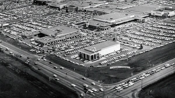
So it's fun to break sprawl down into its constituent parts. It's so easy to understand, the places where you only live, the places where you only work, the places where you only shop, and our super-sized public institutions. Schools get bigger and bigger, and therefore, further and further from each other. And the ratio of the size of the parking lot to the size of the school tells you all you need to know, which is that no child has ever walked to this school, no child will ever walk to this school. The seniors and juniors are driving the freshmen and the sophomores, and of course we have the crash statistics to prove it.
اینکه پراکندگی (شهری) رو به قطعات کوچکتر تقسیم کنیم، جالبه. فهمیدنش خیلی آسان است، مکانهایی که شما فقط زندگی کردید، مکانهایی که فقط در آن کار کردید، مکانهایی که در آن فقط خرید کردید، و موسسات دولتی بزرگ. مدرسه ها بزرگ و بزرگتر میشوند، و به همین خاطر از همدیگر دورتر و دورتر میشوند. ونسبت اندازه پارکینگ ها به اندازه مدرسه به شما هرچیزی لازم باشد میگوید، هیچ بچه ای به این مدرسه پیاده نرفته است، هیچ بچه ای به این مدرسه پیاده نخواهد رفت. سال بالایی ها سال اولی ها و دومی ها را میبرند، و صد البته ما آمار تصادفات را برای اثبات آن داریم.
And then the super-sizing of our other civic institutions like playing fields -- it's wonderful that Westin in the Ft. Lauderdale area has eight soccer fields and eight baseball diamonds and 20 tennis courts, but look at the road that takes you to that location, and would you let your child bike on it? And this is why we have the soccer mom now. When I was young, I had one soccer field, one baseball diamond and one tennis court, but I could walk to it, because it was in my neighborhood.
و همچنین بزرگ تر شدن موسسات دیگر شهریمان مثل زمین های بازی خیلی عالیست که وستین در محدوده فوت لادردیل ۸ زمین فوتبال و ۸ زمین بیسبال دارد و ۲۰ زمین تنیس، ولی به راهی که باید طی کنیم تا به آنجا برسیم نگاه کنید، میگذارید بچه تان این راه را با دوچرخه برود؟ همین دلیل داشتن"مادر فوتبالی" است. وقتی من بچه بودم، من یک زمین فوتبال داشتم، یک زمین بیسبال و یک زمین تنیس، ولی من میتوانستم پیاده به آن بروم، چون نزدیک خونمون بود.
Then the final part of sprawl that everyone forgot to count: if you're going to separate everything from everything else and reconnect it only with automotive infrastructure, then this is what your landscape begins to look like. The main message here is: if you want to have a walkable city, you can't start with the sprawl model. you need the bones of an urban model. This is the outcome of that form of design, as is this. And this is something that a lot of Americans want. But we have to understand it's a two-part American dream. If you're dreaming for this, you're also going to be dreaming of this, often to absurd extremes, when we build our landscape to accommodate cars first. And the experience of being in these places --
و آخرین بخش پراکندگی که همه فراموش میکنند به حساب بیاورند: اگر شما هرچیزی رو از چیزهای دیگر جدا کنید، و دوباره با زیرساخت های خودرویی بهم متصلشان کنیم، بعد این منظره(شهری) است به وجود میاید. پیام اصلی این است: اگر میخواهید یک شهر پیاده داشته باشید، با مدل پراکنده نمیتوانید شروع کنید. شما نیاز به چارچوبی از مدلی شهری دارید. این نتیجه آن فرم طراحیست، همینطور این. این چیزی است که بیشتر آمریکایی ها میخواهند. ولی باید بدانیم که این رویای دوبخشی آمریکایی است. اگر شما این رویا را دارید، شما این رویا را هم دارید، اغلب (ساختار شهری) بی هدف و اضافی اند، منظره شهری را بگونه ای میسازیم که اول ماشینها را درخود جای دهد و تجربه حضور در این مکانها
(Laughter)
(خنده حضار)
This is not Photoshopped. Walter Kulash took this slide. It's in Panama City. This is a real place. And being a driver can be a bit of a nuisance, and being a pedestrian can be a bit of a nuisance in these places. This is a slide that epidemiologists have been showing for some time now,
(متن عکس:این چراغ هیچ وقت سبز نخواهد شد!) این فتوشاپ نیست. والتر کولاش این اسلاید را گرفته است. در شهر پاناماست. این مکان واقعیست. و سواره بودن میتواند ازار باشد. و پیاده بودن میتواند آزار دهنده باشد در این مکانها. این اسلایدیست که اپیدمولوژیست ها برای مدتی نشان داده اند،
(Laughter)
(خنده حضار)
The fact that we have a society where you drive to the parking lot to take the escalator to the treadmill shows that we're doing something wrong. But we know how to do it better.
حقیقتی که ما جامعه ای داریم که به سوی پارکینگ رانندگی میکنیم با پله برقی به سمت تردمیل میرویم نشان میدهد که ما داریم اشتباه میکنیم. ولی میدونیم که چگونه بهترش بکنیم.
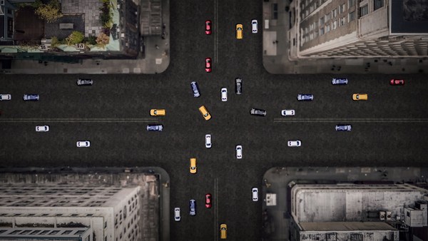
Here are the two models contrasted. I show this slide, which has been a formative document of the New Urbanism now for almost 30 years, to show that sprawl and the traditional neighborhood contain the same things. It's just how big are they, how close are they to each other, how are they interspersed together and do you have a street network, rather than a cul-de-sac or a collector system of streets?
اینجا دو مدل مختلف هست. این اسلاید را نشان میدهم، که سند سازنده شهرسازی نوین بوده است برای حدود 30 سال، تا نشان دهد که پراکندگی و همسایگی سنتی چیزهای یکسانی را شامل میشوند. اینکه چقدر بزرگ هستند، چقدر بهم نزدیک هستند، چقدر باهم آمیخته هستند و آیا شما یک شبکه خیابانی بجای تنگناها و بنبستها دارید یا یک سیستم جمع کننده از خیابان ها دارید؟
So when we look at a downtown area, at a place that has a hope of being walkable, and mostly that's our downtowns in America's cities and towns and villages, we look at them and say we want the proper balance of uses. So what is missing or underrepresented? And again, in the typical American cities in which most Americans live, it is housing that is lacking. The jobs-to-housing balance is off. And you find that when you bring housing back, these other things start to come back too, and housing is usually first among those things. And, of course, the thing that shows up last and eventually is the schools, because the people have to move in, the young pioneers have to move in, get older, have kids and fight, and then the schools get pretty good eventually.
ما وقتی به محدوده مرکز شهر نگاه میکنیم، جایی که امید به پیاده بودن در آنها هست، در شهرهای آمریکایی معمولا مراکز شهرمان هستند، و شهرها و روستاها، به آنها نگاه میکنیم و میگوییم، تعادل مناسبی از کاربریها لازم است. چه چیز فراموش شده یا جاافتاده؟ و دوباره،درشهر معمول آمریکایی که بیشتر آمریکایی ها زندگی میکند، کمبود خانه سازی هست، نسبت کار به مسکن تعادل ندارد. و وقتی معلوم میشود که شما مسکن را برمیگردانید، چیزهای دیگری هم بازمیگردد، معمولا مسکن اولینشان است. و البته در آخر چیزی که نمایان میشود، مدرسه ها هستند، چون مردم باید نقل مکان کنند، پیشگامان جوان نقل مکان میکنند، سنشان بالا میرود و بچه دار میشوند و دعوا میکنند، درنهایت مدرسه ها خوب میشوند.
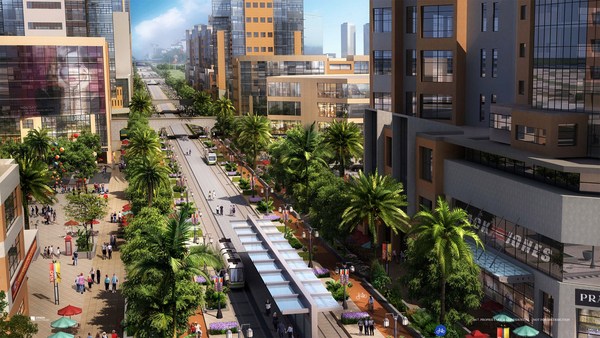
The other part of this part, the useful city part, is transit, and you can have a perfectly walkable neighborhood without it. But perfectly walkable cities require transit, because if you don't have access to the whole city as a pedestrian, then you get a car, and if you get a car, the city begins to reshape itself around your needs, and the streets get wider and the parking lots get bigger and you no longer have a walkable city. So transit is essential. But every transit experience, every transit trip, begins or ends as a walk, and so we have to remember to build walkability around our transit stations.
بخش دیگری از این قسمت، بخش کارآمد شهر، عبور ومرور است، و شما میتوانید بدون آن یک محله پیاده داشته باشید. ولی شهرهای کاملاً پیاده هم نیازمند عبور و مرور هستند، چون اگر شما به عنوان یک پیاده دسترسی به کل شهر نداشته باشید، شما ماشین میگیرید، و اگر ماشین بگیرید، شهر در راستای نیازهای شما دوباره شکل میگیرد، خیابان ها پهن تر میشوند، و پارکینگها بزرگتر میشوند و شما دیگر یک شهر پیاده ندارید. پس عبور و مرور لازم است. ولی هر تجربه عبور و مرور، هر سفر شهری، شروع یا پایانش با راه رفتن است، پس ما باید قابلیت پیاده بودن را اطراف ایستگاه هایمان در نظر بگیریم.
Next category, the biggest one, is the safe walk. It's what most walkability experts talk about. It is essential, but alone not enough to get people to walk. And there are so many moving parts that add up to a walkable city.
تقسیم بندی بعدی،بزرگترین آن، راه رفتن امن است. چیزیست که بیشتر متخصصان درباره آن میگویند. ضروریست،ولی به تنهایی کافی نیست که مردم را وادار به راه رفتن کند. بخش های زیاد دیگری وجود دارد که به شهر پیاده اضافه میشود.
The first is block size. This is Portland, Oregon, famously 200-foot blocks, famously walkable. This is Salt Lake City, famously 600-foot blocks, famously unwalkable. If you look at the two, it's almost like two different planets, but these places were both built by humans and in fact, the story is that when you have a 200-foot block city, you can have a two-lane city, or a two-to-four lane city, and a 600-foot block city is a six-lane city, and that's a problem. These are the crash statistics. When you double the block size -- this was a study of 24 California cities -- when you double the block size, you almost quadruple the number of fatal accidents on non-highway streets.
اولینشان اندازه بلوک است، این پرتلند، اورگان است، مشهور به بلوکهای ۲۰۰ فوتی، مشهور به راه رفتنی بودن. این سالت لیک سیتی است معروف به بلوکهای ۶۰۰ فوتی، معروف به غیرقابل راه رفتن. اگر به این دو نگاه کنید، تقریبا شبیه دو سیاره مختلف هستند. ولی این دو مکان به دست انسان ساخته شده است. و در حقیقت، داستان زمانیست که شما یک شهر با بلوک ۲۰۰ فوتی دارید، میتوانید شهر دولاینه داشته باشید یا یک شهر ۲ تا ۴ لاینه، یک شهر با بلوکهای ۶۰۰ فوتی، یک شهر ۶ لاینه است،و همین مشکل است. اینها آمار تصادفات هستند. وقتی شما ابعاد بلوک را دو برابر میکنید این مطالعه در ۲۴ شهرکالیفرنیا انجام شد -- وقتی ابعاد بلوک را ۲ برابر میکنید، تقریبا تعداد تصادفات کشنده را ۴ برابر میکنید در خیاباتهای غیر بزرگراه.
So how many lanes do we have? This is where I'm going to tell you what I tell every audience I meet, which is to remind you about induced demand. Induced demand applies both to highways and to city streets. And induced demand tells us that when we widen the streets to accept the congestion that we're anticipating, or the additional trips that we're anticipating in congested systems, it is principally that congestion that is constraining demand, and so that the widening comes, and there are all of these latent trips that are ready to happen. People move further from work and make other choices about when they commute, and those lanes fill up very quickly with traffic, so we widen the street again, and they fill up again. And we've learned that in congested systems, we cannot satisfy the automobile.
پس ما چند لاین داریم؟ این جاییست که من به شما خواهم گفت آنچه که به همه مخاطبانم میگویم، که به شما درباره تقاضاهای القایی یادآور میشود. نیازهای القایی هم به بزرگراهها و هم به خیابانها اعمال میشود. و به ما میگوید که وقتی ما خیابان ها را پهن میکنیم برای قبول ازدحامیست که پیش بینی میکنیم، یا سفرهای اضافی است که پیش بینی میکنیم در سیستم های متراکم، یک اصل است که ازدحام نیاز را تحمیل میکند، و پس پهن کردن انجام میشود، و سفرهای پنهان زیادی هستند که آماده وقوع هستند. مردم از کارشان دورتر میشوند تصمیمهای دیگری درباره زمان آمد و شدشان میگیرند، و آن لاینها به سرعت با ترافیک پر میشوند، پس ما دوباره خیابانها را پهن میکنیم، باز پر میشوند. و ما فهمیدیم که در سیستمهای متراکم، ما نمیتوانیم ماشین را راضی کنیم.
This is from Newsweek Magazine -- hardly an esoteric publication: "Today's engineers acknowledge that building new roads usually makes traffic worse." My response to reading this was, may I please meet some of these engineers, because these are not the ones that I -- there are great exceptions that I'm working with now -- but these are not the engineers one typically meets working in a city, where they say, "Oh, that road is too crowded, we need to add a lane." So you add a lane, and the traffic comes, and they say, "See, I told you we needed that lane." This applies both to highways and to city streets if they're congested.
این از مجله نیوزویک است به سختی یک نشریه داخلیست: مهندسان امروزه اذعان کرده اند: "ساختن راههای جدید معمولا ترافیک را بدتر میکند." پاسخ من به خواندن این بود: ممکنه تعدادی از این مهندسان را ملاقات کنم، چون اینها معمولا آنهایی نیستند که من استثنا هم هست، آنهایی که امروزه من باهاشان کار میکنم اینها مهندسانی نیستند که معمولا روی شهرها کار میکنند، جایی که آنها میگویند: آن راه شلوع است بیایید یک لاین دیگر اضافه کنیم. پس یک لاین اضافه میکنید، و ترافیک میآید و میگویند،"دیدید به آن لاین دیگر نیاز داشتیم." این هم به بزرگراهها و هم به خیابانها اگر متراکم باشد اعمال میشود.
But the amazing thing about most American cities that I work in, the more typical cities, is that they have a lot of streets that are actually oversized for the congestion they're currently experiencing. This was the case in Oklahoma City, when the mayor came running to me, very upset, because they were named in Prevention Magazine the worst city for pedestrians in the entire country. Now that can't possibly be true, but it certainly is enough to make a mayor do something about it. We did a walkability study, and what we found, looking at the car counts on the street -- these are 3,000-, 4,000-, 7,000-car counts and we know that two lanes can handle 10,000 cars per day. Look at these numbers -- they're all near or under 10,000 cars, and these were the streets that were designated in the new downtown plan to be four lanes to six lanes wide. So you had a fundamental disconnect between the number of lanes and the number of cars that wanted to use them.
ولی نکته جالب درباره اکثر شهرهای آمریکایی که رویشان کار کردم، معمولی ترین شهرها، این است که دارای خیابان های زیادی هستند که زیادی بزرگ شده اند برای ازدحامی که اکنون دارند. این یک مورد در اکلوهوما است وقتی که شهردار خیلی ناراحت به دیدنم آمد، چون اسمشان در مجله "جلوگیری" آمده بود بدترین شهر برای عابران پیاده در تمام کشور. آن احتمالا نمیتواند درست باشد، ولی قطعا کافیست تا شهردار را وادار به کاری کند مطالعه ای برای امکان پیاده روی کردیم و با نگاه کردن به تعداد ماشینها در خیابان فهمیدیم ۳۰۰۰،۴۰۰۰،۷۰۰۰ ماشین هست و میدانیم جاده های دولاینه ها روزانه ۱۰۰۰۰ جای میدهند. به این ارقام نگاه کنید تماما نزدیک یا زیر ده هزار هستند، و اینها خیابان هایی بودند که تعیین شده بودند در نقشه جدید مرکزشهر که ۴ یا ۶ لاینه باشند. پس یک تفکیک بنیادی بین تعداد لاین ها و تعداد ماشین های مورد مصرف داریم
So it was my job to redesign every street in the downtown from curb face to curb face, and we did it for 50 blocks of streets, and we're rebuilding it now. So a typical oversized street to nowhere is being narrowed, and now under construction, and the project is half done. The typical street like this, you know, when you do that, you find room for medians. You find room for bike lanes. We've doubled the amount of on-street parking. We've added a full bike network where one didn't exist before.
پس این کار من بود که تمام خیابان های مرکزشهر را دوباره طراحی کنم از جدول به جدول (خیابانها)، اینکارا برای خیابانهای ۵۰ بلوک انجام دادیم، و داریم دوباره میسازیمش. پس یک خیابان زیادی بزرگ شده معمولی به هیچکجا باریک شد،و اکنون در حال ساخت است، پروژه نصفیش انجام شده. خیابانهای معمولی مانند این،میدانید، وقتی آنرا انجام میدهید، فضا برای میانه جاده ها پیدا میشود. برای لاین دوچرخه. ما گنجایش پارکینگ خیابان را دو برابر کردیم. یک شبکه دوچرخه که قبلا وجود نداشت اضافه کردیم.
But not everyone has the money that Oklahoma City has, because they have an extraction economy that's doing quite well. The typical city is more like Cedar Rapids, where they have an all four-lane system, half one-way system. And it's a little hard to see, but what we've done -- what we're doing; it's in process right now, it's in engineering right now -- is turning an all four-lane system, half one-way into an all two-lane system, all two-way, and in so doing, we're adding 70 percent more on-street parking, which the merchants love, and it protects the sidewalk. That parking makes the sidewalk safe, and we're adding a much more robust bicycle network.
ولی همه پولی که اکلوهما سیتی داشت را ندارند، چون آنها یک اصل اقتصادی داشتند که خوب کار میکرد. یک شهر معمولی بیشتر شبیه سیدار راپیدز است، جاییکه سیستم چهارلاینه که نصف یک طرفه است، دارند. و کمی سخت است که ببینیم، ولی ما کاری که شما دارید انجام میدهید را انجام دادیم،درحال پیشرفت است، الان درحال مهندسی است درحال تبدیل سیستم دو لاین رفت، دو لاین برگشت به سیتم یک لاین رفت، یک لاین برگشت هستیم و برای انجام آن،ما ۷۰ درصد به پارکینگ خیابانی اضافه میکنیم، که بازرگانان دوست دارند، و (این طرح) از پیاده رو حفاظت میکند. (ایجاد) پارکینگ پیاده رو را امن میکند، و داریم یک شبکه قوی دوچرخه اضافه میکنیم.
Then the lanes themselves. How wide are they? That's really important. The standards have changed such that, as Andrés Duany says, the typical road to a subdivision in America allows you to see the curvature of the Earth.
بعد لاین ها خودشان چقدر پهنا دارند؟ واقعا مهم است. استانداردها تغییر کردند، اندرس دوانی میگوید، یک راه معمولی به بخش فرعی در آمریکا به شما امکان دیدن گردی زمین را میدهد.
(Laughter)
(خنده حضار)
This is a subdivision outside of Washington from the 1960s. Look very carefully at the width of the streets. This is a subdivision from the 1980s. 1960s, 1980s. The standards have changed to such a degree that my old neighborhood of South Beach, when it was time to fix the street that wasn't draining properly, they had to widen it and take away half our sidewalk, because the standards were wider. People go faster on wider streets. People know this. The engineers deny it, but the citizens know it, so that in Birmingham, Michigan, they fight for narrower streets. Portland, Oregon, famously walkable, instituted its "Skinny Streets" program in its residential neighborhood. We know that skinny streets are safer. The developer Vince Graham, in his project I'On, which we worked on in South Carolina, he goes to conferences and he shows his amazing 22-foot roads. These are two-way roads, very narrow rights of way, and he shows this well-known philosopher, who said, "Broad is the road that leads to destruction ... narrow is the road that leads to life."
این یک بخش فرعی خارج از واشنگتن در دهه ۶۰ است. به پهنای خیابانها با دقت نگاه کنید. این یک بخش فرعی از دهه ۸۰ است. دهه۶۰، دهه۸۰. استاندارها چنین تغییر کرده اند آن همسایگی قدیمی من در ساحل جنوبی، وقتی زمان درست کردن خیابانها شد، خوب تخلیه نمی کرد، باید پهنش میکردند و نصفی از پیاده رو را گرقتند، چون استانداردها پهنتر بود. مردم در خیابانهای پهن سریعتر میروند. مردم این رو میدونند. مهندسان زیربار نمیروند، ولی شهروندان میدانند، پس در بیرمنگهام، میشیگان، برای خیابان های باریک مبارزه کردند. پرتلند،اورگان مشهور به قابل پیاده بودن. در محله های مسکونی خود برنامه "خیابانهای باریک" را اجرا کرد. میدانیم که خیابانهای باریک امن ترند. وینس گراهام در پروژه"آی آن" خود که ما در کارولینا جنوبی کار کردیم، او به کنفرانس ها میرفت و راههای ۲۲ فوتی جذاب خود را نشان میداد. این راهها دوطرفه هستند، راههای بسیار باریک، و این فیلسوف معروف نشان داد، که گفت،: "راه پهن منجر به تخریب و راه باریک به زندگی هدایت میکند."
(Laughter)
(خنده حضار)
(Applause)
(تشویق)
This plays very well in the South.
این در جنوب خوب عمل کرد.
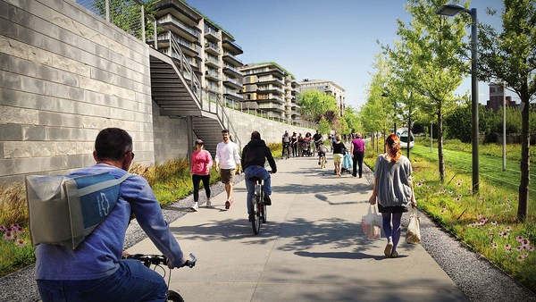
Now: bicycles. Bicycles and bicycling are the current revolution underway in only some American cities. But where you build it, they come. As a planner, I hate to say that, but the one thing I can say is that bicycle population is a function of bicycle infrastructure. I asked my friend Tom Brennan from Nelson\Nygaard in Portland to send me some pictures of the Portland bike commute. He sent me this. I said, "Was that bike to work day?" He said, "No, that was Tuesday." When you do what Portland did and spend money on bicycle infrastructure -- New York City has doubled the number of bikers in it several times now by painting these bright green lanes. Even automotive cities like Long Beach, California: vast uptick in the number of bikers based on the infrastructure. And of course, what really does it, if you know 15th Street here in Washington, DC -- please meet Rahm Emanuel's new bike lanes in Chicago, the buffered lane, the parallel parking pulled off the curb, the bikes between the parked cars and the curb -- these mint cyclists. If, however, as in Pasadena, every lane is a bike lane, then no lane is a bike lane. And this is the only bicyclist that I met in Pasadena, so ...
حالا: دوچرخه ها. دوچرخه و راندنش یک انقلاب درحال انجام است در بعضی شهرهای آمریکا. اما جایی که بسازیدش،میآیند. به عنوان یک طراح،بدم میاد آنرا بگویم، اما چیزی که میتونم بگم این است که جمعیت دوچرخه سوار تابعی از زیرساخت های دوچرخه است. از دوستم تام برنان درباره رفت و آمد دوچرخه در پرتلند پرسیدم که برایم عکس بفرستند از رفت و آمد دوچرخه در پرتلند. این را فرستاد.گفتم: "دوچرخه در یک روز کاری است؟" گفت،"نه،سه شنبه است." وقتی شما کاری که پرتلند کرد را میکنید و بر زیرساخت های دوچرخه هزینه میکنید نیویورک تا الان تعداد دوچرخه سوارانش را چندبرابر کرده است با کشیدن این لاینهای سبز روشن. حتی شهرهای ماشینی مانند لانگ بیچ، کالیفرنیا: تابع زیرساخت ها تعداد دوچرخه سواران بسیار افزایش یافته. و البته،آنچه واقعا انجامش داد، اگر شما خیابان ۱۵ ام را در واشینگتن بشناسید لطفا لاین های جدید دوچرخه رام امانویس را در شیکاگو ببینید، لاین میانه،موازی جای پارک کشیده شده کنار جدول، دوچرخه ها بین جای پارک و جدول این دوچرخه سواران تر و تازه. اگر،اگرچه، مانند پاسادنا، همه لاین ها لاین دوچرخه است پس هیچ لاینی لاین دوچرخه نیست. و این تنها دوچرخه ای بود که من پاسادانا دیدم، پس
(Laughter)
(خنده خضار)
The parallel parking I mentioned -- it's an essential barrier of steel that protects the curb and pedestrians from moving vehicles. This is Ft. Lauderdale; one side of the street, you can park, the other side of the street, you can't. This is happy hour on the parking side. This is sad hour on the other side. And then the trees themselves slow cars down. They move slower when trees are next to the road, and, of course, sometimes they slow down very quickly. All the little details -- the curb return radius. Is it one foot or is it 40 feet? How swoopy is that curb to determine how fast the car goes and how much room you have to cross. And then I love this, because this is objective journalism. "Some say the entrance to CityCenter is not inviting to pedestrians." When every aspect of the landscape is swoopy, is aerodynamic, is stream-form geometrics, it says: "This is a vehicular place." So no one detail, no one speciality, can be allowed to set the stage. And here, you know, this street: yes, it will drain within a minute of the hundred-year storm, but this poor woman has to mount the curb every day.
پارکینگ های موازی که قبلا گفتم مانع فولادی مهمی هستند که جدول و پیاده ها را از وسایل نقلیه محافظت میکند. این فورت لادردیل است، یک طرف خیابان میتوانید پارک کنید، آن طرف نمیتوانید. این لحظات خوبی در طرف پارک است، این لحظات بد در طرف بدون پارک است. و بعد درختان خودشان سرعت ماشین ها را کم میکنند. (رانده ها) آرام تر میرانند وقتی درختان کنار جاده هستند، و البته بعضی وقت ها خیلی سریع سرعت کم میکنند.(تصادف میکنند با درختان) تمام جزئیات کوچک شعاع دور زدن جدول (خیابان). ۱ فوت یا ۴۰ فوت است؟ چقدر آن جدول برای تعیین سرعت ماشین ها انحنای نرم دارد؟ و چقدر جا برای گذر کردن دارید؟ و بعد من این را دوست دارم، چون یک خبرنگاری بیطرفانه است. "بعضی میگویند ورودی مرکز شهر برای پباده ها دعوت کننده نیست." وقتی هر جنبه از منظره انحنا دارد، آیرودینامیک است، شکل هندسی جریانی است، میگوید:"یک مکان وابسطه به وسائل نقلیه است." پس هیج جزئیاتی، هیچ ویژگی خاصی، نماند اجازه داده شود تا وضعیت را درست کند و اینجا،شما میدانید، این خیابان: بله، در دقیقه ای از طوفان صدساله خالی میشود، اما این زن بیچاره، باید هر روز از جدول بالا برود.
So then quickly, the comfortable walk has to do with the fact that all animals seek, simultaneously, prospect and refuge. We want to be able to see our predators, but we also want to feel that our flanks are covered. And so we're drawn to places that have good edges, and if you don't supply the edges, people won't want to be there. What's the proper ratio of height to width? Is it one to one? Three to one? If you get beyond one to six, you're not very comfortable anymore. You don't feel enclosed. Now, six to one in Salzburg can be perfectly delightful. The opposite of Salzburg is Houston. The point being the parking lot is the principal problem here. However, missing teeth, those empty lots can be issues as well, and if you have a missing corner because of an outdated zoning code, then you could have a missing nose in your neighborhood. That's what we had in my neighborhood. This was the zoning code that said I couldn't build on that site. As you may know, Washington, DC is now changing its zoning to allow sites like this to become sites like this. We needed a lot of variances to do that. Triangular houses can be interesting to build, but if you get one built, people generally like it. So you've got to fill those missing noses.
پس سریعا،پیاده روی آسان با این حقیقت مواجه میشود تمام حیوانات، به طور همزمان، دنبال رفاه و آسایش هستند. دوست داریم که بتوانیم شکارچیانمان را ببینیم، همچنین دوست داریم که حس کنیم که اطرافمان پوشیده است. پس مکان هایی را میکشیم که لبه های خوبی دارند، اگر لبه ها را خوب نکشید مردم نمیخواهند که آنجا باشند. نسبت مناسب ارتفاع به پهنا چقدر است؟ یک به یک؟ سه به یک؟ اگر بیشتر از 6 به یک باشد دیگر خیلی راحت نخواهید بود. حس محصور بودن نمیکنید. حالا،6 به 1 در سالزبورگ میتواند خیلی مناسب باشد. برعکس سالزبورگ، هوستون است. مسئله اصلی اینجا نقطه پارک ماشین است. هرچند،مثل دندان افتاده، این پارکینگ های خالی میتواند مسئله ساز باشد، و اگر یک گوشه از دست رفته به خاطر منطقه بندی قدیمی داشته باشید، بعد میتوانید یک منظره بدی در محله خود داشته باشید. این چیزیست که در محله من داریم. منطقه بندی ای بود که میگفت نمیتوانم آنجا ساخت و ساز کنم. همانطور که ممکن است بدانید،واشنگتن، در حال تغییر منطقه بندیست تا سایتی هایی مانند این را اجازه دهد مثل این بشوند. اختلافات زیادی میخواهیم تا آن را انجام دهیم. خانه های مثلثی، میتوانند برای ساخت جالب باشد، ولی اگر یکی را بسازید، مردم بطور کلی دوستش دارند. پس شما باید آن منظره های خالی را پر کنید.
And then, finally, the interesting walk: signs of humanity. We are among the social primates. Nothing interests us more than other people. We want signs of people. So the perfect one-to-one ratio, it's a great thing. This is Grand Rapids, a very walkable city, but nobody walks on this street that connects the two best hotels together, because if on the left, you have an exposed parking deck, and on the right, you have a conference facility that was apparently designed in admiration for that parking deck, then you don't attract that many people. Mayor Joe Riley, in his 10th term, Mayor of Charleston, South Carolina, taught us it only takes 25 feet of building to hide 250 feet of garage. This one I call the Chia Pet Garage. It's in South Beach. That active ground floor.
و بعد درنهایت،(نکته) جالب پیاده روی: نشانه های انسانیت است. ما در میان پستانداران اجتماعی هستیم. هیچیز ما را بیشتر از دیگران هیجان زده نمیکند. ما نشانه های مردم را میخواهیم. پس نسبت ۱ به ۱ عالیست. این گراندرپیدز است. یک شهر قابل پیاده روی. ولی کسی بر این خیابان راه نمیرود که دو تا از بهترین هتل ها را بهم وصل میکند چون اگر در چپ، یک پارکینگ روباز دارید و در راست، تسهیلات کنفرانس دارید که ظاهرا برای تحسین پارکینگ ساخته شده است، بعد شما مردم زیادی را جذب نمیکنید. شهردار جو رایلی، در دوره دهم خود، شهردار چارلزتون،کارولینای جنوبی به ما یاد داد که فقط ۲۵ فوت ساختمان لازم است تا یک پارکنیگ ۲۵۰ فوتی را بپوشاند. این یکی که به آن پارکینگ "چای پت" میگویم در ساحل جنوبیست. آن طبقه همکف پر جنب وجوش.
I want to end with this project that I love to show. It's by Meleca Architects. It's in Columbus, Ohio. To the left is the convention center neighborhood, full of pedestrians. To the right is the Short North neighborhood -- ethnic, great restaurants, great shops, struggling. It wasn't doing very well because this was the bridge, and no one was walking from the convention center into that neighborhood. Well, when they rebuilt the highway, they added an extra 80 feet to the bridge. Sorry -- they rebuilt the bridge over the highway. The city paid 1.9 million dollars, they gave the site to a developer, the developer built this and now the Short North has come back to life. And everyone says, the newspapers, not the planning magazines, the newspapers say it's because of that bridge.
میخواهم با این پروژه که دوست دارم نشان بدهم، تمام کنم. توسط معماران ملکا طراحی شده است. در کولومبوس، اوهایو. در چپ یک مرکز همایش محله، پر از پیاده قرار دارد. در راست محله شورت نورت قرار دارد. قومی، رستوران های بزرگ، مغازه های بزرگ، باشگاه. خوب عمل نمیکرد چون این پل بود، و هیچکس از مرکز محله به آن محله نمیرفت. خب،وقتی دوباره بزرگراه را ساختند، ۸۰ فوت به پل اضافه کردند. ببخشید..آنها پل رو روی بزرگراه دوباره ساختند. شهر ۱.۹ میلیون دلار هزینه کرد، این سایت را به یک پیمانکار دادند، و پیمانکار این را ساخت و حالا شورت نورت به زندگی برگشت. و همه میگویند،روزنامه ها، نه مجله های طراحی، روزنامه ها میگویند که به خاطر پل است.
So that's it. That's the general theory of walkability. Think about your own cities. Think about how you can apply it. You've got to do all four things at once. So find those places where you have most of them and fix what you can, fix what still needs fixing in those places.
خب همین است. این تئوری قابل راه رفتن کردن است. به شهرهای خودتون فکر کنید. فکرکنید که چگونه میتوانید (این ایده) رو اعمال کنید. باید تمام این ۴ کار را با هم انجام دهید. پس مکانهایی را پیدا کنید که ازشون زیادی دارید. و آنچه که میتوانید رو درست کنید. در آن مکانها آنچه که نیاز به درست شدن دارد رو درست کنید.
I really appreciate your attention, and thank you for coming today.
واقعا قدردان توجهتون هستم. و مرسی که امروز آمدید.
(Applause)
(تشویق)