So I'm here to talk to you about the walkable city. What is the walkable city? Well, for want of a better definition, it's a city in which the car is an optional instrument of freedom, rather than a prosthetic device. And I'd like to talk about why we need the walkable city, and I'd like to talk about how to do the walkable city.
Estoy aquí para hablarles sobre la ciudad peatonal. ¿Qué es una ciudad peatonal? En espera de una mejor definición, es una ciudad en la que el automóvil es instrumento opcional de libertad, más que un dispositivo prostético. Me gustaría hablar del porqué se necesita una ciudad peatonal, y de cómo hacer una ciudad peatonal.
Most of the talks I give these days are about why we need it, but you guys are smart. And also I gave that talk exactly a month ago, and you can see it at TED.com. So today I want to talk about how to do it. In a lot of time thinking about this, I've come up with what I call the general theory of walkability. A bit of a pretentious term, it's a little tongue-in-cheek, but it's something I've thought about for a long time, and I'd like to share what I think I've figured out.
La mayoría de las charlas que doy son acerca del porqué se necesitan, pero Uds. son inteligentes. Además, di esa charla hace un mes exactamente, y la pueden ver en TED.com. Así que hoy quiero hablarles sobre cómo se hace. Después de pensarlo mucho se me ha ocurrido lo que llamo la teoría general de la peatonalidad. Un término un tanto pretencioso, de broma, pero es algo en lo que he pensado durante mucho tiempo, y me gustaría compartir lo que creo haber descubierto.
In the American city, the typical American city -- the typical American city is not Washington, DC, or New York, or San Francisco; it's Grand Rapids or Cedar Rapids or Memphis -- in the typical American city in which most people own cars and the temptation is to drive them all the time, if you're going to get them to walk, then you have to offer a walk that's as good as a drive or better. What does that mean? It means you need to offer four things simultaneously: there needs to be a proper reason to walk, the walk has to be safe and feel safe, the walk has to be comfortable and the walk has to be interesting. You need to do all four of these things simultaneously, and that's the structure of my talk today, to take you through each of those.
En la típica ciudad estadounidense, que no es Washington D.C., o Nueva York, o San Francisco, sino Grand Rapids o Cedar Rapids o Memphis, la típica ciudad estadounidense, donde casi todos tienen auto y la tentación es conducirlo todo el tiempo, la gente solo camina si se les promete una caminata que sea tan buena o mejor que un viaje en auto. ¿Qué significa esto? Que se necesitan cuatro cosas al mismo tiempo: se necesita una buena razón para caminar, la caminata debe ser y sentirse segura, debe ser cómoda, e interesante. Se debe cumplir con todo esto simultáneamente, y esa es la estructura de mi charla el día de hoy, los llevaré por cada una de estas cosas.
The reason to walk is a story I learned from my mentors, Andrés Duany and Elizabeth Plater-Zyberk, the founders of the New Urbanism movement. And I should say half the slides and half of my talk today I learned from them. It's the story of planning, the story of the formation of the planning profession. When in the 19th century people were choking from the soot of the dark, satanic mills, the planners said, hey, let's move the housing away from the mills. And lifespans increased immediately, dramatically, and we like to say the planners have been trying to repeat that experience ever since.
La razón por qué caminar es una historia que aprendí de mis mentores, Andrés Duany y Elizbeth Plater-Zyberk, los fundadores del Nuevo Urbanismo. Y debo decirles que la mitad de mis diapositivas y de mi charla, la aprendí de ellos. Es la historia de la planeación, la historia de la formación de la profesión de la planeación. En el siglo XIX cuando la gente se asfixiaba con el hollín de las oscuras y diabólicas fábricas, los urbanistas decidieron llevarse las casas lejos de las fábricas. Y la esperanza de vida se incrementó inmediata y drásticamente, y nos gusta decir que desde entonces los urbanistas siguen tratando de repetir esa experiencia.
So there's the onset of what we call Euclidean zoning, the separation of the landscape into large areas of single use. And typically when I arrive in a city to do a plan, a plan like this already awaits me on the property that I'm looking at. And all a plan like this guarantees is that you will not have a walkable city, because nothing is located near anything else. The alternative, of course, is our most walkable city, and I like to say, you know, this is a Rothko, and this is a Seurat. It's just a different way -- he was the pointilist -- it's a different way of making places. And even this map of Manhattan is a bit misleading because the red color is uses that are mixed vertically.
Ese es el comienzo del Urbanismo Euclidiano, la separación del paisaje en grandes áreas de uso único. Cuando llego a una ciudad para hacer un plan, un plan como este me espera en la propiedad que mire. Todo plan como este garantiza que no tendrás una ciudad peatonal, porque nada se encuentra cerca de nada. La alternativa es, sin duda, una ciudad más peatonal, y me gusta decir que este es un Rothko, y este un Seurat. Se trata de una forma diferente, él era puntillista, es una manera diferente de crear lugares. Incluso este mapa de Manhattan es un tanto erróneo porque el color rojo está mezclado verticalmente.
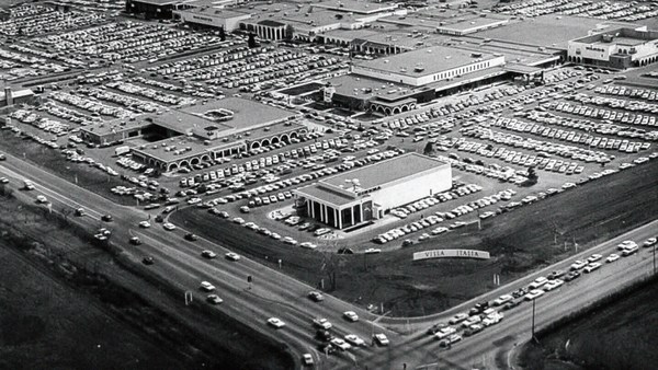
So this is the big story of the New Urbanists -- to acknowledge that there are only two ways that have been tested by the thousands to build communities, in the world and throughout history. One is the traditional neighborhood. You see here several neighborhoods of Newburyport, Massachusetts, which is defined as being compact and being diverse -- places to live, work, shop, recreate, get educated -- all within walking distance. And it's defined as being walkable. There are lots of small streets. Each one is comfortable to walk on. And we contrast that to the other way, an invention that happened after the Second World War, suburban sprawl, clearly not compact, clearly not diverse, and it's not walkable, because so few of the streets connect, that those streets that do connect become overburdened, and you wouldn't let your kid out on them. And I want to thank Alex Maclean, the aerial photographer, for many of these beautiful pictures that I'm showing you today.
Esta es la historia de los nuevos urbanistas, reconocer que hay solo dos maneras, que han sido probadas miles de veces, para construir comunidades en el mundo a través del tiempo. Una es el vecindario típico. Aquí pueden ver varios vecindarios de Newburyport, Massachusetts, el cual se define por ser tan compacto como diverso, hay lugar para vivir, trabajar, comprar, divertirse, estudiar, y a todo se puede ir caminando. Se define como peatonal. Hay muchas calles pequeñas. Todas son muy cómodas para caminar. Y se diferencia de las otras, inventadas después de la Segunda Guerra Mundial, la expansión suburbana, evidentemente nada compacta, ni diversa, ni peatonal, porque solo unas pocas calles conectan y las que sí conectan se sobre cargan, y no dejarían Uds. a sus hijos salir ahí. Quiero agradecerle a Alex Maclean, fotógrafo aéreo, por todas estas hermosas fotos que les estoy mostrando.
So it's fun to break sprawl down into its constituent parts. It's so easy to understand, the places where you only live, the places where you only work, the places where you only shop, and our super-sized public institutions. Schools get bigger and bigger, and therefore, further and further from each other. And the ratio of the size of the parking lot to the size of the school tells you all you need to know, which is that no child has ever walked to this school, no child will ever walk to this school. The seniors and juniors are driving the freshmen and the sophomores, and of course we have the crash statistics to prove it.
Es divertido desbaratar la expansión suburbana en sus componentes. Es tan fácil de entender, los lugares donde solo se vive, los lugares donde solo se trabaja, los lugares donde solo se compra, y nuestras enormes instituciones públicas. Las escuelas crecen y crecen, y, por lo tanto, se alejan más y más entre ellas. La relación entre el tamaño del estacionamiento y el de la escuela, nos dice todo, ningún niño ha caminado jamás a esta escuela, y ningún niño jamás lo hará. Los alumnos del último grado llevan a los de primero, tendríamos que revisar estadísticas para probarlo.
And then the super-sizing of our other civic institutions like playing fields -- it's wonderful that Westin in the Ft. Lauderdale area has eight soccer fields and eight baseball diamonds and 20 tennis courts, but look at the road that takes you to that location, and would you let your child bike on it? And this is why we have the soccer mom now. When I was young, I had one soccer field, one baseball diamond and one tennis court, but I could walk to it, because it was in my neighborhood.
Y luego, el supertamaño de nuestras otras instituciones públicas como campos de juego, --es maravilloso que Westin en el área de Ft. Lauderdale tenga ocho campos de fútbol, ocho de béisbol, y 20 canchas de tenis--, pero miren el camino que conduce a ese lugar, ¿dejarían a su hijo ir en bicicleta? Por esta razón existe la mamá futbolera. Cuando era joven, tenía un campo de fútbol, uno de béisbol y una cancha de tenis, y podía llegar caminando porque estaban en mi vecindario.
Then the final part of sprawl that everyone forgot to count: if you're going to separate everything from everything else and reconnect it only with automotive infrastructure, then this is what your landscape begins to look like. The main message here is: if you want to have a walkable city, you can't start with the sprawl model. you need the bones of an urban model. This is the outcome of that form of design, as is this. And this is something that a lot of Americans want. But we have to understand it's a two-part American dream. If you're dreaming for this, you're also going to be dreaming of this, often to absurd extremes, when we build our landscape to accommodate cars first. And the experience of being in these places --
La parte final de la expansión que todos olvidan mencionar: si vas a aislar todo de todo lo demás y lo vas a reconectar mediante infraestructura automovilística, así lucirá tu paisaje. El mensaje es: si quieres una ciudad peatonal, no debes seguir la expansión suburbana. Necesitas un modelo urbano. Este es el resultado de ese tipo de diseño, y este también. Y esto es lo que muchos estadounidenses quieren. Pero hay que entender que es un sueño americano de dos partes. Si uno sueña con esto, también deberá soñar con esto, a veces absurdos extremos... cuando diseñamos para acomodar autos en primer lugar. La experiencia de estar en estos lugares...
(Laughter)
(Risas)
This is not Photoshopped. Walter Kulash took this slide. It's in Panama City. This is a real place. And being a driver can be a bit of a nuisance, and being a pedestrian can be a bit of a nuisance in these places. This is a slide that epidemiologists have been showing for some time now,
Esto no es Photoshop. Walter Kulash hizo esta toma. Es en la ciudad de Panamá. Es un lugar real. Y ser conductor puede ser una molestia, y ser un peatón puede ser una molestia en estos lugares. Varios epidemiólogos han mostrado esta imagen desde hace tiempo,
(Laughter)
(Risas)
The fact that we have a society where you drive to the parking lot to take the escalator to the treadmill shows that we're doing something wrong. But we know how to do it better.
Vivir en una sociedad donde conduces hasta el estacionamiento y tomas una escalera eléctrica hasta la corredora, prueba que estamos haciendo algo mal. Pero sabemos cómo hacerlo mejor.
Here are the two models contrasted. I show this slide, which has been a formative document of the New Urbanism now for almost 30 years, to show that sprawl and the traditional neighborhood contain the same things. It's just how big are they, how close are they to each other, how are they interspersed together and do you have a street network, rather than a cul-de-sac or a collector system of streets?
Aquí pueden ver dos modelos. Les muestro esta diapositiva que ha sido un documento formativo del Nuevo Urbanismo por 30 años, para mostrar que el expandido y el tradicional contienen lo mismo. Solo varían en el tamaño, y en lo cerca que están, y lo entremezclados, y que uno tiene una red de calles, y no un camino cerrado o una colección de calles.
So when we look at a downtown area, at a place that has a hope of being walkable, and mostly that's our downtowns in America's cities and towns and villages, we look at them and say we want the proper balance of uses. So what is missing or underrepresented? And again, in the typical American cities in which most Americans live, it is housing that is lacking. The jobs-to-housing balance is off. And you find that when you bring housing back, these other things start to come back too, and housing is usually first among those things. And, of course, the thing that shows up last and eventually is the schools, because the people have to move in, the young pioneers have to move in, get older, have kids and fight, and then the schools get pretty good eventually.
Cuando miramos el área del centro, de un lugar que pudiera ser peatonal, o sea, varias de nuestras ciudades estadounidenses, pueblos y aldeas, queremos un balance adecuado de usos. ¿Qué falta o está poco representado? En la típica ciudad estadounidense en la que casi todos viven, faltan viviendas. El balance empleo-vivienda es bajo. Y cuando se incrementan las viviendas todo lo demás se reinstaura también, sobre todo, las viviendas. Y, claro, lo siguiente, las escuelas, porque la gente se muda a esos lugares, los pioneros se mudan, envejecen, tienen hijos y luchan, y las escuelas se vuelven mejores finalmente.
The other part of this part, the useful city part, is transit, and you can have a perfectly walkable neighborhood without it. But perfectly walkable cities require transit, because if you don't have access to the whole city as a pedestrian, then you get a car, and if you get a car, the city begins to reshape itself around your needs, and the streets get wider and the parking lots get bigger and you no longer have a walkable city. So transit is essential. But every transit experience, every transit trip, begins or ends as a walk, and so we have to remember to build walkability around our transit stations.
El otro lado de esto, la utilidad de la ciudad, es el tránsito, y se puede tener una perfecta ciudad peatonal sin ello. Pero las perfectas ciudades peatonales necesitan del tránsito, porque si no tienes acceso a toda la ciudad como peatón, entonces usas el auto, y si usas el auto, la ciudad se remodela de acuerdo a tus necesidades, y las calles se ensanchan, y los estacionamientos crecen, y dejas de tener una ciudad peatonal. El tránsito es esencial. Pero cada tipo de tránsito comienza o termina con una caminata, Por tanto, se necesita construir la peatonalidad alrededor del tránsito.
Next category, the biggest one, is the safe walk. It's what most walkability experts talk about. It is essential, but alone not enough to get people to walk. And there are so many moving parts that add up to a walkable city.
La siguiente y más extensa categoría es la seguridad. Es de lo que más hablan los expertos en peatonalidad. Es importante, pero no es lo único que se requiere para que la gente camine. Y hay muchas cosas que se necesitan en una ciudad peatonal.
The first is block size. This is Portland, Oregon, famously 200-foot blocks, famously walkable. This is Salt Lake City, famously 600-foot blocks, famously unwalkable. If you look at the two, it's almost like two different planets, but these places were both built by humans and in fact, the story is that when you have a 200-foot block city, you can have a two-lane city, or a two-to-four lane city, and a 600-foot block city is a six-lane city, and that's a problem. These are the crash statistics. When you double the block size -- this was a study of 24 California cities -- when you double the block size, you almost quadruple the number of fatal accidents on non-highway streets.
Primera, el tamaño de las cuadras. Esto es Portland, Oregon, famosa por sus 200 cuadras, famosa por su peatonalidad. Esta es Salt Lake City, famosa por sus 600 cuadras, famosamente no peatonal. Si las miran bien, lucen como dos planetas diferentes, pero ambos fueron construidos por humanos. Cuando tienes una ciudad de 200 cuadras, puedes tener calles de dos carriles, o de dos a cuatro. Y en una de 600, hasta seis carriles, lo cual es un problema. Estas, las estadísticas de choques. Cuando se duplica el tamaño de la cuadra, --según un estudio en 24 ciudades en California-- cuando se duplica el tamaño, se cuadruplica el número de accidentes mortales en calles de baja velocidad.
So how many lanes do we have? This is where I'm going to tell you what I tell every audience I meet, which is to remind you about induced demand. Induced demand applies both to highways and to city streets. And induced demand tells us that when we widen the streets to accept the congestion that we're anticipating, or the additional trips that we're anticipating in congested systems, it is principally that congestion that is constraining demand, and so that the widening comes, and there are all of these latent trips that are ready to happen. People move further from work and make other choices about when they commute, and those lanes fill up very quickly with traffic, so we widen the street again, and they fill up again. And we've learned that in congested systems, we cannot satisfy the automobile.
¿Cuántos carriles tenemos? Aquí les diré lo que le digo a todas mis audiencias, les recuerdo sobre la demanda inducida. La demanda inducida aplica para carreteras y calles. Una demanda inducida nos dice que cuando se ensanchan las calles para atender la congestión que estamos anticipando, o los viajes adicionales que anticipamos en sistemas congestionados, es principalmente esa congestión la que limita la demanda, y entonces se ensanchan las calles, y todos esos viajes latentes ocurren. La gente se muda más lejos de su trabajo y hacen otras elecciones sobre cuándo conmutar, y los carriles se llenan muy rápido, y ensanchamos otra vez las calles y se llenan de nuevo. Y aprendemos que en los sistemas congestionados no podemos satisfacer al automóvil.
This is from Newsweek Magazine -- hardly an esoteric publication: "Today's engineers acknowledge that building new roads usually makes traffic worse." My response to reading this was, may I please meet some of these engineers, because these are not the ones that I -- there are great exceptions that I'm working with now -- but these are not the engineers one typically meets working in a city, where they say, "Oh, that road is too crowded, we need to add a lane." So you add a lane, and the traffic comes, and they say, "See, I told you we needed that lane." This applies both to highways and to city streets if they're congested.
Esto es de la revista Newsweek, difícilmente desconocida: "Los ingenieros de hoy admiten que la construcción de nuevas calles empeora el tráfico". Mi respuesta a este artículo fue, me gustaría conocer a estos ingenieros, pues estos no son los que yo --hay grandes excepciones, con quienes trabajo--. pero estos no son los ingenieros que uno suele conocer en una ciudad, ellos dicen "Oh, esa calle es muy concurrida, agreguemos otro carril". Se agrega el carril, el tráfico llega, y dicen "Te dije que necesitábamos ese carril". Esto aplica a carreteras y calles si están congestionadas.
But the amazing thing about most American cities that I work in, the more typical cities, is that they have a lot of streets that are actually oversized for the congestion they're currently experiencing. This was the case in Oklahoma City, when the mayor came running to me, very upset, because they were named in Prevention Magazine the worst city for pedestrians in the entire country. Now that can't possibly be true, but it certainly is enough to make a mayor do something about it. We did a walkability study, and what we found, looking at the car counts on the street -- these are 3,000-, 4,000-, 7,000-car counts and we know that two lanes can handle 10,000 cars per day. Look at these numbers -- they're all near or under 10,000 cars, and these were the streets that were designated in the new downtown plan to be four lanes to six lanes wide. So you had a fundamental disconnect between the number of lanes and the number of cars that wanted to use them.
Lo sorprendente de las ciudades donde trabajo, las más típicas, es que tienen muchas calles demasiado grandes para la congestión que actualmente experimentan. Este es el caso de Oklahoma, cuando el alcalde vino a mí, bastante molesto, porque la revista "Prevention" declaró que era la peor ciudad para peatones en todo el país. Eso no puede ser verdad, pero ciertamente provocó que el alcalde hiciera algo al respecto. Hicimos un estudio de peatonalidad, y encontramos que, basado en en el número de autos en la ciudad, --3000, 4000, 7000--, sabemos que dos carriles manejan 10 000 autos al día. Miren esos números, todos por debajo de los 10 000 autos, estas son las calles que diseñamos en el plan del centro para que tuvieran de cuatro a seis carriles. Entonces se tuvo una desconexión entre el número de carriles y el número de autos que los usarían.
So it was my job to redesign every street in the downtown from curb face to curb face, and we did it for 50 blocks of streets, and we're rebuilding it now. So a typical oversized street to nowhere is being narrowed, and now under construction, and the project is half done. The typical street like this, you know, when you do that, you find room for medians. You find room for bike lanes. We've doubled the amount of on-street parking. We've added a full bike network where one didn't exist before.
Mi trabajo fue rediseñar todas las calles del centro de cuneta a cuneta, en 50 bloques de calles, y lo seguimos reconstruyendo ahora. Las calles enormes que no conducen a ningún lado las angostamos, ahora se están construyendo, el proyecto está por la mitad. Las típicas calles como esta, cuando se hace eso, queda buen espacio. Hay espacio para ciclovías. Duplicamos la cantidad de estacionamiento en la calle. Instauramos una red para bicicletas que no existía.
But not everyone has the money that Oklahoma City has, because they have an extraction economy that's doing quite well. The typical city is more like Cedar Rapids, where they have an all four-lane system, half one-way system. And it's a little hard to see, but what we've done -- what we're doing; it's in process right now, it's in engineering right now -- is turning an all four-lane system, half one-way into an all two-lane system, all two-way, and in so doing, we're adding 70 percent more on-street parking, which the merchants love, and it protects the sidewalk. That parking makes the sidewalk safe, and we're adding a much more robust bicycle network.
Pero no todos tienen el dinero que la ciudad de Oklahoma tiene, ya que su economía va bastante bien. La típica ciudad se asemeja más a Cedar Rapids, donde tienen cuatro carriles, la mitad de un sentido. Y es difícil imaginar pero lo que estamos haciendo, está en proceso, es ingeniería, convertir los cuatro carriles, mitad en un sentido, en dos, y todas de doble sentido. Al hacer esto se añadiría un 70 % de estacionamiento en calle, que los comerciantes aman y que protege las aceras. Ese estacionamiento asegura las aceras, y también enriquece la red de bicicletas.
Then the lanes themselves. How wide are they? That's really important. The standards have changed such that, as Andrés Duany says, the typical road to a subdivision in America allows you to see the curvature of the Earth.
¿Qué tan anchos son los carriles? Esto es importante, Los estándares han cambiado, como dice Andrés Duany, la calle típica de una subdivisión en EE. UU. te permite ver la curvatura de la Tierra.
(Laughter)
(Risas)
This is a subdivision outside of Washington from the 1960s. Look very carefully at the width of the streets. This is a subdivision from the 1980s. 1960s, 1980s. The standards have changed to such a degree that my old neighborhood of South Beach, when it was time to fix the street that wasn't draining properly, they had to widen it and take away half our sidewalk, because the standards were wider. People go faster on wider streets. People know this. The engineers deny it, but the citizens know it, so that in Birmingham, Michigan, they fight for narrower streets. Portland, Oregon, famously walkable, instituted its "Skinny Streets" program in its residential neighborhood. We know that skinny streets are safer. The developer Vince Graham, in his project I'On, which we worked on in South Carolina, he goes to conferences and he shows his amazing 22-foot roads. These are two-way roads, very narrow rights of way, and he shows this well-known philosopher, who said, "Broad is the road that leads to destruction ... narrow is the road that leads to life."
Esta es una subdivisión afuera de Washington en 1960. Observen el ancho de las calles. Esta es una subdivisión de 1980. 1960, 1980. Los estándares han cambiado a tal grado que mi viejo vecindario en South Beach, cuando arreglaron la calle porque no drenaba bien, la ensancharon y nos quitaron media acera, porque los estándares eran más anchos. La gente conduce más rápido en calles más anchas. La gente lo sabe. Los ingenieros lo niegan, pero la gente lo sabe, por eso en Birmingham, Michigan, luchan por calles más angostas. Portland, Oregon, famosamente peatonal, instauró su programa de calles muy estrechas en vecindarios residenciales. Sabemos que calles muy estrechas son más seguras. El desarrollador Vince Graham, en su proyecto "I'On", que trabajó en Carolina del Sur, en conferencias muestra sus espectaculares calles de 7 metros. Son calles de doble sentido, muy estrechas, y cita al famoso filósofo, que dijo, "Ancho es el camino que conduce a la destrucción... angosto el que conduce a la vida".
(Laughter)
(Risas)
(Applause)
(Aplausos)
This plays very well in the South.
Esto funciona muy bien en el sur.
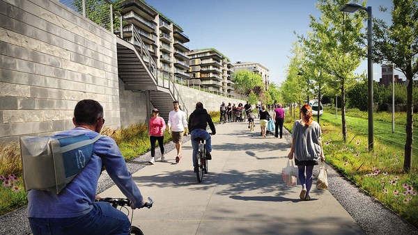
Now: bicycles. Bicycles and bicycling are the current revolution underway in only some American cities. But where you build it, they come. As a planner, I hate to say that, but the one thing I can say is that bicycle population is a function of bicycle infrastructure. I asked my friend Tom Brennan from Nelson\Nygaard in Portland to send me some pictures of the Portland bike commute. He sent me this. I said, "Was that bike to work day?" He said, "No, that was Tuesday." When you do what Portland did and spend money on bicycle infrastructure -- New York City has doubled the number of bikers in it several times now by painting these bright green lanes. Even automotive cities like Long Beach, California: vast uptick in the number of bikers based on the infrastructure. And of course, what really does it, if you know 15th Street here in Washington, DC -- please meet Rahm Emanuel's new bike lanes in Chicago, the buffered lane, the parallel parking pulled off the curb, the bikes between the parked cars and the curb -- these mint cyclists. If, however, as in Pasadena, every lane is a bike lane, then no lane is a bike lane. And this is the only bicyclist that I met in Pasadena, so ...
Ahora: bicicletas. Las bicicletas son una revolución en progreso solo en algunas ciudades de EE. UU. Pero cuando se construye, llegan. Como urbanista, odio decirlo pero debo decir que el uso de bicicletas depende de la infraestructura para estas. Le pedí a mi amigo Tom Brennan de Nelson\Nygaard en Portland que me enviara unas fotos del sistema de bicicleta de allá. Me envió esto y dije, "¿Era día de la bicicleta?". Él dijo, "No, era martes". Cuando se gasta dinero en infraestructura para bicicleta, como en Portland... recientemente Nueva York duplicó el número de ciclistas pintando carriles de verde. Incluso en ciudades como Long Beach, California: hubo un repunte en el número de ciclistas gracias a la infraestructura. Claro, lo que realmente lo logra, si conocen la calle 15 aquí en Washington, D.C. ... les presento las nuevas ciclovías de Rahm Emanuel en Chicago, las ciclovías, el estacionamiento junto a la cuneta, las bicicletas entre los autos estacionados y la cuneta, estos impecables ciclistas. Si, como en Pasadena, todos los carriles son a la vez ciclovía, significa que no hay ciclovías. Este es el único ciclista que conocí en Pasadena...
(Laughter)
(Risas)
The parallel parking I mentioned -- it's an essential barrier of steel that protects the curb and pedestrians from moving vehicles. This is Ft. Lauderdale; one side of the street, you can park, the other side of the street, you can't. This is happy hour on the parking side. This is sad hour on the other side. And then the trees themselves slow cars down. They move slower when trees are next to the road, and, of course, sometimes they slow down very quickly. All the little details -- the curb return radius. Is it one foot or is it 40 feet? How swoopy is that curb to determine how fast the car goes and how much room you have to cross. And then I love this, because this is objective journalism. "Some say the entrance to CityCenter is not inviting to pedestrians." When every aspect of the landscape is swoopy, is aerodynamic, is stream-form geometrics, it says: "This is a vehicular place." So no one detail, no one speciality, can be allowed to set the stage. And here, you know, this street: yes, it will drain within a minute of the hundred-year storm, but this poor woman has to mount the curb every day.
El estacionamiento paralelo es una barrera de acero imprescindible que protege la cuneta y a los peatones de los vehículos. Esto es Ft. Lauderdale; en un lado uno puede estacionar, en el otro, no. La hora feliz del lado del estacionamiento. Esta es hora infeliz del otro. Así, los autos desaceleran por los árboles. Se mueven más lento cuando hay árboles en la calle, y claro, a veces desaceleran muy deprisa. Todos los detalles... el radio de retorno. ¿Es de medio o de 12 metros? Qué curvada está esa cuneta para determinar cuán rápido van los autos y la distancia que se debe cruzar. Me encanta esto porque se trata de periodismo objetivo. "Algunos dicen que la entrada a CityCenter no es atractiva para peatones". Cuando todo tiene curvas, es aerodinámico, y hay figuras geométricas, significa: "Este es un lugar para vehículos". Ningún detalle, ninguna especialidad. puede usarse en la escena. Aquí, esta calle: se drenaría en un minuto en la tormenta del siglo, pero esta pobre mujer tiene que subir la cuneta todos los días.
So then quickly, the comfortable walk has to do with the fact that all animals seek, simultaneously, prospect and refuge. We want to be able to see our predators, but we also want to feel that our flanks are covered. And so we're drawn to places that have good edges, and if you don't supply the edges, people won't want to be there. What's the proper ratio of height to width? Is it one to one? Three to one? If you get beyond one to six, you're not very comfortable anymore. You don't feel enclosed. Now, six to one in Salzburg can be perfectly delightful. The opposite of Salzburg is Houston. The point being the parking lot is the principal problem here. However, missing teeth, those empty lots can be issues as well, and if you have a missing corner because of an outdated zoning code, then you could have a missing nose in your neighborhood. That's what we had in my neighborhood. This was the zoning code that said I couldn't build on that site. As you may know, Washington, DC is now changing its zoning to allow sites like this to become sites like this. We needed a lot of variances to do that. Triangular houses can be interesting to build, but if you get one built, people generally like it. So you've got to fill those missing noses.
De repente la caminata cómoda se relaciona con que todos los animales buscan, simultáneamente, perspectiva y refugio. Queremos ser capaces de ver a nuestros predadores, así como tener nuestros flancos protegidos. Así llegamos a lugares con buenos bordes, y si estos no se proveen, la gente no querrá estar allí. ¿Cuál es el ratio adecuado entre altura y anchura? ¿Uno a uno? ¿Tres a uno? si se pasa de uno a seis, se pierde la comodidad. No se siente uno protegido. Seis a uno en Salzburgo sería perfecto. Lo opuesto a Salzburgo es Houson. Mi punto es que el estacionamiento es el problema aquí. No obstante, esos lotes vacíos pueden ser un problema, si falta una esquina a causa de un mal código de zonificación, es como si al vecindario le faltara la nariz. Eso ocurrió en mi vecindario. Había un código de zonificación según el cual no se podía construir. Como saben, Washington D.C. está cambiando la zonificación para permitir que sitios así, se conviertan a sitios así. Necesitamos muchas varianzas para hacer algo así. Construir casas triangulares puede ser interesante, y si construyes una, a la gente usualmente le gusta. Así que, ¡a llenar esas narices perdidas!
And then, finally, the interesting walk: signs of humanity. We are among the social primates. Nothing interests us more than other people. We want signs of people. So the perfect one-to-one ratio, it's a great thing. This is Grand Rapids, a very walkable city, but nobody walks on this street that connects the two best hotels together, because if on the left, you have an exposed parking deck, and on the right, you have a conference facility that was apparently designed in admiration for that parking deck, then you don't attract that many people. Mayor Joe Riley, in his 10th term, Mayor of Charleston, South Carolina, taught us it only takes 25 feet of building to hide 250 feet of garage. This one I call the Chia Pet Garage. It's in South Beach. That active ground floor.
Por último, la caminata interesante: signos de humanidad. Somos primates sociables. Nada nos interesa más que la otra gente. Queremos signos de gente. El ratio uno a uno es perfecto. Esto es Grand Rapids, una ciudad muy peatonal, pero nadie camina en esta calle que conecta a los dos mejores hoteles, porque a la izquierda hay un estacionamiento expuesto, y a la derecha una unidad de conferencias que aparentemente fue diseñada para admirar el estacionamiento, y así no se atrae mucha gente. El alcalde Joe Riley, de Carolina del Sur en su décimo mandato, nos enseñó que solo se necesitan 8 metros de construcción para esconder 80 metros de estacionamiento. A esto lo llamo Chia Pet Garage. Está en South Beach. Hay mucha actividad en la calle.
I want to end with this project that I love to show. It's by Meleca Architects. It's in Columbus, Ohio. To the left is the convention center neighborhood, full of pedestrians. To the right is the Short North neighborhood -- ethnic, great restaurants, great shops, struggling. It wasn't doing very well because this was the bridge, and no one was walking from the convention center into that neighborhood. Well, when they rebuilt the highway, they added an extra 80 feet to the bridge. Sorry -- they rebuilt the bridge over the highway. The city paid 1.9 million dollars, they gave the site to a developer, the developer built this and now the Short North has come back to life. And everyone says, the newspapers, not the planning magazines, the newspapers say it's because of that bridge.
Finalizaré con este proyecto que me encanta mostrar. Es de los arquitectos Meleca. Está en Columbus, Ohio. A la izquierda el vecindario del centro de convenciones, lleno de peatones. A la derecha, el vecindario Short North, étnico, hay fantásticos restaurantes, tiendas, apuros. No le iba bien porque este era el puente, y nadie caminaba desde el centro de convenciones hasta aquel vecindario. Cuando reconstruyeron la carretera, le agregaron 24 metros al puente. Perdón, reconstruyeron el puente sobre la carretera. La ciudad pagó 1,9 millones de dólares, un desarrollador se encargó, y lo construyó y ahora Short North ha resucitado. Y todos lo dicen, los periódicos, no las revistas de urbanismo, que es debido al puente, dicen los periódicos.
So that's it. That's the general theory of walkability. Think about your own cities. Think about how you can apply it. You've got to do all four things at once. So find those places where you have most of them and fix what you can, fix what still needs fixing in those places.
De esto se trata la teoría general de la peatonalidad. Piensen en sus propias ciudades y en cómo aplicarla. Tienen que cumplir las cuatro a la vez. Encuentren lugares que cuenten con la mayoría, y arreglen lo que se pueda, lo que aún necesita arreglarse en esos lugares.
I really appreciate your attention, and thank you for coming today.
Agradezco mucho su atención, y gracias por asistir.
(Applause)
(Aplausos)