Technology can change our understanding of nature.
A tecnologia pode mudar a nossa compreensão da natureza.
Take for example the case of lions. For centuries, it's been said that female lions do all of the hunting out in the open savanna, and male lions do nothing until it's time for dinner. You've heard this too, I can tell. Well recently, I led an airborne mapping campaign in the Kruger National Park in South Africa. Our colleagues put GPS tracking collars on male and female lions, and we mapped their hunting behavior from the air. The lower left shows a lion sizing up a herd of impala for a kill, and the right shows what I call the lion viewshed. That's how far the lion can see in all directions until his or her view is obstructed by vegetation. And what we found is that male lions are not the lazy hunters we thought them to be. They just use a different strategy. Whereas the female lions hunt out in the open savanna over long distances, usually during the day, male lions use an ambush strategy in dense vegetation, and often at night. This video shows the actual hunting viewsheds of male lions on the left and females on the right. Red and darker colors show more dense vegetation, and the white are wide open spaces. And this is the viewshed right literally at the eye level of hunting male and female lions. All of a sudden, you get a very clear understanding of the very spooky conditions under which male lions do their hunting.
Vejamos, por exemplo, o caso dos leões. Por séculos, foi dito que as leoas se ocupam da caça na savana aberta, e leões machos não fazem nada até a hora do jantar. Vocês já ouviram isso também, dá para perceber. Bem, recentemente, eu conduzi uma campanha de mapeamento aéreo no Parque Nacional Kruger, na África do Sul. Nossos colegas colocaram coleiras de rastreamento GPS em leões machos e fêmeas, e mapeamos seu comportamento de caça do ar. No canto inferior esquerdo, tem um leão avaliando um rebanho de impalas para o ataque, e à direita tem o que eu chamo de campo de visão do leão. Essa é a distância que o leão pode ver em todas as direções, até que a sua visão seja obstruída pela vegetação. E o que descobrimos é que os leões machos não são os caçadores preguiçosos que nós pensávamos que eram. Eles só usam uma estratégia diferente. Enquanto as leoas caçam na savana aberta por longas distâncias, geralmente durante o dia, leões machos usam uma estratégia de emboscada na vegetação densa, e normalmente durante a noite. Este vídeo mostra os verdadeiros campos de visão de caça de leões machos à esquerda, e das fêmeas à direita. As cores vermelhas e escuras mostram vegetação mais densa, e o branco são amplos espaços abertos. E este é o campo de visão literalmente bem ao nível dos olhos de leões caçadores machos e fêmeas. De repente, tem-se uma compreensão muito clara das condições bem assustadoras sob as quais os leões machos se ocupam da caça. Levanto esse exemplo para começar,
I bring up this example to begin, because it emphasizes how little we know about nature. There's been a huge amount of work done so far to try to slow down our losses of tropical forests, and we are losing our forests at a rapid rate, as shown in red on the slide. I find it ironic that we're doing so much, yet these areas are fairly unknown to science. So how can we save what we don't understand?
porque ele enfatiza o quão pouco nós sabemos sobre a natureza. Houve uma enorme quantidade de trabalho feita até agora para tentar desacelerar nossas perdas de florestas tropicais, e estamos perdendo nossas florestas em um ritmo rápido, como mostrado em vermelho no <i>slide</i>. Acho irônico que estejamos fazendo tanto e, ainda assim, estas áreas sejam bastante desconhecidas da ciência. Como podemos salvar o que não entendemos? Bem, eu sou um ecologista global e um explorador da Terra,
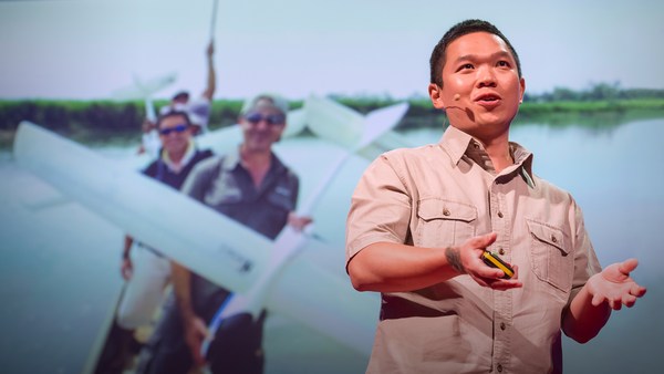
Now I'm a global ecologist and an Earth explorer with a background in physics and chemistry and biology and a lot of other boring subjects, but above all, I'm obsessed with what we don't know about our planet. So I created this, the Carnegie Airborne Observatory, or CAO. It may look like a plane with a fancy paint job, but I packed it with over 1,000 kilos of high-tech sensors, computers, and a very motivated staff of Earth scientists and pilots. Two of our instruments are very unique: one is called an imaging spectrometer that can actually measure the chemical composition of plants as we fly over them. Another one is a set of lasers, very high-powered lasers, that fire out of the bottom of the plane, sweeping across the ecosystem and measuring it at nearly 500,000 times per second in high-resolution 3D. Here's an image of the Golden Gate Bridge in San Francisco, not far from where I live. Although we flew straight over this bridge, we imaged it in 3D, captured its color in just a few seconds. But the real power of the CAO is its ability to capture the actual building blocks of ecosystems. This is a small town in the Amazon, imaged with the CAO. We can slice through our data and see, for example, the 3D structure of the vegetation and the buildings, or we can use the chemical information to actually figure out how fast the plants are growing as we fly over them. The hottest pinks are the fastest-growing plants. And we can see biodiversity in ways that you never could have imagined. This is what a rainforest might look like as you fly over it in a hot air balloon. This is how we see a rainforest, in kaleidoscopic color that tells us that there are many species living with one another. But you have to remember that these trees are literally bigger than whales, and what that means is that they're impossible to understand just by walking on the ground below them. So our imagery is 3D, it's chemical, it's biological, and this tells us not only the species that are living in the canopy, but it tells us a lot of information about the rest of the species that occupy the rainforest.
com formação em física, química, biologia e uma série de outros assuntos chatos, mas, acima de tudo, sou obcecado com o que não sabemos sobre o nosso planeta. Então, eu criei isso, o Observatório Aéreo Carnegie, ou CAO. Pode parecer um avião com uma pintura sofisticada, mas eu o enchi com mais de 1.000 quilos de sensores de alta tecnologia, computadores, e uma equipe muito motivada de cientistas planetários e pilotos. Dois dos nossos instrumentos são muito originais: um é chamado espectrômetro de imagem, que consegue medir a composição química das plantas à medida que as sobrevoamos. Outro é um conjunto de <i>lasers</i>, <i>lasers</i> muito potentes, que são disparados da parte inferior do avião, varrendo o ecossistema e medindo-o a cerca de 500 mil vezes por segundo em alta resolução 3D. Eis uma imagem da Ponte Golden Gate, em São Francisco, não muito longe de onde eu moro. Apesar de termos voado direto sobre esta ponte, nós a capturamos em 3D, capturamos sua cor em apenas alguns segundos. Mas o verdadeiro poder do CAO é a sua capacidade de capturar os alicerces dos ecossistemas. Esta é uma pequena cidade na Amazônia, fotografada com o CAO. Podemos passar pelos nossos dados e ver, por exemplo, a estrutura em 3D da vegetação e dos edifícios, ou podemos usar as informações químicas para descobrir a velocidade com que as plantas estão crescendo enquanto as sobrevoamos. As áreas em rosa mais forte são as plantas que crescem mais rápido. E podemos ver a biodiversidade de formas que vocês nunca poderiam ter imaginado. É assim que pode parecer uma floresta tropical ao sobrevoá-la em um balão de ar quente. Assim é como nós vemos uma floresta tropical, em cores caleidoscópicas que nos dizem que há muitas espécies convivendo umas com as outras. Mas temos que lembrar que essas árvores são, literalmente, maiores do que baleias, e isso significa que é impossível entendê-las apenas andando pelo chão, abaixo delas. Assim, as nossas imagens são 3D, químicas, biológicas, e nos mostram não só as espécies que estão vivendo nas copas, mas nos dão uma grande quantidade de informação sobre o resto das espécies que ocupam a floresta tropical. Bem, eu criei o CAO
Now I created the CAO in order to answer questions that have proven extremely challenging to answer from any other vantage point, such as from the ground, or from satellite sensors. I want to share three of those questions with you today. The first questions is, how do we manage our carbon reserves in tropical forests? Tropical forests contain a huge amount of carbon in the trees, and we need to keep that carbon in those forests if we're going to avoid any further global warming. Unfortunately, global carbon emissions from deforestation now equals the global transportation sector. That's all ships, airplanes, trains and automobiles combined. So it's understandable that policy negotiators have been working hard to reduce deforestation, but they're doing it on landscapes that are hardly known to science. If you don't know where the carbon is exactly, in detail, how can you know what you're losing? Basically, we need a high-tech accounting system. With our system, we're able to see the carbon stocks of tropical forests in utter detail. The red shows, obviously, closed-canopy tropical forest, and then you see the cookie cutting, or the cutting of the forest in yellows and greens. It's like cutting a cake except this cake is about whale deep. And yet, we can zoom in and see the forest and the trees at the same time. And what's amazing is, even though we flew very high above this forest, later on in analysis, we can go in and actually experience the treetrops, leaf by leaf, branch by branch, just as the other species that live in this forest experience it along with the trees themselves.
a fim de responder perguntas que se mostraram extremamente desafiadoras de qualquer outro ponto de vista, tais como do solo, ou de sensores de satélite. Quero compartilhar três dessas questões com vocês hoje. A primeira pergunta é: como vamos gerenciar nossas reservas de carbono nas florestas tropicais? As florestas tropicais contêm uma enorme quantidade de carbono nas árvores, e precisamos manter o carbono nessas florestas se quisermos evitar mais aquecimento global. Infelizmente, as emissões globais de carbono do desmatamento agora são equivalentes às do setor de transporte global. São todos os navios, aviões, trens e automóveis juntos. Portanto, é compreensível que os negociadores de políticas públicas venham trabalhando arduamente para reduzir o desmatamento, mas eles estão fazendo isso em cenários que são pouco conhecidos pela ciência. Se não soubermos onde o carbono está, exatamente, e detalhadamente, como podemos saber o que estamos perdendo? Basicamente, precisamos de um sistema de contabilidade de alta tecnologia. Com nosso sistema, podemos ver os estoques de carbono das florestas tropicais em detalhes absolutos. Em vermelho, obviamente, são florestas tropicas de dossel fechado, e dá para ver o corte em forma de bolo, ou o corte da floresta em amarelos e verdes. É como cortar um bolo, exceto que este bolo tem a profundidade de uma baleia. E, no entanto, pode-se ampliar e ver a floresta e as árvores ao mesmo tempo. E o surpreendente é que, apesar de termos voado muito alto, acima dessa floresta, mais tarde na análise, podemos entrar e realmente vivenciar as copas das árvores, folha por folha, galho por galho, assim como as outras espécies que vivem nessa floresta vivenciam-na juntamente com as próprias árvores. Temos usado a tecnologia para explorar
We've been using the technology to explore and to actually put out the first carbon geographies in high resolution in faraway places like the Amazon Basin and not-so-faraway places like the United States and Central America. What I'm going to do is I'm going to take you on a high-resolution, first-time tour of the carbon landscapes of Peru and then Panama. The colors are going to be going from red to blue. Red is extremely high carbon stocks, your largest cathedral forests you can imagine, and blue are very low carbon stocks. And let me tell you, Peru alone is an amazing place, totally unknown in terms of its carbon geography until today. We can fly to this area in northern Peru and see super high carbon stocks in red, and the Amazon River and floodplain cutting right through it. We can go to an area of utter devastation caused by deforestation in blue, and the virus of deforestation spreading out in orange. We can also fly to the southern Andes to see the tree line and see exactly how the carbon geography ends as we go up into the mountain system. And we can go to the biggest swamp in the western Amazon. It's a watery dreamworld akin to Jim Cameron's "Avatar." We can go to one of the smallest tropical countries, Panama, and see also a huge range of carbon variation, from high in red to low in blue. Unfortunately, most of the carbon is lost in the lowlands, but what you see that's left, in terms of high carbon stocks in greens and reds, is the stuff that's up in the mountains. One interesting exception to this is right in the middle of your screen. You're seeing the buffer zone around the Panama Canal. That's in the reds and yellows. The canal authorities are using force to protect their watershed and global commerce. This kind of carbon mapping has transformed conservation and resource policy development. It's really advancing our ability to save forests and to curb climate change.
e para realmente colocar as primeiras regiões de carbono em alta resolução em lugares distantes, como a Bacia Amazônica, e lugares não tão distantes, como os Estados Unidos e a América Central. O que vou fazer é que vou levá-los em um <i>tour</i> inédito, em alta resolução, do mapeamento de carbono do Peru e, em seguida, do Panamá. As cores irão de vermelho ao azul. O vermelho representa estoques de carbono extremamente altos, as maiores florestas catedrais que vocês possam imaginar, e o azul são estoques de carbono muito baixos. E deixem-me lhes dizer, o Peru por si só é um lugar incrível, totalmente desconhecido em termos de sua geografia de carbono, até hoje. Podemos voar a esta área, no norte do Peru, e ver estoques de carbono muito altos, em vermelho, e o Rio Amazonas e a planície inundada cortando através dela. Podemos ir para uma área de devastação completa causada pelo desmatamento, em azul, e o vírus do desmatamento espalhando-se, em laranja. Também podemos voar para o sul dos Andes para ver a linha das árvores e ver exatamente como as geografia de carbono termina, à medida que subimos a cadeia de montanhas. E podemos ir ao maior pântano no oeste da Amazônia. É um mundo de sonhos aquáticos semelhante ao "Avatar", de Jim Cameron. Podemos ir a um dos menores países tropicais, o Panamá, e ver também uma enorme gama de variação de carbono, de alto, em vermelho, ao baixo, em azul. Infelizmente, a maior parte do carbono é perdida nas terras baixas, mas o que dá para ver que resta, em termos de reservas de carbono em verdes e vermelhos, é o que está no alto das montanhas. Uma exceção interessante está bem no meio da tela. Dá para ver a zona de reserva em torno do Canal do Panamá. Está nos vermelhos e amarelos. As autoridades do canal estão usando força para proteger sua bacia hidrográfica e comércio global. Este tipo de mapeamento de carbono transformou os esforços de conservação e o desenvolvimento de políticas de recursos. Está mesmo melhorando nossa capacidade de salvar florestas e refrear a mudança climática.
My second question: How do we prepare for climate change in a place like the Amazon rainforest? Let me tell you, I spend a lot of time in these places, and we're seeing the climate changing already. Temperatures are increasing, and what's really happening is we're getting a lot of droughts, recurring droughts. The 2010 mega-drought is shown here with red showing an area about the size of Western Europe. The Amazon was so dry in 2010 that even the main stem of the Amazon river itself dried up partially, as you see in the photo in the lower portion of the slide. What we found is that in very remote areas, these droughts are having a big negative impact on tropical forests. For example, these are all of the dead trees in red that suffered mortality following the 2010 drought. This area happens to be on the border of Peru and Brazil, totally unexplored, almost totally unknown scientifically.
A minha segunda pergunta: como nos preparamos para a mudança climática em um lugar como a Floresta Amazônica? Vou lhes dizer, eu passo muito tempo nestes lugares, e estamos vendo que o clima já está mudando. As temperaturas estão aumentando, e o que realmente acontece é que estamos tendo muitas secas, secas recorrentes. Aqui está a mega seca de 2010, em vermelho, mostrando uma área de cerca do tamanho da Europa Ocidental. A Amazônia estava tão seca em 2010, que até o principal leito do próprio Rio Amazonas secou parcialmente, como se vê na foto, na parte de baixo do <i>slide</i>. Descobrimos que em áreas muito remotas, essas secas estão tendo um grande impacto negativo nas florestas tropicais. Por exemplo, em vermelho são todas as árvores mortas que sofreram mortalidade em consequência da seca de 2010. Essa área está na fronteira entre o Peru e o Brasil, totalmente inexplorada, quase totalmente desconhecida cientificamente.
So what we think, as Earth scientists, is species are going to have to migrate with climate change from the east in Brazil all the way west into the Andes and up into the mountains in order to minimize their exposure to climate change. One of the problems with this is that humans are taking apart the western Amazon as we speak. Look at this 100-square-kilometer gash in the forest created by gold miners. You see the forest in green in 3D, and you see the effects of gold mining down below the soil surface. Species have nowhere to migrate in a system like this, obviously.
Então, o que pensamos, como cientistas planetários, é que as espécies vão ter de migrar com a mudança climática, do leste do Brasil até o outro lado, a oeste no Andes, e subir as montanhas a fim de minimizar sua exposição à mudança climática. Um dos problemas com isso é que os seres humanos estão destruindo a Amazônia ocidental neste exato momento. Vejam este talho de 100 quilômetros quadrados na floresta, criado por garimpeiros. Dá para ver a floresta em verde, em 3D, e dá para ver os efeitos da mineração de ouro abaixo da superfície do solo. As espécies não têm para onde migrar em um sistema como este, obviamente.
If you haven't been to the Amazon, you should go. It's an amazing experience every time, no matter where you go. You're going to probably see it this way, on a river. But what happens is a lot of times the rivers hide what's really going on back in the forest itself. We flew over this same river, imaged the system in 3D. The forest is on the left. And then we can digitally remove the forest and see what's going on below the canopy. And in this case, we found gold mining activity, all of it illegal, set back away from the river's edge, as you'll see in those strange pockmarks coming up on your screen on the right. Don't worry, we're working with the authorities to deal with this and many, many other problems in the region.
Se vocês nunca foram para a Amazônia, deveriam ir. É uma experiência incrível toda vez, não importa onde vocês forem. Vocês provavelmente a verão desta forma, em um rio. Mas o que acontece é que, geralmente, os rios escondem o que realmente está acontecendo por detrás da própria floresta. Sobrevoamos este mesmo rio, escaneamos o sistema em 3D. A floresta esta à esquerda. E podemos remover a floresta digitalmente e ver o que está acontecendo abaixo da copa. E, neste caso, encontramos atividade de mineração de ouro, toda ilegal, afastadas da margem do rio, como dá para ver nessas manchas estranhas aparecendo na tela, à direita. Não se preocupem, estamos trabalhando com as autoridades para lidar com isso e muitos outros problemas na região. Portanto, a fim de montar um plano de conservação
So in order to put together a conservation plan for these unique, important corridors like the western Amazon and the Andes Amazon corridor, we have to start making geographically explicit plans now. How do we do that if we don't know the geography of biodiversity in the region, if it's so unknown to science? So what we've been doing is using the laser-guided spectroscopy from the CAO to map for the first time the biodiversity of the Amazon rainforest. Here you see actual data showing different species in different colors. Reds are one type of species, blues are another, and greens are yet another. And when we take this together and scale up to the regional level, we get a completely new geography of biodiversity unknown prior to this work. This tells us where the big biodiversity changes occur from habitat to habitat, and that's really important because it tells us a lot about where species may migrate to and migrate from as the climate shifts. And this is the pivotal information that's needed by decision makers to develop protected areas in the context of their regional development plans.
para estes corredores singulares e importantes, como o corredor do oeste da Amazônia e o da Amazônia dos Andes, temos que começar a fazer planos geograficamente explícitos agora. Como vamos fazer isso se não conhecemos a geografia da biodiversidade na região, se é tão desconhecida pela ciência? Então, o que estamos fazendo é usar a espectroscopia guiada por <i>laser</i> do CAO para mapear pela primeira vez a biodiversidade da floresta amazônica. Eis aqui dados reais, mostrando diferentes espécies, em cores diferentes. Em vermelho, um tipo de espécie, em azul, outra, e em verde, outra. E quando juntamos tudo e ampliamos ao nível regional, vemos uma geografia completamente nova de biodiversidade desconhecida, até este trabalho. Isso nos diz onde as grandes mudanças da biodiversidade ocorrem de <i>habitat</i> para <i>habitat</i>, e é muito importante porque nos mostra para onde as espécies podem migrar e de onde elas podem vir com as mudanças climáticas. E esta é a informação crucial e necessária aos responsáveis pelas decisões no desenvolvimento de áreas protegidas, no âmbito dos seus planos de desenvolvimentos regionais.
And third and final question is, how do we manage biodiversity on a planet of protected ecosystems? The example I started out with about lions hunting, that was a study we did behind the fence line of a protected area in South Africa. And the truth is, much of Africa's nature is going to persist into the future in protected areas like I show in blue on the screen. This puts incredible pressure and responsibility on park management. They need to do and make decisions that will benefit all of the species that they're protecting. Some of their decisions have really big impacts. For example, how much and where to use fire as a management tool? Or, how to deal with a large species like elephants, which may, if their populations get too large, have a negative impact on the ecosystem and on other species. And let me tell you, these types of dynamics really play out on the landscape. In the foreground is an area with lots of fire and lots of elephants: wide open savanna in blue, and just a few trees. As we cross this fence line, now we're getting into an area that has had protection from fire and zero elephants: dense vegetation, a radically different ecosystem. And in a place like Kruger, the soaring elephant densities are a real problem. I know it's a sensitive issue for many of you, and there are no easy answers with this. But what's good is that the technology we've developed and we're working with in South Africa, for example, is allowing us to map every single tree in the savanna, and then through repeat flights we're able to see which trees are being pushed over by elephants, in the red as you see on the screen, and how much that's happening in different types of landscapes in the savanna. That's giving park managers a very first opportunity to use tactical management strategies that are more nuanced and don't lead to those extremes that I just showed you. So really, the way we're looking at protected areas nowadays is to think of it as tending to a circle of life, where we have fire management, elephant management, those impacts on the structure of the ecosystem, and then those impacts affecting everything from insects up to apex predators like lions.
E a terceira e última questão é: como vamos gerenciar a biodiversidade em um planeta de ecossistemas protegidos? O exemplo com que comecei sobre leões caçando foi um estudo que fizemos por detrás da cerca de uma área protegida na África do Sul. E a verdade é que muito da natureza da África vai continuar existindo, no futuro, em áreas protegidas, como mostradas em azul na tela. Isso coloca uma pressão e responsabilidade incríveis no gerenciamento do parque. Eles precisam fazer e tomar decisões que vão beneficiar todas as espécies que eles estão protegendo. Algumas de suas decisões têm impactos realmente grandes. Por exemplo, quanto e onde usar o fogo como ferramenta de gestão? Ou, como lidar com uma espécie grande, como os elefantes, que podem, se sua população crescer demais, ter um impacto negativo no ecossistema e em outras espécies? E deixem-me lhes dizer, esses tipos de dinâmica realmente acontecem no meio ambiente. Em primeiro plano está uma área com muito fogo e muitos elefantes: a savana aberta, em azul, e apenas algumas árvores. Cruzando essa cerca, agora estamos chegando em uma área que foi protegida contra incêndio e zero elefantes: vegetação densa, um ecossistema radicalmente diferente. E em um lugar como Kruger, a densidade crescente de elefantes é um problema real. Sei que essa é uma questão delicada para muitos de vocês, e não há respostas fáceis para ela. Mas o bom é que a tecnologia que nós desenvolvemos e com que estamos trabalhando na África do Sul, por exemplo, permite-nos mapear cada uma das árvores na savana, e, em seguida, por meio de vários voos, conseguimos ver quais árvores estão sendo empurradas pelos elefantes, em vermelho, como dá para ver na tela, e o quanto isso está acontecendo em diferentes tipos de panoramas na savana. Isso está dando aos gerentes dos parques a primeira oportunidade de usar estratégias táticas de gestão que são mais sutis e não resultam naqueles extremos que acabei de lhes mostrar. Então, realmente, a maneira pela qual estamos encarando as áreas protegidas, hoje em dia, é pensar nelas com cuidando do círculo da vida, onde temos a gestão do fogo, gestão de elefantes, dos impactos sobre a estrutura do ecossistema, e, em seguida, esses impactos afetando tudo, desde insetos até predadores de ponta, como leões.
Going forward, I plan to greatly expand the airborne observatory. I'm hoping to actually put the technology into orbit so we can manage the entire planet with technologies like this. Until then, you're going to find me flying in some remote place that you've never heard of. I just want to end by saying that technology is absolutely critical to managing our planet, but even more important is the understanding and wisdom to apply it.
Daqui para frente, pretendo expandir o observatório aéreo. Espero conseguir colocar a tecnologia em órbita para que possamos gerenciar o planeta inteiro com tecnologias como esta. Até lá, vocês me encontrarão voando em algum lugar remoto de que vocês nunca ouviram falar. Eu gostaria de terminar dizendo que a tecnologia é absolutamente fundamental para gerenciar nosso planeta, mas ainda mais importante é a compreensão e a sabedoria para aplicá-la.
Thank you.
Obrigado.
(Applause)
(Aplausos)