Technology can change our understanding of nature.
Tehnologija može promijeniti naše razumijevanje prirode.
Take for example the case of lions. For centuries, it's been said that female lions do all of the hunting out in the open savanna, and male lions do nothing until it's time for dinner. You've heard this too, I can tell. Well recently, I led an airborne mapping campaign in the Kruger National Park in South Africa. Our colleagues put GPS tracking collars on male and female lions, and we mapped their hunting behavior from the air. The lower left shows a lion sizing up a herd of impala for a kill, and the right shows what I call the lion viewshed. That's how far the lion can see in all directions until his or her view is obstructed by vegetation. And what we found is that male lions are not the lazy hunters we thought them to be. They just use a different strategy. Whereas the female lions hunt out in the open savanna over long distances, usually during the day, male lions use an ambush strategy in dense vegetation, and often at night. This video shows the actual hunting viewsheds of male lions on the left and females on the right. Red and darker colors show more dense vegetation, and the white are wide open spaces. And this is the viewshed right literally at the eye level of hunting male and female lions. All of a sudden, you get a very clear understanding of the very spooky conditions under which male lions do their hunting.
Uzmite na primjer slučaj lavova. Kroz stoljeća, govoreno je kako ženke lavova obavljaju sav lov na otvorenoj savani a lavovi mužjaci ne rade ništa sve dok ne dođe vrijeme za večeru. I vi ste to čuli, vidim. Pa nedavno, vodio sam kampanju mapiranja iz zraka u Nacionalnom parku Kruger u Južnoj Africi. Naši su kolege stavili ovratnike za praćenje preko GPS na muške i ženske lavove, a mi smo mapirali njihovo lovačko ponašanje iz zraka. Niže lijevo pokazuje lavove kako promatraju stado impala radi lova, a desno pokazuje što zovem lavlji pregled. To je kako daleko lav može vidjeti u svim smjerovima dok mu ili joj pogled nije prekinut vegetacijom. A što smo otkrili je da muški lavovi nisu lijeni lovci kako što smo mislili. Samo koriste drugačiju strategiju. Dok lavice love na otvorenoj savani preko velikih udaljenosti, obično tijekom dana, muški lavovi koriste strategiju zasjede u gustoj vegetaciji, i često noću. Ovaj video pokazuje lovački pregled lavova mužjaka lijevo a ženki desno. Crvena i tamnije boje pokazuju gušću vegetaciju, a bijelo su širom otvoreni prostori. A ovo je pregled točan doslovno u razini očiju mužjaka i ženke lava u lovu. Odjednom, dobijete vrlo jasno razumjevanje vrlo sablasnih uvjeta pod kojima muški lavovi obavljaju svoj lov.
I bring up this example to begin, because it emphasizes how little we know about nature. There's been a huge amount of work done so far to try to slow down our losses of tropical forests, and we are losing our forests at a rapid rate, as shown in red on the slide. I find it ironic that we're doing so much, yet these areas are fairly unknown to science. So how can we save what we don't understand?
Navodim ovaj primjer za početak, jer naglašava kako malo znamo o prirodi. Već je obavljena ogromna količina rada u pokušaju da se uspori gubitak naših tropskih šuma, a gubimo šume brzom stopom, kao što je prikazano crvenom na slajdu. Nalazim ironičnim da radimo toliko puno, a ipak ova su područja zapravo nepoznata znanosti. Pa kako možemo sačuvati što ne razumijemo?
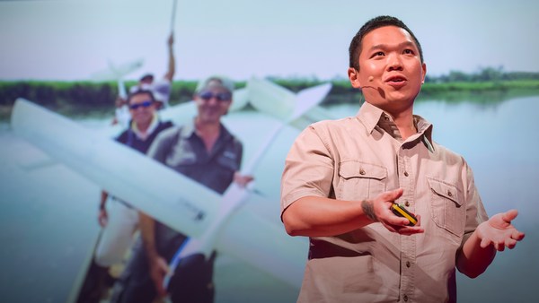
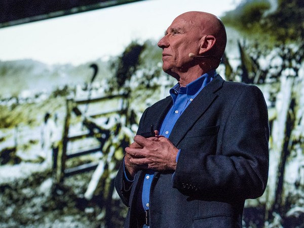
Now I'm a global ecologist and an Earth explorer with a background in physics and chemistry and biology and a lot of other boring subjects, but above all, I'm obsessed with what we don't know about our planet. So I created this, the Carnegie Airborne Observatory, or CAO. It may look like a plane with a fancy paint job, but I packed it with over 1,000 kilos of high-tech sensors, computers, and a very motivated staff of Earth scientists and pilots. Two of our instruments are very unique: one is called an imaging spectrometer that can actually measure the chemical composition of plants as we fly over them. Another one is a set of lasers, very high-powered lasers, that fire out of the bottom of the plane, sweeping across the ecosystem and measuring it at nearly 500,000 times per second in high-resolution 3D. Here's an image of the Golden Gate Bridge in San Francisco, not far from where I live. Although we flew straight over this bridge, we imaged it in 3D, captured its color in just a few seconds. But the real power of the CAO is its ability to capture the actual building blocks of ecosystems. This is a small town in the Amazon, imaged with the CAO. We can slice through our data and see, for example, the 3D structure of the vegetation and the buildings, or we can use the chemical information to actually figure out how fast the plants are growing as we fly over them. The hottest pinks are the fastest-growing plants. And we can see biodiversity in ways that you never could have imagined. This is what a rainforest might look like as you fly over it in a hot air balloon. This is how we see a rainforest, in kaleidoscopic color that tells us that there are many species living with one another. But you have to remember that these trees are literally bigger than whales, and what that means is that they're impossible to understand just by walking on the ground below them. So our imagery is 3D, it's chemical, it's biological, and this tells us not only the species that are living in the canopy, but it tells us a lot of information about the rest of the species that occupy the rainforest.
Sad, ja sam globalni ekolog i istraživač Zemlje sa pozadinom u fizici i kemiji i biologiji i mnoštvu drugih dosadnih predmeta, ali iznad svega, opsjednut sam onime što ne znamo o našem planetu. Pa sam stvorio ovo, Carnegiejev zračni opservatorij, ili CAO. Može izgledati poput aviona sa lijepim bojama, ali opremio sam ga sa preko 1000 kilograma visokotehnoloških senzora, računala, i vrlo motiviranom posadom znanstvenika o Zemlji i pilota. Dva od naših instrumenata su vrlo jedinstveni: jedan se zove oslikavajući spektrometar koji može mjeriti kemijski sastav biljaka dok ih nadlijećemo. Drugi je skup lasera, vrlo moćnih lasera, koji pucaju s donjeg dijela aviona prelazeći preko ekosustava i mjereći ga pri gotovo 500.000 taktova u sekundi u 3D visoke razlučivosti. Ovdje je slika mosta preko Golden Gatea u San Franciscu, ne daleko od gdje živim. Iako smo letjeli ravno iznad ovog mosta snimili smo ga u 3D, ulovili njegovu boju u samo nekoliko sekundi. Ali prava je moć CAO njegova sposobnost da uhvati stvarne sastavne dijelove raznih ekosustava. Ovo je gradić u Amazoni, oslikan sa CAO. Možemo sjeckati kroz naše podatke i vidjeti, na primjer, 3D strukturu vegetacije i građevina, ili možemo koristiti kemijsku informaciju da odredimo kako brzo biljke rastu dok ih nadlijećemo. Najtoplije ružičaste su najbrže rastuće biljke. I možemo vidjeti bioraznolikost na načine koje nikad niste mogli ni zamisliti. Ovo je kako kišna šuma može izgledati dok letite iznad nje u balonu. Ovo je kako mi vidimo kišnu šumu, u kaleidoskopskoj boji koja nam govori kako je tamo puno vrsta koje žive jedne s drugima. Ali morate zapamtiti da je ovo drveće doslovno veće od kitova, a to znači je kako ih je nemoguće razumjeti samo hodajući po tlu ispod njih. Dakle naš prikaz je 3D, kemijski je, biološki je, i ne govori nam samo o vrstama koje žive u krošnji, već nam govori puno informacija o ostatku vrsta koje nastanjuju kišnu šumu.
Now I created the CAO in order to answer questions that have proven extremely challenging to answer from any other vantage point, such as from the ground, or from satellite sensors. I want to share three of those questions with you today. The first questions is, how do we manage our carbon reserves in tropical forests? Tropical forests contain a huge amount of carbon in the trees, and we need to keep that carbon in those forests if we're going to avoid any further global warming. Unfortunately, global carbon emissions from deforestation now equals the global transportation sector. That's all ships, airplanes, trains and automobiles combined. So it's understandable that policy negotiators have been working hard to reduce deforestation, but they're doing it on landscapes that are hardly known to science. If you don't know where the carbon is exactly, in detail, how can you know what you're losing? Basically, we need a high-tech accounting system. With our system, we're able to see the carbon stocks of tropical forests in utter detail. The red shows, obviously, closed-canopy tropical forest, and then you see the cookie cutting, or the cutting of the forest in yellows and greens. It's like cutting a cake except this cake is about whale deep. And yet, we can zoom in and see the forest and the trees at the same time. And what's amazing is, even though we flew very high above this forest, later on in analysis, we can go in and actually experience the treetrops, leaf by leaf, branch by branch, just as the other species that live in this forest experience it along with the trees themselves.
Sad, stvorio sam CAO da bih odgovorio na pitanja koja su se pokazala izuzetno zahtjevna za odgovoriti iz bilo koje točke gledišta, kao sa zemlje, ili pomoću satelitskog senzora. Želim danas s vama podijeliti tri od tih pitanja. Prvo je pitanje, Kako upravljamo našim ugljičnim rezervama u tropskim šumama? Tropske šume sadrže ogromnu količinu ugljika u drveću, i mi trebamo zadržati taj ugljik u tim šumama ako želimo izbjeći ikakvo daljnje globalno zagrijavanje. Nažalost, globalno ispuštanje ugljika od krčenja šuma je sada jednako globalnom prijevozničkom sektoru. To su svi brodovi, avioni, vlakovi i automobili zajedno. Pa je razumljivo da politički pregovaratelji naporno rade kako bi smanjili krčenje šuma, ali oni to čine u krajobrazima koji jedva da su poznati znanosti. Ako ne znate gdje je ugljik točno, detaljno, kako možete znati što gubite? U osnovi, trebamo visokotehnološki računovodstveni sustav. S našim sustavom, moguće nam je vidjeti zalihe ugljika u tropskim šumama do najmanjeg detalja. Crvena pokazuje, očito, tropsku šumu zatvorene krošnje, i onda vidite rez kolača, ili rezove šume u žutima i zelenima. To je poput rezanja kolača osim što je ovaj kolač otprilike dubine kita. Pa ipak, možemo zumirati i vidjeti šumu i drveće istovremeno. A što je zapanjujuće, iako smo letjeli vrlo visoko iznad ove šume, kasnije u analizi, možemo ući unutra i zbilja iskusiti vrhove krošanja, list po list, granu po granu, baš kao što je druge vrste koje žive u ovoj šumi same doživljavaju zajedno sa drvima.
We've been using the technology to explore and to actually put out the first carbon geographies in high resolution in faraway places like the Amazon Basin and not-so-faraway places like the United States and Central America. What I'm going to do is I'm going to take you on a high-resolution, first-time tour of the carbon landscapes of Peru and then Panama. The colors are going to be going from red to blue. Red is extremely high carbon stocks, your largest cathedral forests you can imagine, and blue are very low carbon stocks. And let me tell you, Peru alone is an amazing place, totally unknown in terms of its carbon geography until today. We can fly to this area in northern Peru and see super high carbon stocks in red, and the Amazon River and floodplain cutting right through it. We can go to an area of utter devastation caused by deforestation in blue, and the virus of deforestation spreading out in orange. We can also fly to the southern Andes to see the tree line and see exactly how the carbon geography ends as we go up into the mountain system. And we can go to the biggest swamp in the western Amazon. It's a watery dreamworld akin to Jim Cameron's "Avatar." We can go to one of the smallest tropical countries, Panama, and see also a huge range of carbon variation, from high in red to low in blue. Unfortunately, most of the carbon is lost in the lowlands, but what you see that's left, in terms of high carbon stocks in greens and reds, is the stuff that's up in the mountains. One interesting exception to this is right in the middle of your screen. You're seeing the buffer zone around the Panama Canal. That's in the reds and yellows. The canal authorities are using force to protect their watershed and global commerce. This kind of carbon mapping has transformed conservation and resource policy development. It's really advancing our ability to save forests and to curb climate change.
Koristili smo tehnologiju da istražimo i objavimo prve zbiljske ugljične zemljopise u visokoj rezoluciji udaljenih mjesta poput Amazonskog bazena i ne tako udaljenih mjesta poput Sjedinjenih država i Srednje Amerike. Što ću sad napraviti je povesti vas na turu visoke razlučivoti, po prvi put, po ugljičnim krajobrazima Perua i potom Paname. Boje će se kretati od crvene do plave. Crveno su krajnje visoke zalihe ugljika, najveće katedralne šume koje možete zamisliti, a plavo su vrlo niske ugljične zalihe. I da vam kažem, već je sam Peru zapanjujuće mjesto, posve nepoznat u pogledu vlastitog ugljičnog zemljopisa do danas. Možemo odletjeti do ovog mjesta u sjevernom Peruu i vidjeti supervisoke zalihe ugljika u crvenoj, te rijeku Amazonu i poplavnu ravnicu kako prolazi kroz njih. Možemo otići do područja krajnjeg uništenja uzrokovanog krčenjem šuma u plavoj, te virusa krčenja šuma kako se širi van u narančastoj. Također možemo odletjeti do južnih Andi kako bi vidjeli granicu drveća i točno vidjeli kako ugljični zemljopis završava dok se penjemo u planinski sustav. I možemo otići do najveće močvare u zapadnoj Amazoni. To je vodena zemlja snova nalik Jim Cameronovom "Avataru" Možemo otići do jedne od najmanjih tropskih zemalja, Paname, i također vidjeti ogroman raspon varijacije ugljika, od visoke u crvenom do niske u plavom. Nažalost, najviše je ugljika izgubljeno u nizinama, ali ono što vidite da je preostalo, u pogledu visokih ugljičnih zaliha u zelenima i crvenima, je stvar koja je u planinama. Jedna zanimljiva iznimka od toga je točno na sredini ekrana. Vidite tampon zonu oko Panamskog kanala. To je u crvenima i žutima. Vlasti kanala koriste silu da zaštite svoje razvođe i globalnu trgovinu. Ova vrsta mapiranja ugljika je promijenila razvoj politike očuvanja i razvoj politike spram resursa. Zbilja nam je unaprijedila sposobnost da sačuvamo šume i obuzdamo klimatske promjene.
My second question: How do we prepare for climate change in a place like the Amazon rainforest? Let me tell you, I spend a lot of time in these places, and we're seeing the climate changing already. Temperatures are increasing, and what's really happening is we're getting a lot of droughts, recurring droughts. The 2010 mega-drought is shown here with red showing an area about the size of Western Europe. The Amazon was so dry in 2010 that even the main stem of the Amazon river itself dried up partially, as you see in the photo in the lower portion of the slide. What we found is that in very remote areas, these droughts are having a big negative impact on tropical forests. For example, these are all of the dead trees in red that suffered mortality following the 2010 drought. This area happens to be on the border of Peru and Brazil, totally unexplored, almost totally unknown scientifically.
Moje drugo pitanje: Kako se pripremiti za klimatske promjene na mjestu poput Amazonske prašume? Da vam kažem, provodim puno vremena ma takvim mjestima, i već vidimo klimu kako se mijenja. Temperature rastu, i što se zbilja događa je kako dobijamo puno suša, ponavljajućih suša. Mega-suša iz 2010. je prikazana ovdje sa crvenom koja pokazuje područje veličine oko zapadne Europe. Amazona je bila toliko suha te 2010. da se čak i sam glavni tok rijeke Amazone djelomično osušio, kao što vidite na fotografiji u nižem dijelu slajda. Što smo otkrili je kako u vrlo udaljenim područjima, ove suše imaju veliki negativni utjecaj na tropske šume. Na primjer, ovo je svo mrtvo drveće u crvenom koje je pretrpjelo usmrćenje uslijed suše 2010. Ovo je područje na granici Perua i Brazila, potpuno neistraženo, gotovo potpuno nepoznato znanosti.
So what we think, as Earth scientists, is species are going to have to migrate with climate change from the east in Brazil all the way west into the Andes and up into the mountains in order to minimize their exposure to climate change. One of the problems with this is that humans are taking apart the western Amazon as we speak. Look at this 100-square-kilometer gash in the forest created by gold miners. You see the forest in green in 3D, and you see the effects of gold mining down below the soil surface. Species have nowhere to migrate in a system like this, obviously.
Pa što mislimo, kao znanstvenici o Zemlji, je kako će se vrste morati seliti sa klimatskom promjenom istočno iz Brazila zapadno sve do unutar Andi i u planine da bi smanjile svoju izloženost promjeni klime. Jedan od problema s tim je kako ljudi rastavljaju zapadnu Amazonu baš u ovom trenutku. Pogledajte ovaj duboki rez od sto kvadratnih kilometara u šumi koji su napravili rudari zlata. Vidite šumu u zelenom u 3D, i vidite učinke rudarenja zlata ispod površine zemlje. Vrste nemaju kuda seliti u sustavu poput ovog, očito.
If you haven't been to the Amazon, you should go. It's an amazing experience every time, no matter where you go. You're going to probably see it this way, on a river. But what happens is a lot of times the rivers hide what's really going on back in the forest itself. We flew over this same river, imaged the system in 3D. The forest is on the left. And then we can digitally remove the forest and see what's going on below the canopy. And in this case, we found gold mining activity, all of it illegal, set back away from the river's edge, as you'll see in those strange pockmarks coming up on your screen on the right. Don't worry, we're working with the authorities to deal with this and many, many other problems in the region.
Ako niste bili u Amazoni, trebali bi otići. To je zapanjujuće iskustvo svaki put, bez obzira gdje odete. Vjerojatno ćete ju vidjeti na ovaj način, sa rijeke. Ali što se događa je kako puno puta rijeke sakrivaju što se zbilja događa iza u samoj šumi. Letjeli smo iznad iste ove rijeke, slikali sustav u 3D. Šuma je lijevo. A potom možemo digitalno maknuti šumu i gledati što se dešava ispod krošanja. A u ovom slučaju, našli smo aktivnosti rudarenja zlata, sve bespravne, postavljene nešto dalje od ruba rijeke. kao što ćete vidjeti u ovim neobičnim jamicama koje dolaze s desna. Ne brinite, radimo s vlastima da riješimo ovaj i brojne, brojne druge probleme u regiji.
So in order to put together a conservation plan for these unique, important corridors like the western Amazon and the Andes Amazon corridor, we have to start making geographically explicit plans now. How do we do that if we don't know the geography of biodiversity in the region, if it's so unknown to science? So what we've been doing is using the laser-guided spectroscopy from the CAO to map for the first time the biodiversity of the Amazon rainforest. Here you see actual data showing different species in different colors. Reds are one type of species, blues are another, and greens are yet another. And when we take this together and scale up to the regional level, we get a completely new geography of biodiversity unknown prior to this work. This tells us where the big biodiversity changes occur from habitat to habitat, and that's really important because it tells us a lot about where species may migrate to and migrate from as the climate shifts. And this is the pivotal information that's needed by decision makers to develop protected areas in the context of their regional development plans.
Pa kako bismo sastavili plan očuvanja za te jedinstvene, važne koridore poput koridora zapadne Amazone i andske Amazone, moramo početi raditi zemljopisno određene planove sada. Kako to činiti ako ne znamo zemljopis bioraznolikosti u regiji, ako je tako nepoznata znanosti? Pa što smo radili je koristili smo laserom vođenu spektroskopiju iz CAO da po prvi put mapiramo bioraznolikost Amazonske prašume. Ovdje vidite prave podatke koji pokazuju različite vrste u različitim bojama. Crveno su vrste jednog tipa, plavo drugog, a zelene opet nekog slijedećeg. A kad to saberemo zajedno i povećamo do regionalne razine, dobijemo posve novi zemljopis bioraznolikosti nepoznat prije ovog rada. Ovo nam govori gdje se velike promjene u bioraznolikosti pojavljuju od staništa do staništa, a to je zbilja važno jer nam govori puno o tome gdje se vrste mogu doseliti i odseliti kako se klima mijenja. A to je informacija od glavnog značaja koju trebaju donositelji odluka kako bi razvili zaštićena područja u kontekstu svojih regionalnih planova za razvoj.
And third and final question is, how do we manage biodiversity on a planet of protected ecosystems? The example I started out with about lions hunting, that was a study we did behind the fence line of a protected area in South Africa. And the truth is, much of Africa's nature is going to persist into the future in protected areas like I show in blue on the screen. This puts incredible pressure and responsibility on park management. They need to do and make decisions that will benefit all of the species that they're protecting. Some of their decisions have really big impacts. For example, how much and where to use fire as a management tool? Or, how to deal with a large species like elephants, which may, if their populations get too large, have a negative impact on the ecosystem and on other species. And let me tell you, these types of dynamics really play out on the landscape. In the foreground is an area with lots of fire and lots of elephants: wide open savanna in blue, and just a few trees. As we cross this fence line, now we're getting into an area that has had protection from fire and zero elephants: dense vegetation, a radically different ecosystem. And in a place like Kruger, the soaring elephant densities are a real problem. I know it's a sensitive issue for many of you, and there are no easy answers with this. But what's good is that the technology we've developed and we're working with in South Africa, for example, is allowing us to map every single tree in the savanna, and then through repeat flights we're able to see which trees are being pushed over by elephants, in the red as you see on the screen, and how much that's happening in different types of landscapes in the savanna. That's giving park managers a very first opportunity to use tactical management strategies that are more nuanced and don't lead to those extremes that I just showed you. So really, the way we're looking at protected areas nowadays is to think of it as tending to a circle of life, where we have fire management, elephant management, those impacts on the structure of the ecosystem, and then those impacts affecting everything from insects up to apex predators like lions.
I treće i konačno pitanje je, Kako upravljati bioraznolikošću na planetu zaštićenih ekosustava? Primjer s kojim sam započeo, o lavljem lovu, to je bilo istraživanje koje smo činili iza ograde zaštićenog područja u Južnoj Africi. A istina je kako će većina afričke prirode ustrajati u budućnosti u zaštićenim područjima poput ovih koje vam pokazujem plavo na ekranu. To stavlja nevjerojatan pritisak i odgovornost na upravu parka. Moraju izvršavati i donositi odluke koje će pogodovati svim vrstama koje štite. Neke od njihovih odluka imaju zbilja velike utjecaje. Na primjer, koliko puno i gdje koristiti vatru kao alat za upravljanje? Ili, kako se nositi sa velikim vrstama poput slonova, koji mogu, ako im populacije postanu prevelike, imati negativan utjecaj na ekosustav i na druge vrste? I da vam kažem, ovi tipovi dinamika se zbilja odražavaju na krajobrazu. U prvom je planu područje sa puno vatre i puno slonova: širom otvorena savana u plavom, i samo nekoliko drvećaa. Kako prelazimo ovu ogradu, sad dolazimo u područje koje je imalo zaštitu od vatre i ništa slonova: gusta vegetacija, temeljito različit ekosustav. A na mjestu poput Krugera, velike gustoće slonova su stvarni problem. Znam da je to osjetljivo pitanje za puno vas, i nema laganih odgovora s tim u vezi. Ali što je dobro je kako nam tehnologija koju smo razvili i s kojom radimo u Južnoj Africi, na primjer, omogućuje da mapiramo svako pojedino drvo u savani, te potom kroz ponavljane letove smo u stanju vidjeti koja drva su prevaljena od slonova, u crvenom kako vidite na ekranu, i koliko se toga događa u različitim tipovima krajobraza u savani. To daje upraviteljima parkova prvu priliku da koriste strategije taktičkog upravljanja koje su istančanije i koje ne vode u krajnosti koje sam vam upravo pokazao. Pa zapravo, način na koji gledamo na zaštićena područja danas je razmišljati o njima kao o brizi za krug života, gdje imamo upravljanje vatrom, upravljanje slonovima, takve utjecaje na strukturu ekosustava, a potom se ti utjecaji odražavaju na sve od insekata do vršnih grabežljivaca poput lavova.
Going forward, I plan to greatly expand the airborne observatory. I'm hoping to actually put the technology into orbit so we can manage the entire planet with technologies like this. Until then, you're going to find me flying in some remote place that you've never heard of. I just want to end by saying that technology is absolutely critical to managing our planet, but even more important is the understanding and wisdom to apply it.
U nastavku, planiram jako proširiti zračni opservatorij. Nadam se da ću zapravo staviti tehnologiju u orbitu tako da možemo upravljati čitavim planetom s tehnologijama poput ove. Do tada, naći ćete me kako letim u nekom udaljenom mjestu za koje nikad niste čuli. Samo bih želio reći kako je tehnologija apsolutno kritična za upravljanje našim planetom, ali još je važnije razumijevanje i mudrost da se primijeni.
Thank you.
Hvala vam.
(Applause)
(Pljesak)