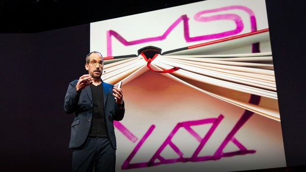
What I'm going to show you first, as quickly as I can, is some foundational work, some new technology that we brought to Microsoft as part of an acquisition almost exactly a year ago. This is Seadragon, and it's an environment in which you can either locally or remotely interact with vast amounts of visual data.
Ensiksi näytän teille niin nopeasti kuin voin joitakin perustöitä, uutta teknologiaa, jota toimme Microsoftiin yrityskaupassa lähes vuosi sitten. Tämä on Seadragon. Se on ympäristö, jossa voi joko paikallisesti tai etäältä olla yhteydessä suureen määrään visuaalista tietoa.
We're looking at many, many gigabytes of digital photos here and kind of seamlessly and continuously zooming in, panning through it, rearranging it in any way we want. And it doesn't matter how much information we're looking at, how big these collections are or how big the images are. Most of them are ordinary digital camera photos, but this one, for example, is a scan from the Library of Congress, and it's in the 300 megapixel range. It doesn't make any difference because the only thing that ought to limit the performance of a system like this one is the number of pixels on your screen at any given moment. It's also very flexible architecture. This is an entire book, so this is an example of non-image data. This is "Bleak House" by Dickens. Every column is a chapter. To prove to you that it's really text, and not an image, we can do something like so, to really show that this is a real representation of the text; it's not a picture. Maybe this is an artificial way to read an e-book. I wouldn't recommend it.
Katselemme monen gigatavun kokoisia digitaalisia kuvia ja lähennämme jatkuvasti saumattomasti, panoroimme kuvien läpi, järjestelemme ne mielemme mukaan. Ei haittaa, kuinka paljon informaatiota on katsottavana, kuinka suuria kokoelmat ovat tai kuinka suuria kuvat ovat. Useimmat niistä on otettu tavallisella digikameralla, mutta tämä on skannattu Library of Congressista ja kooltaan noin 300 megapikseliä. Se ei haittaa, sillä ainoa tämäntyyppistä järjestelmää rajoittava tekijä on oman näyttönne pikselimäärä. Arkkitehtuuriltaan se on myös hyvin joustava. Tämä on kokonainen kirja, esimerkki ei-kuvatiedosta. Kirja on Dickensin Bleak House. Jokainen sarake on luku. Todistamme, että se on todella tekstiä, eikä kuva tekemällä esimerkiksi näin, jolloin näette että kyseessä on oikea teksti, ei kuva. Ehkä tämä on hieman keinotekoinen tapa lukea kirjaa verkossa. En suosittelisi sitä.
This is a more realistic case, an issue of The Guardian. Every large image is the beginning of a section. And this really gives you the joy and the good experience of reading the real paper version of a magazine or a newspaper, which is an inherently multi-scale kind of medium. We've done something with the corner of this particular issue of The Guardian. We've made up a fake ad that's very high resolution -- much higher than in an ordinary ad -- and we've embedded extra content. If you want to see the features of this car, you can see it here. Or other models, or even technical specifications. And this really gets at some of these ideas about really doing away with those limits on screen real estate. We hope that this means no more pop-ups and other rubbish like that -- shouldn't be necessary.
Tämä on realistisempi tapaus. The Guardian -sanomalehti. Jokaisesta isosta kuvasta alkaa uusi osa. Tämä todella on miellyttävä ja hyvä tapa lukea aikakauslehden tai sanomalehden paperiversio, joka on luonnostaan monipuolinen väline. Olemme myös lisänneet jotakin tämän The Guardian -lehden kulmaan. Olemme lisänneet tekaistun mainoksen, jonka resoluutio on korkeampi kuin normaalisti olisi mahdollista ja upottaneet siihen lisäsisältöä. Tämän auton ominaisuudet voitte nähdä tässä. Voitte nähdä muita malleja, tai jopa tekniset tiedot. Tämä todella toteuttaa ideoita näytön asettamien rajojen poistamisesta. Toivomme, että tämä poistaa ponnahdusikkunat ja muun vastaavan roskan, joka ei ole tarpeen.
Of course, mapping is one of those obvious applications for a technology like this. And this one I really won't spend any time on, except to say that we have things to contribute to this field as well. But those are all the roads in the U.S. superimposed on top of a NASA geospatial image. So let's pull up, now, something else. This is actually live on the Web now; you can go check it out.
Tietenkin, kartoitus on yksi päivänselvistä sovelluksista tällaiselle teknologialle. Enkä aio kuluttaa aikaa tämän kanssa, paitsi sanoa, että meillä on myös annettavaa tälle alalle. Nuo ovat kaikki tiet Yhdysvalloissa heijastettuna NASAn geospatiaalisen kuvan päälle. Otetaan sitten esiin jotain muuta. Tämä on itse asiassa tosiaikainen verkossa nyt, voitte tarkistaa.
This is a project called Photosynth, which marries two different technologies. One of them is Seadragon and the other is some very beautiful computer-vision research done by Noah Snavely, a graduate student at the University of Washington, co-advised by Steve Seitz at U.W. and Rick Szeliski at Microsoft Research. A very nice collaboration. And so this is live on the Web. It's powered by Seadragon. You can see that when we do these sorts of views, where we can dive through images and have this kind of multi-resolution experience.
Tämä on projekti nimeltään Photosynth, joka itse asiassa liittää yhteen kaksi teknologiaa. Toinen niistä on Seadragon ja toinen erittäin ihana tietokonenäkötutkimus, jonka suoritti Noah Snavely, Washingtonin yliopiston jatko-opiskelija, ohjaajinaan Steve Seitz ja Microsoftin Rick Szeliski. Erittäin hyvää yhteistyötä. Tämä siis on tosiaikaista verkossa. Sitä ohjaa Seadragon. Voitte nähdä, että me luomme tällaisia näkymiä, joissa voimme sukeltaa kuvien läpi ja saada moniresoluutioisen kokemuksen.
But the spatial arrangement of the images here is actually meaningful. The computer vision algorithms have registered these images together so that they correspond to the real space in which these shots -- all taken near Grassi Lakes in the Canadian Rockies -- all these shots were taken. So you see elements here of stabilized slide-show or panoramic imaging, and these things have all been related spatially. I'm not sure if I have time to show you any other environments. Some are much more spatial. I would like to jump straight to one of Noah's original data-sets -- this is from an early prototype that we first got working this summer -- to show you what I think is really the punch line behind the Photosynth technology, It's not necessarily so apparent from looking at the environments we've put up on the website. We had to worry about the lawyers and so on.
Kuvien tilajärjestely on tässä itse asiassa merkityksellistä. Tietokonenäön algoritmit ovat rekisteröineet nämä kuvat yhteen, joten ne vastaavat todellista tilaa, jossa nämä kuvat - kaikki otettu lähellä Grassi-järviä Kanadan Kalliovuorilla - Joten näette täällä elementtejä stabiloidusta diaesityksestä tai panoraamakuvista, ja nämä täällä on kaikki liitetty spatiaalisesti. En ole varma onko minulla aikaa näyttää teille muita ympäristöjä. Nämä ovat paljon spatiaalisempia. Haluaisin siirtyä suoraan yhteen Noahin alkuperäiseen tietosarjaan - ja tässä on aikainen prototyyppi Photosynthistä, jonka saimme toimimaan kesällä - ja näyttää teille mikä mielestäni on tämän teknologian todellinen huipentuma, Photosynth-teknologia. Se ei välttämättä ole niin näkyvä katsottaessa ympäristöjä, joita olemme ladanneet verkkosivuille. Meidän on otettava huomioon asianajajat ja niin edelleen.
This is a reconstruction of Notre Dame Cathedral that was done entirely computationally from images scraped from Flickr. You just type Notre Dame into Flickr, and you get some pictures of guys in T-shirts, and of the campus and so on. And each of these orange cones represents an image that was discovered to belong to this model. And so these are all Flickr images, and they've all been related spatially in this way. We can just navigate in this very simple way.
Tämä on rekonstruoitu Notre Damen katedraali, joka tehtiin kokonaan tietokoneistetusti kuvista, jotka poimittiin Flickr.comista. Kirjoita Notre Dame Flickriin, ja saat kuvia kavereista t-paidoissa ja yliopiston kampuksella jne. Jokainen näistä oransseista kartioista edustaa kuvaa, jonka havaittiin kuuluvan tähän malliin. Joten kaikki nämä ovat Flickrin kuvia, ja ne on liitetty spatiaalisesti tällä tavalla. Voimme navigoida tällä yksinkertaisella tavalla.
(Applause)
(Aplodit)
(Applause ends)
You know, I never thought that I'd end up working at Microsoft. It's very gratifying to have this kind of reception here.
En koskaan kuvitellut, että lopulta olisin töissä Microsoftissa. Olen iloinen saamastani vastaanotosta.
(Laughter)
(Naurua)
I guess you can see this is lots of different types of cameras: it's everything from cell-phone cameras to professional SLRs, quite a large number of them, stitched together in this environment. If I can find some of the sort of weird ones -- So many of them are occluded by faces, and so on. Somewhere in here there is actually a series of photographs -- here we go. This is actually a poster of Notre Dame that registered correctly. We can dive in from the poster to a physical view of this environment.
Voitte varmaan nähdä, että kameroita on monenlaisia: kännykkäkameroista SLR-ammattikameroihin, aika suuri joukko kursittu yhteen tässä ympäristössä. Jos voin, haen joitakin tosi erikoisia. Niin monet niistä ovat kasvojen peittämiä, ja niin edelleen. Jossain täällä on itse asiassa sarja valokuvia - tässä. Tämä on itse asiassa juliste Notre Damesta, joka rekisteröityi oikein. Me voimme sukeltaa julisteesta tämän ympäristön fyysiseen näkymään.
What the point here really is is that we can do things with the social environment. This is now taking data from everybody -- from the entire collective memory, visually, of what the Earth looks like -- and link all of that together. Those photos become linked, and they make something emergent that's greater than the sum of the parts. You have a model that emerges of the entire Earth. Think of this as the long tail to Stephen Lawler's Virtual Earth work. And this is something that grows in complexity as people use it, and whose benefits become greater to the users as they use it. Their own photos are getting tagged with meta-data that somebody else entered. If somebody bothered to tag all of these saints and say who they all are, then my photo of Notre Dame Cathedral suddenly gets enriched with all of that data, and I can use it as an entry point to dive into that space, into that meta-verse, using everybody else's photos, and do a kind of a cross-modal and cross-user social experience that way. And of course, a by-product of all of that is immensely rich virtual models of every interesting part of the Earth, collected not just from overhead flights and from satellite images and so on, but from the collective memory.
Todellinen juttu tässä on, että me voimme tehdä asioita sosiaalisessa ympäristössä. Ottaa tietoa jokaiselta - koko kollektiivisesta muistista visuaalisesti, miltä maapallo näyttää - ja linkittää se kaikki yhteen. Kaikki nuo kuvat linkittyvät yhteen, ja niistä tulee esiin jotakin suurempaa kuin sen osien summa. Tässä on malli, joka tulee esiin maapallosta kokonaisuudessaan. Ajatelkaa tätä Stephen Lawlerin työn Virtual Earth jatkeena. Tämä on jotakin, joka kasvaa monimutkaisemmaksi kun ihmiset käyttävät sitä, ja jonka edut tulevat suuremmiksi käyttäjille käytön myötä. Heidän omiin kuviinsa liitetään metatietoa, jonka joku muu syötti. Jos joku vaivaantui merkitsemään kaikki nämä pyhimykset ja kertoi keitä he ovat, niin minun kuvani Notre Damen katedraalista onkin äkkiä rikkaampi kaiken tuon tiedon ansiosta ja voin käyttää sitä lähtökohtana ja sukeltaa tähän tilaan, siihen metaversumiin, käyttäen kaikkien muiden kuvia, ja tehdä tavallaan ristimodaalisen tai käyttäjien välisen sosiaalisen kokemuksen. Tietenkin kaiken tämän sivutuotteena on valtavan rikkaat virtuaalimallit jokaisesta maapallon mielenkiintoisesta paikasta kerättynä ei vain lentokoneiden ja satelliittien ottamista kuvista vaan yhteisestä muistista.
Thank you so much.
Paljon kiitoksia.
(Applause)
(Aplodit)
(Applause ends)
Chris Anderson: Do I understand this right? What your software is going to allow, is that at some point, really within the next few years, all the pictures that are shared by anyone across the world are going to link together?
Chris Anderson: Ymmärsikö tämän oikein? Ohjelmanne mahdollistaa sen, että ehkä jo muutaman vuoden kuluessa, kaikki kenen tahansa kanssa maailmassa jakamamme kuvat voidaan periaatteessa linkittää yhteen?
BAA: Yes. What this is really doing is discovering, creating hyperlinks, if you will, between images. It's doing that based on the content inside the images. And that gets really exciting when you think about the richness of the semantic information a lot of images have. Like when you do a web search for images, you type in phrases, and the text on the web page is carrying a lot of information about what that picture is of. What if that picture links to all of your pictures? The amount of semantic interconnection and richness that comes out of that is really huge. It's a classic network effect.
BAA: Kyllä. Se itse asiassa tarkoittaa löytöjä. Se luo hyperlinkkejä kuvien välillä. Ja se tekee tätä kuvien sisällön perusteella. Tämä on todella jännittävää, jos ajatellaan sitä semanttisen tiedon rikkautta, jota monet näistä kuvista sisältävät. Aivan kuin haet kuvia verkossa, kirjoitat hakusanat, ja sivustolla oleva teksti antaa paljon tietoa siitä, mitä kuva sisältää. Mitä jos kyseinen kuva linkittyy kaikkii omiiin kuviisi? Tällöin semanttisten liitäntöjen määrä ja sen rikkauden määrä, jonka se aikaansaa, on todella valtava. Se on klassinen verkkovaikutus. CA: Blaise, se on todella uskomatonta. Onneksi olkoon.
CA: Truly incredible. Congratulations.
BAA: Todella paljon kiitoksia.