I'd like to start with a short story. It's about a little boy whose father was a history buff and who used to take him by the hand to visit the ruins of an ancient metropolis on the outskirts of their camp. They would always stop by to visit these huge winged bulls that used to guard the gates of that ancient metropolis, and the boy used to be scared of these winged bulls, but at the same time they excited him. And the dad used to use those bulls to tell the boy stories about that civilization and their work.
Es vēlētos sākt ar īsu stāstu. Tas ir par mazu zēnu, kura tēvs aizrāvās ar vēsturi un mēdza viņu aiz rokas vadāt uz tepat pie viņu mājas atrodamajām senās metropoles drupām. Viņi vienmēr devās apciemot šos milzīgos spārnotos vēršus, kas sargāja šīs senās metropoles vārtus, un puika allaž bijās šo spārnoto vēršu, taču tajā pat laikā tie viņu piesaistīja. Un viņa tēvs izmantoja šos vēršus, lai zēnam stāstītu par šo civilizāciju un tās sasniegumiem.
Let's fast-forward to the San Francisco Bay Area many decades later, where I started a technology company that brought the world its first 3D laser scanning system. Let me show you how it works. Female Voice: Long range laser scanning by sending out a pulse that's a laser beam of light. The system measures the beam's time of flight, recording the time it takes for the light to hit a surface and make its return. With two mirrors, the scanner calculates the beam's horizontal and vertical angles, giving accurate x, y, and z coordinates. The point is then recorded into a 3D visualization program. All of this happens in seconds. Ben Kacyra: You can see here, these systems are extremely fast. They collect millions of points at a time with very high accuracy and very high resolution. A surveyor with traditional survey tools would be hard-pressed to produce maybe 500 points in a whole day. These babies would be producing something like ten thousand points a second. So, as you can imagine, this was a paradigm shift in the survey and construction as well as in reality capture industry.
Pārlēksim vairākas desmitgades vēlāk Sanfrancisko līča apgabalā, kur es izveidoju tehnoloģiju uzņēmumu, kurš izveidoja pasaulē pirmo 3D lāzera skenēšanas sistēmu. Ļaujiet man vispirms parādīt, kā tā strādā. Sievietes balss: Lieldistances lāzera skenēšana notiek lāzeram raidot gaismas staru impulsus. Sistēma izmēra stara atstarošanās laiku, reģistrējot laiku, kas nepieciešams gaismai, lai nonāktu līdz mērķim un atpakaļ. Ar diviem spoguļiem, skeneris aprēķina stara līmeniskos un vertikālos leņķus, iegūstot precīzas x, y un z koordinātes. Tad iegūtais punkts tiek atlikts 3D attēlveides programmā. Tas viss notiek pāris sekunžu laikā. Bens Kasira: Kā jau jūs varat redzēt, šī sistēma ir ļoti ātra. Tā ar ļoti lielu precizitāti un ļoti augstā izšķirtspējā reģistrē miljoniem punktu. Mērnieks ar tradicionāliem mērīšanas rīkiem dienā, ar grūtībām reģistrētu kādus 500 punktus. Šie smukulīši reģistrē kādus desmit tūkstošus punktu sekundē. Kā jau jūs varat iedomāties tas bija revolucionārs atklājums mērniecībā, celtniecībā, kā arī visā realitātes attēlošanas industrijā.
Approximately ten years ago, my wife and I started a foundation to do good, and right about that time, the magnificent Bamiyan Buddhas, hundred and eighty foot tall in Afghanistan, were blown up by the Taliban. They were gone in an instant. And unfortunately, there was no detailed documentation of these Buddhas. This clearly devastated me, and I couldn't help but wonder about the fate of my old friends, the winged bulls, and the fate of the many, many heritage sites all over the world. Both my wife and I were so touched by this that we decided to expand the mission of our foundation to include digital heritage preservation of world sites. We called the project CyArk, which stands for Cyber Archive.
Pirms apmēram desmit gadiem, mēs ar sievu izveidojām labdarības organizāciju un tieši ap to laiku, kad talibi uzspridzināja krāšņās, simt astoņdesmit pēdu lielās Bamjānas Budas statujas. Vienā acumirklī noslaucītas no zemes. Un diemžēl par šīm Budas statujām nebija pieejama nekāda detalizēta dokumentācija. Tas, protams, mani satrieca un es aizdomājos par savu veco draugu, spārnoto vēršu likteni, kā arī daudzu daudzu citu pasaules vēsturiskā mantojumu vietu likteni. Mūs ar sievu tas tik ļoti aizskāra, ka mēs nolēmām paplašināt savas organizācijas mērķi, iekļaujot tajā arī pasaules kultūras mantojuma ciparisko (digitālo) saglabāšanu. Mēs šo projektu nosaucām par CyArk, kas sastāv no vārdiem „Cyber” un „Archive”.
To date, with the help of a global network of partners, we've completed close to fifty projects. Let me show you some of them: Chichen Itza, Rapa Nui -- and what you're seeing here are the cloud of points -- Babylon, Rosslyn Chapel, Pompeii, and our latest project, Mt. Rushmore, which happened to be one of our most challenging projects. As you see here, we had to develop a special rig to bring the scanner up close and personal. The results of our work in the field are used to produce media and deliverables to be used by conservators and researchers. We also produce media for dissemination to the public -- free through the CyArk website. These would be used for education, cultural tourism, etc.
Līdz šim brīdim ar vispasaules sadarbības partneru tīkla palīdzību mēs esam pabeiguši apmēram piecdesmit projektu. Parādīšu jums dažus no tiem. Čicenica, Rapanuji — lūk, jūs redzat punktu sakopojumus, Babilonija. Roslinas kapella, Pompeja, un mūsu jaunākais projekts — Rašmoras kalns, kas izrādījās arī viens no mūsu vissarežģītākajiem projektiem. Kā jūs redzat, mums vajadzēja īpašu aprīkojumu, lai ierīci nostiprinātu ar virvēm un novietotu pietiekami tuvā attālumā. Mūsu darba rezultātus izmanto, lai izstrādātu dažādas filmas un modeļus, ko pēc tam izmanto zinātnieki un pētnieki. Mēs arī radām materiālus publiskai izplatīšanai, kas bez maksas pieejami CyArk mājaslapā. Tos var izmantot izglītībai, kultūras tūrismam utt.
What you're looking at in here is a 3D viewer that we developed that would allow the display and manipulation of [the] cloud of points in real time, cutting sections through them and extracting dimensions. This happens to be the cloud of points for Tikal. In here you see a traditional 2D architectural engineering drawing that's used for preservation, and of course we tell the stories through fly-throughs. And here, this is a fly-through the cloud of points of Tikal, and here you see it rendered and photo-textured with the photography that we take of the site. And so this is not a video. This is actual 3D points with two to three millimeter accuracy. And of course the data can be used to develop 3D models that are very accurate and very detailed. And here you're looking at a model that's extracted from the cloud of points for Stirling Castle. It's used for studies, for visualization, as well as for education.
Lūk, jūs skatāties uz mūsu izstrādāto 3D skatītāju, kurš var reāllaikā attēlot manipulācijas ar punktu sakopojumiem, modeļa griešanu pa daļām un atsevišķu dimensiju iegūšana Šis ir Tikalas punktu sakopojums. Lūk, jūs varat redzēt tradicionālo 2D arhitektūras inženierijas rasējumu, ko izmanto saglabāšanai, un, protams, mēs stāstām stāstus izmantojot caurlidojumus. Lūk, Tikalas punktu sakopojums, kas renderēts ar šīs vietas uzņemto fotogrāfiju tekstūrām, ko arī var aplūkot caurlidojumā. Šis nav video. Šie ir īstie 3D punkti, kuri reģistrēti ar no divu līdz trīs milimetru precizitāti. Un šos datus, protams, var izmantot ļoti precīzai un detalizētai 3D modeļu izveidei. Un šeit jūs redzat Stērlingas pils modeli, kas sastāv no daudziem punktu kopojumiem. Šos modeļus var izmantot mācībām, vizualizācijai, kā arī izglītībai.
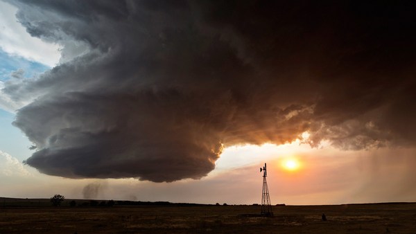
And finally, we produce mobile apps that include narrated virtual tools. The more I got involved in the heritage field, the more it became clear to me that we are losing the sites and the stories faster than we can physically preserve them. Of course, earthquakes and all the natural phenomena -- floods, tornadoes, etc. -- take their toll. However, what occurred to me was human-caused destruction, which was not only causing a significant portion of the destruction, but actually it was accelerating. This includes arson, urban sprawl, acid rain, not to mention terrorism and wars. It was getting more and more apparent that we're fighting a losing battle. We're losing our sites and the stories, and basically we're losing a piece -- and a significant piece -- of our collective memory. Imagine us as a human race not knowing where we came from.
Un visbeidzot mēs izstrādājam mobilo tālruņu sīklietotnes, kuros pieejami virtuālie rīki ar stāstījumu. Man vairāk iesaistoties šajā mantojuma jomā, arvien skaidrāks kļūst tas, ka mēs zaudējam šīs vietas un stāstus ātrāk nekā fiziski spējam tos saglabāt. Protams, zemestrīces un visas pārējās dabas parādības — plūdi, virpuļviesuļi utt. nodara savu kaitējumu. Tomēr es sapratu, ka cilvēka radītais kaitējums ne tikai veido lielu daļu šīs iznīcības, bet to pat paātrina. Tai skaitā dedzināšana, pilsētu izplešanās, skābais lietus, nemaz nerunājot par terorismu un karu. Tas paliek arvien un arvien acīmredzamāk, ka mēs zaudējam cīņā. Mums zaudējot šīs vietas un šos stāstus, mēs patiesībā zaudējam daļu, nozīmīgu daļu, mūsu kolektīvās atmiņas. Iedomājaties mūs kā cilvēku rasi, kas neapzinās savu izcelsmi.
Luckily, in the last two or three decades, digital technologies have been developing that have helped us to develop tools that we've brought to bear in the digital preservation, in our digital preservation war. This includes, for example, the 3D laser scanning systems, ever more powerful personal computers, 3D graphics, high-definition digital photography, not to mention the Internet. Because of this accelerated pace of destruction, it became clear to us that we needed to challenge ourselves and our partners to accelerate our work. And we created a project we call the CyArk 500 Challenge -- and that is to digitally preserve 500 World Heritage Sites in five years.
Par laimi pēdējās divās, trīs desmitgadēs ir attīstījušās ciparu tehnoloģijas, kas mums palīdzējušas izstrādāt rīkus, kas mums krietni palīdz cipariskajā saglabāšanā, šajā cipariskās saglabāšanas cīņā. Piemēram, jau iepriekš minētā, 3D lāzera skenēšanas sistēma arvien jaudīgāki personālie datori, 3D grafika, augstas izšķirtspējas ciparu fotogrāfijas, nemaz nerunājot par pašu Internetu. Šīs paātrinātās iznīcības dēļ ir kļuvis skaidrs, ka mums un mūsu partneriem ir jāizaicina sevi un jāpaātrina mūsu darbība. Mēs izveidojām projektu „CyArk 500 Challenge”, kura mērķis ir piecu gadu laikā cipariski saglabāt 500 Pasaules mantojuma vietas.
We do have the technology that's scaleable, and our network of global partners has been expanding and can be expanded at a rapid rate, so we're comfortable that this task can be accomplished. However, to me, the 500 is really just the first 500. In order to sustain our work into the future, we use technology centers where we partner with local universities and colleges to take the technology to them, whereby they then can help us with digital preservation of their heritage sites, and at the same time, it gives them the technology to benefit from in the future.
Mums ir uzlabojama un papildināma tehnoloģija, kā arī mūsu strauji pieaugošais vispasaules sadarbības partneru tīkls, tāpēc mēs esam droši, ka šo mērķi mums izdosies sasniegt. Taču, man šie 500 ir tikai paši pirmie 500. Lai turpinātu mūsu darbību, mēs izmantojam tehnoloģiju centrus, kas sadarbojas ar vietējām universitātēm un koledžām kur mēs nogādājam savu tehnoloģiju, kur tie var mums palīdzēt ar vēsturiskā mantojuma vietu ciparisko saglabāšanu, un tajā pat laikā, tas viņiem sniedz tehnoloģiju, no kā mēs nākotnē būsim ieguvēji.
Let me close with another short story. Two years ago, we were approached by a partner of ours to digitally preserve an important heritage site, a UNESCO heritage site in Uganda, the Royal Kasubi Tombs. The work was done successfully in the field, and the data was archived and publicly disseminated through the CyArk website. Last March, we received very sad news. The Royal Tombs had been destroyed by suspected arson. A few days later, we received a call: "Is the data available and can it be used for reconstruction?" Our answer, of course, was yes.
Ļaujat man pastāstīt vēl vienu īsu stāstu. Pirms diviem gadiem ar mums sazinājās viens no mūsu partneriem ar vēlmi cipariski saglabāt nozīmīgu mantojuma vietu, UNESCO mantojuma vietu Ugandā Kasubi karaliskās kapenes. Darbs tika pabeigts sekmīgi, datus arhivēja un publiski izplatīja caur CyArk mājaslapu. Šī gada martā mēs saņēmām ļoti apbēdinošas ziņas. Kasubi kapenes izpostīja iespējama ļaunprātīga dedzināšana. Pēc pāris dienām man zvanīja: „Vai ir pieejami dati, kurus varētu izmantot atjaunošanai?“ Mūsu atbilde, protams, bija jā.
Let me leave you with a final thought. Our heritage is much more than our collective memory -- it's our collective treasure. We owe it to our children, our grandchildren and the generations we will never meet to keep it safe and to pass it along. Thank you.
Atstāšu jums pēdējo vielu pārdomām. Mūsu mantojums ir kas vairāk par mūsu kopējām atmiņām, tie ir mūsu kopējie dārgumu. Mēs esam to parādā saviem bērniem, saviem mazbērniem un paaudzēm, kuras mēs nesatiksim, šīs vietas saglabāt un nodot tālāk. Paldies.
(Applause) Thank you.
(Aplausi) Paldies.
Thank you.
Paldies.
Thank you.
Paldies.
Well, I'm staying here because we wanted to demonstrate to you the power of this technology and so, while I've been speaking, you have been scanned. (Laughter) The two wizards that I have that are behind the curtain will help me bring the results on the screen. (Applause)
Es te vēl joprojām stāvu, jo vēlos jums parādīt šīs tehnoloģijas potenciālu, un kamēr es ar jums te runāju, jūs visus noskenēja. (Smiekli) Aiz šiem aizkariem stāv divi burvji, kas man palīdzēs atnest rezultātus uz ekrāna. (Aplausi)
This is all in 3D and of course you can fly through the cloud of points. You can look at it from on top, from the ceiling. You can look from different vantage points, but I'm going to ask Doug to zoom in on an individual in the crowd, just to show the amount of detail that we can create. So you have been digitally preserved in about four minutes. (Laughter)
Tas viss, protams, būs 3D jūs varēsit pievilkt šos punktu kopojumus. Jūs to varat apskatīt no augšas, no griestiem. Jūs to varat apskatīt no dažādiem interesantiem punktiem, palūgšu Dagam, lai viņš pievelk tuvāk kādu no pūļa cilvēkiem, lai jums parādītu iegūto augsto detalizētumu. Apmēram četru minūšu laikā jūs esat tikuši cipariski saglabāti. (Smiekli)
I'd like to thank the wizards here. We were very lucky to have two of our partners participate in this: the Historic Scotland, and the Glasgow School of Art. I'd like to also thank personally the efforts of David Mitchell, who is the Director of Conservation at Historic Scotland. David. (Applause) And Doug Pritchard, who's the Head of Visualization at the Glasgow School of Art. Let's give them a hand.
Vēlos pateikties šiem burvjiem. Mums ir ļoti paveicies, ka divi no mūsu sadarbības partneriem ir: „Historic Scotland“ un Glāzgovas mākslas skola. Es vēlētos arī personīgi pateikties par pūliņiem Deividam Mičelam, kurš ir Historic Scotland saglabāšanas nodaļas direktors. Deivid. (Aplausi) Un Dagam Pričardam, kurš ir Glāzgovas mākslas skolas vizualizācijas nodaļas direktors. Sniegsim palīdzīgu roku.
(Applause)
(Aplausi)
Thank you.
Paldies.