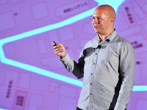
What I do is I organize information. I'm a graphic designer. Professionally, I try to make sense often of things that don't make much sense themselves.
Jestem grafikiem, porządkuję informacje. Zajmuję się rozumieniem rzeczy, które często nie mają wiele sensu. Mój ojciec tego pewnie nie rozumie.
So my father might not understand what it is that I do for a living. His part of my ancestry has been farmers. He's part of this ethnic minority called the Pontic Greeks. They lived in Asia Minor and fled to Greece after a genocide about a hundred years ago. And ever since that, migration has somewhat been a theme in my family. My father moved to Germany, studied there and married, and as a result, I now have this half-German brain, with all the analytical thinking and that slightly dorky demeanor that come with that. And of course it meant that I was a foreigner in both countries, and that of course made it pretty easy for me to migrate as well, in good family tradition, if you like.
Mój ojciec tego pewnie nie rozumie. Pochodzi z rodziny farmerów, mniejszości etnicznej zwanej Pontami. Żyli w Azji mniejszej i uciekli do Grecji po masakrze przed 100 laty. Od tego czasu emigracja stała się naszym motywem rodzinnym. Ojciec studiował i ożenił się w Niemczech, stąd też mój mózg jest w połowie niemiecki, analitycznie myślący, a także trochę dziwny. W obu krajach czułem się obco, co ułatwiło mi emigrację, zgodnie z rodzinną tradycją.
But of course, most journeys that we undertake from day to day are within a city. And, especially if you know the city, getting from A to B may seem pretty obvious, right? But the question is, why is it obvious? How do we know where we're going?
Na co dzień podróżujemy w obrębie miasta, a przemieszczanie się w znajomym mieście z punktu A do B, wydaje się proste. Pytanie brzmi: dlaczego? Skąd wiemy, dokąd zmierzamy?
So I washed up on a Dublin ferry port about 12 years ago, a professional foreigner, if you like, and I'm sure you've all had this experience before, yeah? You arrive in a new city, and your brain is trying to make sense of this new place. Once you find your base, your home, you start to build this cognitive map of your environment. It's essentially this virtual map that only exists in your brain. All animal species do it, even though we all use slightly different tools. Us humans, of course, we don't move around marking our territory by scent, like dogs. We don't run around emitting ultrasonic squeaks, like bats. We just don't do that, although a night in the Temple Bar district can get pretty wild.
12 lat temu zawinąłem do portu w Dublinie. Pewnie też doświadczyliście takiego uczucia, kiedy po przyjeździe do nowego miasta, mózg stara się je ogarnąć. Po znalezieniu bazy, nowego domu, tworzymy wirtualną mapę nowego środowiska. Wszystkie zwierzęta to robią, Wszystkie zwierzęta to robią, każde w nieco inny sposób. Nie zaznaczamy terytorium zapachem, jak psy, Nie zaznaczamy terytorium zapachem, jak psy, ani nie używamy echolokacji, jak nietoperze. Choć kto wie, szalona noc może skończyć się różnie. (Śmiech)
(Laughter)
Używamy innych metod.
No, we do two important things to make a place our own. First, we move along linear routes. Typically, we find a main street, and this main street becomes a linear strip map in our minds. But our mind keeps it pretty simple, yeah? Every street is generally perceived as a straight line, and we kind of ignore the little twists and turns that the streets make. When we do, however, make a turn into a side street, our mind tends to adjust that turn to a 90-degree angle. This of course makes for some funny moments when you're in some old city layout that follows some sort of circular city logic, yeah? Maybe you've had that experience as well.
Po pierwsze, poruszamy się wzdłuż linii ciągłych. Zwykle to główna ulica staje się centrum naszej mapy. Umysł woli postrzegać każdą ulicę jako linię prostą Umysł woli postrzegać każdą ulicę jako linię prostą i ignoruje wszelkie zakręty na jej długości. Każdy skręt w boczną ulicę umysł postrzega jako kąt prosty, co może być zabawne w mieście, które rozplanowane jest na innym kształcie, na przykład koła. Wiecie o czym mówię?
Let's say you're on some spot on a side street that projects from a main cathedral square, and you want to get to another point on a side street just like that. The cognitive map in your mind may tell you, "Aris, go back to the main cathedral square, take a 90-degree turn and walk down that other side street." But somehow you feel adventurous that day, and you suddenly discover that the two spots were actually only a single building apart. Now, I don't know about you, but I always feel like I find this wormhole or this inter-dimensional portal.
Z ulicy, z której widać plac katedralny chcesz dostać się na inną z podobnym widokiem. Wewnętrzna mapa powie ci, żeby wrócić na plac główny, skręcić pod kątem prostym w następną ulicę. Ale równie dobrze możesz odkryć, że te dwa miejsca, oddzielone były jednym budynkiem. Zawsze wydaje mi się, jakbym odkrył portal między dwoma wymiarami.
(Laughter)
Poruszamy się wzdłuż linii prostych,
So we move along linear routes and our mind straightens streets and perceives turns as 90-degree angles.
nasz umysł prostuje ulice i wszystkie zakręty widzi jako kąty proste.
The second thing that we do to make a place our own is we attach meaning and emotions to the things that we see along those lines. If you go to the Irish countryside and you ask an old lady for directions, brace yourself for some elaborate Irish storytelling about all the landmarks, yeah? She'll tell you the pub where her sister used to work, and "... go past that church where I got married," that kind of thing. So we fill our cognitive maps with these markers of meaning. What's more, we abstract repeat patterns and recognize them. We recognize them by the experiences and we abstract them into symbols. And of course, we're all capable of understanding these symbols.
Po drugie przywiązujemy znaczenia i emocje do obiektów, które widzimy wzdłuż tych linii. Starsza pani w irlandzkiej wiosce spytana o drogę, nie oszczędzi historii o wszystkich okolicznych obiektach. Opowie o pubie, gdzie pracowała jej siostra, o kościele, w którym wyszła za mąż. Swoje mapy wypełniamy takimi znaczeniami. Doszukujemy się wzorów i zaczynamy je rozpoznawać w powiązaniu z własnymi doświadczeniami. Abstrahujemy je w symbole. Każdy z nas potrafi
(Laughter)
odkodować taki symbol. (Śmiech)
What's more, we're all capable of understanding the cognitive maps, and you are all capable of creating these cognitive maps yourselves. So next time, when you want to tell your friend how to get to your place, you grab a beermat, grab a napkin, and you just observe yourself create this awesome piece of communication design. It's got straight lines. It's got 90-degree corners. You might add little symbols along the way. And when you look at what you've just drawn, you realize it does not resemble a street map. If you were to put an actual street map on top of what you've just drawn, you'd realize your streets and the distances -- they'd be way off. No, what you've just drawn is more like a diagram or a schematic. It's a visual construct of lines, dots, letters, designed in the language of our brains.
Każdy z nas nie tylko rozumie wewnętrzną mapę, Każdy z nas nie tylko rozumie wewnętrzną mapę, ale także potrafi ją stworzyć. Wyjaśniając, jak się dostać do waszego domu, łapiemy serwetkę, i tworzymy idealny przykład komunikacji graficznej. Linie proste. Kąty proste. Czasem jakieś symbole. Przyglądając się rysunkowi zauważycie, że nie przypomina rzeczywistej mapy. Po nałożeniu jej na wasz rysunek okaże się, że ulice i odległości są zupełnie inne. Wasz rysunek jest schematyczny, jak diagram. To kod z linii, kropek i liter, napisany językiem naszych mózgów.
So it's no big surprise that the big information-design icon of the last century -- the pinnacle of showing everybody how to get from A to B, the London Underground map -- was not designed by a cartographer or a city planner; it was designed by an engineering draftsman. In the 1930s, Harry Beck applied the principles of schematic diagram design and changed the way public transport maps are designed forever. Now the very key to the success of this map is in the omission of less important information and in the extreme simplification. So, straightened streets, corners of 90 and 45 degrees, but also the extreme geographic distortion in that map. If you were to look at the actual locations of these stations, you'd see they're very different. But this is all for the clarity of the public Tube map. If you, say, wanted to get from Regent's Park station to Great Portland Street, the Tube map would tell you: take the Tube, go to Baker Street, change over, take another Tube. Of course, what you don't know is that the two stations are only about a hundred meters apart.
Nic dziwnego, że ikona grafiki informacyjnej XX w., szczyt skutecznego przedstawienia drogi od A do B, czyli mapa londyńskiego metra, to nie projekt planisty miast ani kartografa, tylko rysownika technicznego. W latach 30. Henry Beck dzięki metodzie schematycznego projektowania na zawsze zmienił projekt map transportu miejskiego. Kluczem do sukcesu tej mapy jest pominięcie mniej ważnych informacji i maksymalne uproszczenie. Proste ulice, kąty 90 i 45 stopni a także ogromne zniekształcenia geograficzne. Rzeczywiste lokalizacje tych stacji są zupełnie inne, ale przejrzystość mapy jest zachowana. Według mapy, by dostać się ze stacji Regent's Park na Great Portland Street, trzeba jechać na Baker Street i się przesiąść. Ale nie widać, że te dwie stacje dzieli zaledwie 100 metrów. Skoro już o tym mowa,
Now we've reached the subject of public transport, and public transport here in Dublin is a somewhat touchy subject.
transport w Dublinie to delikatna sprawa. (Śmiech)
(Laughter)
W skrócie, miejscowy system autobusowy
For everybody who does not know the public transport here in Dublin, essentially, we have this system of local buses that grew with the city. For every outskirt that was added, there was another bus route added, running from the outskirt all the way to the city center. And as these local buses approach the city center, they all run side by side and converge in pretty much one main street.
rozrastał się wraz z miastem. Kiedy dodawano nowe dzielnice, dodawano też nowy autobus, prowadzący z danego miejsca do centrum. Dojeżdżając do centrum, spotykają się wszystkie
So when I stepped off the boat 12 years ago,
na tej samej ulicy.
I tried to make sense of that. Because exploring a city on foot only gets you so far. But when you explore a foreign and new public transport system, you will build a cognitive map in your mind in pretty much the same way. Typically, you choose yourself a rapid transport route, and in your mind, this route is perceived as a straight line. And like a pearl necklace, all the stations and stops are nicely and neatly aligned along the line. And only then you start to discover some local bus routes that would fill in the gaps, and that allow for those wormhole, inter-dimensional portal shortcuts. So I tried to make sense, and when I arrived, I was looking for some information leaflets that would help me crack this system and understand it, and I found those brochures.
Kiedy tu przypłynąłem 12 lat temu starałem się to pojąć, bo na piechotę nie da się daleko zajść. Badając obcy system komunikacji miejskiej tak samo tworzymy w mózgu wirtualną mapę. Wybieramy szybką trasę transportu, którą w głowie postrzegamy jako linię prostą, naszyjnik z przystankami ułożonymi równiutko wzdłuż linii. Dopiero potem odkrywamy inne autobusy, które wypełniają transportowe luki, niczym tajne przejścia. Kiedy przyjechałem starałem się rozwiązać zagadkę tego systemu z pomocą różnych broszur, jak te. (Śmiech) z pomocą różnych broszur, jak te. (Śmiech)
(Laughter)
Nie były zniekształcone geograficznie.
They were not geographically distorted. They had a lot of omission of information, but unfortunately, the wrong information. Say, in the city center -- there were never actually any lines that showed the routes.
Pominięto na nich wiele informacji, ale nie te, które należało. Brakowało tras autobusowych,
(Laughter)
There are actually not even any stations with names.
przystanki nie miały nazw.
(Laughter)
Now, the maps of Dublin transport have gotten better, and after I finished the project, they got a good bit better, but still no station names, still no routes.
Kiedy skończyłem projekt, mapy się znacznie poprawiły, choć nadal nie ma nazw i szlaków.
So, being naive, and being half-German, I decided, "Aris, why don't you build your own map?" So that's what I did. I researched how each and every bus route moved through the city, nice and logical, every bus route a separate line. I plotted it into my own map of Dublin, and in the city center ... I got a nice spaghetti plate.
Jako naiwny pół-Niemiec postanowiłem stworzyć własną mapę. Zbadałem trasy autobusów prowadzące przez miasto, przedstawiając każdy autobus jako oddzielną linię, i naniosłem na mapę Dublina. W centrum miasta zrobiło się istne spaghetti. (Śmiech)
(Laughter)
Żeby to uporządkować postanowiłem zastosować
Now, this is a bit of a mess, so I decided, of course, "You're going to apply the rules of schematic design," cleaning up the corridors, widening the streets where there were loads of buses and making the streets at straight, 90-degree corners, 45-degree corners or fractions of that, and filled it in with the bus routes. And I built this city center bus map of the system, how it was five years ago. I'll zoom in again so that you get the full impact of the quays and Westmoreland Street.
projektowanie schematyczne, oczyścić korytarze, poszerzyć ulice z dużą ilością autobusów, zastosować kąty 90 i 45 stopni. Mapę transportu w centrum miasta zaprojektowałem 5 lat temu. Zbliżę, przyjrzyjcie się nabrzeżom i Westmoreland Street. (Śmiech)
(Laughter)
Z dumą powiem...(Brawa)
Now I can proudly say --
(Applause)
...że jako mapa komunikacji miejskiej,
I can proudly say, as a public transport map, this diagram is an utter failure.
ten diagram to porażka. (Śmiech)
(Laughter) Except, probably, in one aspect: I now had a great visual representation of just how clogged up and overrun the city center really was.
Jednak dobrze oddaje, Jednak dobrze oddaje, jak bardzo zatkane było centrum miasta.
Now, call me old-fashioned, but I think a public transport route map should have lines, because that's what they are, yeah? They're little pieces of string that wrap their way through the city center or through the city. If you will, the Greek guy inside of me feels if I don't get a line, it's like entering the labyrinth of the Minotaur without having Ariadne giving you the string to find your way. So the outcome of my academic research, loads of questionnaires, case studies and looking at a lot of maps, was that a lot of the problems and shortcomings of the public transport system here in Dublin was the lack of a coherent public transport map -- a simplified, coherent public transport map -- because I think this is the crucial step to understanding a public transport network on a physical level, but it's also the crucial step to make a public transport network mappable on a visual level.
Może jestem staromodny, ale uważam, że na mapie powinny być linie, wstążki, przeplatające się przez miasto. wstążki, przeplatające się przez miasto. Moja grecka połowa czuje, że bez linii dostajemy labirynt Minotaura bez nici Ariadny. Wynikiem moich dochodzeń, kwestionariuszy, badań, studiowania map, było odkrycie, że większość niedociągnięć systemu komunikacji wynikało z braku prostej i przejrzystej mapy, która jest kluczem do zrozumienia transportu publicznego, a także do przedstawienia go w sposób czytelny wizualnie.
So I teamed up with a gentleman called James Leahy, a civil engineer and a recent master's graduate of the Sustainable Development program at DIT, and together we drafted the simplified model network, which I could then go ahead and visualize.
Wraz z inżynierem Jamesem Leahym, magistrem w dziedzinie zrównoważonego rozwoju z Politechniki Dublińskiej, stworzyliśmy uproszczony model sieci transportu, który mogłem potem przedstawić wizualnie.
So here's what we did. We distributed these rapid-transport corridors throughout the city center, and extended them into the outskirts. Rapid, because we wanted them to be served by rapid-transport vehicles. They would get exclusive road use, where possible, and it would be high-quantity, high-quality transport. James wanted to use bus rapid transport for that, rather than light rail. For me, it was important that the vehicles that would run on those rapid transport corridors would be visibly distinguishable from local buses on the street. Now we could take out all the local buses that ran alongside those rapid transport means. Any gaps that appeared in the outskirts were filled again. So, in other words, if there was a street in an outskirt where there had been a bus, we put a bus back in, only now these buses wouldn't run all the way to the city center, but connect to the nearest rapid-transport mode, one of these thick lines over there. So the rest was merely a couple of months of work, and a couple of fights with my girlfriend, of our place constantly being clogged up with maps, and the outcome, one of the outcomes, was this map of the Greater Dublin area. I'll zoom in a little bit.
Przez miasto poprowadziliśmy trasy szybkiego transportu, które rozciągnęliśmy też na przedmieścia. Szybkiego, bo chcieliśmy by obsługiwały je szybkie środki komunikacji miejskiej. Wysokiej jakości i pojemności pojazdy miałyby oddzielne pasy ruchu. James wolał autobusy, a nie kolejkę. Dla mnie ważne było, by wyraźnie różniły się od lokalnych autobusów. Pozbyliśmy się linii, które poruszały się tymi samymi trasami, i wypełniliśmy luki na przedmieściach. Jeśli na podmiejskiej ulicy jeździł dawniej autobus, zostawialiśmy go tam, z tą różnicą, że teraz nie jechał już do centrum, tylko do najbliższej linii szybkiego transportu, jednej z tych grubych linii na mapie. Po paru miesiącach pracy i kilku kłótniach z dziewczyną o walające się po domu mapy, powstała ta mapa. Mapa Dublina. Powiększę.
This map only shows the rapid transport connections, no local bus, very much in the "metro map" style that was so successful in London, and that since has been exported to so many other major cities, and therefore is the language that we should use for public transport maps. What's also important is, with a simplified network like this, it now would become possible for me to tackle the ultimate challenge and make a public transport map for the city center, one where I wouldn't just show rapid transport connections, but also all the local bus routes, streets and the likes, and this is what a map like this could look like. I'll zoom in a little bit.
Pokazuje ona tylko szybkie połączenia, bez autobusów lokalnych, podobnie jak mapa metra w Londynie, którą zaadaptowano w wielu dużych miastach. To właściwy język dla map transportu publicznego. Taka uproszczona sieć umożliwiła mi zmierzenie się z największym wyzwaniem: mapą transportu w centrum miasta, która pokazywałaby nie tylko trasy szybkiego ruchu, ale też autobusy lokalne, ulice itp. Mogłaby wyglądać tak. Zbliżę. Mogłaby wyglądać tak. Zbliżę.
In this map, I'm including each transport mode, so rapid transport, bus, DART, tram and the likes. Each individual route is represented by a separate line. The map shows each and every station, each and every station name, and I'm also displaying side streets. In fact, most of the side streets even with their name, and for good measure, also a couple of landmarks, some of them signified by little symbols, others by these isometric three-dimensional bird's-eye-view drawings.
Przedstawia ona wszystkie formy transportu, autobusy zwykłe, pospieszne, tramwaje itp. Każdą trasę przedstawia oddzielna linia. Pokazane są wszystkie przystanki i stacje wraz z nazwami, a nawet boczne ulice, w większości także z nazwami oraz kilka punktów orientacyjnych oznaczonych symbolami, lub trójwymiarowymi rysunkami izometrycznymi z lotu ptaka.
The map is relatively small in overall size, so something that you could still hold as a fold-out map or display in a reasonably-sized display box on a bus shelter. I think it tries to be the best balance between actual representation and simplification -- the language of way-finding in our brain. So, straightened lines, cleaned-up corners, and of course, that very, very important geographic distortion that makes public transport maps possible. If you, for example, have a look at the two main corridors that run through the city -- the yellow and orange one over here -- this is how they look in an actual, accurate street map, and this is how they would look in my distorted, simplified public transport map.
Mapa nie jest duża, może służyć jako rozkładana mapa podręczna, albo wisieć na przystanku autobusowym. To przedstawienie transportu wyważone między rzeczywistością a uproszczeniem, na sposób stosowany przez nasz mózg. Linie proste, jasne kąty oraz bardzo ważne zniekształcenie geograficzne, umożliwiające tworzenie takich map. Weźmy dwie trasy biegnące przez miasto, Weźmy dwie trasy biegnące przez miasto, żółtą i pomarańczową. Tak wyglądają na prawdziwej mapie, a tak na mojej, zniekształconej i uproszczonej mapie transportu.
So for a successful public transport map, we should not stick to accurate representation, but design them in the way our brains work.
Dobra mapa transportu nie trzyma się rzeczywistości, ale sposobu działania mózgu.
The reactions I got were tremendous, it was really good to see. And of course, for my own self, I was very happy to see that my folks in Germany and Greece finally have an idea what I do for a living.
Zareagowano bardzo pozytywnie. Cieszyłem się, że moja rodzina w Grecji i Niemczech zrozumie może w końcu, czym zarabiam ma życie (Śmiech) Dziękuję. (Brawa)
(Laughter)
Thank you.
(Applause)