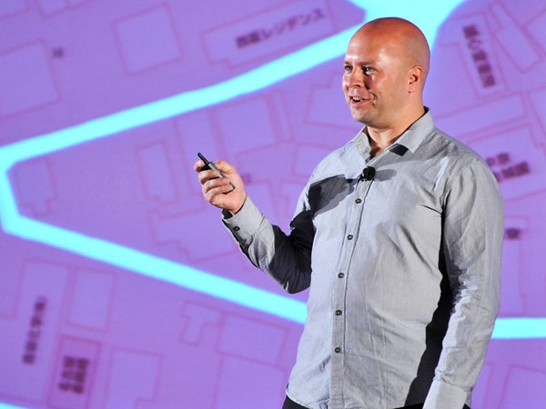
What I do is I organize information. I'm a graphic designer. Professionally, I try to make sense often of things that don't make much sense themselves.
ئەوەی من دەیکەم بریتیە لە رێکخستنی زانیاری، من دیزاینەرێکی نەخشەسازیم وەک ئەرکێک، من هەوڵ دەدەم کە مانا دروست بکەم لە شتانێک کە خوودی خۆیان مانا نابەخشن بۆیە دەشێت باوکم تێنەگات کە ئەوە چییە
So my father might not understand what it is that I do for a living. His part of my ancestry has been farmers. He's part of this ethnic minority called the Pontic Greeks. They lived in Asia Minor and fled to Greece after a genocide about a hundred years ago. And ever since that, migration has somewhat been a theme in my family. My father moved to Germany, studied there and married, and as a result, I now have this half-German brain, with all the analytical thinking and that slightly dorky demeanor that come with that. And of course it meant that I was a foreigner in both countries, and that of course made it pretty easy for me to migrate as well, in good family tradition, if you like.
ئەوە ئەنجام دەدەم بۆ دابینکردنی ژیانم چونکە ئەو بەشەی ئەو لەڕەچەڵەکی مندا هەبوو جووتیار بوو ئەو سەر بەو ڕەچەڵەکەیە کەناو دەبرێت بە دەریای ڕەشی یۆنانییەکان لە ئاسیای بچووک ژیاون، وە پاشان کۆچیان کردووە بۆ یۆنان لەپاش کۆمەڵکوژییەک سەد ساڵ لەمەو بەر وە هەر لەو کاتەوە کۆچکردن بەجۆرێک لە جۆرەکان بو بە دیاردەیەک لە خێزانەکەمدا باوکم کۆچی کرد بۆ ئەڵمانیا، لەوێ خوێندی وە خێزانی پێکهێنا وە دەرئەنجامی ئەوەش، ئەم مێشکە نیوە ئەڵمانیەم هەیە لەگەڵ هەموو بیرە شیکارییەکانی وە ئەو هەڵسوکەوتە گەمژانەش کە لەگەڵ ئەوەدا بێت ئەوەش ئەوە دەگەیەنێت کە من بێگانە بووم لەهەردوو وڵاتەکەدا ئەوەش کارەکەی زۆر ئاسان کردبوو بۆ من کەمنیش کۆچ بکەم، لەکلتووری خێزانیمدا، ئەگەر بتانەوێ
But of course, most journeys that we undertake from day to day are within a city. And, especially if you know the city, getting from A to B may seem pretty obvious, right? But the question is, why is it obvious? How do we know where we're going?
بەڵام بێگومان، زۆربەی ئەو گەشتانەی کەئەنجامی دەدەین لەڕۆژێکەوە بۆ رۆژێک لەشارەکان، وە بەتایبەتی ئەگەر شارەزابیت، لە ئەیەوە بچیت بۆ بی ئەوە زۆر ئاشکرایە، وایە؟ بەڵام پرسیارەکە ئەوەیە، ئەوە بۆچی ئاشکرایە؟ چۆن بزانین کە بۆ کوێ دەچین؟
So I washed up on a Dublin ferry port about 12 years ago, a professional foreigner, if you like, and I'm sure you've all had this experience before, yeah? You arrive in a new city, and your brain is trying to make sense of this new place. Once you find your base, your home, you start to build this cognitive map of your environment. It's essentially this virtual map that only exists in your brain. All animal species do it, even though we all use slightly different tools. Us humans, of course, we don't move around marking our territory by scent, like dogs. We don't run around emitting ultrasonic squeaks, like bats. We just don't do that, although a night in the Temple Bar district can get pretty wild.
لەبەر ئەوە لەبەندەرێک لە کەناری دبلنەوە گیرسامەوە دوانزە ساڵ لەمەو بەر، بێگانەیەکی شارەزابووم، ئەگەر بتانەوێ ئێستا من دڵنیام کە ئێوە ئەم ئەزموونەتان پێشتر دیوە، وایە؟ تۆ دەگەیتە شارێکی تازە، وە مێشکیشتان هەوڵ دەدات کە مانایەک ببەخشێتە ئەم شوێنە تازەیە هەر جارێک کەبەردی بناغەی خۆتان دۆزییەوە، ماڵەکەت هەڵدەستی بەدروستکردنی ئەم نەخشە زانراوانە لەبارەی ژینگەکەتەوە ئەوە لەبنەماوە ئەو نەخشە خەیاڵییە هەیە لە مێشکماندا، هەموو ئاژەڵەکانیش وادەکەن وابزانم هەر یەکەمان ئامرازی جیاواز بەکاردەهێننین ئێمەی مرۆڤ، بێگومان ئێمە ناگەڕێین بۆ نیشانەکردنی ناوچەکەمان بە بۆن، وەکو سەگەکان ئێمە بەو ناوەدا ناسوڕێینەوە و شەپۆلی سەروودەنگ دەر ناکەین، وەک شەمشەمەکوێرەکان ئێمە واناکەین وە هەروەها شەوێک لەتێمبڵ باڕ دەشێت زۆر شێتانەبێت. پێکەنین
(Laughter)
نەخێر، ئێمە دوو شتی زۆر گرنگ ئەنجام دەدەین بۆ ئەوەی کە شوێنێک بکەین بە هی خۆمان
No, we do two important things to make a place our own. First, we move along linear routes. Typically, we find a main street, and this main street becomes a linear strip map in our minds. But our mind keeps it pretty simple, yeah? Every street is generally perceived as a straight line, and we kind of ignore the little twists and turns that the streets make. When we do, however, make a turn into a side street, our mind tends to adjust that turn to a 90-degree angle. This of course makes for some funny moments when you're in some old city layout that follows some sort of circular city logic, yeah? Maybe you've had that experience as well.
یەکەم ئێمە دەجوڵێین لەسەر هێڵە سەرەکییەکان بەشێوەیەکی نموونەیی ئێمە شەقامە سەرەکییەکە دەدۆزینەوە، ئەم شەقامە سەرەکییەش دەبێتە هێڵی سەرەکی سەرنەخشەی ناو مێشکمان بەڵام مێشکی ئێمە ئەوە زۆر بەئاسانی دەهێڵێتەوە، وایە؟ بە گشتی هەموو شەقامێک بەشێوەی هێڵێکی ڕاستی هەستپێکراوە ئێمە بەجۆرێک ئەو پێچ و چەمانەوانەی شەقامەکە دروست دەکەین کە خۆمانی لێلادەدەین کاتێک کە ئێمە وادەکەین، دەگەڕێینەوە بۆ بەشی ئەو پەڕی شەقامەکە مێشکی ئێمە ئارەزوو دەکات کە ئەو گەڕانەوەیە بکاتە ٩٠ پلەی گۆشەیی بەدڵنیاییەوە ئەمە بۆ کەسانێک ساتەوەختی پێکەنیناوی دروست دەکەن کاتێک کە لە شارێکی نەخشە کۆنیت ئەوە هەستی جۆرێک شاری شێوە بازنەیی دەگەیەنێت، وایە؟ لەوانەیە ئێوە ئەو جۆرە ئەزموونەتان بینیبێت، وایە؟
Let's say you're on some spot on a side street that projects from a main cathedral square, and you want to get to another point on a side street just like that. The cognitive map in your mind may tell you, "Aris, go back to the main cathedral square, take a 90-degree turn and walk down that other side street." But somehow you feel adventurous that day, and you suddenly discover that the two spots were actually only a single building apart. Now, I don't know about you, but I always feel like I find this wormhole or this inter-dimensional portal.
باوابڵێین کە ئێوە لەشوێنێکی لای شەقامەکە کە ئەوە دەگەیەنێت لە شەقامی سەرەکی کاثدێراڵ، وە دەتەوێت بێیتە خاڵێکی تری شەقامی ئەو بەر هەروەک ئەمە دەشێت نەخشە خەیاڵییەکەی ناو مێشکت پێت ڕابگەیەنێت، ئاریس بگەڕێیتەوە بۆ شەقامی کاثدێراڵەکە سوڕانەوەیەکی ٩٠ پلەیی، بگەڕێیتەوە بەرەو خواری شەقامەکە بەڵام هەر لەخۆتەوە هەست بەگەشت کردن دەکەیت ئەو ڕۆژە لەناکاو بۆت دەردەکەوێ کە هەردوو ناوچەکە لەڕاستیدا ئەم لاو ئەولای باڵەخانەیەکن من بۆ نازانم، بەڵام هەمیشە هەستم وایە کە من ئەم چاڵە یاخود ئەم دەرگایە دەدۆزمەوە
(Laughter)
بۆیە بەدرێژایی هێڵی شەقامەکان
So we move along linear routes and our mind straightens streets and perceives turns as 90-degree angles.
وە مێشکمان شەقامی ڕاست و یوتێرنەکان دەخوێنێتەوە بە گۆشەی ٩٠ پلەیی
The second thing that we do to make a place our own is we attach meaning and emotions to the things that we see along those lines. If you go to the Irish countryside and you ask an old lady for directions, brace yourself for some elaborate Irish storytelling about all the landmarks, yeah? She'll tell you the pub where her sister used to work, and "... go past that church where I got married," that kind of thing. So we fill our cognitive maps with these markers of meaning. What's more, we abstract repeat patterns and recognize them. We recognize them by the experiences and we abstract them into symbols. And of course, we're all capable of understanding these symbols.
دووەم شت کە ئێمە ئەنجامی دەدەین بۆ ئەوەی جێگایەک بکەین بە هی خۆمان ئەوەیە کە سۆز و مانا دەبەخشینە شتەکان ئێمە بەدرێژایی ڕێگاکان دەیانبینین ئەگەر بەلادێیەکی ئێرلەندیدا تێپەڕیت، وە بپرسیت لە خانمێکی پیر لەبارەی ئاڕاستەکانەوە، خۆتان ئامادە بکەن بۆ هەندێ چیرۆکی ئێرلەندی باشت پێدەڵێت لەبارەی هەموو شوێنە دیارەکانەوە، وایە؟ ئەو باڕەت نیشان دەدات کە خوشکەکەی کاری لێکردوە وە بەو پەرستگایەدا تێدەپەڕیت کە شووم لێکردووە، ئا لەو جۆرە شتانە بۆیە ئێمە نەخشە هەستەوەریەکانمان پڕکردۆتەوە بەم جۆرە هێمایانەی ماناکان وە هەروەها، ئێمە وای دەردەبڕین شێوازەکەی دووبارە دەکەینەوە، وە دەیانناسینەوە ئێمە ئەوان دەناسینەوە بەهۆی ئەزموونەوە وە ئێمە جیایان دەکەینەوە بۆ چەند نیشانەیەک وە بێگومان، ئێمە ئەو توانایەمان هەیە
(Laughter)
بۆ تێگەیشتن لەم شتانە، پێکەنین
What's more, we're all capable of understanding the cognitive maps, and you are all capable of creating these cognitive maps yourselves. So next time, when you want to tell your friend how to get to your place, you grab a beermat, grab a napkin, and you just observe yourself create this awesome piece of communication design. It's got straight lines. It's got 90-degree corners. You might add little symbols along the way. And when you look at what you've just drawn, you realize it does not resemble a street map. If you were to put an actual street map on top of what you've just drawn, you'd realize your streets and the distances -- they'd be way off. No, what you've just drawn is more like a diagram or a schematic. It's a visual construct of lines, dots, letters, designed in the language of our brains.
وە هەروەها، ئێمە هەموو توانای تێگەیشتنمان هەیە بۆ نەخشە زانراوانەکان، وە ئێوەش هەموو لەتواناتاندا هەیە بۆ دروستکردنی ئەم نەخشە زانراوانە بۆ خۆتان بۆیە جاری داهاتوو، کاتێک ویستتان بەهاوڕێیەکتان بڵێن کە چۆن بگاتە شوێنێک تەپڵەکی ژێر پەرداخەکەت ڕابکێشە، دەستە سڕێ ڕابکێشە تێبینی خۆت دەکەیت کە ئەم پارچە تەختە جوانە دروست دەکەیت لە دیزاینی پەیوەندی بەستن، ئەوە هێڵە ڕاستەکانی وەرگرتووە ئەوە گۆشە ٩٠ پلەکانی وەرگرتووە لەوانەیە تۆ نیشانەیەکی بچووک جێبهێڵیت بە درێژایی ڕێگەکە وە کاتێک کە تەماشای ئەوە دەکەیت کە کێشاوتە بۆت دەردەکەوێت کە ئەوە لە نەخشەیەکی شەقامەکان ناچێت ئەگەر ویستت نەخشەیەکی ڕاستەقینەی شەقام بکێشیت لەبەشی سەرەوەی ئەوەی کە کێشاوتە، شەقامەکانت دەناسنەوە وە دوورییەکانیش، کە دەیان بێت نەخێر، ئەوەی کە کێشاوتە زیاتر وەک نەخشەیەکە یان ئەندازەیەکە ئەوە کێشراوێکی بەرجەستەی هێڵکارییە، خاڵێکی پیت لێدراوە دیزاین کراوە لەسەر شێوەی زمانی مێشکی ئێمە
So it's no big surprise that the big information-design icon of the last century -- the pinnacle of showing everybody how to get from A to B, the London Underground map -- was not designed by a cartographer or a city planner; it was designed by an engineering draftsman. In the 1930s, Harry Beck applied the principles of schematic diagram design and changed the way public transport maps are designed forever. Now the very key to the success of this map is in the omission of less important information and in the extreme simplification. So, straightened streets, corners of 90 and 45 degrees, but also the extreme geographic distortion in that map. If you were to look at the actual locations of these stations, you'd see they're very different. But this is all for the clarity of the public Tube map. If you, say, wanted to get from Regent's Park station to Great Portland Street, the Tube map would tell you: take the Tube, go to Baker Street, change over, take another Tube. Of course, what you don't know is that the two stations are only about a hundred meters apart.
بۆیە ئەوە سەڕسوڕمانێکی وەها نییە کە زانیارییەکی زۆری دیزاینی ئایکۆن لەسەدەی پێشووەکاندا، ترۆیکی نیشاندانی هەمووانە کە چۆن لەخاڵی (ئەی) بچین بۆ خاڵی (بی)، هێڵی ژێرزەمینی لەندەن لەلایەن ئەندازیاری شارستانی یاخود نەخشە سازێکەوە نەکێشرابوو لەلایەن نەخشەسازێکی هونەرییەوە نەخشەی بۆ کێشرابوو لە ساڵی ١٩٣٠، (هاری بێک) بنەماکانی دیزاینی نەخشەسازی بەیانی داهێنابوو، وە گۆڕی ئەو شێوازەی کە دیزاینی هاتووچۆی گشتی پێ کرابوو بۆ هەتاهەتایە ئێستا کلیلی سەرکەوتنی ئەم نەخشەیەیە لە پشتگوێخستنی ئەو زانیارییانەدایە کەکەمتر گرنگن وە ئێجگار سادەشن بۆیە ڕاستە شەقامەکان، گۆشەکانی (٤٥) و (٩٠)ەن بەڵام بەهەمان شێوە ئێجگار لە شێوازەکانی جوگرافیش لەو نەخشەیەدا ئەگەر ویستت سەیری پێگەی ڕاستەقینەی ئەم وێستگانە بکەیت دەبینی کە ئەوانە زۆر جیاوازن، وایە؟ بەڵام ئەمە هەمووی بۆ ڕوونی نەخشەی شەمەندەفەرە کارەباییەکانە بەڵێ ئەگەر وتت دەتەوێت لە ڕیجنت پارک ستەیشنەوە بچیت بۆ جادەی گرەیت پۆرتلاند، نەخشەی شەمەندەفەرە کارەباییەکە پێت دەڵێت سوار شەمەندەفەرەکە ببە، بچۆ بۆ جادەی بەیکەر، بسوڕێرەوە، سوار شەمەندەفەرێکی تر ببە بێگومان، ئەوەی کەنایزانیت ئەوەیە کەئەو دوو وێستگەیە هەریەکەیان نزیکەی سەد مەترێک دوورن ئێستا ئێمە گەیشتوینەتە بابەتی هێڵی گشتی
Now we've reached the subject of public transport, and public transport here in Dublin is a somewhat touchy subject.
وە هێڵی هاتووچۆی گشتی لە دوبلین بابەتێکی بەجۆرێک هەستیارە، پێکەنین
(Laughter)
بۆ هەموو ئەوانەی کە هێڵی گواستنەوەی دوبلین نازانێت
For everybody who does not know the public transport here in Dublin, essentially, we have this system of local buses that grew with the city. For every outskirt that was added, there was another bus route added, running from the outskirt all the way to the city center. And as these local buses approach the city center, they all run side by side and converge in pretty much one main street.
لەبنەڕەتدا ئەم سیستەمەی پاسە ناوخۆییەکانە کە لەگەڵ شارەکەدا گەشەی کردووە، بۆ هەموو لایەکی زیادکراوە هێڵێکی تری پاس هەبوو کە دەست پێدەکات لەهەموو ناوچەکانەوە بەرەو ناوەندی شار وە هەموو ئەم بپاسە ناوخۆییانە نزیک دەبنەوە لەناوەندی شار هەموویان شان بە شان دەڕۆن، بەیەکەوە
So when I stepped off the boat 12 years ago,
بەشەقامی سەرەکیدا
I tried to make sense of that. Because exploring a city on foot only gets you so far. But when you explore a foreign and new public transport system, you will build a cognitive map in your mind in pretty much the same way. Typically, you choose yourself a rapid transport route, and in your mind, this route is perceived as a straight line. And like a pearl necklace, all the stations and stops are nicely and neatly aligned along the line. And only then you start to discover some local bus routes that would fill in the gaps, and that allow for those wormhole, inter-dimensional portal shortcuts. So I tried to make sense, and when I arrived, I was looking for some information leaflets that would help me crack this system and understand it, and I found those brochures.
بۆیە کاتێک کە لەبەلەمەکەدا کە هەنگاوی دابەزینم دا لە ١٢ ساڵ لەمەو بەر هەوڵم دا مانا لەوە دروست بکەم چونکە گەڕانی شارێک بە پێ تەنها دوورت دەخاتەوە بەڵام کاتێک کە سیستەمێکی گواستنەوەی گشتی بێگانە تاقی دەکەیتەوە نەخشەیەکی زانین لەمێشکتدا دروست دەکەیت بەشێوەی هاوشێوەی ئەمە بە شێوەیەکی نموونەیی، تۆ شێوازی هاتووچۆی گشتی خۆت ئامادە دەکەیت وە لەمێشکی خۆتدا هێڵی سەرەکیت بە شێوەی هێڵێکی ڕاست وەرگرتووە وە لەشێوەی ملوانکەیەکی مرواریدا، هەموو وێستگەکان و جێی وەستانەکان هەمووی بەڕێکی بەجوانی ڕیزبەندکراون بەپێی هێڵەکە وە تەنها لەو کاتەدا تۆ دەست پێدەکەیت بە دۆزینەوەی هەندێ هێڵی پاسە ناوخۆییەکان کە ئەو بۆشاییانە پڕدەکاتەوە کە ڕێگە دەدات بە تۆ بۆ ئەو ڕێگایە، دەرگای ڕێگا کورتکراوە جیاوازەکان بۆیە هەوڵمدا مانا ببەخشم، وە کاتێک کە گەیشتم دەگەڕام بەدوای هەندێ زانیاری هەڵواسراویدا کە یارمەتیم بدات پەی بەم سیستەمە ببەم و لێی تێبگەم وە ئەو کتێبانەی ڕێبەریم دەستکەوت، پێکەنین
(Laughter)
بە شێوەیەکی جوگرافیانە ڕێکنەخرابوو
They were not geographically distorted. They had a lot of omission of information, but unfortunately, the wrong information. Say, in the city center -- there were never actually any lines that showed the routes.
ژمارەیەکی زۆری لە پشت گوێخستنی زانیاری تێدا بوو بەڵام بەداخەوە زانیاری هەڵە، بڵێین، لەناوەندی شاردا بوو لە ڕاستیدا هیچ هێڵێک نەبوو کە ڕێگەکان نیشان بدات
(Laughter)
There are actually not even any stations with names.
لەڕاستیدا هیچ ناوێکیشی لەسەر نەبوو
(Laughter)
Now, the maps of Dublin transport have gotten better, and after I finished the project, they got a good bit better, but still no station names, still no routes.
ئێستا نەخشەکانی هێڵی گواستنەوەی دوبلین، باشتر کراون وە پاش ئەوەی کەپڕۆژەکەم تەواو کرد، ئەوانە کەمێکی تر باشتر بوون بەڵام هێشتا ناوی وێستگە نییە، ڕێگە نییە
So, being naive, and being half-German, I decided, "Aris, why don't you build your own map?" So that's what I did. I researched how each and every bus route moved through the city, nice and logical, every bus route a separate line. I plotted it into my own map of Dublin, and in the city center ... I got a nice spaghetti plate.
بۆیە خۆشباوەڕیە، ڕەچەڵەکت نیوەی ئەڵمانی بێت، بڕیارم دا ئاریس، بۆ نەخشەی خۆت بنیات نانێیت؟ ئەوەش ئەوەبوو کە من ئەنجامم دا، لێکۆڵینەوەم کرد کە چۆن هەر هێڵێکی پاس بە شارەکەدا ڕۆیشتووە جوان و لۆژیکییە، هەر ڕێگەیەکی پاس هێڵێکی جیایە وە ئەوەم یاداشت کرد لەناو نەخشەکەی دوبلینی خۆم وە لەناوەندی شاردا قاپێک سپاگێتی جوانم دەست کەوت. پێکەنین
(Laughter)
ئەمەش کەمێک بوو لە زۆرێک، بۆیە بەدڵنیاییەوە، بڕیارم دا
Now, this is a bit of a mess, so I decided, of course, "You're going to apply the rules of schematic design," cleaning up the corridors, widening the streets where there were loads of buses and making the streets at straight, 90-degree corners, 45-degree corners or fractions of that, and filled it in with the bus routes. And I built this city center bus map of the system, how it was five years ago. I'll zoom in again so that you get the full impact of the quays and Westmoreland Street.
کەدەبێت یاساکانی دیزاینی هێڵی بەیانی جێبەجی بکەم ڕێگای ڕاڕەوەکانم سڕییەوە، شەقامەکانم فراوانتر کرد کەتێیدا پاسەکان هەن، وە شەقامەکانم ڕاست کردەوە، بۆسووچی ٩٠ پلەیی، وە سووچی ٤٥ پلەیی، یاخوود کەمکراوەی ئەوە خستمە نەخشەکەوە لەگەڵ هێڵی پاسەکاندا، وە ئەم نەخشەی ناوەندی شارەم بۆ پاسەکانی سیستەمەکە کێشا، چۆن بووە پێنج ساڵ لەمەو بەر جارێکی تر دەیهێنمەوە پێشەوە تا ئێوە بەتەواوی کاریگەربن بە بە بەندەرەکان و جادەی وێستمۆرلاند، پێکەنین
(Laughter)
ئێستا بە شانازییەوە دەتوانم بڵێم، چەپڵە لێدان
Now I can proudly say --
(Applause)
ئێستا بەشانازییەوە دەتوانم بڵێم، وەک نەخشەی هێڵی گواستنەوەو
I can proudly say, as a public transport map, this diagram is an utter failure.
ئەم نەخشەیە شکستێکی بێگومانە، پێکەنین
(Laughter) Except, probably, in one aspect: I now had a great visual representation of just how clogged up and overrun the city center really was.
بەلایەنی کەمەوە جگە لەلایەنێکی بەرجەستەکردنێکی بینراوم هەبوو کە ناوەندی شار چەند پڕ ئاستەنگ و پێچاوپێچ بوو
Now, call me old-fashioned, but I think a public transport route map should have lines, because that's what they are, yeah? They're little pieces of string that wrap their way through the city center or through the city. If you will, the Greek guy inside of me feels if I don't get a line, it's like entering the labyrinth of the Minotaur without having Ariadne giving you the string to find your way. So the outcome of my academic research, loads of questionnaires, case studies and looking at a lot of maps, was that a lot of the problems and shortcomings of the public transport system here in Dublin was the lack of a coherent public transport map -- a simplified, coherent public transport map -- because I think this is the crucial step to understanding a public transport network on a physical level, but it's also the crucial step to make a public transport network mappable on a visual level.
پێم بڵێن دواکەوتوو، باشە، بەڵام وای بۆ دەچم کە نەخشەی هێڵی گواستنەوەی گشتی دەبێ هێڵی هەبێ چونکە ئەوان ئاوان، وایە؟ ئەوان دەزووی بچوکن کە بەڕێگەی خۆیاندا لول دەبن بە تێپەڕبوون بەناوەندی شاردا، یاخود بە شارەکەدا ئەگەر وا بکەیت، کوڕە یۆنانییەکەی ناو من هەست دەکات، ئەگەر هێڵێک نەکێشم، ئەوە وەک ئەوە وایە بچیتە لایبیرینسی میناتۆر بەبێ ئەوەی کە ئاریادانت لەگەڵدا بێت هەتا ڕێگەکەت پێنیشان بدات بۆیە ئەنجامی لێکۆڵینەوە ئەکادیمیەکەم ژمارەیەکی زۆر پرسیار، بابەتی لێکۆڵینەوە وە تەماشاکردنی ژمارەیەکی زۆر نەخشە، ئەوە ژمارەیەکی زۆری کێشەکان بوو وە خاڵی لاوازی گواستنەوەی دوبلین نەبوونی نەخشەی بەستەرەوەبوو... نەخشەیەکی ئاسانکراو، هێڵی گواستنەوەی گشتی چونکە من پێم وایە کە ئەمە هەنگاوی یەکلاکەرەوەیە بۆ تێگەیشتن لە لە هێڵی گواستنەوەی گشتی لە ئاستێکی فیزیاییدا بەڵام بە هەمان شێوە هەنگاوی یەکلاکەرەوەیە بۆ ئەوەی کە هێڵی گواستنەوەی گشتی وا لێبکات کە زیاتر بۆ نەخشەکردن بگونجێ لەسەر ئاستێکی بەرجەستەتردا
So I teamed up with a gentleman called James Leahy, a civil engineer and a recent master's graduate of the Sustainable Development program at DIT, and together we drafted the simplified model network, which I could then go ahead and visualize.
بۆیە من گروپێکم پێک هێنا لە بەڕێزێک کە ناوی جەیمس لێیە ئەندازیاری مەدەنی و دەرچووی ماستەری پڕۆگرامی بەرەو پێش جوون لە(دی ئات تی)یە بەیەکەوە کە ئەم شێوازە ئاسانکراوەی نەخشەکە کە ئێستا دەتوانم ڕاستەوخۆ بەکاری بهێنم و بەرجەستەی بکەم
So here's what we did. We distributed these rapid-transport corridors throughout the city center, and extended them into the outskirts. Rapid, because we wanted them to be served by rapid-transport vehicles. They would get exclusive road use, where possible, and it would be high-quantity, high-quality transport. James wanted to use bus rapid transport for that, rather than light rail. For me, it was important that the vehicles that would run on those rapid transport corridors would be visibly distinguishable from local buses on the street. Now we could take out all the local buses that ran alongside those rapid transport means. Any gaps that appeared in the outskirts were filled again. So, in other words, if there was a street in an outskirt where there had been a bus, we put a bus back in, only now these buses wouldn't run all the way to the city center, but connect to the nearest rapid-transport mode, one of these thick lines over there. So the rest was merely a couple of months of work, and a couple of fights with my girlfriend, of our place constantly being clogged up with maps, and the outcome, one of the outcomes, was this map of the Greater Dublin area. I'll zoom in a little bit.
کەوابێ، ئەمە ئەو کارە بوو کە ئەنجامماندا ئێمە ئەم هێڵانەی گواستنەوە خێراکانمان دابەشکرد بەناو ناوەندی شارەکەدا، وە فراوانمان کرد بەدەوروبەریدا خێرا، چونکە ویستمان کە خزمەت بکەین بە هۆی ئۆتۆمبێلە خێراکانی گواستنەوەوە، وایە؟ ئەوان شێوازێکی تری بەکارهێنانی شەقامەکان بەدەست دێنن، کە ڕێی تێدەچێت کە ژمارەیەکی زۆر دەبێت، وە چۆنییەتییەکەی باش دەبێت جەیمس ویستی هێڵی گواستنەوەی خێرای پاس بەکاربهێنێت بۆ ئەوە زیاتر لە هێڵی ئاسنین، بۆ من ئەوە گرنگ بوو کە ئەو ئۆتۆمبێلانە تێدەپەڕن بە هێڵی گواستنەوەی خێرای ڕێگەکاندا کە بەشێوەیەکی بەرچاو جیادەکرێتەوە لە پاسە ئاساییەکانی سەر شەقامەکان ئێستا دەتوانین هەموو پاسە ناوخۆییەکان لاببەین کە تێدەپەڕن بەتەنیشت هێڵە گواستنەوە خێراکاندا هەر بۆشاییەکیش دروست بێت لەنێوان هێڵە لاوەکییەکاندا جارێکی تر پڕیان دەکەینەوە کەوابێت، بەشێوەیەکی تر، ئەگەر شەقامێک هەبێت لەو دەوروبەرەدا کە پاسێکی پێدا تێپەڕ بێت، ئەوا پاسەکەی بۆ دەگێڕینەوە تەنها لە ئێستادا ئەم پاسانە ناتوانن بە هەموو ڕێگەکاندا بگەڕێنەوە ناوەندی شار بەڵام دەبەسترێنەوە بە هێڵی گواستنەوە خێراکانەوە یەکێک لەم هێڵە پانانەی کە لێرەدان بەڵام ئەوەی تر کە مابۆوە تەنها چاند مانگێک کارکردنی دەوێت وە چەند شەڕێک لەگەڵ هاوڕێ کچەکەمدا لە شوێنی خۆمان کەبەهۆی نەخشەی ڕێگە گیراوەکانەوە کەم بۆتەوە وە داهاتەکەشی، وە یەکێک لەداهاتەکان ئەم نەخشەیە بوو لەبارەی ناوچەی گەورەی دوبلینەوە، کەمێک نزیکتری دەکەمەوە
This map only shows the rapid transport connections, no local bus, very much in the "metro map" style that was so successful in London, and that since has been exported to so many other major cities, and therefore is the language that we should use for public transport maps. What's also important is, with a simplified network like this, it now would become possible for me to tackle the ultimate challenge and make a public transport map for the city center, one where I wouldn't just show rapid transport connections, but also all the local bus routes, streets and the likes, and this is what a map like this could look like. I'll zoom in a little bit.
ئەم نەخشەیە تەنها پەیوەندییەکانی هێڵی گواستنەوە خێراکانە هیچ پاسێکی ناوخۆیی نیە، زۆر لە شێوازی نەخشەی میترۆ دەچێت کە ئەوە زۆر سەرکەوتوتربوو لە لەندەن، وە لەو کاتەوە زۆر فراوان کرابوو بۆ زۆرێک لە شارەگەورەکان بۆیە ئەو زمانەیە کە دەبێت بەکاربێت بۆ نەخشەی هێڵی گواستنەوەی گشتی وە ئەوەش کە گرنگە ، لەگەڵ نەخشەیەکی ئاسانکراوی وەک ئەمە ئەوە لە ئێستادا گونجاو دەبێت بۆ من کە باس لە چارەسەرکردنی کێشمەکێشم دەکات وە نەخشەیەکی گشتگیری هێڵی گشتی دروست بکەین یەکێک کە نەک تەنها هێڵی گواستنەوەی خێرا نیشان بدات بەڵکو بەهەمان شێوە هێڵەکانی پاسی ناوخۆش، شەقامەکانیش ئەمەش ئەوەیە کە دەشێت نەخشەکە لەم شێوەیەدا بێت کەمێکی تر نزیکی دەکەمەوە
In this map, I'm including each transport mode, so rapid transport, bus, DART, tram and the likes. Each individual route is represented by a separate line. The map shows each and every station, each and every station name, and I'm also displaying side streets. In fact, most of the side streets even with their name, and for good measure, also a couple of landmarks, some of them signified by little symbols, others by these isometric three-dimensional bird's-eye-view drawings.
لەم نەخشەیەدا، ئاماژەم بە هەموو شێوازەکانی گواستنەوە کردووە هێڵە زۆر خێراکانی گواستنەوە، پاسەکان،دارت، هێڵی شەمەندەفەرو هاوشێوەکانی هەموو تاکە هێڵێک بە هێڵێکی جیا نمایش کراوە نەخشەکە کە هەریەک وە هەموو وێستگەکان نیشان دەدات وە ناوی هەمووی لەگەڵ هەر وێستگەیەک وە بەهەمان شێوە شەقامە لاوەکیەکانیشم نیشان داوە لەڕاستیدا، زۆربەی شەقامە لاوەکییەکان بە ناوەکانیشیانەوە وە بەپێوەرێکی باش، هەروەها چەند شوێنەوارێکی تریش هەندێکیان بەنیشانەی بچووک بە دیارخراون لێرەدا ئەم شێوە سێ دوورییە ئەو کێشراوەی کە لەشێوازی باڵندەدان
The map is relatively small in overall size, so something that you could still hold as a fold-out map or display in a reasonably-sized display box on a bus shelter. I think it tries to be the best balance between actual representation and simplification -- the language of way-finding in our brain. So, straightened lines, cleaned-up corners, and of course, that very, very important geographic distortion that makes public transport maps possible. If you, for example, have a look at the two main corridors that run through the city -- the yellow and orange one over here -- this is how they look in an actual, accurate street map, and this is how they would look in my distorted, simplified public transport map.
نەخشەکە تاڕادەیەک بچووک کرایەوە بۆیە ئەوەی کەبەدەستییەوە دەگری وەک کاغەزێکی قەدکراو وایە یان کە بە شێوەیەکی بچووک دەردەکەوێت، لە چەکمەجەی پاسەکەدا وای بۆ دەچم کە ئەوە وای لێهاتبێت کە هاوسەنگی بێت لەنێوان بەرجەستەی ڕاستەقینەداو وە ئاسانکارییەکان، زمانی دۆزینەوەی ڕێگاکان لەمێشکمدا هێڵی زۆر ڕاستە کێشراون، کە سوچەکانی لابردراون وە بێگومان، ئەوە زۆر زۆر گرنگە تێکدانە جوگرافییەکان نەخشەی هێڵی گواستنەوەی گشتی ئاسان دەکات بۆ نموونە ئەگەر تۆ، تەماشایەکی هەردوو ڕاڕەوی سەرەکی بکەیت کە بەشارەکەدا تێدەپەڕێن زەردەکەو پرتەقاڵیەکەی ئێرە، ئەمە ئەوەیە کە چۆن دەردەکەون لەسەر نەخشەی چەسپاندنی هێڵی شەقام ئەمە ئەو شێوەیەیە کە دەردەکەون دوای دەستکارییەکەی من نەخشەی هێڵی گواستنەوەی گشتی
So for a successful public transport map, we should not stick to accurate representation, but design them in the way our brains work.
بۆیە، بۆ نەخشەیەکی هێڵی گواستنەوەی گشتی نابێت بوەستیت لە چەسپاندنی بەرجەستەییدا بەڵام دیزاین کردن بەو شێوەیەی کە مێشکمان کاری پێدەکات
The reactions I got were tremendous, it was really good to see. And of course, for my own self, I was very happy to see that my folks in Germany and Greece finally have an idea what I do for a living.
ئەو پەرچەکردارانەی کە نواندم، ئەوە زۆر باشبوو کە بیبینم وە بەدڵنیاییەوە، بۆ خودی خۆم، زۆر دڵخۆش بووم بە بینینی ئەوەی کە دواجار گەلەکەم لە یۆنان و ئەڵمانیادا بیرۆکەیەکیان هەیە لەبارەی ئەوەی کە من چی دەکەم بۆ سەرچاوەی ژیانم. پێکەنین. سوپاس. چەپڵە لێدان
(Laughter)
Thank you.
(Applause)